

Mistakes on Maps - Fringe 2026
Step 0 of 0
1
Mistakes on Maps
2
Flat Earth
3
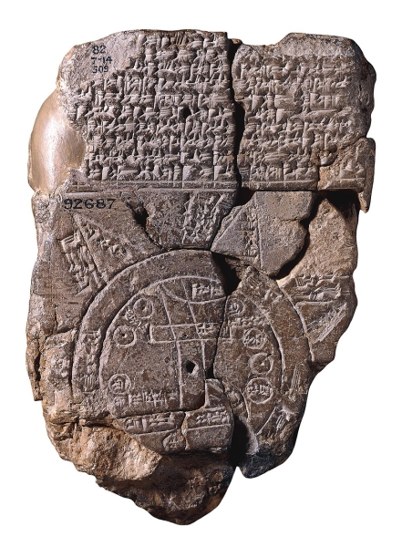
Babylonian Map of the World - 8th Century, BC
4
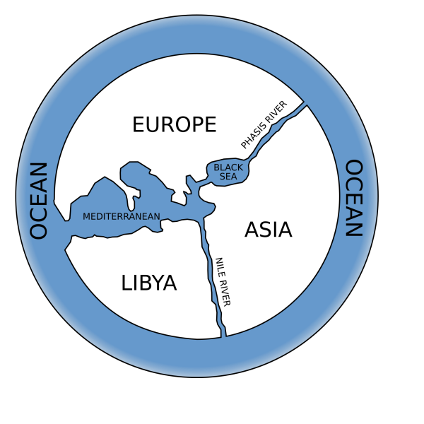
Animaxander's View of the World - 6th Century, BC
5
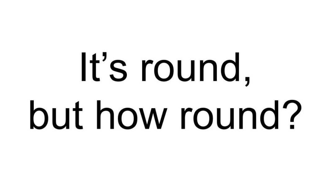
It Is Round, But How Round
6
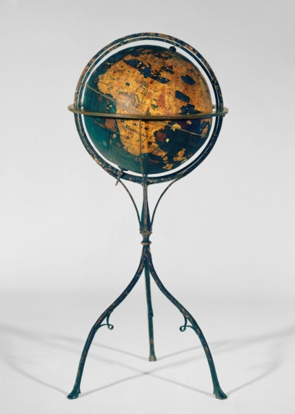
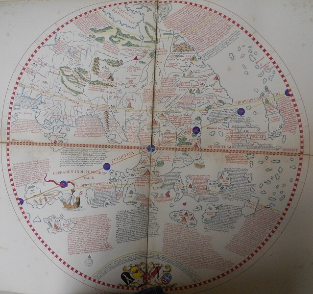
Globe - Martin Behaim - 1492
7
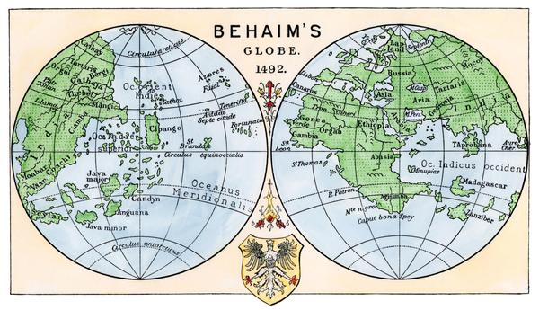
Behaim Globe - 1492
8
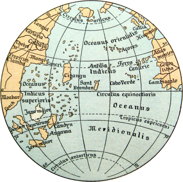
Ocean Map - from globe by Martin Behaim - 1492
9
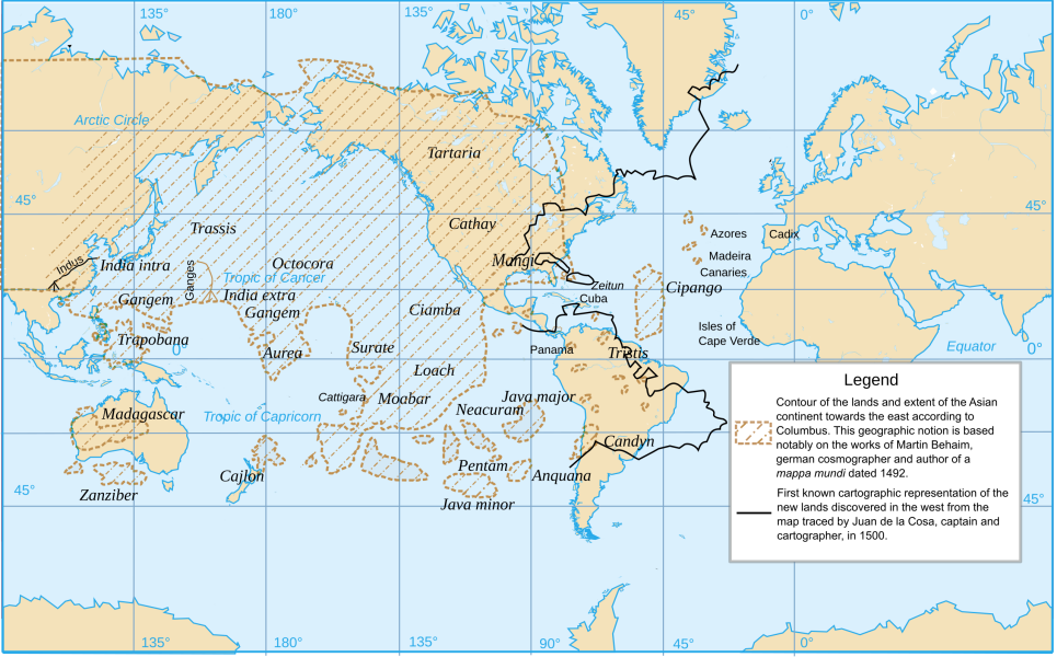
What Columbus Thought
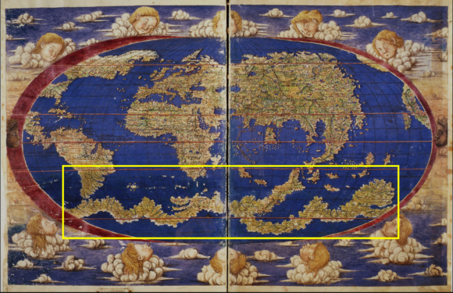
10
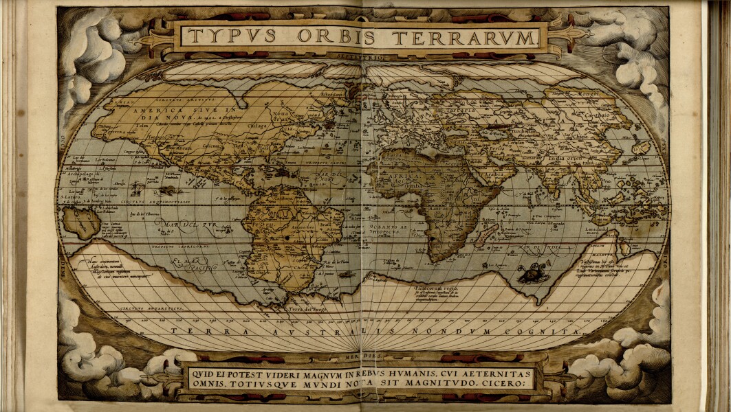
Martin Behaim 1492 - Eastern Hemisphere
11
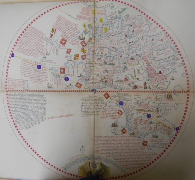
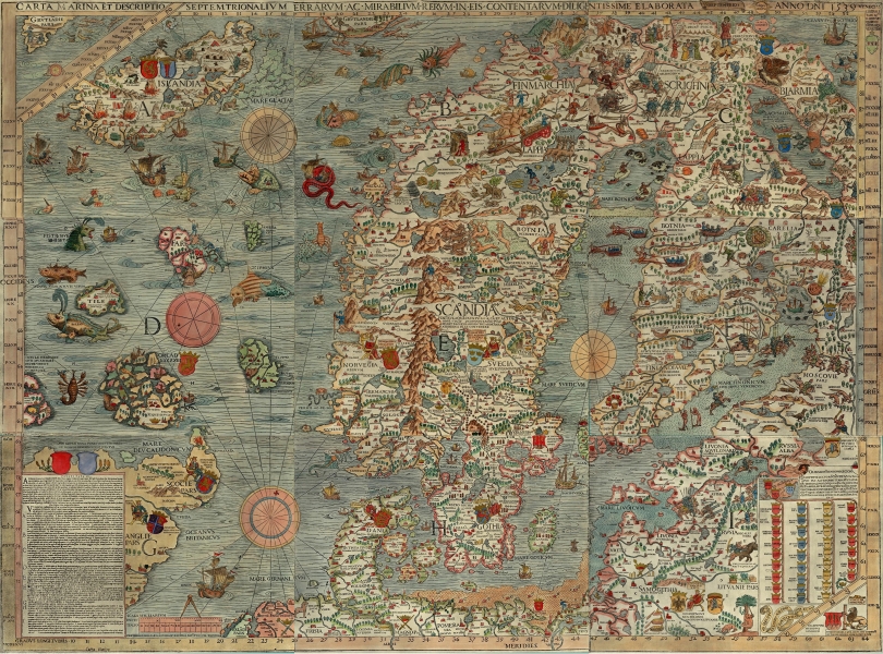
Martin Behaim 1492 - Western Hemisphere
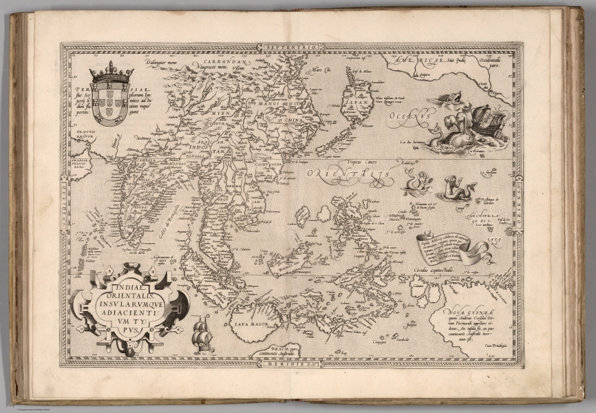
12

East Indies or West Indies?
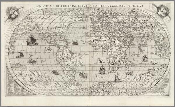
13
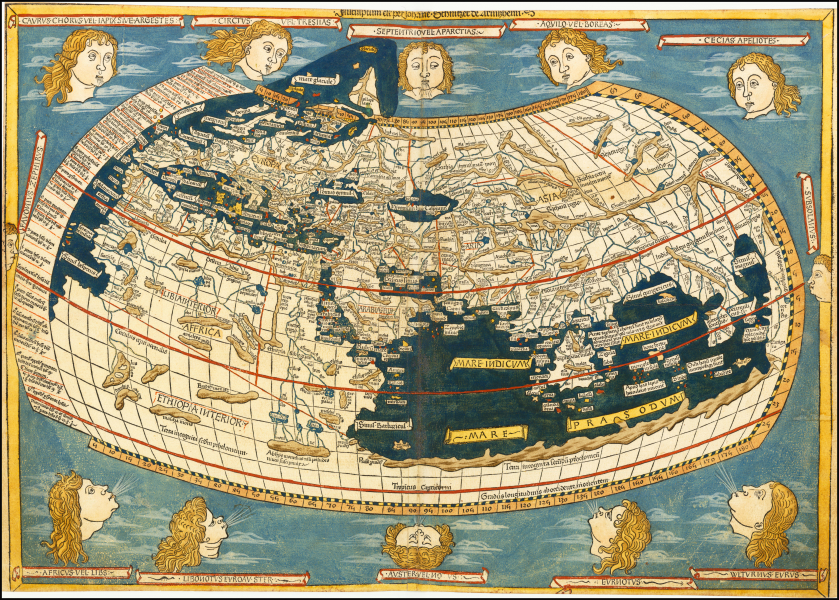
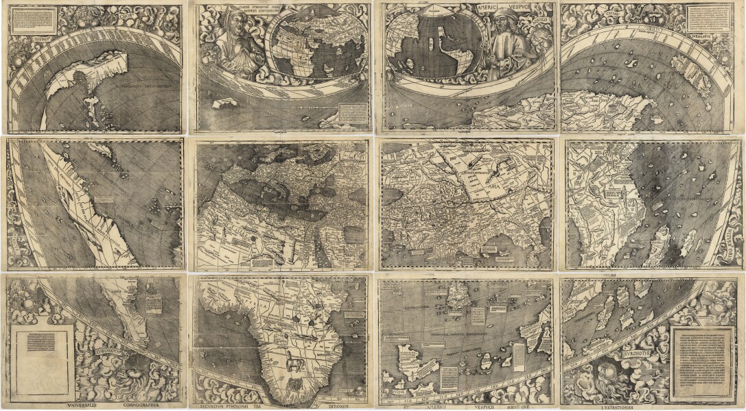
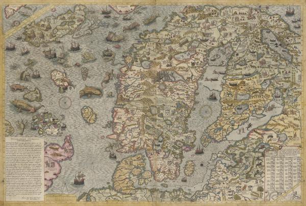
Ulm Ptolemy - 1482
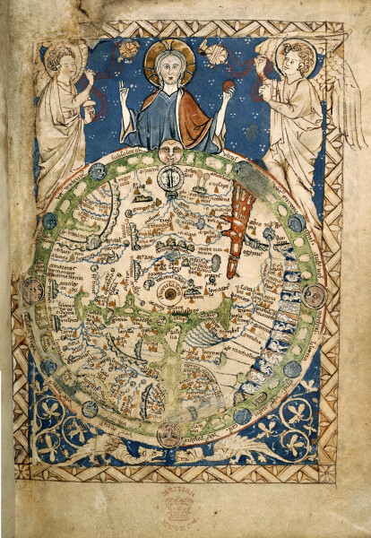
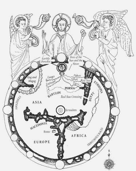
14
2025-06-23 14:24:27 DUPLICATED
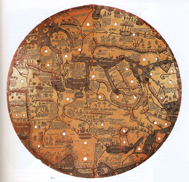
15
The World - Waldseemueller - 1507
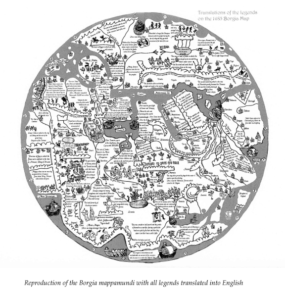
16

Here Be Dragons!
17
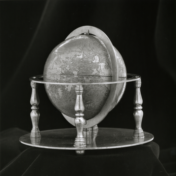
Hunt-Lenox Globe - 1508
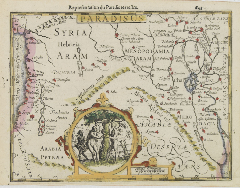
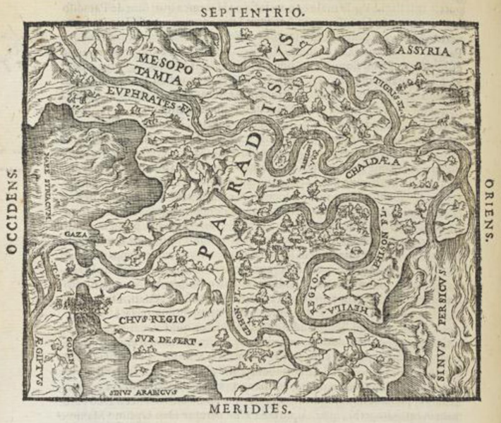
18
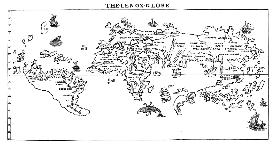
The Lenox Globe Map
19

The Great Southern Continent Below
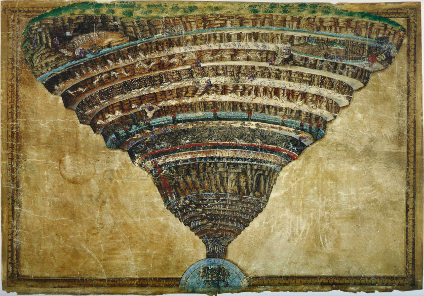
20
Oval planisphere - 1530 - Biblioteca Vaticana, codex Urb Lat 274
21
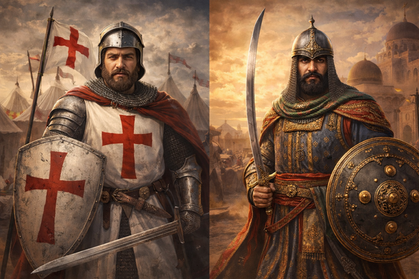
Typus Orbus Terrarum - Ortelius - 1570
22
Sea Monsters
23
Carta Marina - Olaus Magnus - 1539
24
Indiae Orientalis - Abraham Ortelius - 1570
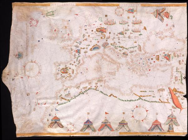
25
Universale Descrittione Di Tutta la Terra Conosciuta Fin Qui - Giacomo Gastaldi - 1568
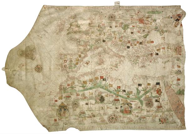
26
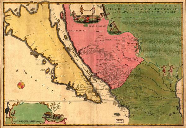
Map of the Sea - Olaus Magnus - 1572
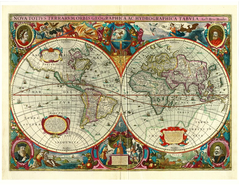
27

Monstrous People
28
Psalter Map - artist unknown - 1265
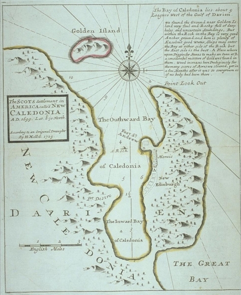
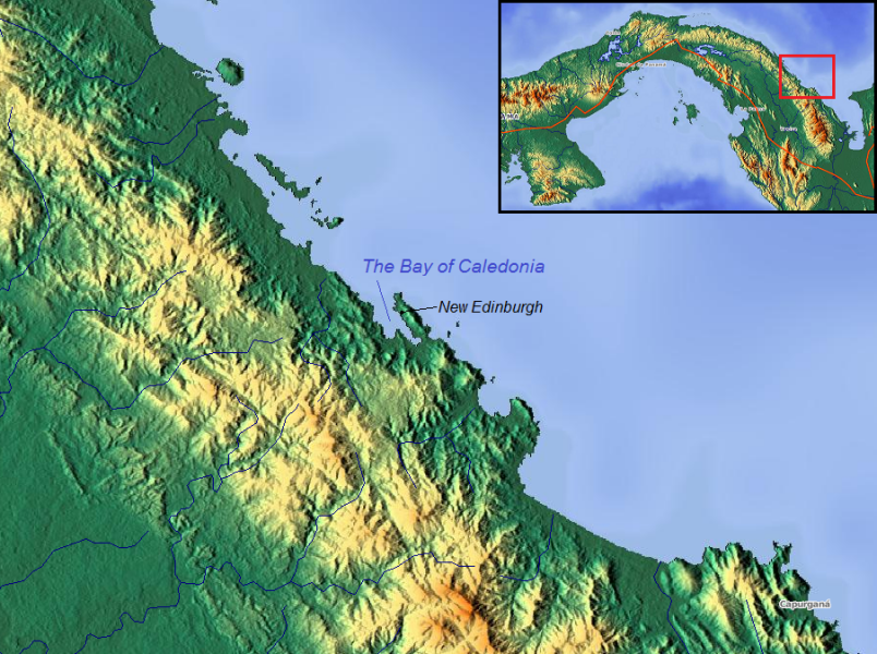
29
Psalter Map (Line Drawing)
30
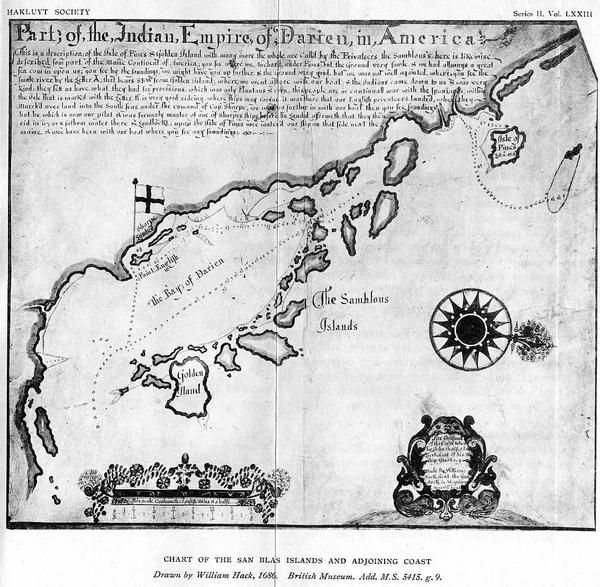
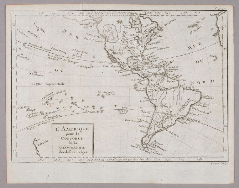
Borgia Map - 1450
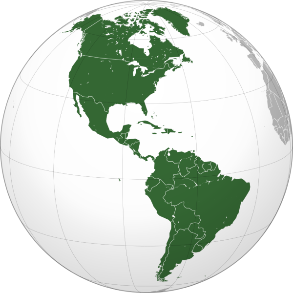
31
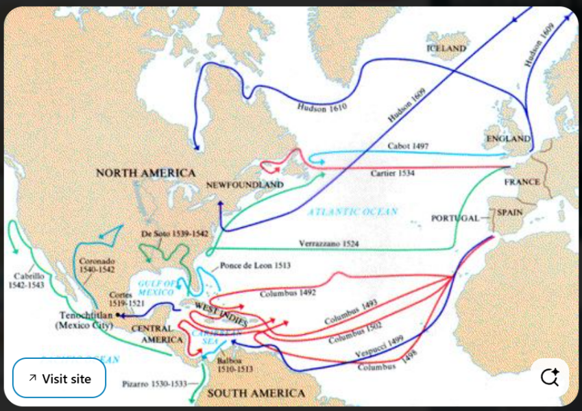
Borgia Map (Line Drawing)
32
Borgia Map (Line Drawing with Translated Text)
33
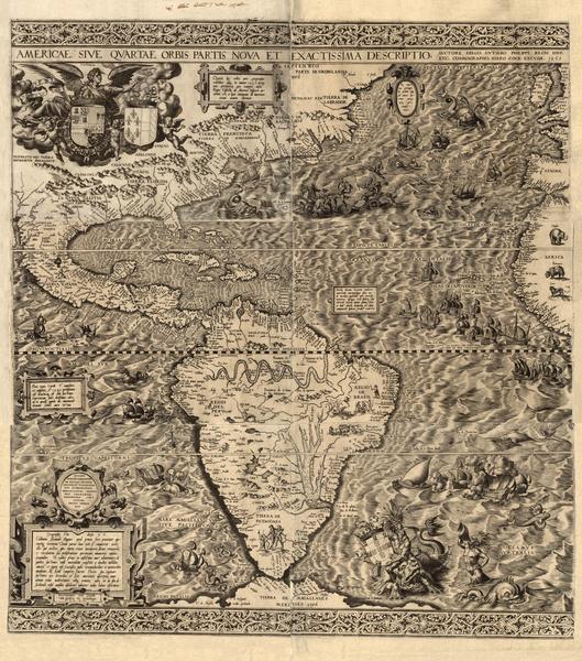
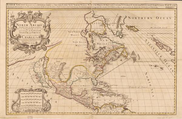
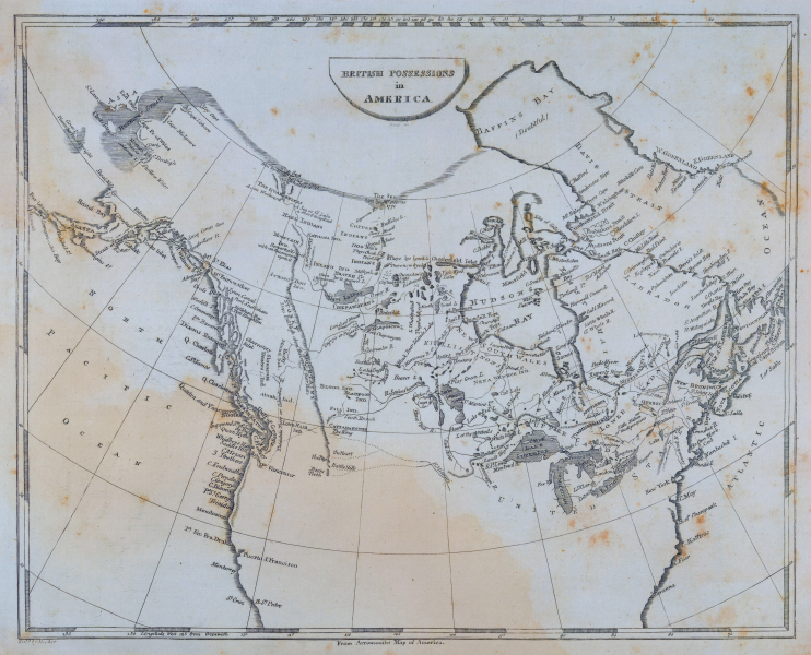
Americae sive qvartae orbis partis nova et exactissima descriptio - Diego Gutiérrez - 1562
34
Flat Earth - Round 2 & 3
35
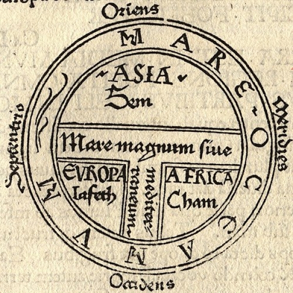
T-O Maps
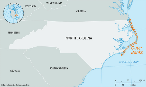
36
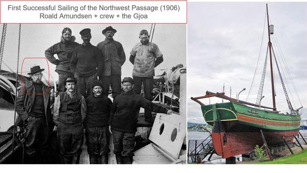
Paradise
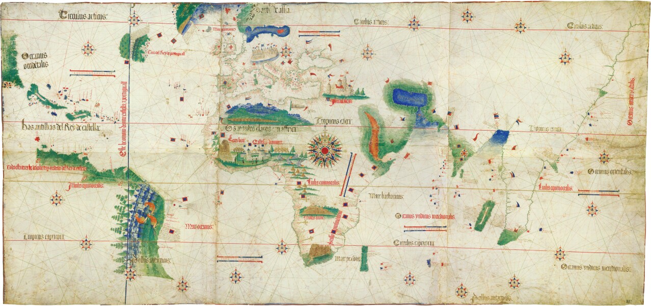
37

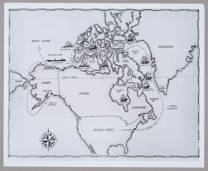
Psalter Map - artist unknown - 1265DUPLICATED
38
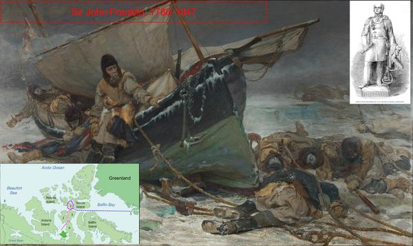
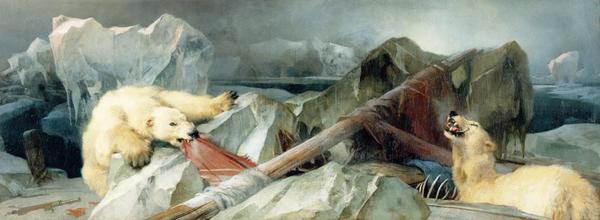
Paradise - Hondius and Mercator - 1607
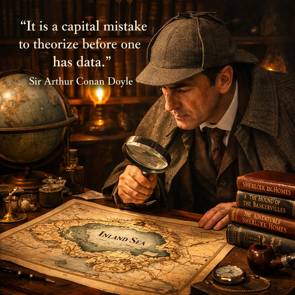
39
Paradise - Mathieu Brouart Beroalde - 1575
40
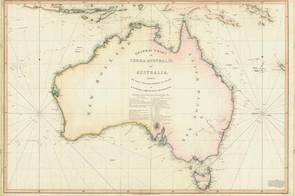
The Map of Hell - Sandro Botticelli - 1480-1490
41
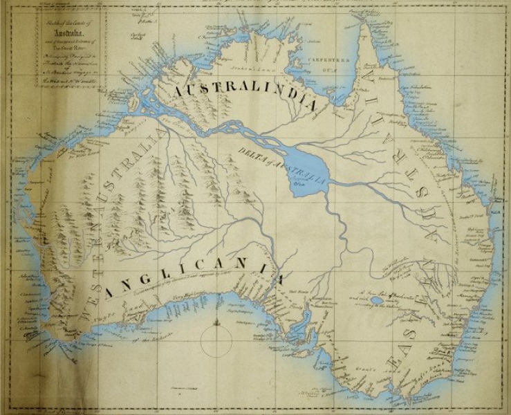
![[ 2026-03-22 18:51:56 ]](https://pxpbstrg.s3.us-west-1.amazonaws.com/images/thumbs/1774205552_69c03a70c454a.jpg)
[ 2026-03-22 18:51:56 ]
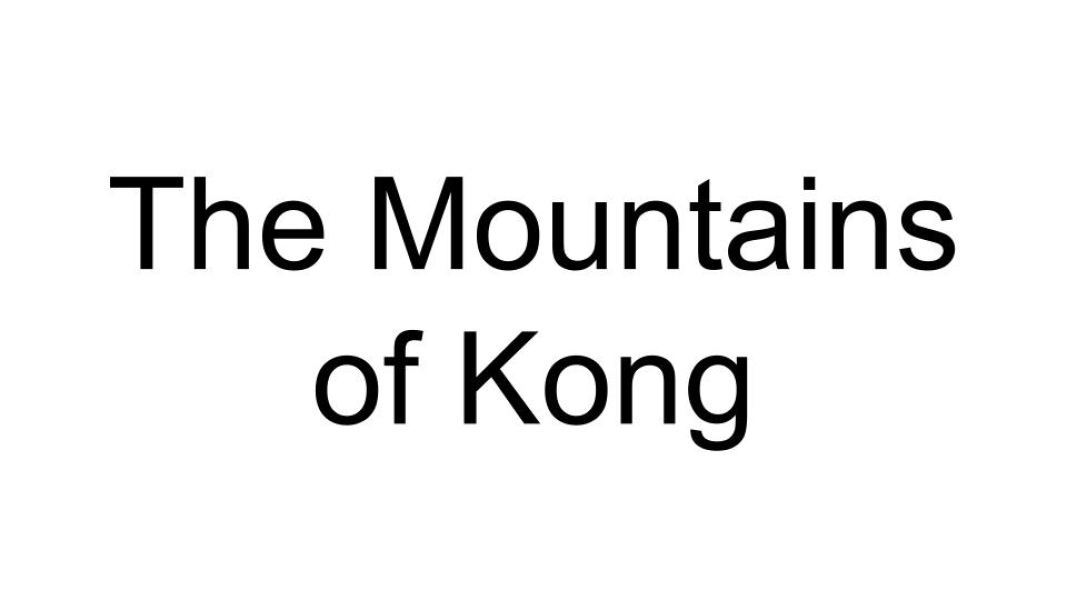
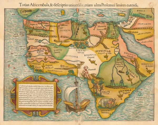
42

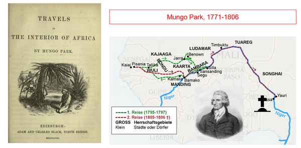
Prester John
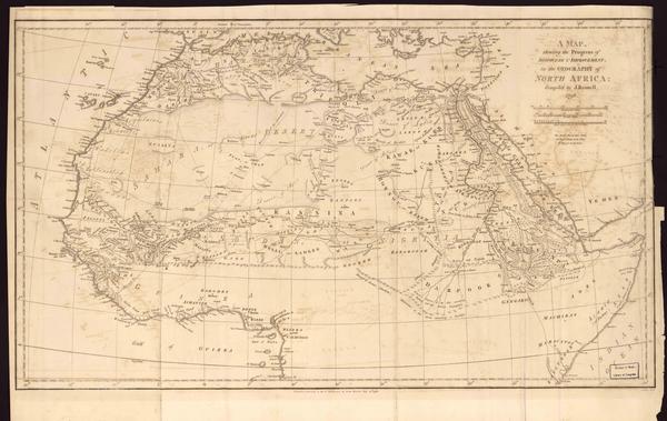
43
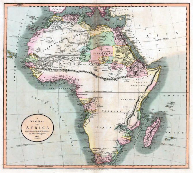
Christendom vs. Islam
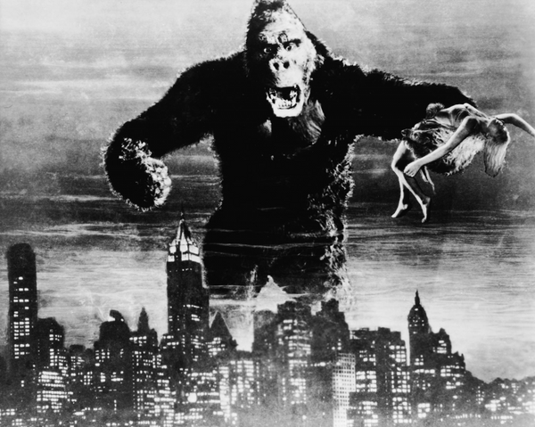
44
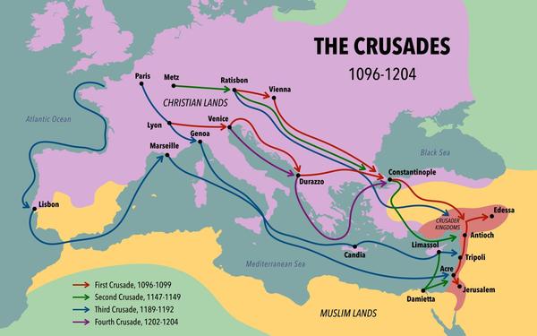
The Crusades
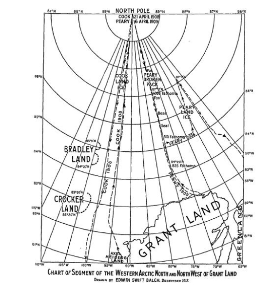
45

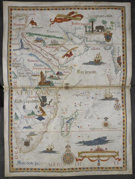
Prester John - Diego Homem - 1558
46
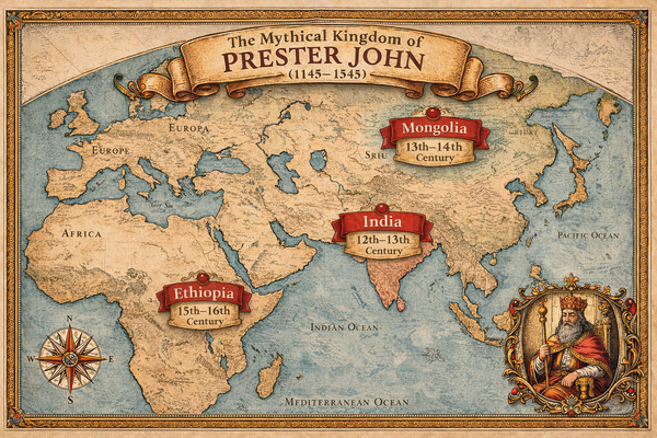
The Mythical Kingdoms of Prester John
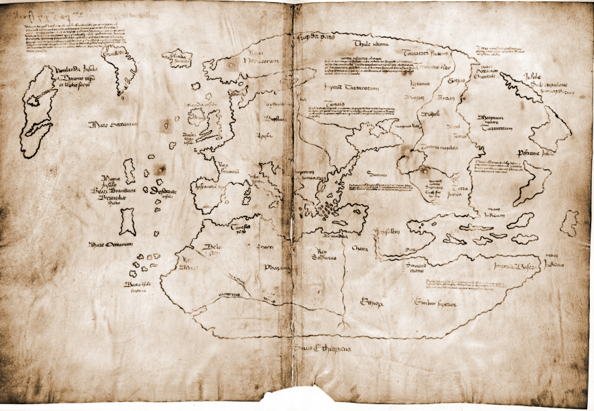
47
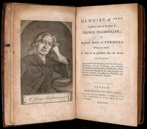
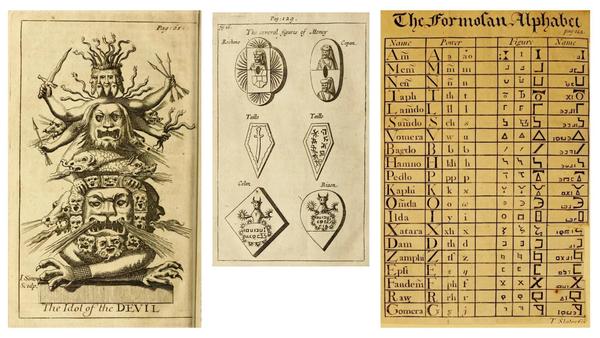
Prester John - British Library
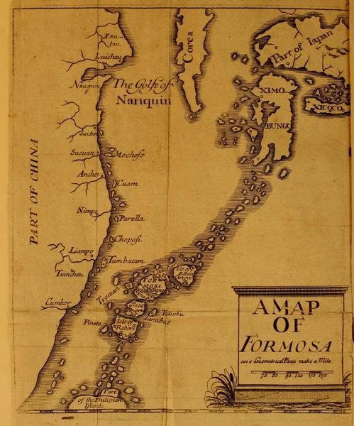
48

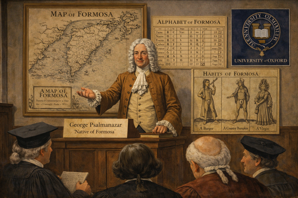
Africa - Munster - 1550
49
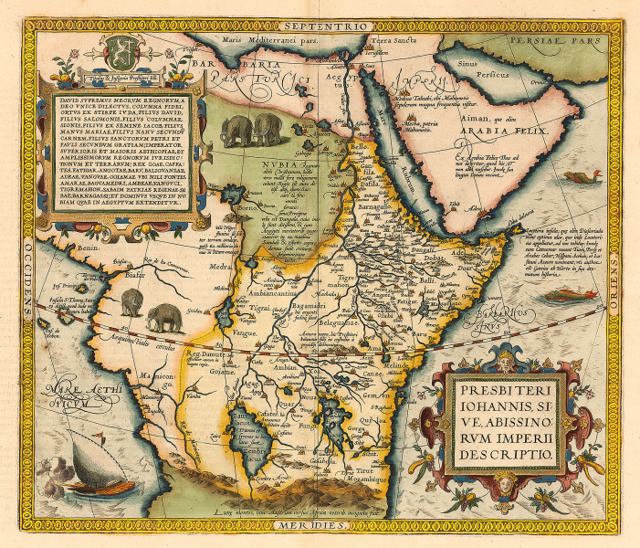
A Description of the Empire of Prester John - Abraham Ortelius - 1564
50
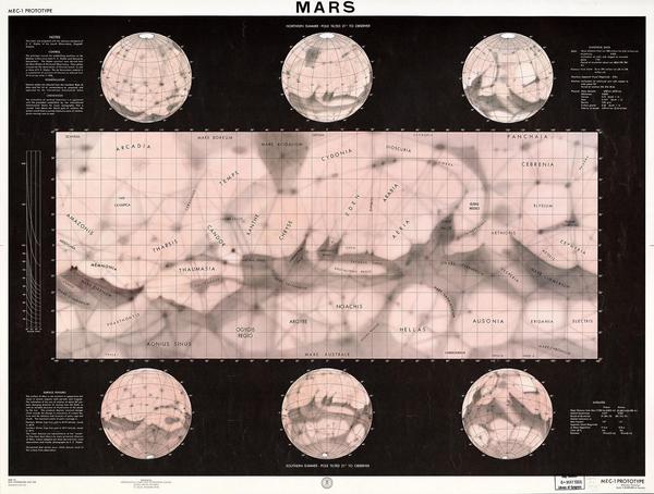
Portolan chart of the Mediterranean Sea - Giacomo Maggiolo - 1553
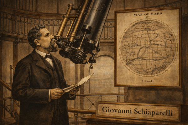
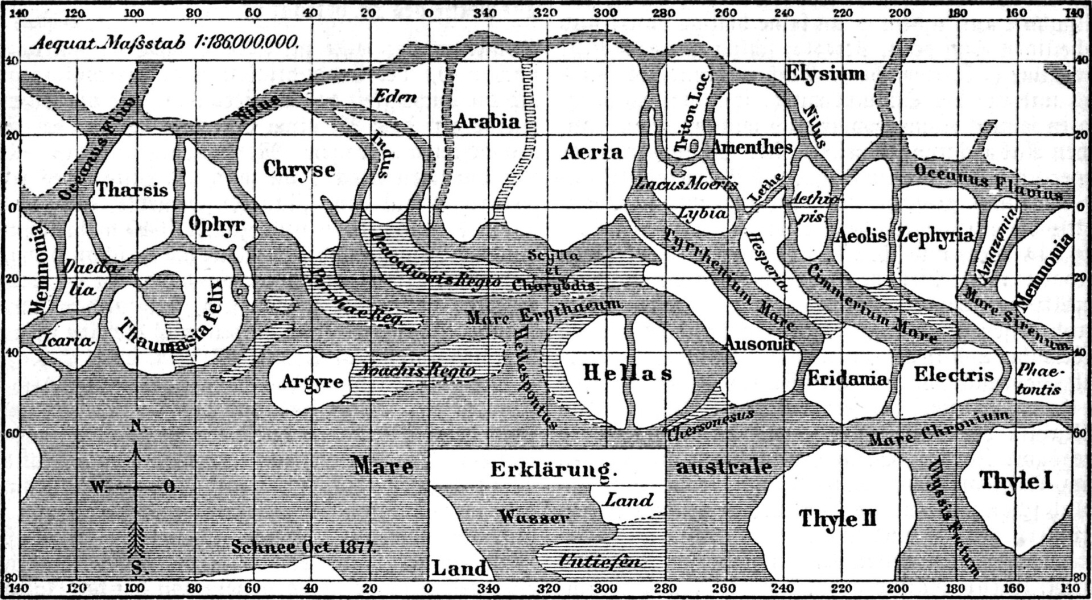
51
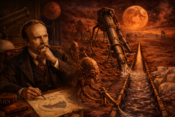
Portolan - Jacobus Russus of Messina - 1533
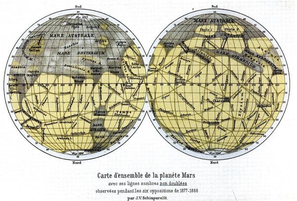
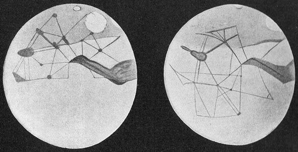
52
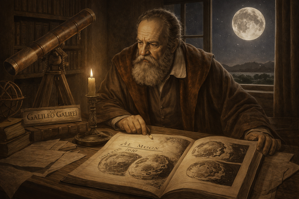
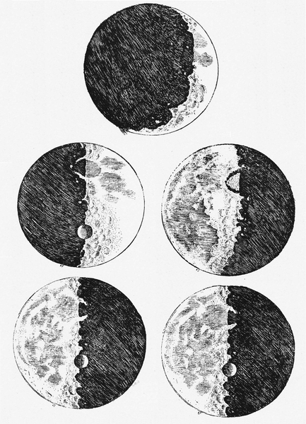
![[ 2026-03-15 19:57:15 ]](https://pxpbstrg.s3.us-west-1.amazonaws.com/images/thumbs/1773604798_69b70fbe4873d.jpg)
[ 2026-03-15 19:57:15 ]
53

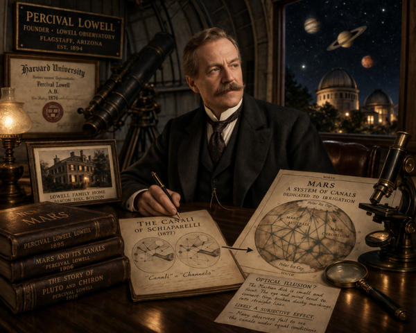
The Island of California
54
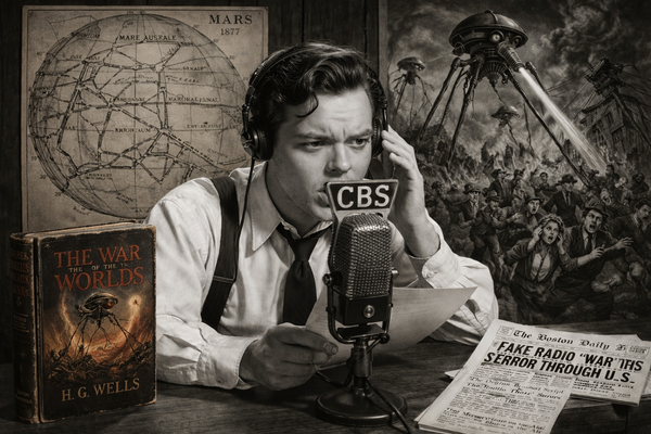
Map of the World - Hendrik Hondius - 1630
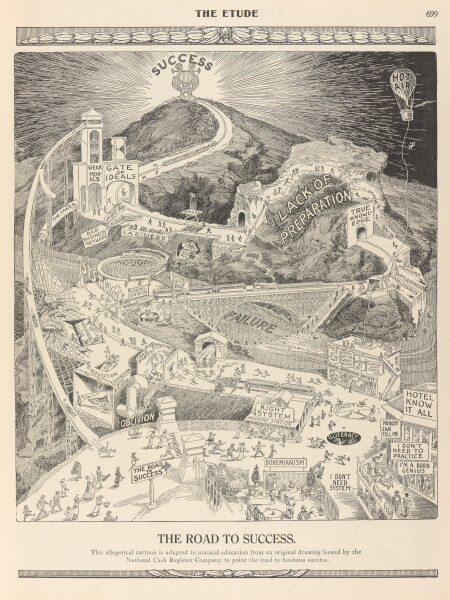
55
North America - Berry & Sanson - 1680DUPLICATED
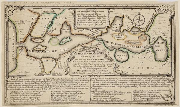
56
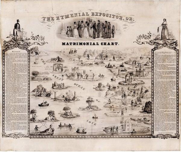
La Californie ou Nouvelle Caroline - Nicolas de Fer - 1720DUPLICATED
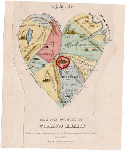
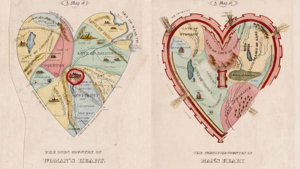
57

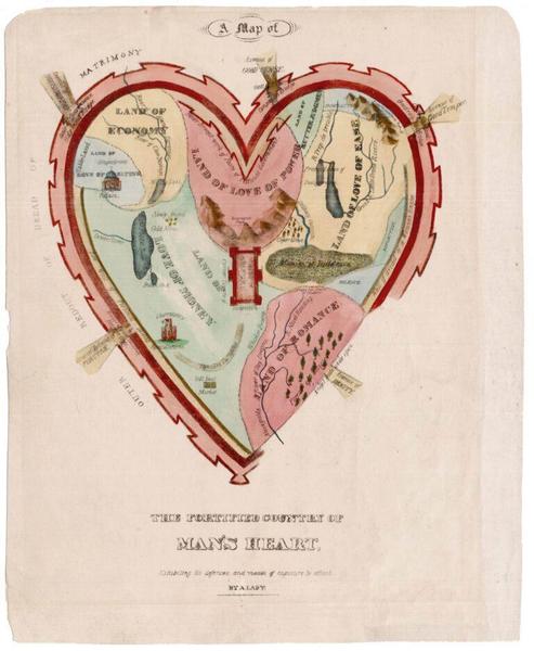
The Darien Scheme
58

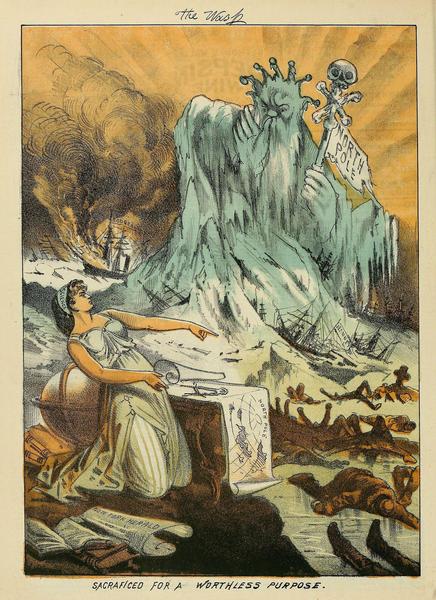
William Paterson
59
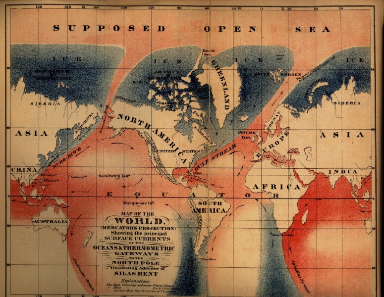
New Caledonia in Darien - Herman Moll - 1699
60
Map of Darien
61
The Americas
62
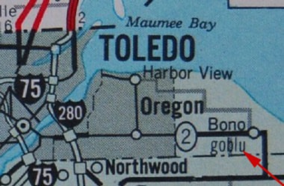
Location of Darien
63

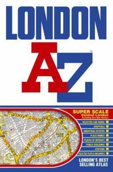
The Northwest Passage
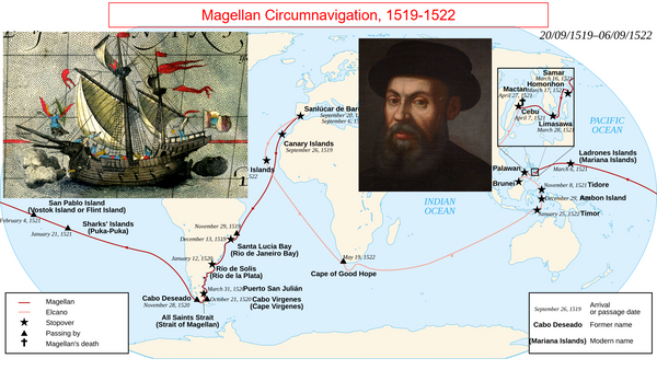
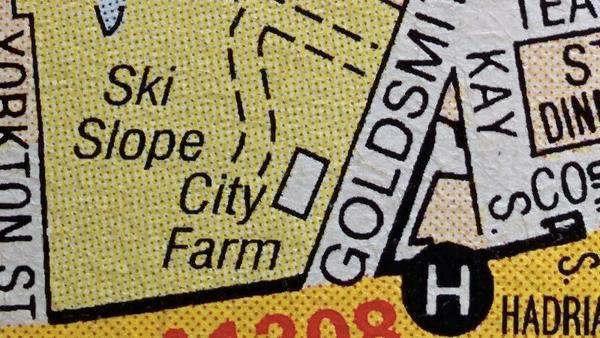
64
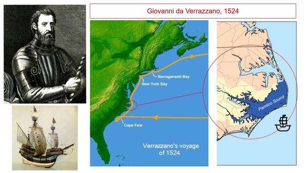
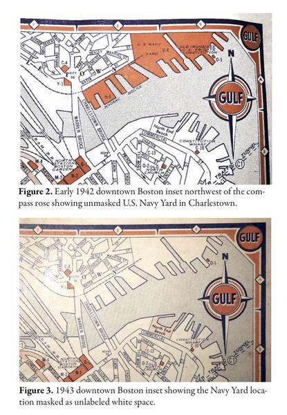
Magellan's Circumnavigation - 1522
65
Verrazzano's Voyage - 1524
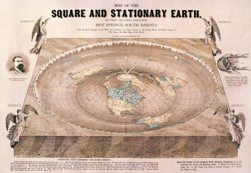
66
North and South America - Sebastian Munster - 1559
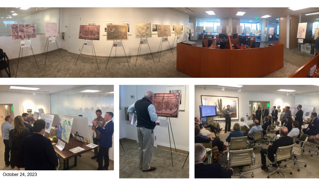
67
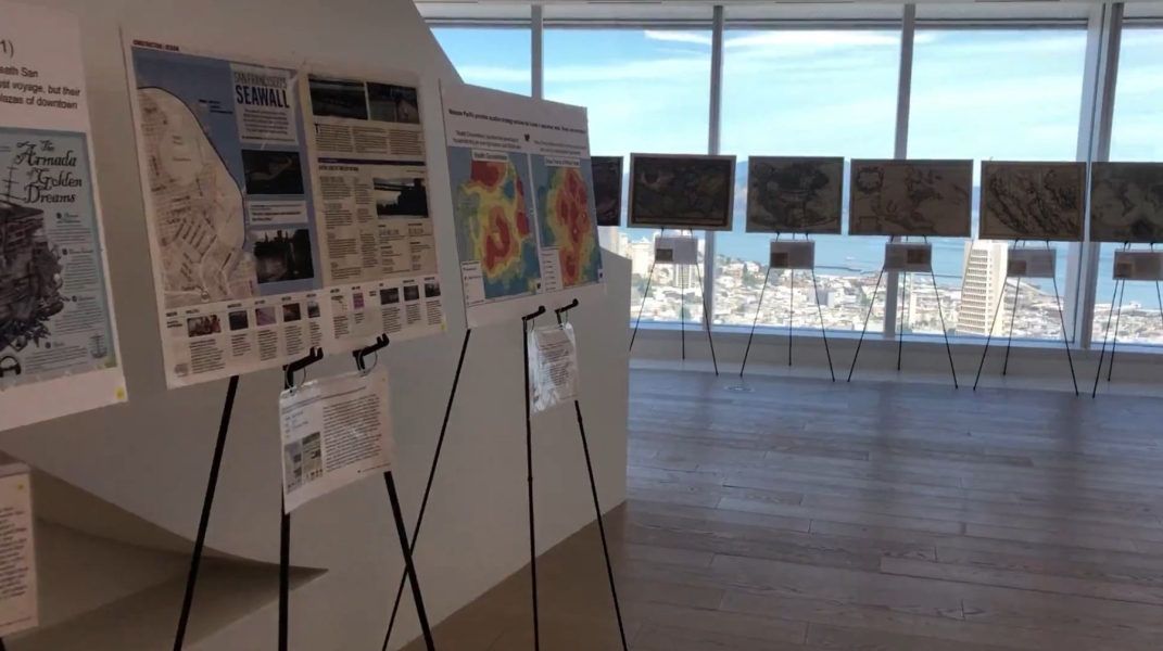
British Possessions in America - Thomas and Andrews - 1805
68

Northwest Passage - Robert de Vaugondy - 1772
69
Franklin Expedition - 1845
70
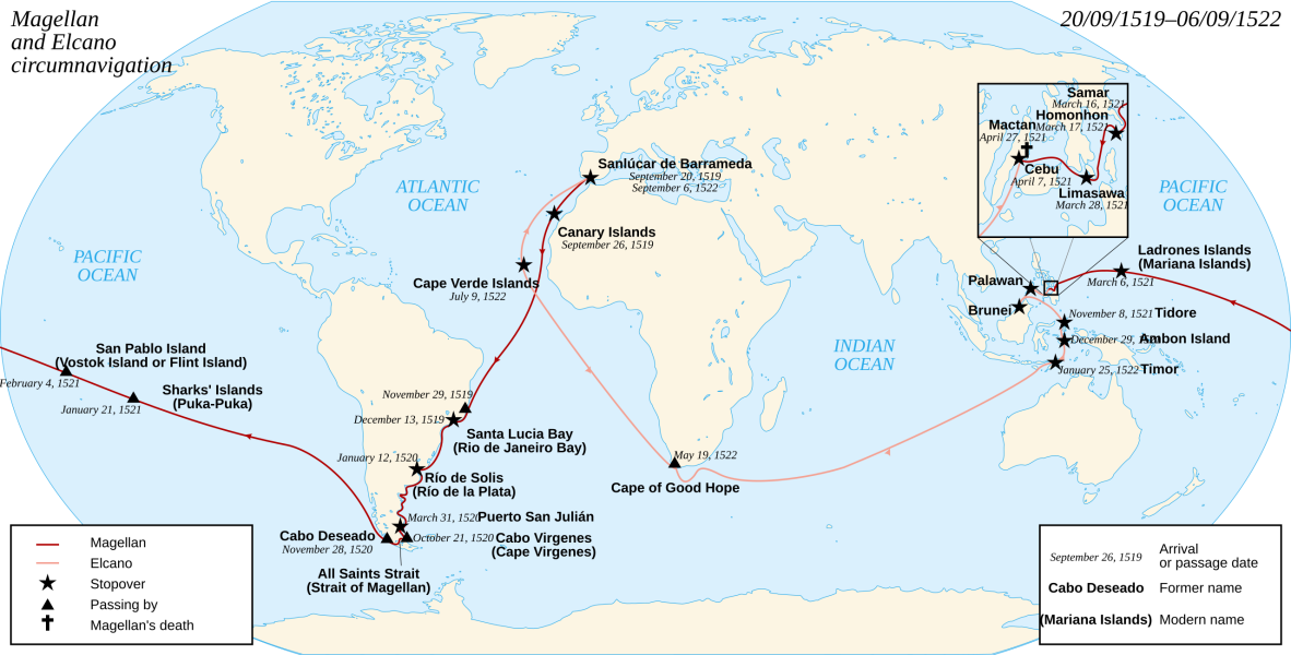
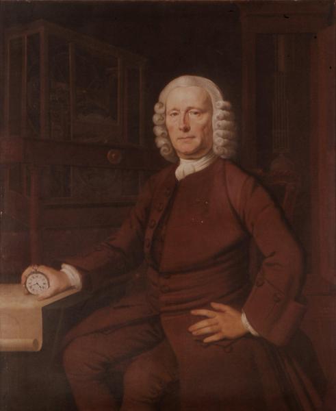
Magellan Expedition - 1521
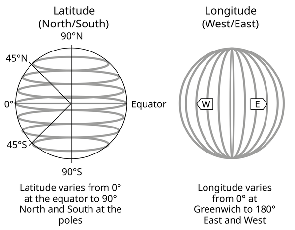
71
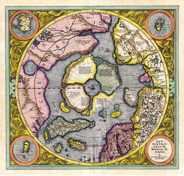
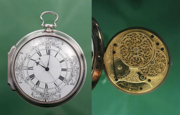
The North Pole - Gerhard Mercator - 1595
72
The Outer Banks
73
Amundsen + Crew + Gjoa - 1905
74
Cantino Planisphere - Unknown Maker - 1502
75
Expeditions to Find The Northwest Passage
76
North and South America - Noël-Antoine Pluche - 1764-1772
77
Man Proposes, God Disposes - Edwin Landseer - 1864
78

The Australian Inland Sea
79
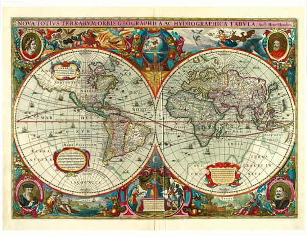
Map of the World - Hendrik Hondius - 1630
80
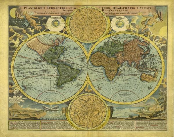
Planiglobii Terrestris - Johann Baptist Homann - 1716
81
Matthew Flinders Map of Australia - 1814
82
Australia's Inland Sea - Thomas J. Maslen - 1827
83
Quote by Sir Arthur Conan Doyle
84
The Mountains of Kong
85
Africa - Munster - 1550
86
Mungo Park - 1771-1806
87
North Africa - James Rennell - 1798
88
A New Map of Africa" - John Cary - 1805
89
King Kong - 1933
90

Fake Islands for Financiers
91
Map of Supposed Crocker Land and Bradley Land - 1912
92
The Arctic - 1910
93
Baldwin-Ziegler Expedition - Anthony Fiala - 1903
94

Famous Forgeries
95
Vinland Map - Forgery
96
Memoirs of George Psalmanazar - 1704
97
A Map of Formosa - George Psalmanazar - 1704
98
George Psalmanazar at Oxford - 1704
99
Images of Formosa - George Psalmanazar - 1704
100
![[ 2026-03-27 17:33:04 ]](https://pxpbstrg.s3.us-west-1.amazonaws.com/images/thumbs/1774632866_69c6bfa2efba3.jpg)
[ 2026-03-27 17:33:04 ]
101

Canals on Mars
102
US Government Map of Mars - 1962
103
Giovanni Schiaparelli - 1877
104
Galileo in His Study - ChatGPT - 2026
105
Mars - Schiaparelli - 1877
106
Galileo's sketches of the moon - 1610
107
Mars - Giovanni Schiaparelli - 1877
108
Percival Lowell’s Theory About Ancient Canals Built on Mars
109
Percival Lowell’s Drawing of Canals on Mars
110
Percival Lowell at his Observatory
111
War Of The Worlds - Orson Welles - 1938
112
A Map of Life Mistakes
113
The Road to Success - Etude Magazine - 1913
114
A Map or Chart of the Road of Love, and Harbour of Marriage - 1748
115
Matrimonial Chart
116
Woman’s Heart
117
Man’s Heart
118
Male and female heart
119

The Open Polar Sea
120

The North Pole - Gerhard Mercator - 1595
121
Open Polar Sea - Silas Bent - 1872
122
Jeannette Expedition
123
![[ 2026-03-07 00:37:39 ]](https://pxpbstrg.s3.us-west-1.amazonaws.com/images/thumbs/1772843878_69ab73664333a.jpeg)
[ 2026-03-07 00:37:39 ]
124
![[ 2026-03-07 00:37:59 ]](https://pxpbstrg.s3.us-west-1.amazonaws.com/images/thumbs/1772843914_69ab738ac54a4.jpeg)
[ 2026-03-07 00:37:59 ]
125
![[ 2026-03-07 00:38:36 ]](https://pxpbstrg.s3.us-west-1.amazonaws.com/images/thumbs/1772843931_69ab739b2b57e.jpeg)
[ 2026-03-07 00:38:36 ]
126
Map Traps
127
Map of Michigan (Goblu) - Peter Fletcher, State Highway Commission - 1978-1979
128
![[ 2026-03-07 00:22:32 ]](https://pxpbstrg.s3.us-west-1.amazonaws.com/images/thumbs/1772842987_69ab6feb7a8f8.jpeg)
[ 2026-03-07 00:22:32 ]
129
London A to Z
130
Ski Slope - London A to Z
131
Map of Boston - Gulf Motor Oil Company - 1942 & 1943 (from David Smollar)
132
Agloe New York
133
![[ 2025-12-09 14:05:33 ]](https://pxpbstrg.s3.us-west-1.amazonaws.com/images/thumbs/1765289143.jpeg)
[ 2025-12-09 14:05:33 ]
134
Flat Earth map - Orlando Ferguson - 1893
135
Gulf of What?
136
Example Exhibit of Maps
137
Example 2 Exhibit of Maps
138

Scilly Naval Disaster
139
![[ 2023-12-16 06:37:59 ]DUPLICATED](https://pxpbstrg.s3.us-west-1.amazonaws.com/images/thumbs/1773033396_69ae57b4c6f6f.jpg)
[ 2023-12-16 06:37:59 ]DUPLICATED
140
![[ 2023-12-16 06:22:41 ]DUPLICATED](https://pxpbstrg.s3.us-west-1.amazonaws.com/images/thumbs/1773033415_69ae57c7ad7f8.jpg)
[ 2023-12-16 06:22:41 ]DUPLICATED
141
![[ 2023-12-16 06:20:50 ]DUPLICATED](https://pxpbstrg.s3.us-west-1.amazonaws.com/images/thumbs/1773033479_69ae580746376.jpg)
[ 2023-12-16 06:20:50 ]DUPLICATED
142
![[ 2023-12-16 06:22:31 ]DUPLICATED](https://pxpbstrg.s3.us-west-1.amazonaws.com/images/thumbs/1773033583_69ae586f90186.jpg)
[ 2023-12-16 06:22:31 ]DUPLICATED
143
John HarrisonDUPLICATED
144
Latitude and LongitudeDUPLICATED
145
H4
146
![[ 2026-03-09 05:50:24 ]](https://pxpbstrg.s3.us-west-1.amazonaws.com/images/thumbs/1773035439_69ae5fafa4583.png)
[ 2026-03-09 05:50:24 ]
147

Mark Twain Quote
148
![[ 2026-03-16 17:03:51 ]](https://pxpbstrg.s3.us-west-1.amazonaws.com/images/thumbs/1773680659_69b83813dad02.png)
[ 2026-03-16 17:03:51 ]
149
![[ 2026-03-16 17:04:54 ]](https://pxpbstrg.s3.us-west-1.amazonaws.com/images/thumbs/1773680711_69b83847bf3ec.png)
[ 2026-03-16 17:04:54 ]
150

Never Let The Truth Get In The Way Of A Good Story - Mark Twain
Place a DOT on the image