San Francisco Historic Maps
Step 0 of 0
1

2
3
4
5
6

7

8

9

10

11

12

13

14

15

16

17

18

19

20

21

22

23

24

25

26

27

28

29

30

31

32

33

34
35

36

37

38

39

40

41

42

43

44

45

46

47

48

49

50

51

52

53

54
55

56

57

58

59

60

61

62

63

64

65

66

67

68

69

70

71

72

73

74

75

76

77

78

79

80

81
![[ 2025-06-28 21:43:55 ]](https://pxpbstrg.s3.us-west-1.amazonaws.com/images/thumbs/1751147050.png)
82

83

84

85

86
87

88
89
90
![[ 2025-07-30 17:25:36 ]](https://pxpbstrg.s3.us-west-1.amazonaws.com/images/thumbs/1753896350.jpeg)
91
![[ 2025-07-30 17:25:54 ]](https://pxpbstrg.s3.us-west-1.amazonaws.com/images/thumbs/1753896388.jpeg)
92
![[ 2025-07-30 17:26:31 ]](https://pxpbstrg.s3.us-west-1.amazonaws.com/images/thumbs/1753896474.jpeg)
93
![[ 2025-07-30 17:27:57 ]](https://pxpbstrg.s3.us-west-1.amazonaws.com/images/thumbs/1753896495.jpeg)
94
![[ 2025-07-30 17:28:26 ]](https://pxpbstrg.s3.us-west-1.amazonaws.com/images/thumbs/1753896536.jpeg)
95
![[ 2025-07-30 17:28:57 ]](https://pxpbstrg.s3.us-west-1.amazonaws.com/images/thumbs/1753896560.jpeg)
96
![[ 2025-07-31 01:37:24 ]](https://pxpbstrg.s3.us-west-1.amazonaws.com/images/thumbs/1753925954.jpeg)
97
![[ 2025-08-07 18:49:53 ]](https://pxpbstrg.s3.us-west-1.amazonaws.com/images/thumbs/1754592613.JPG)
98
![[ 2025-08-07 18:50:13 ]](https://pxpbstrg.s3.us-west-1.amazonaws.com/images/thumbs/1754592634.JPG)
99
![[ 2025-08-07 18:50:35 ]](https://pxpbstrg.s3.us-west-1.amazonaws.com/images/thumbs/1754592645.JPG)
100
![[ 2025-08-07 18:50:46 ]](https://pxpbstrg.s3.us-west-1.amazonaws.com/images/thumbs/1754592654.JPG)
101
![[ 2025-08-07 18:50:55 ]](https://pxpbstrg.s3.us-west-1.amazonaws.com/images/thumbs/1754592667.JPG)
102
![[ 2025-08-07 18:51:07 ]](https://pxpbstrg.s3.us-west-1.amazonaws.com/images/thumbs/1754592676.JPG)
103
![[ 2025-08-07 18:51:17 ]](https://pxpbstrg.s3.us-west-1.amazonaws.com/images/thumbs/1754592686.jpg)
104
![[ 2025-08-07 18:51:26 ]](https://pxpbstrg.s3.us-west-1.amazonaws.com/images/thumbs/1754592694.jpg)
105
![[ 2025-08-07 18:51:35 ]](https://pxpbstrg.s3.us-west-1.amazonaws.com/images/thumbs/1754592703.JPG)
106
![[ 2025-08-09 18:55:01 ]](https://pxpbstrg.s3.us-west-1.amazonaws.com/images/thumbs/1754765731.jpeg)
San Francisco Historic Maps - July 31, 2025, 5-7pm
The image behind this poster is from 1864 by James Butler. It shows a period of substantial transition, from ranchos to claims to plats, as well as the development of the railroad and the expected fill along the bayside shores inside the Golden Gate.


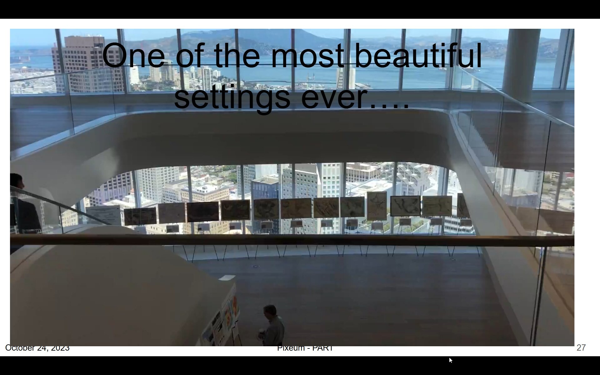
Starting on July 27, 2025, San Francisco Historic Maps will be on display at the Chamber of Commerce’s downtown gallery space, called YesSF, at 220 Montgomery Street. The exhibit of over 30 maps will run from July 27th to at least August 1st, 2025, 9am to 5pm daily. On July 31st, from 5 to 7pm, there will be a reception and presentation by Tom Paper and Jim Schein. Register for July 31st here. Questions? tom@pixeum.org.
It centers on the newly operational San Francisco & San Jose Railroad (S.F. & S.J. R.R.), which began service that year. The map details the railroad’s route from its terminal at Temple/Old San Jose (modern 25th and San Jose Avenue) southwest through Noe Valley and Glen Park, with depots marked at Mt. Vernon and Lakeville. A key feature is the Bernal Cut—a 35-foot-deep, quarter-mile-long excavation through bedrock enabling the line to traverse the San Bruno Range2.
Land Claims and Ranchos:
The map reflects the transition of former Mexican-era ranchos into urban plats. While it does not explicitly label ranchos, the depicted area overlaps historically contested lands like the Potrero Nuevo (de Haro family) and Potrero Viejo (Bernal family) ranchos. These areas, once embroiled in U.S. Land Commission disputes, appear subdivided for development, illustrating how railroad infrastructure accelerated the shift from pastoral claims to residential and commercial use3. The route cuts through regions where squatters and speculators had occupied disputed lands since the 1850s, now formalized into street grids and property lines.
Plats and Urbanization:
Butler’s map highlights the S.F. & S.J. R.R.’s influence on land use:
- The railroad’s path follows Valencia Street to 25th, then diverts southwest, avoiding the Mission Bay wetlands2.
- Emerging neighborhoods like Noe Valley show new platting, with overpasses and bridges (e.g., at 27th/Dolores) accommodating the rail line.
- The map underscores San Francisco’s expansion beyond the 1851 charter line, with former rancho lands repurposed for transportation and settlement13.
In essence, the Butler map captures San Francisco’s rapid evolution from disputed ranchos to a modern city shaped by rail, documenting infrastructure’s role in resolving land conflicts and driving urbanization.
- https://www.raremaps.com/gallery/detail/43069/map-of-the-country-40-miles-around-san-francisco-exhibiting-ransom
- https://www.nesssoftware.com/www/sf/sfsjrr.php
- https://www.foundsf.org/Mexican_Land_Claims%E2%80%94The_U.S._Land_Commission_and_The_Burden_of_Proof,_1851-1854
- https://collections.leventhalmap.org/search/commonwealth:kh04p696p
- https://pixeum.org/exhibits/166
- https://www.davidrumsey.com/luna/servlet/detail/RUMSEY~8~1~303659~90074286:Map-of-the-City-and-County-of-San-F?sort=pub_list_no_initialsort%2Cpub_list_no_initialsort%2Cpub_date%2Cpub_date&qvq=q%3A%3DSan+Francisco+AND+%3Dmining+%3Bsort%3Apub_list_no_initialsort%2Cpub_list_no_initialsort%2Cpub_date%2Cpub_date%3Blc%3ARUMSEY~8~1&mi=4&trs=44
- https://www.raremaps.com/mapmaker/11558/F_S_Butler
- https://geodata.lib.berkeley.edu/catalog/stanford-xj983zr6622
- https://www.davidrumsey.com/luna/servlet/view/all/who/Butler,+James,+1863-1864/what/Separate+Map?sort=pub_list_no
- https://www.outsidelands.org/a-drive-by-history-of-great-highway.php
- https://www.outsidelands.org/crucible/author/wnpoffice_wp/page/2/
- https://www.locallanguageart.com/products-archive/llp0039
- https://www.davidrumsey.com/luna/servlet/view/all/what/Separate+Map/where/San+Francisco+(Calif.)?sort=author%2Cpub_list_no&os=0&pgs=50&cic=RUMSEY~8~1
- https://www.raremaps.com/category/Maps/United_States/California/California?order_by=creator
- https://archive.org/details/sanfranciscbusi186465sanf
- https://www.sanfranciscohistory.com/BVHP_Context.pdf
- https://default.sfplanning.org/Preservation/CorbettHeightsHCS/hp_corbett_hcs_Corbett_Heights_HCS_Draft-May2017.pdf
- https://www.raremaps.com/gallery/detail/111610
- https://default.sfplanning.org/Preservation/CorbettHeightsHCS/hp_corbett_hcs_HCS_FINAL-081617.pdf
[ 2025-06-12 12:37:07 ]
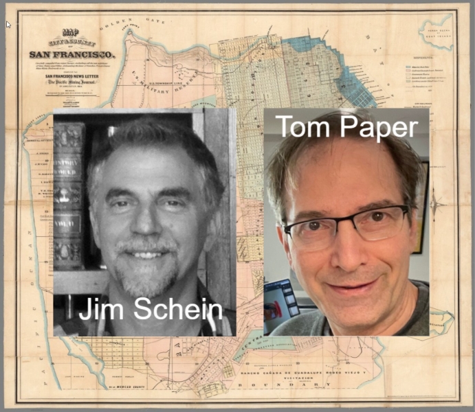
Jim Schein and Tom Paper
Jim Schein is Founder of Schein & Schein, a map and print store originally based in North Beach and now online. Jim is also the author of the book Gold Mountain, Big City. nytimes | amazon
Tom Paper, Founder of the website Pixeum, which helps people tell stories with art.


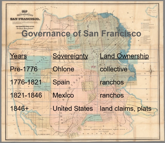
Governance of San Francisco
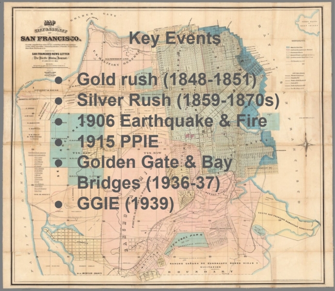
Key Events in San Francisco History
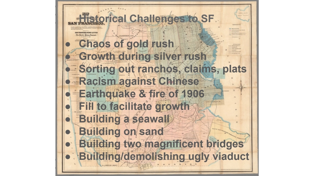
Historic Challenges to San Francisco
The World - Waldseemueller - 1507
The history of San Francisco begins with the history of the Americas coming into focus. This 1507 map by Waldseemueller shows great detail about Europe, but a lot less about North and South America. It also is the first map that ever showed the word “America.”


 i36724
 i36725
“In 2003, the Library of Congress bought Martin Waldseemüller’s world map for a world record $10 million dollars, because it is the first map to name America and show the Pacific. Widely regarded as ‘America’s birth certificate’, the map was believed lost until found by a Jesuit priest in a castle in Germany in 1900, where it remained 2003, when the library persuaded its owner, a German count, to sell it. Made by Waldseemüller and a team of scholars in Germany in 1507, its distinctive bulb-shaped projection reflects their attempt to keep up with the extraordinary period of rapid discoveries made by the Spanish and Portuguese from the late fifteenth century, including landfalls in southern Africa, India, Asia, and of course, the Americas. At the top of the map are Ptolemy (left) and Amerigo Vespucci (right), whose voyages proved conclusively that America was a separate continent, disproving Columbus’ belief that he had landed in Asia. It is a map that remains full of mysteries: how did Waldseemüller know about the Pacific six years before any European discovered it?” Time.com 2013
https://www.loc.gov/item/2003626426/
https://blogs.loc.gov/maps/2015/11/mr-duerer-comes-to-washington/
North and South America - Munster - 1559
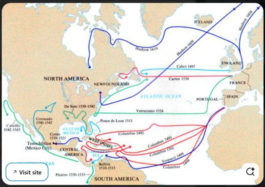
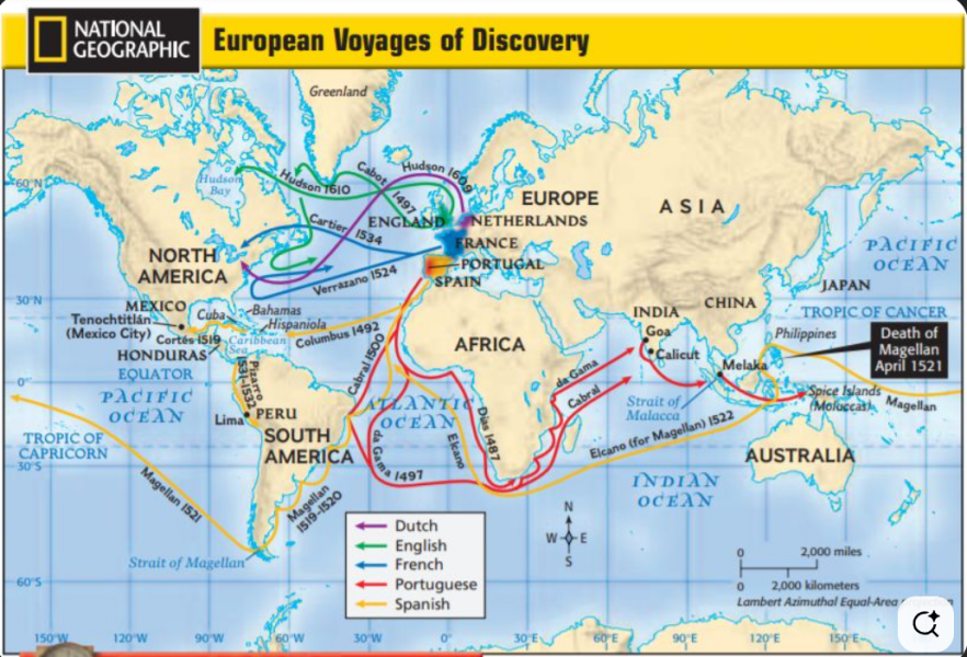
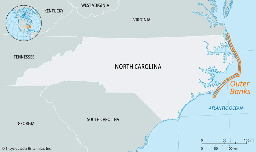
By 1559, considerably more voyages had been made to both North and South America, but things were still greatly out of focus. Verrazzano’s voyage happened in 1524 and, in one of the great geographic misconceptions of all time, Verrazzano arrived at the Outer Banks of North Carolina and thought he was looking at the Pacific Ocean. Munster drew this map according to Verrazzano’s error.


 i36727
“His Cosmographia of 1544 was the earliest German-language description of the world...The Cosmographia was one of the most successful and popular works of the 16th century. It passed through 24 editions in 100 years. This success was due to the fascinating woodcuts...in addition to including the first to introduce "separate maps for each of the four continents known then-- America, Africa, Asia and Europe." It was most important in reviving geography in 16th century Europe. The last German edition was published in 1628, long after his death...He died at Basel of the plague in 1552.” wikipedia.org
"Excellent example of the earliest separate map of the entire Western Hemisphere. This was also the earliest map to refer to the Pacific Ocean (along with Munster's world map) by a variant of its present name, Mare pacificum. It was one of earliest acquirable maps to show Japan prominently, which is depicted as a large single island called Zipangri (after Polo) just off the coasts of California and Mexico. The depiction of North America is dominated by one of the most dramatic geographic misconceptions to be found on early maps--the so-called Verrazanean Sea. On the map, the Pacific Ocean cuts deeply into North America so that there is only a narrow isthmus between the Atlantic and Pacific oceans. This resulted from the voyage of Verrazano, who mistook the waters to the west of the Outer Banks, the long barrier islands outlining the North Carolina coast, as the Pacific Ocean. The division of the New World between Spain and Portugal is recognized on the map by the flag of Castile planted in Puerto Rico, here called Sciana.”Martaya Lan
https://www.loc.gov/item/2005630225/
Typus Orbus Terrarum - Ortelius - 1570
Abraham Ortelius’s 1570 “Typus Orbis Terrarum” is the first modern world map published in an atlas. Centered on the Atlantic, it shows a blend of recent exploration and myth, most notably the unknown southern continent, an idea dating back to ancient Greece.


“Ortelius' book of maps, first published in 1570, is considered the first modern world atlas. It was the first time that a set of maps, contemporary to the date of publication, was designed, drawn, and engraved with the intention of publishing them in a bound volume. Ortelius did not refer to his publication as an "atlas," as we know it today. Rather he entitled it "Theater of the World," implying not only that the entire known world could be viewed in this one book, but that the Earth was a stage on which human actions unfolded. Although most of the maps in this book pertain to European countries and provinces, it can be considered a world atlas because it also includes a map of the world (displayed here), as well as one map for each of the four continents. The featured map is from the second state and was published c.1578 and is similar to the first state map, but with a few corrections. It is one of the most recognized maps from the Age of Discovery. This version includes the mythical Great Northern Passage, an irregular "bulge" on the west side of South America and the mythical Great Southern Continent, "Terra Australis Ingognita," roughly in the place of Antartica before its discovery. Most of North America is still based on conjecture and mythology, though he does credit Columbus for its discovery.” Steve Hanon, themapmaven.com
https://www.loc.gov/resource/g3200m.gct00003/?sp=18 http://www.themapmaven.com/my-map-gallery
The World - Quad and Bussemacher - 1600
A world map, issued as part of an atlas, by Quad and Bussacher, it shows the new world coming into focus, but several parts not fully-formed. South America is mid-shaped; North America is a blob and Jesus is placed over much of what is unknown.
Perplexity |


“Striking full color example of this fine early map of the World, which first appeared in the third of edition of Quad's Europae totius orbis terrarum, published by Johann Bussemacher. / Quad's map derives from Mercator's planispheric map of 1569, with the addition of the figure of Christ and a quote from Cicero at the bottom. South America includes the large western bulge, as shown in contemporary maps by Mercator and Ortelius. The mythical islands of Groclant, Thule, Frischlant and S. Brandam appear near Greenland. Large Terra Australis Incognita at the bottom of the map, predating the voyages of Le Maire and Schouten which identified the route around Cape Horn--with only the Straits of Magellan showing. / The cartography of Southeast Asia includes references to the mythical lands of Beach and Lucach, based upon Marco Polo, in the general vicinity of Australia, with a note crediting the Venetian for his travels in the region. No sign of the Korean Peninsula. Oddly shaped Japan. Unusual NW coast of America with clearly delineated NW passage and Northeast passage, the former being obscured by the image of Christ. Classic 16th Century cartographic representation of North America, dominated by the conjectural course of the St. Lawrence River reaching to Texas and the Great Plains. Quivira is a town on the west coast of North America. Many other early cartographic misprojections.” Raremaps.com
Nova Totius Terrarum Orbis Geographica Ac Hydrographica Tabula - Willem Janszoon Blaeu - 1606


The rare early state of Guillaume Blaeu's classic world map on Mercator's projection, first issued in 1606.
The present state of the map includes the date of 1606 and the name used by Blaeu in his earliest years, Gul(laume) Janssonius. The inclusion of the Straits of Le Maire dates this map to circa 1617, and a matching map of Europe was issued with that date.
One of the finest and most famous world maps to appear in an atlas during the Golden Age of Dutch cartography. The map became Blaeu's standard world map in his atlases until 1662 when he added a double hemisphere map of the world and later a double hemisphere polar projection, which was apparently not issued during his lifetime but was later issued by Valck.
The map's rectangular shape and the regular grid of latitude and longitude lines reflect Blaeu's use of Gerard Mercator's projection which Mercator first introduced in 1569.
[ 2025-01-03 22:46:45 ]
North America - Henry Briggs - 1625
This map by Henry Briggs, published in 1625, was the first map to show California as an island, based on Spanish sources. This fallacy persisted on European maps of North America for a hundred years.


“Nice example of Henry Briggs map of North America, one of the most important and influential printed maps of the 17th Century. While noteworthy as the first English map to show California as an Island, the map has many other important features and firsts. Briggs map is the first to name Hudson Bay, Hudson's Strait, Hudson River, Cape Cod and Delaware Bay. While the map post dates Goos 1624 map showing California as an island, most authorities believe that the Briggs map was the source map for the Goos. Similar errors appear on both, and the East Coast and English nomenclature are similar, particularly in New England, where only the English had explored to that date. Briggs wrote of California's insularity as early as 1622. Burden surmises that the Briggs map may have either been issued first or that the maps have a common English source. The map gives credit to Spanish sources for the insular California theory. Vizcaino's 1602 expedition to the west coast is also noted, including the first appearances of San Diego and San Clemente. The map is the first to name Santa Fe, founded in 1608, and also shows Plymouth and James Citti on the East Coast. Briggs wrote a treatise of the North-West Passage, which was reprinted by Haklyut in volume 3 of Purchas' Pilgrimes. The map does not clearly delineate a Northwest Passage, but certainly leaves the question open. It is one of the most important maps of North America published in the first part of the 17th Century.” Stanford Libraries
North America - Berry & Sanson - 1680
North America, William Berry and Nicholas Sanson, published in 1680. This map is unique for showing vast spaces as blanks, for parts that were unknown, while also confidently displaying other parts that had been discovered. That confidence was blatantly unfounded and speculative in its depiction of California as an island.


“William Berry (1671-1708) was a London bookseller and engraver who produced a series of maps and geographies. In the title to this map of North America he attributes indebtedness to the Nicholas Sanson family. In fact, it is based on the Sanson/Jaillot map of 1674 with the Strait of Anian repositioned. The territory claimed by the English was expanded from the French sources. This remains a large format map in the French tradition, published in London by a cartographer whose best known atlas was referred to as the “English Sanson”.” arkway.com
La Californie ou Nouvelle Caroline - Nicolas de Fer - 1720
Nicolas de Fer’s 1720 map, La Californie ou Nouvelle Caroline, is a striking artifact from the era when California was widely depicted as an island. Published in Paris, the map draws on earlier sources, notably the 1696 manuscript map by Father Eusebio Quino, and provides detailed information about Spanish missions, Native American villages, and river systems across Mexico and the American Southwest. Despite Kino's findings by 1701 that California was a peninsula, de Fer’s map perpetuated the myth, reflecting the enduring European misconception. This map is emblematic of the persistent cartographic error that characterized many 17th and 18th century maps, illustrating how myth and politics often overruled empirical evidence in early mapping.


Nicolas de Fer’s 1720 map, La Californie ou Nouvelle Caroline, is a striking artifact from the era when California was widely depicted as an island. Published in Paris, the map draws on earlier sources, notably the 1696 manuscript map by Father Eusebio Kino, and provides detailed information about Spanish missions, Native American villages, and river systems across Mexico and the American Southwest. Despite Kino’s findings by 1701 that California was a peninsula, de Fer’s map perpetuated the myth, reflecting the enduring European misconception. This map is emblematic of the persistent cartographic error that characterized many 17th- and 18th-century maps, illustrating how myth and politics often overruled empirical evidence in early mapping143.
- https://www.loc.gov/item/98687119/
- https://publicdomainreview.org/collection/maps-showing-california-as-an-island/
- https://digitalcommons.csumb.edu/hornbeck_spa_1_a/
- https://digitalcommons.csumb.edu/hornbeck_spa_1_a/10/
- https://www.atlasobscura.com/articles/california-island-maps
- https://bigthink.com/strange-maps/map-california-island/
- https://www.amusingplanet.com/2021/03/when-california-was-thought-to-be-island.html
- https://www.geographyrealm.com/california-as-an-island/
- https://www.raremaps.com/gallery/detail/86632/la-californie-ou-nouvelle-caroline-teatro-de-los-trabajos-a-de-fer
- https://go.usa.gov/xRVYN/
- https://www.themaphouse.com/artworks/categories/46/132244-nicolas-de-fer-rare-map-of-the-american-southwest-and-california-1720/
- https://calisphere.org/item/ark:/13960/t08x1jz7h/
- https://catalogue.swanngalleries.com/Lots/auction-lot/DE-FER-NICOLAS-La-Californie-ou-Nouvelle-Caroline?saleno=2450&lotNo=51
- https://archive.org/details/map19820040425
- https://pdimagearchive.org/images/258935c1-5384-47d3-b9db-6ac4d74849ab
- https://longstreet.typepad.com/thesciencebookstore/2012/11/blank-and-missing-things-land-california-as-an-island.html
- https://calisphere.org/item/ark:/13030/hb6g5010v0/
- https://thevintagemapshop.com/products/vintage-map-california-as-an-island-de-fer-1720


The French cartographer and engraver, Nicolas de Fer, was a master at creating maps that were works of art. The maps that he published were printed during the Baroque period when the decorative arts were characterized by ornate detail. De Fer’s detailed maps and atlases were valued more for their decorative content than their geographical accuracy.
Nicolas de Fer was born in 1646. His father, Antoine de Fer, owned a mapmaking firm. At the age of twelve, Nicolas was apprenticed to a Parisian engraver named Louis Spirinx. The family business was starting to decline when his father died in 1673. Nicolas de Fer’s mother, Genevieve, took over the business after the death of her husband. In 1687 the business was passed on to Nicolas and the profits increased after he took over the firm. Nicolas de Fer was a prolific cartographer who produced atlases and hundreds of single maps. He eventually became the official geographer to King Louis XIV of France and King Philip V of Spain.
One of de Fer’s major works is an atlas titled L’atlas curieux (The curious atlas). The atlas includes descriptions of cities as well as plans of churches, palaces, and gardens.
https://blogs.loc.gov/maps/2021/05/nicolas-de-ferthe-royal-geographer/
https://www.loc.gov/item/98687119/
Fer’s large-format map of the Island of California is the largest separate representation of the so-called island on a printed map. It is essentially a dramatically enlarged edition of de Fer's map of 1700, derived directly from information provided by Fra Kino, who had by then the myth of California as an island. The title cartouche includes a rather detailed account of California up to 1695, and is embellished by a number of finely drawn figures of indigenous peoples. The scale cartouche in the lower left quadrant is also decorative, with flora and fauna of the region. The original is an extremely scarce and highly-sought after map which appears on the market infrequently.
https://thevintagemapshop.com/products/vintage-map-california-as-an-island-de-fer-1720
Variations of California - Vaugondy - 1770


“Didier Robert de Vaugondy’s compilation in 1772 illustrates the history of this cartographic odyssey clearly showing the various depictions of the mapping of California during this period. The map was published in Diderot and D'Alembert's Encyclopedie, ou Dictioinaire raisonné des Sciences, des Arts, et des Metiers (Paris, 1751-1778).” exhibits.stanford.edu
“Gilles and Didier Robert De Vaugondy produced their maps and terrestrial globes working together as father and son...The Robert de Vaugondys were descended from the Nicolas Sanson family through Sanson's grandson, Pierre Moulard-Sanson. From him, they inherited much of Sanson's cartographic material, which they combined with maps and plates acquired after Hubert Jaillot's death in 1712 to form the basis the Atlas Universel.” wikipedia.org
The World - Samuel Dunn - 1787


 i5086
i5086
The “River of the West” was a legendary waterway depicted on many 17th- and 18th-century maps of North America, reflecting European hopes for a transcontinental passage from the interior to the Pacific Ocean. Inspired by explorers’ tales and fueled by myths like Admiral de Fonte’s supposed voyage, cartographers drew the river as a possible route for trade and the elusive Northwest Passage12. The river’s imagined course linked the Rocky Mountains to the Pacific, sometimes connecting with the Missouri or Great Lakes. As scientific exploration increased in the late 18th century, notably after Captain Cook’s surveys, the river vanished from maps, replaced by accurate geography34.
- https://commons.wikimedia.org/wiki/File:1762_Janvier_Map_of_North_America_(Sea_of_the_West)_-_Geographicus_-_NorthAmerica-janvier-1762.jpg
- https://www.raremaps.com/gallery/detail/53827/north-america-as-divided-amongst-the-european-powers-dunn
- https://www.oregonhistoryproject.org/articles/historical-records/an-accurate-map-of-north-america-c-1780/
- https://www.historylink.org/File/7611
- https://blogs.loc.gov/maps/2020/06/18th-century-maps-of-north-america/
- https://en.wikipedia.org/wiki/History_of_cartography
- https://dcc.newberry.org/?p=14413
- https://www.geographicus.com/P/AntiqueMap/northamerica-wilkinson-1794
- https://www.nypl.org/blog/2018/05/15/united-states-pre-1900-map-collection
https://www.csmonitor.com/Books/2023/1221/The-river-expedition-that-opened-the-American-West
“An impressive, monumental size double hemisphere world map by Dunn. The world map is full of detail, including topography, settlements, Indian tribes in America, etc. There are 15 insets, including celestial charts (both Northern and Southern Hemisphere), the Solar System, a selenographic map of the moon’s surface as well a smaller world map on Mercator’s projection. This version also shows Captain Cook’s and other explorer’s tracks and voyages. Dunn's decorative double hemisphere map of the World, embellished with a number of different Celestial Models, which has been revised to include the discoveries of Captain Cook on his 3 voyages. There is plentiful of descriptive text throughout the map. This is the first edition of the map, published by Robert Sayer.” Liveauctioneers.com
San Francisco Bay - La Perouse - mapped in 1786 - published in 1797
In 1786, the French explorer La Perouse made a crude map of the San Francisco Bay, one of the first ever made, with East on top. Jim Schein calls this "the map of the seven rabbits." How many can you find?


“This is the earliest obtainable map of San Francisco Bay. The map may seem a little hard to decipher by modern standards. It is oriented to the Northeast, the peninsula emerging from the right is the location of the modern urban center of modern Francisco, with the Golden Gate being the tiny entrance into he larger bay. The general form of San Pablo Bay, which leads into Suisun Bay is evident at the top of the map. The greater part of San Francisco Bay, extending towards the right side of the map is significantly truncated. The map identifies 21 place names, including Alcatraz, the Presidio, Merced, the Mission of San Francisco, and other landmarks, alphanumerically via a table integrated into the title cartouche...La Perouse did not personally survey the Bay, instead he most likely obtained the data for this map from the Spanish pilot Francisco Antonio Mourelle de la Rúa (1750-1820) in Manilla...La Perouse died tragically on a shipwreck near the Solomon Islands. His journals were shipped back to Europe from Australia before the shipwreck and posthumously published in 1797, along with an accompanying atlas volume, from which this map was drawn, Atlas du voyage de La Perouse.” geographicus.com
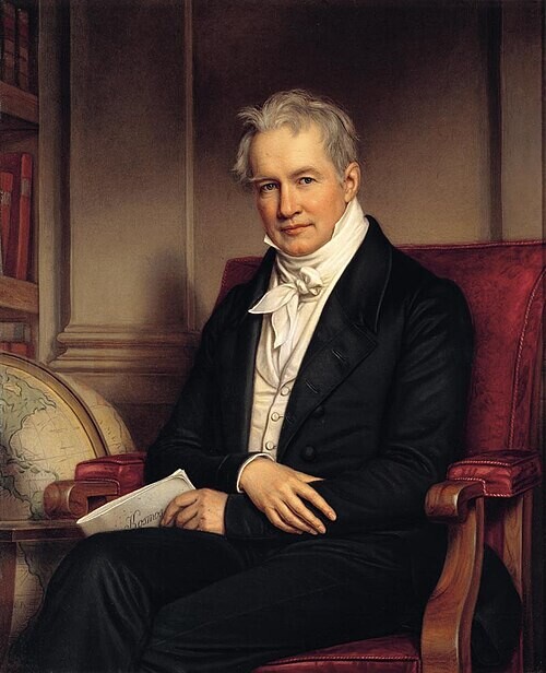
Mexico - Alexander von Humboldt - 1811
This map of North America was made by the famous naturalist, polymath and explorer, Alexander von Humboldt. By 1811, San Francisco Bay has clearly been identified.


Hidden content here...
 i36774
 i5086
i5086
“Humboldt, who during his lifetime was considered the world's greatest living man, composed this map during his 1803 sojourn in New Spain (Mexico). Covering from Alta California to Connecticut and from the Great Salt Lake (here Timpanagos) to Honduras...[this map outlines]...the territory that in the coming years would be subsumed into the expanding United States. Humboldt spent part of 1803 and 1804 living in Mexico City as a guest of the Spanish Crown. As such he had access to rarely seen explorer's accounts and earlier mappings available in the Mexico City archives. These he combined with information from his own travels and explorations, as well as indigenous cartographic traditions and his own theoretical understanding of geography, to create this landmark mapping of the North American southwest…” wikipedia.org
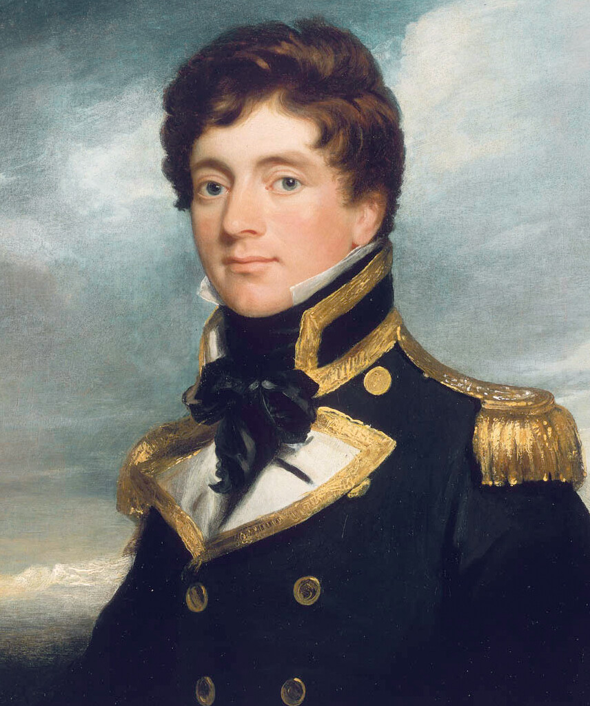
San Francisco Bay - Captain F.W. Beechey - 1827
Made by the British Hydrographic Office in 1827, this is a nautical map made for sailing into the San Francisco Bay and is noteworthy for its geographic accuracy. The map on the right features The Presidio, Yerba Buena Cove and the San Francisco Mission. Mount Diablo and Mount Tamalpais are also both shown, although Mount Tam’s name at the time was Table Hill.


“Very rare and important chart of San Francisco Bay, the result of the first scientific mapping of the Bay. The chart had a wide influence upon later maps of the area. The chart, with copies and adaptations of it, served to the end of the Mexican period and formed the substantial basis of the earliest ones produced under the American regime. It was deficient only in the region beyond Carquinez Strait. The chart of the entrance contains additional hydrographic data pertinent to entering the port and reaching the chief places of anchorage. Accompanying the chart are elevation views depicting the approaches to the bay and the hazards to navigation.” davidrumsey.com
San Francisco Harbor - Augustus Harrison - 1848
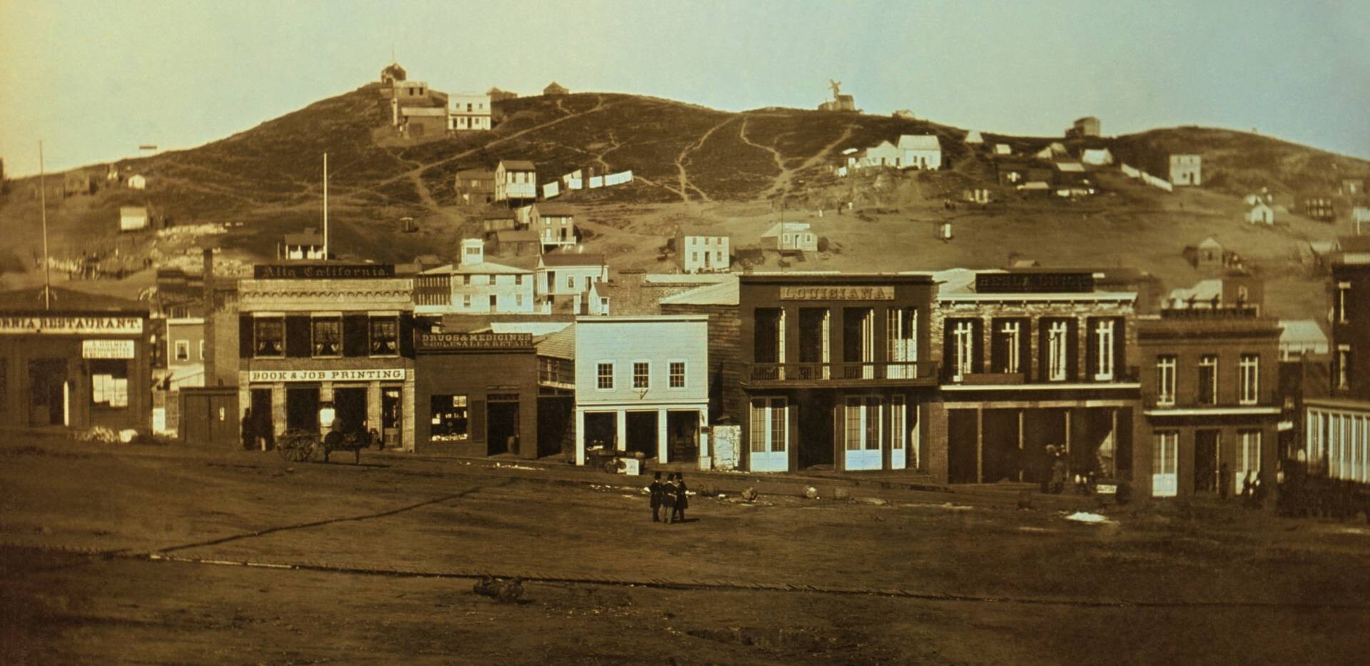
This map of 1848 shows the Yerba Buena harbor and the newly formed streets around the harbor, streets we all recognize today, as well as ships that were anchored in Yerba Buena cove.


https://archive.org/details/sanfranciscowate1977olms/page/280
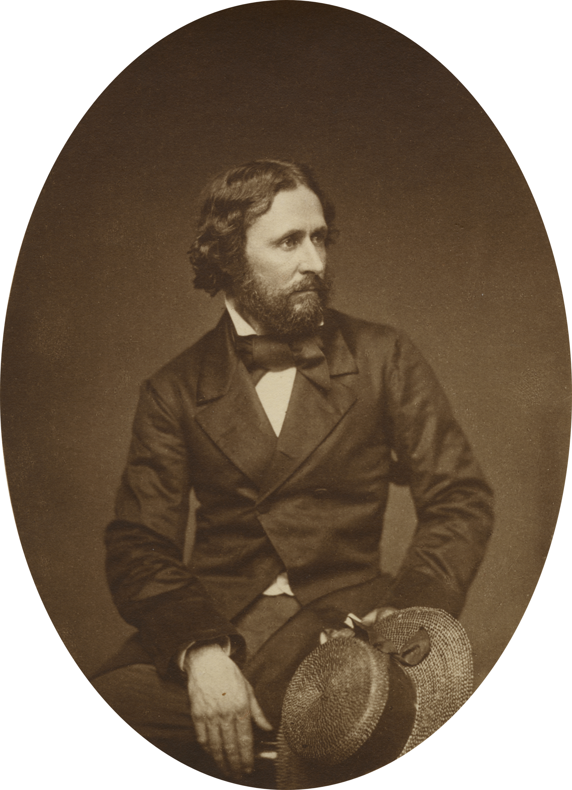
Western North America - John Charles Fremont - 1848
This map by John Fremont, also from 1848, is a seminal map for multiple reasons:
** The map served as a guide for many ‘49ers crossing the country.
** The SF Bay is fully formed and the Golden Gate is first named by Fremont.
** Only months ahead of the discovery at Sutter’s Fort, based on evidence, not a guess, Fremont labels the area around the American River as “El Dorado or Gold Region” based on his team’s surveys, his experience as a geologist and his intel from Native Americans.
** Note also that Lake Tahoe is Lake Bonpland, after the botanist Aime Bonpland, who had travelled with Humboldt.


“Fremont's Map of Oregon and Upper Californi . . . is without question one of the most important 19th Century maps of the American West. As noted by Carl Wheat, "in the history of the American West, the year 1848 is signalized by three events above all others, the discovery of gold at Sutter's Mill… the formal close of the Mexican War… which brought the cession of California and New Mexico… and the creation of the Territory of Oregon… All three events figure in the characteristic maps produced during the year, and particularly the cartographic monument of 1848, the magnificent 'Map of Oregon and Upper California'" (Wheat 49)...More than any other persons, John Charles Fremont and Charles Preuss dominate the cartography of the American West during the three years before the Gold Rush and brought a human tide surging into that land which had so long lain beyond the ken of most Americans" (Wheat, Mapping of the Transmississippi West, 523).”
San Francisco & Gold Country - Bidwell & Larkin - 1849
This is a famous map from 1849 that ushered in the Gold Rush. Published in Boston, I am drawn to the SF Bay where we see Angel and Yerba Buena islands, but Alcatraz here has the less-well-known name “White Island” because of how white a rocky island looks after seagulls have done their business.


“Nice example of Thomas O. Larkin's map of the Sacramento Valley, including the newly discovered gold regions, the first printed map of the gold regions. Thomas Oliver Larkin was an early California merchant, who served as U.S. Consul to the Province of California and U.S. Consul to the Republic of California, following the Bear Flag Revolt. His 2 letters to the president in June 1848 are two of the earliest communications of the discovery of gold in California sent to the East and his map of the Sacramento Valley was the first printed map to show the Gold Regions. The map shows Ranchos in the Central Valley and along the American river has "Gold Region" on both sides. The original was traced from a map prepared for Bidwell in 1844.” raremaps.com
Image: davidrumsey.com
“The title words including the Gold Region and the designation of the Mining District on the map make this map by Thomas Oliver Larkin, the first and last U.S. Consul to Mexican California, one of the key maps of California history. As Carl Wheat points out in his great cartobibliography, The Maps of the California Gold Region, it ranks as “one of the earliest (if not the earliest)” to denote the discovery area along the American River. In creating this map, Larkin simply took the best-known map of the Sacramento Valley, John Bidwell’s manuscript map of 1844, traced it, and made additions. As delineated by Larkin, the Mining District occupied two ranchos bordering both banks of the American River: Rio de los Americanos Rancho of the late William Leidesdorff and Rancho San Juan of Joel P Dedmund. Larkin sent his tracing back to Boston for publication, and publisher T. Wiley, Jr., for protection, placed the lithographed, hand-tinted map in a protective black cloth folder with the magical words Gold Region gilded on the front cover. On the inside cover, Wiley added a paper label with the words “A Correct Survey Of The Gold Region California.” With a copyright date of 1848, this stands as one of the earliest examples of a publisher taking advantage of the gold fever that was just beginning to sweep across the nation. Given the map’s lack of detail, it can hardly be called a “correct survey”.” californiamapsociety.org
California Historic Gold Mines - 1998
This modern-day map helps one see the extent of the gold rush and gold mining in California.


“Historic Gold Mines - In recognition of the California Gold Discovery to Statehood Sesquicentennial (1998-2000) CGS produced the Map of California Historic Gold Mines (PDF) (MM 009) as a poster at the scale of 1:1,500,000. The map shows the location of 13,500 historic California gold mines.” CA Department of Conservation
“The California Gold Rush was the largest mass migration in American history since it brought about 300,000 people to California. It all started on January 24, 1848, when James W. Marshall found gold on his piece of land at Sutter’s Mill in Coloma. The news of gold quickly spread around. People from Oregon, Sandwich Islands (now Hawaii) and Latin America were the first to hear the breaking news, so they were the first to arrive in order to test their luck in California by the end of 1848. Soon the others from the rest of US, Europe, Australia and China followed and since they mainly arrived during 1849 they were called the “forty-niners”...At first, the gold could be picked up from the ground but later on it was recovered from the streams and rivers with the use of pans. The gold rush peaked in 1852 and after that the gold reserves were getting thinner and harder to reach so that more sophisticated methods of mining had to be employed. The best results were achieved with hydraulic mining although it was environmentally damaging...The gold rush resulted in the hasty development of California: many roads, churches, schools and towns were built to accommodate the gold-diggers. In the beginning, property rights in the goldfields were not covered by law and this was solved by the system of staking claims. The gold also helped to speed up the admission of California into the US as a State. All the preparations in terms of constitution and legislature were made in 1849 and California became a state in 1850.” historynet.com
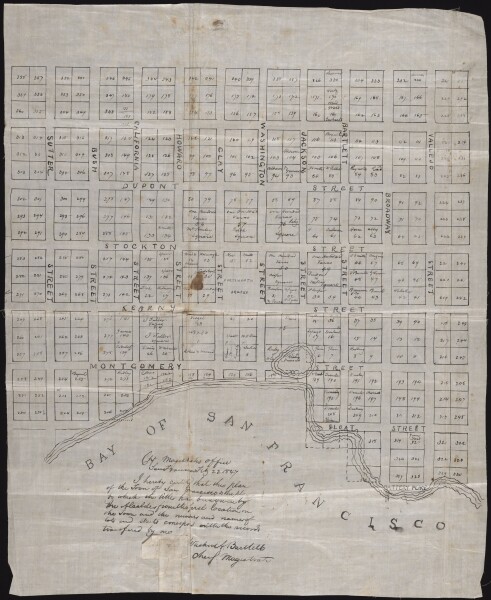
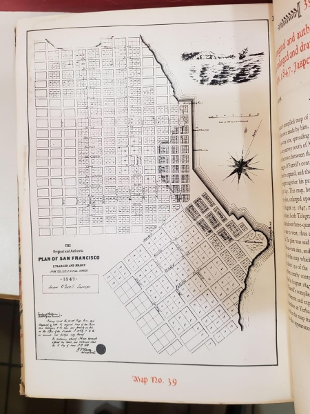
San Francisco - William Eddy - 1849
This 1849 map by William Eddy was made just after the gold rush and shows the plat plan for the city, as well as the planned filling of Yerba Buena cove.


fernhilltours | yale | amazon | google |
 i36730
 i36728
 i36729
”The map shows three small sections in outline color, corresponding to the grants to Senora Briones, the claim of the heirs of Col. J.A. King, and the claim of Senor Pana under a Mexican grant. The streets, original lot numbers, government reserver, Yerba Buena Cemetery, and the earliest wharfs are shown, along with Portsmouth Square and Montgomery Fort... William Eddy, surveyor for the town of San Francisco, created this first street map of the city in 1849. Only three years prior to the publication of the map, the United States had taken possession of the portion of California including San Francisco, and the next year, in 1847, an ordinance changed the city’s name from Yerba Buena to San Francisco. That same year, Jasper O'Farrell completed a survey of San Francisco covering 800 acres to Leavenworth and Fourth streets. Eddy’s map extends the city limits to Larkin, Eighth, and Townsend streets. The next year, California became a state.” neatlinemaps.com loc.gov
San Francisco Bay - William J. Lewis - 1851
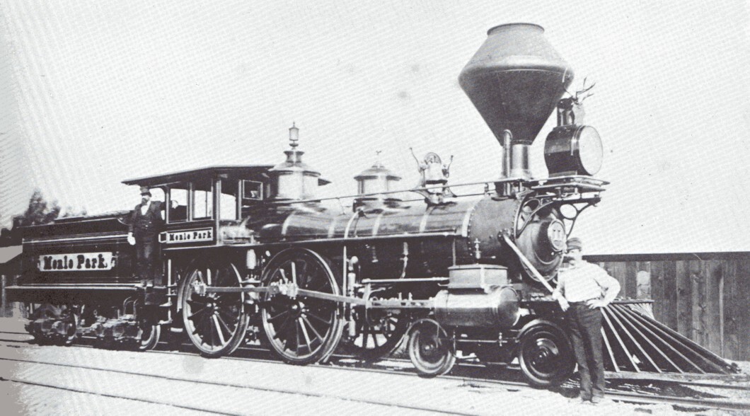
After the gold rush, the need for a railroad to San Francisco was quickly identified and a plan was made to build a rail line from San Jose to San Francisco. This map was made by William J. Lewis, a civil engineer, just 2 years after the gold rush began. It took about 13 years to complete this railway.


"Discussions of a railroad from San Francisco to San Jose were under serious discussion as early as 1851, with William J. Lewis serving as Civil Engineer. As noted in the History of Santa Clara County: The calculations for the building of a railroad between San Francisco and San Jose were, at the time, based upon the amount paid out over the route for transportation and freight. It was estimated that for the seven months ending January 31, 1851, there had journeyed between the two points ten thousand five hundred passengers, who had expended the sum of one hundred and sixty-eight thousand dollars,...By the month of July, fifty thousand dollars had been subscribed; in December the road had been surveyed, and a report made by the civil engineer, William J. Lewis, that was published December 26,1851...Railroad passenger service between San Jose and San Francisco would not begin until October 1863, with the opening of the San Francisco & San Jose Railroad. While a number of railroads were organized in California in the first half of the 1850s, no railroad would commence operation until 1855, when the Sacramento Valley Railroad began its earliest service.” raremaps.com
San Francisco - William Eddy - 1852
An 1852 map by William Eddy, the San Francisco surveyor. The city was developing quickly, but there are issues of competing land claims to be worked out. The claims are acknowledged on the top part of the map, which is oriented to the East. The job of surveyor was a coveted position and often led to wealth, although Eddy died at the age of 34 and likely without significant wealth.


1852, by Eddy. The city is developing quickly, but there are issues of competing land claims to be worked out. The claims are acknowledged on the top part of the map, which is oriented to the East.
"A Topographical & Complete Map of San Francisco. Compiled from the Original Map, from the recent Surveys of W.M. Eddy, County Surveyor, and Others."
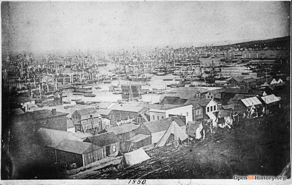
San Francisco Buried Ships - Michael Warner - 2017
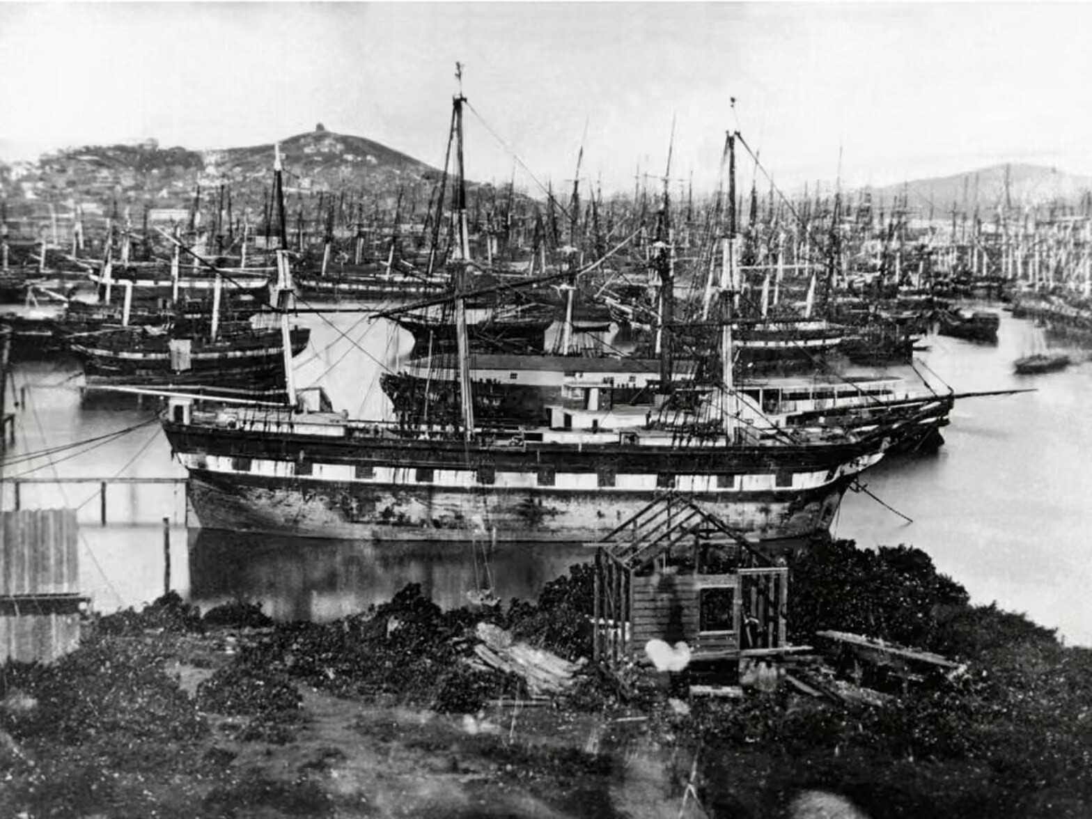
Michael Warner, who has worked as a Park Ranger, made this engaging map in 2017 of the known locations of ships buried in Yerba Buena Cove. During the early 1850s, the city of San Francisco had to deal with the gold rush ships that littered Yerba Burna Cove after being abandoned by their crews.


 i36759
 i36759
 i36760
"Beneath contemporary streets of San Francisco lie the remains of many sailing ships that brought people to San Francisco during the gold rush that began in 1849. The ships have different stories, but many were used at storage as the city's shoreline was expanded outward around them by landfill--some of these and other abandoned ships burned in fires and were buried afterward." San Francisco Maritime National Historic Park
San Francisco - Clement Humphreys - 1853
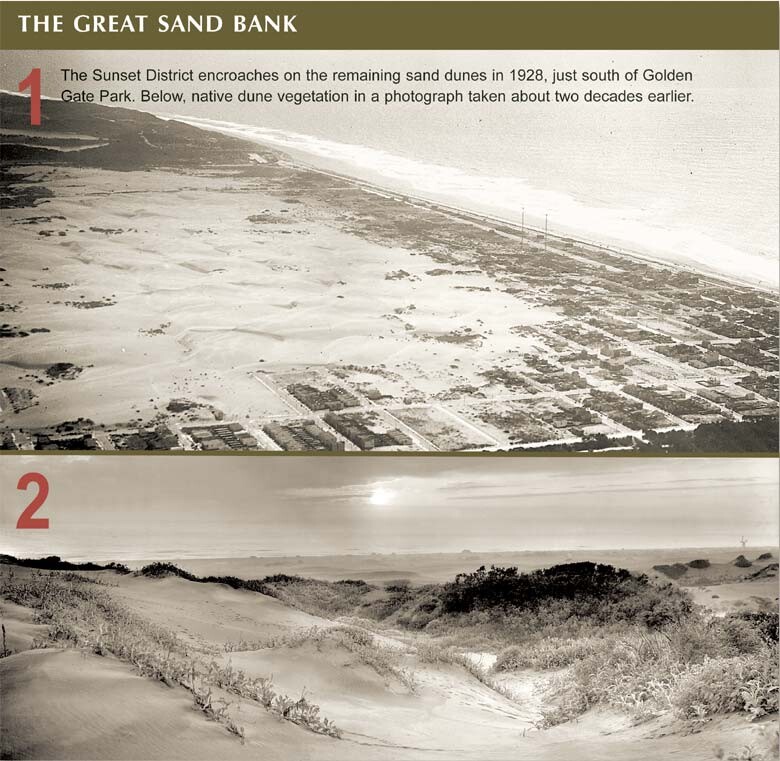
This 1853 map of San Francisco by Clement Humphreys shares both the limited portion of the peninsula San Francisco occupied at the time as well as its ambition to develop further. I love this whole city view, including the Great Sand Bank, part of the wider area that would later become known as the Outside Lands.


“In 1852, the city of San Francisco occupied only the northeastern portion of the peninsula of the same name. The city was also part of the County of San Francisco, which was separately governed and encompassed a much larger area, including what is today San Mateo County. However, San Francisco’s Board of Supervisors harbored ambitions to expand the city beyond its modest limits. As the mapping of the city had hitherto generally been limited to the densely settled area in what is now downtown, they commissioned a map that showed the territory west and south of the city. The map embraces the San Francisco Peninsula from San Bruno northwards, with areas of elevation, cliffs, and wetlands, lakes and streams all indicated. Major roads are shown, as are the Presidio and Telegraph Station above Fort Point, and ranchos are identified and their acreage indicated. The vast barren area to the southwest of the Golden Gate is labeled the “Great Sand Bank.” The city limits of San Francisco are demarcated, including the boundary extensions of 1850 and 1851, though the only man-made details within the city itself are Market Street, the “Mission” (Mission Dolores), the Embarcadero, and an adjacent brickyard.” bostonraremaps.com
San Francisco - US Coast Survey - 1857
This 1857 map was made by the US Coast Survey, who made maps exactly as things were, unlike the plat plans that showed land parcels to be developed in the future. This maps shows how in 1857, development has happened mostly in what is now downtown San Francisco.


“Rare first edition of the U.S. Coast Survey map of the City of San Francisco and vicinity. Printed without color. Relief shown by contours and spot heights. Includes note and table of reference to public buildings. 1857 edition marked a significant improvement in the USCS's mapping of San Francisco. Prepared by A.F. Rogers, it captured the tremendous growth of the City, locating wharves, streets, buildings, roads, topographical features and places such as the Union Race Course and Pioneer Race Course, west of the City. While first issued and corrected in 1857, neither of the 1857 editions was never published in the regular annual Coast Survey reports until a revised edition, dated 1859, was issued.” davidrumsey.com
San Francisco Western Addition Land Claims - anonymous - 1858
1858, nine years after the gold rush. The newly platted streets and the historical land claims are conflicting and need to be resolved. The city of San Francisco made this map and four others to figure it out.


“The three Van Ness Ordinances of 1856 to 1858 resulted in the creation and mapping of the Western Addition neighborhood of San Francisco. These five manuscript maps were likely made to show the existing land claims in relation to the newly platted streets, parks, and other public spaces. They may have been used in the subsequent resolution of the various land claims. They show many interesting artifacts of the early settlement of the area before it was officially made a part of the city in the mid 1850's. The 1858 date of the five maps is estimated, based on the creation of the Van Ness map in the same year. Part of the Mission district is also covered..” davidrumsey.com
“As a San Francisco alderman, [James Van Ness] sponsored the "Van Ness Ordinance", which ordered all land within the City limits that was undeveloped at that time (that is, west of Larkin Street and southwest of Ninth Street) to be surveyed and transferred to their original deedholders. Because there were many fraudulent deed holders at that time, this law led to many lawsuits for many years.” wikipedia.org
San Francisco Bache - 1859
De Groot's Map of the Washoe Mines - 1860
1860. The gold rush has calmed down, but now there’s a new rush, for silver in the area just to the East of what is now Lake Tahoe. In 1860 this lake was called Lake Bigler, after John Bigler, who had governed California in the 1850s. It was renamed Lake Tahoe in the late 19th Century after Bigler had demonstrated Confederate sympathies during the Civil War.


DeGroot’s Map of the Washoe Mines, published in San Francisco in 1860, is a landmark in Western cartography and mining history1. Created by Henry De Groot, one of the first miners to reach the newly discovered Comstock Lode in “Western Utah” (soon to be Nevada), the map was the earliest printed depiction of the Washoe mining region. It meticulously charts towns, ranchos, mining camps, wagon roads, mountain trails, and ditches, serving as an indispensable guide for California gold miners heading east to the silver fields. The map’s detail and accuracy made it the foundational reference for the region, highlighting settlements like Virginia City and Gold Hill1.
A notable feature is the inclusion of “Lake Bigler,” which is present-day Lake Tahoe. The lake’s name was politically contentious: originally named for Governor John Bigler in the 1850s, it became controversial due to Bigler’s later Confederate sympathies. During the Civil War, Unionists promoted the Washoe (Paiute) name “Tahoe,” meaning “lake” or “water in a high place,” and by the late 19th century, “Lake Tahoe” became the common usage, officially adopted in 1945234. DeGroot himself played a role in advocating for the Tahoe name2.
DeGroot’s map is significant for documenting both the mining boom that transformed the West and the evolving identity of one of America’s most famous lakes.
- https://exhibits.stanford.edu/mining/catalog/zb092xj0060
- https://en.wikipedia.org/wiki/Lake_Tahoe
- https://laketahoetraveltips.com/lake-tahoes-rich-history/
- https://www.watereducation.org/western-water/road-iconic-high-sierra-lake-was-once-namedbigler
- https://www.cocohistory.org/essays/contra-costa-county-and-how-lake-tahoe-got-its-name
- https://www.tahoedailytribune.com/news/fremont-discovered-tahoe-150-plus-years-ago-today/
- https://www.moonshineink.com/tahoe-news/bigler-blunder/
- https://substack.com/home/post/p-121625827
- https://rickymortensen.substack.com/p/ep-15-keep-bigler-blue-the-lake-tahoe-a2a
- https://calisphere.org/item/dc93690851b88b81cd1369e28744d172/
- https://calisphere.org/item/40a35cbe0e1ca176eb63315b05c257c5/
- https://www.icollector.com/De-Groot-Map-of-the-Washoe-Mines-Third-Edition-Original-1860-167525_i49117533
- https://www.raremaps.com/mapmaker/2611/Henry_De_Groot
- https://exhibits.stanford.edu/mining/catalog.html?page=1&q=%22early%3B%22&sort=pub_year_isi+asc%2C+title_sort+asc&view=list
- https://exhibits.stanford.edu/mining/catalog.html?f%5Bgeographic_facet%5D%5B%5D=California&page=1&per_page=12&sort=pub_year_isi+asc%2C+title_sort+asc&view=list
- https://www.yosemite.ca.us/library/scenes_of_wonder_and_curiosity/lake_bigler.html
- https://exhibits.stanford.edu/mining/catalog?f%5Bpub_year_w_approx_isi%5D%5B%5D=1860&per_page=12&q=%22Societies.%22&sort=pub_year_isi+asc%2C+title_sort+asc&view=list
- https://www.mininghistoryassociation.org/Journal/MHJ-v8-2001-Francaviglia.pdf
- https://wnhpc.com/details/zb092xj0060
- https://www.youtube.com/watch?v=bFNXYe3mOb4
[ 2025-06-22 21:57:00 ]
San Francisco - City Land Association - 1860
1860 City land associations were the means by which regular people could buy property in San Francisco as it was growing rapidly. These were collective organizations formed to acquire, subdivide, and sell land to their members.


"Date estimated. Due to the historic practice of delineating city parcels on maps whether or not they were developed, the map user should not be misled as to the extent of development."
San Francisco - Butler - 1864
San Francisco in 1864 by James Butler. This map shows a period of substantial transition, from ranchos to plats, as well as the development of the railroad and the expected fill along the shores inside the Golden Gate.


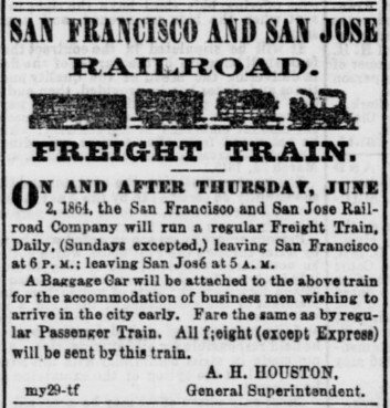
The Butler map of San Francisco, created by G.T. Butler in 1864, documents the city during a transformative period of railroad expansion and urban development. It centers on the newly operational San Francisco & San Jose Railroad (S.F. & S.J. R.R.), which began service that year. The map details the railroad’s route from its terminal at Temple/Old San Jose (modern 25th and San Jose Avenue) southwest through Noe Valley and Glen Park, with depots marked at Mt. Vernon and Lakeville. A key feature is the Bernal Cut—a 35-foot-deep, quarter-mile-long excavation through bedrock enabling the line to traverse the San Bruno Range2.
Land Claims and Ranchos:
The map reflects the transition of former Mexican-era ranchos into urban plats. While it does not explicitly label ranchos, the depicted area overlaps historically contested lands like the Potrero Nuevo (de Haro family) and Potrero Viejo (Bernal family) ranchos. These areas, once embroiled in U.S. Land Commission disputes, appear subdivided for development, illustrating how railroad infrastructure accelerated the shift from pastoral claims to residential and commercial use3. The route cuts through regions where squatters and speculators had occupied disputed lands since the 1850s, now formalized into street grids and property lines.
Plats and Urbanization:
Butler’s map highlights the S.F. & S.J. R.R.’s influence on land use:
- The railroad’s path follows Valencia Street to 25th, then diverts southwest, avoiding the Mission Bay wetlands2.
- Emerging neighborhoods like Noe Valley show new platting, with overpasses and bridges (e.g., at 27th/Dolores) accommodating the rail line.
- The map underscores San Francisco’s expansion beyond the 1851 charter line, with former rancho lands repurposed for transportation and settlement13.
In essence, the Butler map captures San Francisco’s rapid evolution from disputed ranchos to a modern city shaped by rail, documenting infrastructure’s role in resolving land conflicts and driving urbanization.
- https://www.raremaps.com/gallery/detail/43069/map-of-the-country-40-miles-around-san-francisco-exhibiting-ransom
- https://www.nesssoftware.com/www/sf/sfsjrr.php
- https://www.foundsf.org/Mexican_Land_Claims%E2%80%94The_U.S._Land_Commission_and_The_Burden_of_Proof,_1851-1854
- https://collections.leventhalmap.org/search/commonwealth:kh04p696p
- https://pixeum.org/exhibits/166
- https://www.davidrumsey.com/luna/servlet/detail/RUMSEY~8~1~303659~90074286:Map-of-the-City-and-County-of-San-F?sort=pub_list_no_initialsort%2Cpub_list_no_initialsort%2Cpub_date%2Cpub_date&qvq=q%3A%3DSan+Francisco+AND+%3Dmining+%3Bsort%3Apub_list_no_initialsort%2Cpub_list_no_initialsort%2Cpub_date%2Cpub_date%3Blc%3ARUMSEY~8~1&mi=4&trs=44
- https://www.raremaps.com/mapmaker/11558/F_S_Butler
- https://geodata.lib.berkeley.edu/catalog/stanford-xj983zr6622
- https://www.davidrumsey.com/luna/servlet/view/all/who/Butler,+James,+1863-1864/what/Separate+Map?sort=pub_list_no
- https://www.outsidelands.org/a-drive-by-history-of-great-highway.php
- https://www.outsidelands.org/crucible/author/wnpoffice_wp/page/2/
- https://www.locallanguageart.com/products-archive/llp0039
- https://www.davidrumsey.com/luna/servlet/view/all/what/Separate+Map/where/San+Francisco+(Calif.)?sort=author%2Cpub_list_no&os=0&pgs=50&cic=RUMSEY~8~1
- https://www.raremaps.com/category/Maps/United_States/California/California?order_by=creator
- https://archive.org/details/sanfranciscbusi186465sanf
- https://www.sanfranciscohistory.com/BVHP_Context.pdf
- https://default.sfplanning.org/Preservation/CorbettHeightsHCS/hp_corbett_hcs_Corbett_Heights_HCS_Draft-May2017.pdf
- https://www.raremaps.com/gallery/detail/111610
- https://default.sfplanning.org/Preservation/CorbettHeightsHCS/hp_corbett_hcs_HCS_FINAL-081617.pdf
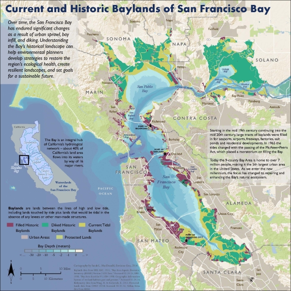
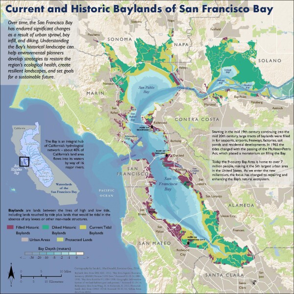
Current and Historic Baylands of San Francisco Bay - MacDonald - 2016
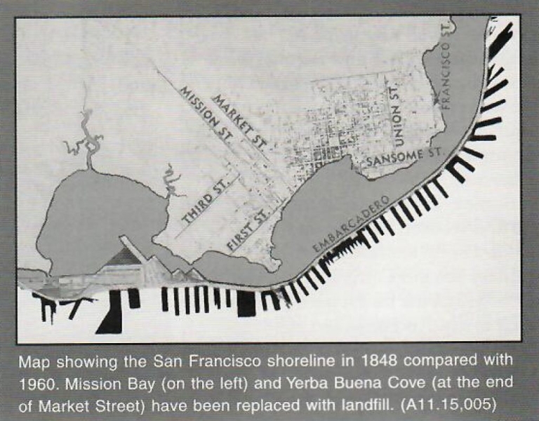
The fill showed in the Butler map of 1864 proved to be a small percentage of the total amount of land that was created by fill. In 1965, a moratorium was placed on further filling of the Bay. Thanks to Sarah MacDonald for this excellent map made in 2016.


[ 2025-07-13 19:36:47 ]
San Francisco - US Coast Survey - 1869
This 1869 Coast Survey map shows how San Francisco remains a city by the Bay and not by the ocean. Halfway across the city, development pretty much doesn’t exist. Jim Schein calls this the Abe Lincoln map of San Francisco.


“A rare 1869 U.S. Coast Survey chart or map of San Francisco Peninsula. This map depicts the city of San Francisco and surrounding areas as far south as San Pedro and Millbrae Station. The San Francisco – San Jose Railroad, the first to link the port of San Francisco to the major inland rail yards in San Jose, is clearly noted. This island Alcatraz is also noted with some of its early military fortifications evident. This chart is of significance not only for its stunning detailed mapping of the San Francisco Peninsula, but also because it is one of the first U.S. Coast Survey charts use contour lines to depict topography. The convention would, in subsequent years be adopted by the U.S. Geological Survey – a late 19th century offshoot of the U.S. Coast Survey. This stunning example of the Coast Survey’s work at its finest was completed under the supervision of A. D. Bache by R. D. Cutts, A. M Harrison, and A. F. Rodgers between 1850 and 1857. It is of note that this example of the maps was not issued as part of the U.S. Coast Survey Annual Report, but rather is an independent issued chart on thick stock.” geographicus.com
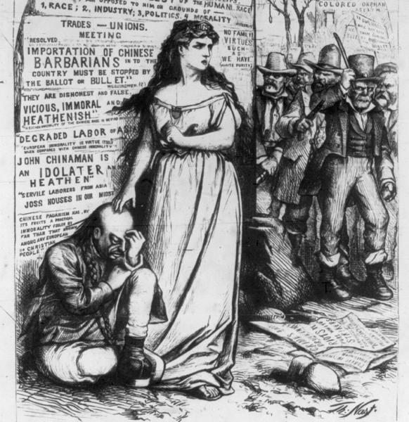
San Francisco Chinatown - Henry Josiah West - 1872
Chinatown by Henry Josiah West, 1872. One of the most unfortunate aspects of San Francisco’s growth was the overt racism against the Chinese that manifested itself in the 1870s and 1880s. Until 1906, virtually all Chinese people in San Francisco were forced to live in the Ghetto of Chinatown, which the Chinese called Tangrenbu. This fear-mongering map even came with a rhyming racist poem.


Note: see poem in the lower left corner of the map. “To outsiders, San Francisco’s Chinatown, with its 20,000 residents, is a tourist attraction, a special place to shop or stroll along the streets. For the Chinese, however, it is “Tangrenbu,” the port of the city of Tang. Today, Chinatown represents the combination of neighborhood and capital of West Coast Chinese culture...Until April 17, 1906, Tangrenbu was a ghetto where outsiders forced the Chinese to live. The Great San Francisco Earthquake and Fire that shook, then burned, the city on April 18, 1906, swallowed Tangrenbu whole.” Lost San Francisco, Dennis Evanosky and Eric J. Kos “San Franciscan’s were worried about a Chinese invasion. This map is part of a years-long campaign to stem Chinese immigration and the Chinese influence in San Francisco and to keep the Chinese in their ghetto, Chinatown.” Tom Paper californiahistoricalsociety.org
Panorama of San Francisco, From California -St. Hill - Eadward Muybridge - 1877
San Francisco panorama, photographed and created in 1877 by Eadward Muybridge, who was famous for working with Leland Stanford on stop-motion photography, as well as for murdering his wife’s boyfriend and getting away with it by arguing that the crime was motivated by defending his Victorian honor.


![[ 2025-03-01 21:50:33 ]](https://pxpbstrg.s3.us-west-1.amazonaws.com/images/thumbs/1740865839.jpg) i32939
i32939
 i34407
[ 2025-03-01 21:54:01 ]
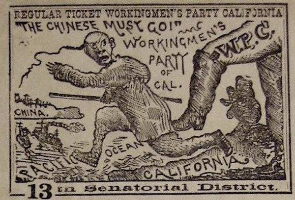
San Francisco Chinatown - Board of Supervisors, Farwell, Kunkler & Pond - 1885
San Francisco’s Chinatown in 1885, made by the Board of Supervisors. This map was specifically made to fuel hatred against the Chinese and keep them in the ghetto of Chinatown. Bright colors are for White prostitution, Chinese prostitution, Joss houses (pejorative for shrines) and opium dens.
 i43324
 i43325

“This map reflects the pervasive bias against the Chinese in California and in turn further fostered the hysteria. It was published as part of an official report of a Special Committee established by the San Francisco Board of Supervisors "on the Condition of the Chinese Quarter." The Report resulted from a dramatic increase in hostility to the Chinese, particularly because many Chinese laborers had been driven out of other Western states by vigilantes and sought safety in San Francisco...From the report: "The Chinese brought here with them and have successfully maintained and perpetuated the grossest habits of bestiality practiced by the human race." The map highlights the Committee's points, particularly the pervasiveness of gambling, prostitution and opium use. The Report concludes with a recommendation that the Chinese be driven out of the City by stern enforcement of the law.” PJ Mode Collection at Cornell
San Francisco - Frederick Marriott - 1875
1875 by Frederick Marriott. This bird’s eye view map style was popular across the United States, for both large cities and small towns. I love how this map conveys a bustling and important city, filled with ships, factories, churches and homes. San Francisco at this time was, in many ways, the second most important city in the United States, after New York City. It represented and was at the center of the growth and opportunity that existed in the American West.


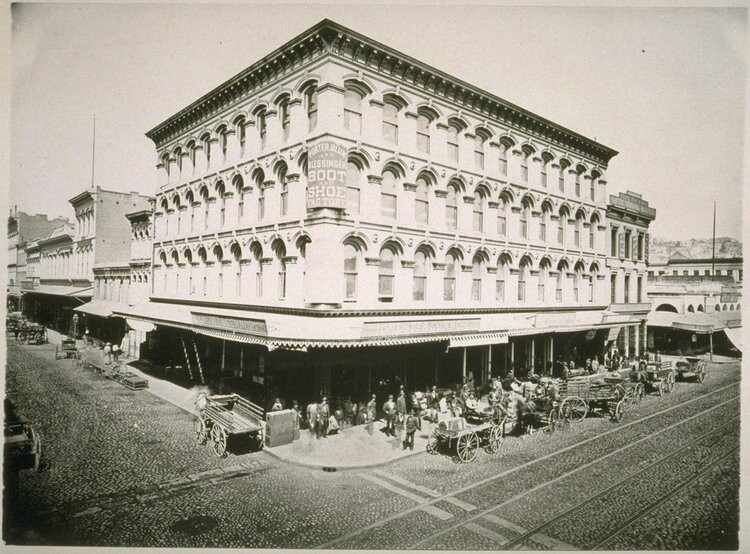
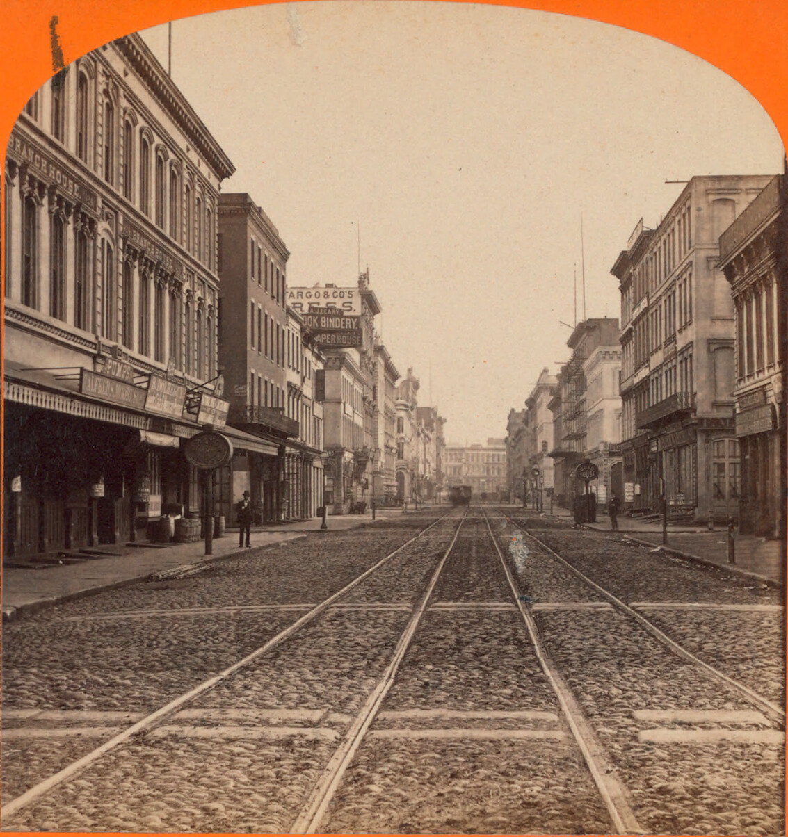
sfseawallblog | emperornortontrust.org
 i36761
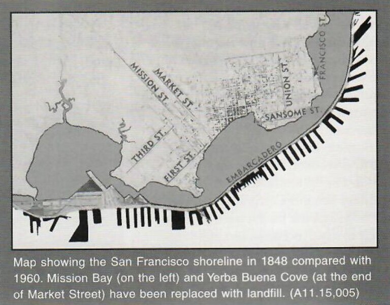 i36762
“Graphic chart of the city and county of San Francisco respectfully dedicated to the leading interests of California and the Pacific coast. The city of San Francisco was incorporated in 1850, and later grew to become one of the most famous cities in the US. The California Gold Rush in 1848 saw the city's population increase from 1,000 to 25,000 over the course of a year. This map published in 1875 by Frederick Marriott of Britton, Rey & Co. from a drawing by L.R. Townsend, E. Wyneken and J. Mendenhall is oriented with north toward the lower right. There are 188 different points-of-interest that are located on this map.” worldmapsonline.com
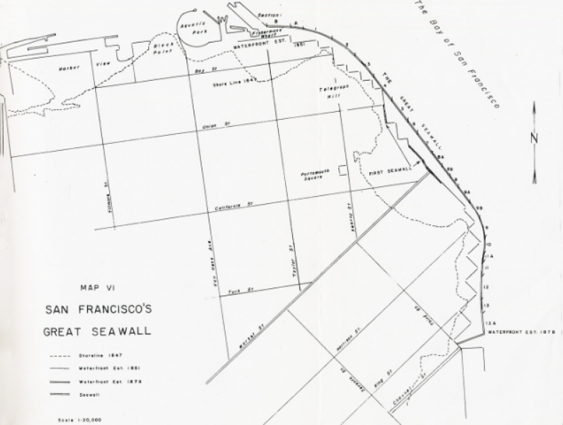
San Francisco Seawall - SF Business Times - 2019
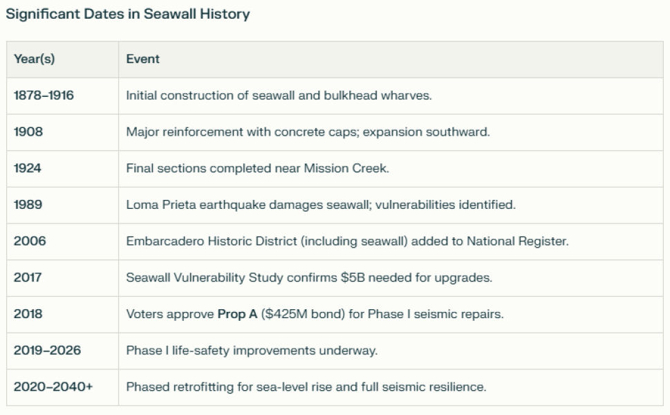
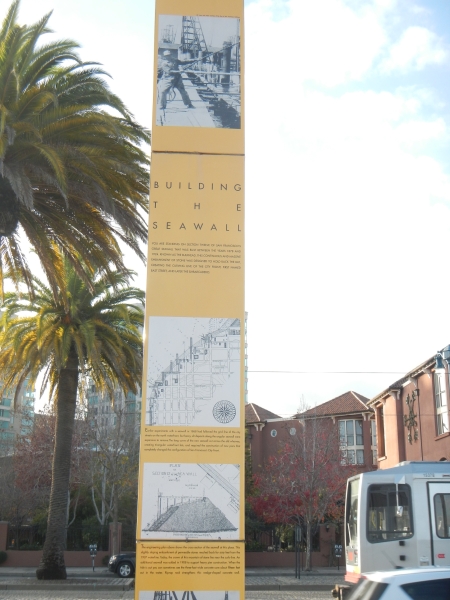
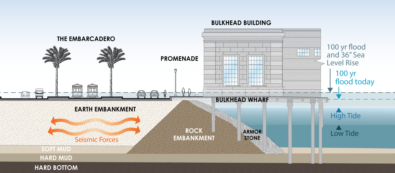
From 1878 to 1916, a seawall was built from Mission Bay all the way to Fisherman’s wharf. The seawall reclaimed huge amounts of shorefront and allowed the city to prosper economically. Fast forward to 1989, the Loma Prieta earthquake, when faults in the seawall were uncovered. $5 billion of spending is now needed to shore up the seawall. Image Source: SF Business Times 2019


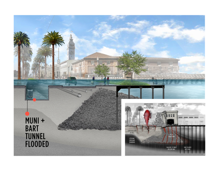 i36767


i36767
“Tens of thousands of people rely on this piece of San Francisco daily but might not even realize it is there. The Embarcadero Seawall stretching south along the Bay for more than three miles from Fisherman’s Wharf supports popular spots including the Ferry Building and Oracle Park, along with vital assets like the Transbay Tube, Muni rail lines and power and water systems. But this often unnoticed behemoth is aging, and recent studies have found it’s not fit to deal with the next big earthquake that hits the region or with the sea level rise that’s already threatening more intense flooding along the waterfront...The city is taking action to remedy this aging protector of San Francisco, rallying support from local voters, the state and federal funding sources for a massive repair project estimated to cost $5 billion. The task now is figuring out how to best address the current and future risks.” SF Business Times | CMG Architecture & Design | sfport |
San Francisco - McDonald and Williams - 1879
San Francisco in 1879 by McDonald & Williams. People were coming to visit San Francisco and they needed a map. I love how this map basically ignores the Outside Lands and makes it seem like the Pacific Ocean abuts downtown.


 i36982
 i36767
“This miniature map of San Francisco features an interior view of the McDonald & Williams “clothing house” as well as a street view placing it at 14 Montgomery, adjacent to Pacific Publishing, the map’s publisher, at 22 Montgomery. The back cover lists “Points of Interest and Information,” including Alcatras (sic) and the U.S. Mint. Timetables for ferries, local trains, and bay and river steamers are listed on the back of the map.” stanford.edu
San Francisco Water Supply - Sanborn Map Company - 1899
A map from 1899 about San Francisco and its water, vital to the city, but, in retrospect, inadequate to put out the fires from the 1906 earthquake. This map shows the water districts and reservoirs. All of this was before Hetch Hetchy, which was only completed in 1934.


foundsf.org | perplexity on log flume | LOC
“The Spring Valley Water Company was a private company that held a monopoly on water rights in San Francisco from 1860 to 1930. Run by land barons, its 70-year history was fraught with corruption, land speculation, favoritism towards the moneyed elite, and widespread ill will from the general populace."
"In 1850 San Francisco was a treeless windswept dunescape, receiving about 22 inches of rain a year, mostly in the winter. The few creeks running through the land could hardly support the instant city rising from the sand. It was clear that water would have to come from outside the city limits, and whoever controlled the water rights and delivery would control the city and its growth, and have unparalleled opportunities for development and great wealth."
"George Ensign rose to the top in a competitive field shrouded in secrecy. The California Legislature had passed an act of eminent domain, permitting the taking of privately held land and water rights for the common good of cities. Thus empowered, George Ensign was able to seize rights of way to store and deliver water to San Francisco. In 1860 George Ensign incorporated the Spring Valley Water Works (later changed to Company), soon to become the state’s most powerful monopoly. For decades to come the power of eminent domain gave for the elite owning the water company an opportunity to acquire empires in real estate with land increasing in value as the water flowed in.” foundsf.org
San Francisco - Grunskey - 1899
1899. Where you have water and humans, you also have sewage and this map showed where sewer lines were built or needed to be built.


“San Francisco is unique in California as the only city served predominantly by a combined sewer system. San Francisco collects both sewage and stormwater in the same network of pipes, then treats and discharges the combined flows to San Francisco Bay or the Pacific Ocean. Except for portions of Old Sacramento, all other cities in California have separate sewer systems, which means there are two sets of pipes in the ground. One set of pipes takes sanitary waste to the treatment plant while a second set carries stormwater runoff from street drains directly into creeks, lakes, or the ocean...Many United States cities built prior to 1900 had combined sewer systems. At that time, sewage treatment was not available and sewers simply directed sewage into local water bodies. When sewage treatment became necessary to protect public health, newer cities built separate systems to save on the costs of treating stormwater. Some of the older cities opted to separate their combined systems. San Francisco, already a dense urban environment, decided that separation was too costly and disruptive to the residents. Separating the sewers would have required ripping open nearly every street for stormwater pipe installations. Today, the treatment of stormwater in San Francisco’s combined sewer system helps protect the environment. Many cities that have separate systems are now initiating treatment of urban runoff.” Oakland Museum of CA
San Francisco - US Coast Survey - 1903
1903. A Coast Survey map, you can see actual roads have extended about half-way across the seven-mile width of San Francisco, but much of the Sunset and the Richmond are undeveloped.


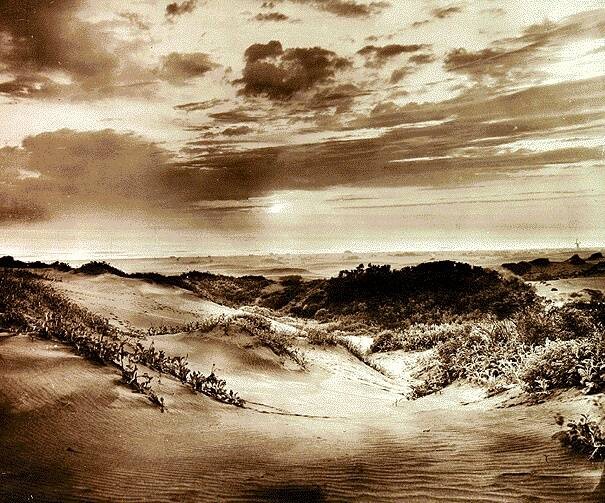
Source: foundsf.org
“When the idea of Golden Gate Park was first hatched, in the mid-1860's, the whole world scoffed: Everyone knew that the western half of San Francisco was an arid wasteland of barren sand dunes, upon which nothing could be made to grow. The Santa Rosa Press-Democrat, in 1873, wrote: "Of all the white elephants the city of San Francisco ever owned, they now own the largest in Golden Gate Park, a dreary waste of shifting sand hills where a blade of grass cannot be raised without four posts to keep it from blowing away..."...Fortunately, San Francisco ignored the conventional wisdom and set about the task of creating America's finest urban park. The two chief requirements were fertilizer and water; the latter was piped in and distributed with the help of the Dutch Windmill that still stands by the ocean near where John F. Kennedy Drive hits the Great Highway, while the former was provided in the form of the copious droppings generously bestowed upon the City's streets by the drays who were, until the 1920's, the mainstay of the local transportation system. Though no reliable estimate of the amount of horse-excrement collected for park fertilizer exists, the total undoubtedly ran into tens, even hundreds of thousands of tons. Despite its "natural" look, Golden Gate Park is a purely artificial paradise. One park gardener, asked to estimate how long the trees and plants would last if the irrigation were cut off, said "it'd be dunes again in ten or fifteen years ... though a few eucalyptus trees might survive." (And speaking of artificial paradises, Golden Gate Park has probably hosted more drug-induced mind-alterations per acre than any other patch of ground in the world.)” foundsf.org
davidrumsey.com sfgate.com sfrecpark.org foundsf.org kalw.org
San Francisco Golden Gate Park - Britton & Rey - 1903
1903. A beautiful and elegant map of Golden Gate Park, which had been developed by Hall and McClaren. This map served both as a navigational aid and a promotional tool, illustrating the city’s commitment to public green spaces and the growing accessibility provided by new roads and streetcar lines.


Map showing the Golden Gate Park, The Avenue And Buena Vista Park. 1903. Lith. Britton & Rey, S.F.
The “Map showing the Golden Gate Park, The Avenue And Buena Vista Park,” published in 1903 by Britton & Rey, captures San Francisco’s western neighborhoods during a pivotal era of urban growth and recreation. By 1903, Golden Gate Park had transformed from windswept sand dunes—stabilized through massive tree-planting and irrigation projects—into a lush, landscaped city centerpiece, featuring meadows, forests, lakes, and the iconic Conservatory of Flowers12.The map highlights not only the park’s intricate pathways and drives but also “The Avenue” (now likely John F. Kennedy Drive or a major park thoroughfare) and Buena Vista Park, San Francisco’s oldest official park, established in 1894.
Britton & Rey’s map served both as a navigational aid and a promotional tool, illustrating the city’s commitment to public green spaces and the growing accessibility provided by new roads and streetcar lines. The inclusion of multiple parks reflects the city’s vision for interconnected leisure spaces at the dawn of the 20th century. The map would have been especially useful to residents and visitors seeking to explore the city’s recreational offerings, as well as to real estate developers marketing the surrounding “Outside Lands” for new housing and investment2.
- https://thethirdself.com/2020/01/18/the-early-history-of-golden-gate-park/
- https://sfrecpark.org/1119/History-of-Golden-Gate-Park
- https://www.davidrumsey.com/luna/servlet/detail/RUMSEY~8~1~1576~170034:Map-of-the-Golden-Gate-Park-
- https://bvcasaskatoon.ca/buena-vista-park/
- https://www.sanfranciscostory.com/making-19th-avenue/
- https://www.davidrumsey.com/luna/servlet/detail/RUMSEY~8~1~234756~5510224:Golden-Gate-Park,-1903
- https://www.geographicus.com/P/AntiqueMap/goldengatepark-britton-1903
- https://www.abebooks.com/maps/Map-showing-Golden-Gate-Park-Avenue/32068511415/bd
- https://archive.org/details/dr_map-showing-the-golden-gate-park-the-avenue-and-buena-vista-park-1903-li-5361000
- https://sfmemory.org/maps/?u=sfm001-01328.jpg
- https://www.sfgate.com/bayarea/slideshow/When-San-Francisco-s-west-end-was-sand-dunes-130773.php
- https://www.outsidelands.org/golden_gate_park.php?f=images
- http://sfmuseum.org/hist2/ggpark.html
- https://www.hmdb.org/m.asp?m=132077
- https://home.nps.gov/goga/learn/historyculture/upload/35159fa%20Web%20version-2.pdf
- https://noehill.com/sf/landmarks/nat2004001137.aspx
- https://en.wikipedia.org/wiki/Golden_Gate_Park
- https://www.foundsf.org/Turning_Sand_Into_Golden_Gate_Park
- https://www.foundsf.org/A_HISTORY_OF_UNION_SQUARE
- https://www.davidrumsey.com/luna/servlet/detail/RUMSEY~8~1~188~10036:Britton-&-Rey-s-Map-Of-The-State-Of?qvq=w4s%3A%2Fwhen%2FCalifornia+Gold+Rush%3Bq%3ACalifornia%3Blc%3ARUMSEY~8~1&mi=16&trs=28
San Francisco - Chevalier - 1904
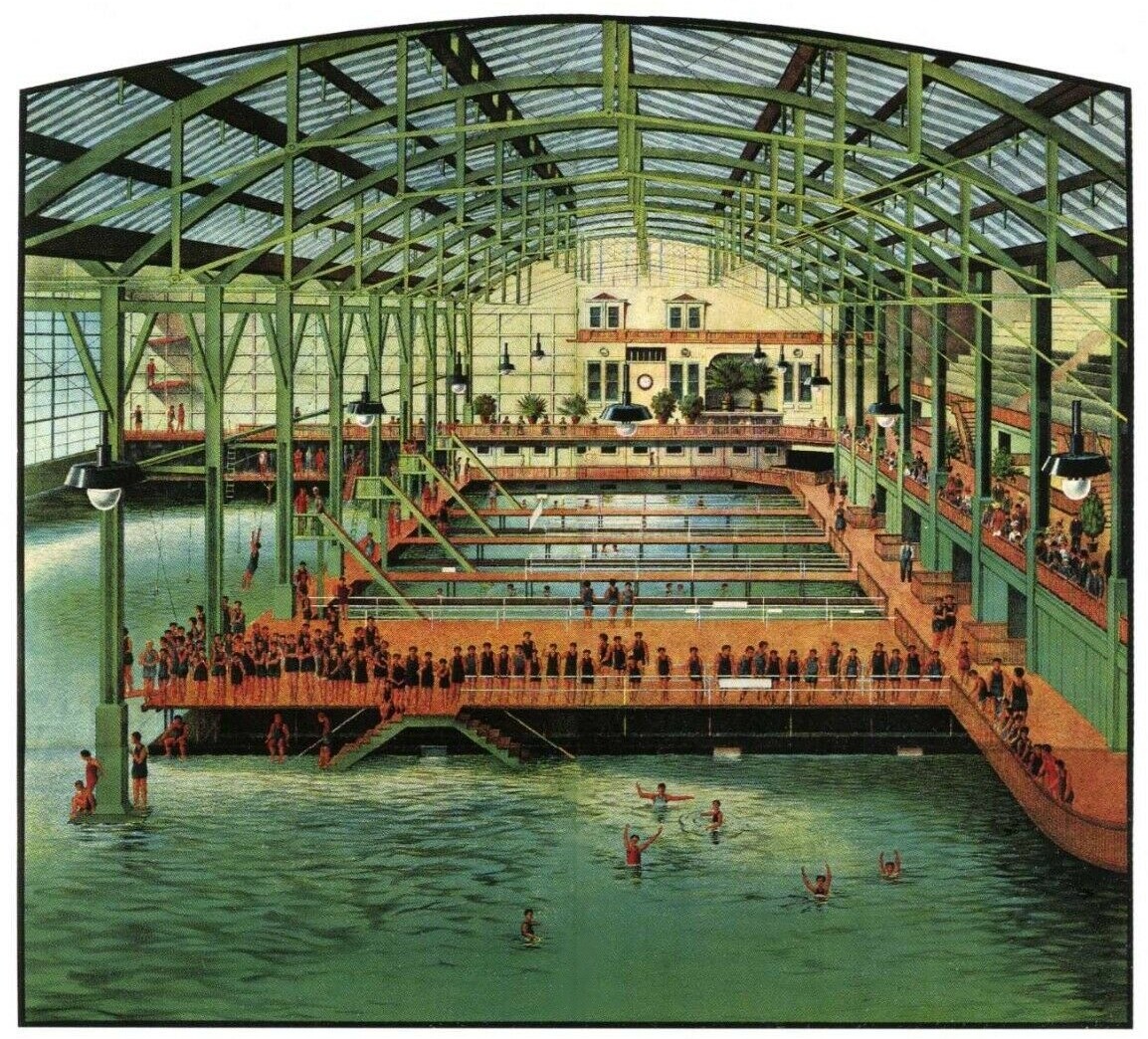
1904 by August Chevalier, a French-born lithographer and cartographer. San Francisco is a city on the rise. Gold and silver have propelled the boom. Big buildings downtown, and, to the west, parks & cemeteries, and, further west, the Sutro Baths, the Cliff House and a railroad to get you there.


“A tourist map, pre-earthquake, with great detail of sights, structures, monuments and land contours. Was a fold-out map in a larger 32-page book on San Francisco.” Tom Paper “Important and rare pre-earth-quake San Francisco town plan. Covering from the "Sunset District" and the Blue Mountain, up to the Golden Gate and the northern shore of the city ("being filled") this is a very fine folding map, complete with its original guide. This colour lithographed plan has nice architectural detail for the key buildings. Including : Cliff House, the U.S. Mint, City Hall, the S.F. Examiner building, Wells Fargo, the Institute of Art and the huge Ferry Building.” swaen.com
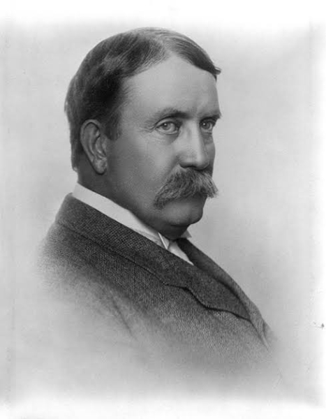
San Francisco - Daniel Burnham - 1905
An amazing map of San Francisco by Daniel Burnham in 1905, just before the famous earthquake and fire of 1906. Burnham’s plan is seen in the orange-shaded streets, which would have cut across the city in diagonals, reminscient of what had happened in Washington DC and Paris. Once the earthquake and fire happened, these plans were scrapped, but the city was rebuilt and celebrated in 1915 with the Pan Pacific International Exposition.


 i36704

“The last comprehensive plan San Francisco had for a greenway network was over a hundred years ago, when architect Daniel Burnham proposed it as part of his comprehensive plan for the City....When Burnham submitted completed plans and drawings to the City, Mayor Schmitz declared, “On behalf of the citizens of San Francisco, it gives me great pleasure to accept these plans and to state that in the future, they shall forever be our guiding star, as far as the beauty of the city is concerned.”When Burnham submitted completed plans and drawings to the City, Mayor Schmitz declared, “On behalf of the citizens of San Francisco, it gives me great pleasure to accept these plans and to state that in the future, they shall forever be our guiding star, as far as the beauty of the city is concerned.”...Burham’s plan was released, with great fanfare, just a few weeks before the 1906 Earthquake and Fire. It proposed carving a network of monumental new boulevards and public spaces through the city’s street grid. The plan also proposed that much of what was then undeveloped San Francisco remain as parkland...Although the 1906 Earthquake and Fire devastated two-thirds of San Francisco, the Burnham Plan’s vision for an integrated system of boulevards and parks was largely ignored, and the city’s subsequent development left the city’s parks largely separate from one another.” livablecity.org
San Francisco - William H. Lee - 1906
April 18, 1906. Tragedy strikes. San Francisco has an earthquake and fire that destroys 80% of the city. This dramatic map not only makes you feel like you are right there during the fire, but it also shows you how much bigger this fire was than the recent fires in Chicago and Baltimore.


 i36743
“A map of the area of San Francisco burned in the 1906 earthquake, with a overlay half-toned in red of the dramatic fire. The map appears to have been derived from one published in Leslie's Magazine shortly after the earthquake. See ID #1154, "Destruction of One of the Greatest Modern Cities" (1906). A comparison of these two images shows how the use of color and graphics can dramatically change the impact of a map. Despite the sensationalist impression conveyed by Lee's map, the text legend ("Plain Facts") emphasizes that "the beautiful Golden Gate city" has not been "entirely destroyed" and the "new San Francisco will be grander and more beautiful." See also ID #1155, "Ideal Picture and Map of San Francisco," 1906. This map is tipped into the front of Searight's book, published by the publishers of the map, Laird & Lee. However, the map is mentioned nowhere in the book, nor does it appear in the lengthy "List of Illustrations" in the book. It appears that the map was added after publication, which explains why it is found only in a small number of copies. Red is often used to emphasize the significance of fire or other hazards.” PJ Mode
San Francisco - Lawrence - 1906
April 18, 1906. The devastation is epic. You can see here the Fairmont Hotel and the James Flood Mansion, which became the Pacific Union Club after the fire. This photograph was taken by George Raymond Lawrence, an enterprising 38-year old who made a small fortune from this image, which he captured with a 49-pound camera kept aloft by a kite.


 i36743
“George Raymond Lawrence (February 24, 1868 – December 15, 1938) was a commercial photographer of northern Illinois. After years of experience building kites and balloons for aerial panoramic photography, Lawrence turned to aviation design in 1910...One of Lawrence's world-renowned photographs is of the ruins of San Francisco, California after the 1906 earthquake. It is a 160-degree panorama from a kite taken 2000 feet (600 m) in the air above the San Francisco Bay that showed the entire city on a single 17-by-48-inch contact print made from a single piece of film. Each print sold for $125 and Lawrence made at least $15,000 (US$ 418,277.78 in 2019) in sales from this one photograph. The camera used in this photograph weighed 49 pounds (22 kg) and used a celluloid-film plate.” wikipedia.org
San Francisco - Pettit - 1906
1906. What’s often overlooked about the fire and what this map shows, is that over 250,000 people were displaced by the 1906 earthquake & fire. That’s about 3 out of 4 people.


 i36744
See Pixeum exhibits of San Francisco immediately before and after the 1906 earthquake and fire.
San Francisco - A. H. M. Davies - 1906
Like our recent pandemic, the death toll from the earthquake and fire was devastating to the lives of San Franciscans. More people died in San Francisco on a % basis than the Spanish Flu or the Covid pandemic. This is a civic booster map made in 1906 to reassure investors, residents and visitors that San Francisco would recover.


 i36745
The "Ideal Picture and Map of San Francisco," published in 1906 immediately after the earthquake and fire, was a persuasive and optimistic map designed to reassure investors, residents, and visitors of the city’s resilience and rapid recovery1. Produced as part of a broader promotional effort, the map highlighted the undamaged neighborhoods and remaining infrastructure, while minimizing the extent of destruction. It was widely circulated, often accompanied by before-and-after photographs, to counteract negative perceptions and encourage business and tourism. The map’s significance lies in its role as a tool of civic boosterism, projecting confidence and hope in the city’s future during a time of crisis1.
- https://digital.library.cornell.edu/catalog/ss:23002903
- https://www.opensfhistory.org/Photoset/1906_Earthquake
- https://en.wikipedia.org/wiki/1906_San_Francisco_earthquake
- https://blogs.loc.gov/picturethis/2012/04/san-francisco-before-and-after-the-1906-earthquake-and-fire/
- https://earthobservatory.nasa.gov/images/6473/1906-san-francisco-earthquake
- https://digital.library.cornell.edu/catalog/ss:19343196
- https://www.reddit.com/r/ArchitecturalRevival/comments/1gtxv60/old_photos_of_san_francisco_before_and_after_the/
- https://digital.library.cornell.edu/catalog/ss:19343197
- https://googlemapsmania.blogspot.com/2015/05/the-great-san-francisco-earthquake-map.html
- https://www.raremaps.com/gallery/detail/92026/panorama-of-san-francisco-from-the-ferry-building-pillsbury-picture-co
- https://earthquake.usgs.gov/earthquakes/events/1906calif/18april/
- https://bigthink.com/strange-maps/161-map-of-the-san-francisco-quake-and-fire-1906/
- https://geo.nyu.edu/catalog/harvard-g4364-s5-1906-w3
- https://www.davidrumsey.com/luna/servlet/detail/RUMSEY~8~1~349848~90117241:Panoramic-View-of-San-Francisco-fro
- https://exhibits.stanford.edu/ruderman/catalog/kh807rw4514
- https://www.latimes.com/local/lanow/la-me-110th-anniversary-san-francisco-earthquake-pictures-20160413-htmlstory.html
- https://www.loc.gov/item/2020780035/
- https://www.conservation.ca.gov/cgs/earthquakes/san-francisco
- https://www.conservation.ca.gov/cgs/Documents/Publications/Special-Publications/SP_125-excerpt-SF-earthquake-and-fire-of-1906.pdf
- https://collections.leventhalmap.org/search/commonwealth:kh04p696p
- https://earthquake.usgs.gov/earthquakes/events/1906calif/virtualtour/
- https://seismo.berkeley.edu/outreach/1906_quake.html
- https://www.loc.gov/item/2023636664/
- https://www.geographicus.com/P/AntiqueMap/sanfrancisco-dewitt-1904
- https://earthjay.com/earthquakes/19060418_san_francisco/boatwritght_bundock_2008_MMI_1906_SAF.pdf
- https://www.britannica.com/event/San-Francisco-earthquake-of-1906
San Francisco - US Geological Survey - 1907
A primary cause of the devastation of the 1906 earthquake and fire was caused by the lack of water to put out the fire. The lack of water was caused by destruction of two critical water mains, which were destroyed by the earthquake. This 1907 map shows the areas destroyed by the fire as well as the city’s principal water systems and cisterns. The fragile water system was the primary reason for the establishment of the Hetch Hetchy reservoir, which was commissioned in 1910s but not completed until 1934.


The 1907 “Map of San Francisco and Vicinity Showing Relation of Burned District to the Entire City and the Location of the Principal Conduits in the Water-Supply System” was published by the U.S. Geological Survey after the 1906 earthquake and fire. This map is significant because it graphically documents the vast area destroyed by fire (highlighted in red) and overlays the city’s principal water conduits and cisterns. The inclusion of water systems is crucial: the earthquake shattered water mains, leaving firefighters unable to contain the fires, which caused most of the city’s destruction. The map thus illustrates the direct link between water infrastructure failure and urban disaster123.
- https://commons.wikimedia.org/wiki/File:1907_Geological_Survey_Map_of_San_Francisco_after_1906_Earthquake_-_Geographicus_-_SanFrancisco-humphrey-1907.jpg
- https://www.creators.com/read/terence-jeffrey/01/25/the-dam-that-keeps-san-francisco-from-running-dry
- https://exhibits.lib.berkeley.edu/spotlight/visualizing-place/catalog/68-3845
- https://cawaterlibrary.net/wp-content/uploads/2020/10/History-of-the-Hetch-Hetchy-System.pdf
- https://www.geengineeringsystems.com/ewExternalFiles/Transmission%201906.pdf
- https://en.wikipedia.org/wiki/San_Francisco_Fire_Department_Auxiliary_Water_Supply_System
- https://digicoll.lib.berkeley.edu/nanna/record/170211/files/brk00009634_34a.pdf?withWatermark=0&withMetadata=0®isterDownload=1&version=1
- https://www.geographicus.com/P/AntiqueMap/sanfrancisco-geologicalsurvey-1906
- https://www.alamy.com/map-of-san-francisco-showing-burned-district-accompanying-report-of-richard-l-humphrey-english-an-unusual-map-of-san-francisco-california-dating-to-1907-this-map-was-published-by-the-us-geological-survey-following-the-terrible-san-francisco-earthquake-and-fire-of-1806-this-natural-disaster-comparable-to-the-devastation-wrought-by-hurricane-katrina-is-considered-the-largest-is-california-history-this-map-highlights-the-developed-parts-of-san-francisco-most-damaged-by-the-fire-in-red-ink-it-also-shows-the-region-occupied-primarily-by-brick-buildings-streets-water-conduits-som-image188135891.html
- https://ms.wikipedia.org/wiki/Fail:1907_Geological_Survey_Map_of_San_Francisco_after_1906_Earthquake_-_Geographicus_-_SanFrancisco-humphrey-1907.jpg
- https://oac.cdlib.org/view?docId=hb7r29p21q%3BNAAN%3D13030&doc.view=frames&chunk.id=div00028&toc.depth=1&toc.id=div00004&brand=oac4
- https://exhibits.stanford.edu/ruderman/catalog/kh807rw4514
- https://www.sparisk.com/documents/06Spectra1906SFEQandFire-EnduringLessonsCRSTDOFTB.pdf
- http://www.waterworkshistory.us/CA/San_Francisco/
- https://blogs.loc.gov/maps/2021/04/shaken-to-the-core/
- https://pubs.usgs.gov/circ/1957/0378/report.pdf
- https://www.davidrumsey.com/luna/servlet/detail/RUMSEY~8~1~224255~5506358:Map-Of-San-Francisco-Showing-The-Wa
San Francisco - Chevalier - 1915 B&W
1915 by August Chevalier. San Francisco recovered brilliantly from the 1906 earthquake and fire. In less than 10 years, San Francisco had been rebuilt and hosted a world exposition celebrating the Panama Canal and the rebirth of San Francisco. Over 19million people visited San Francisco during the PPIE. Today, San Francisco gets about 24 million visitors per year.


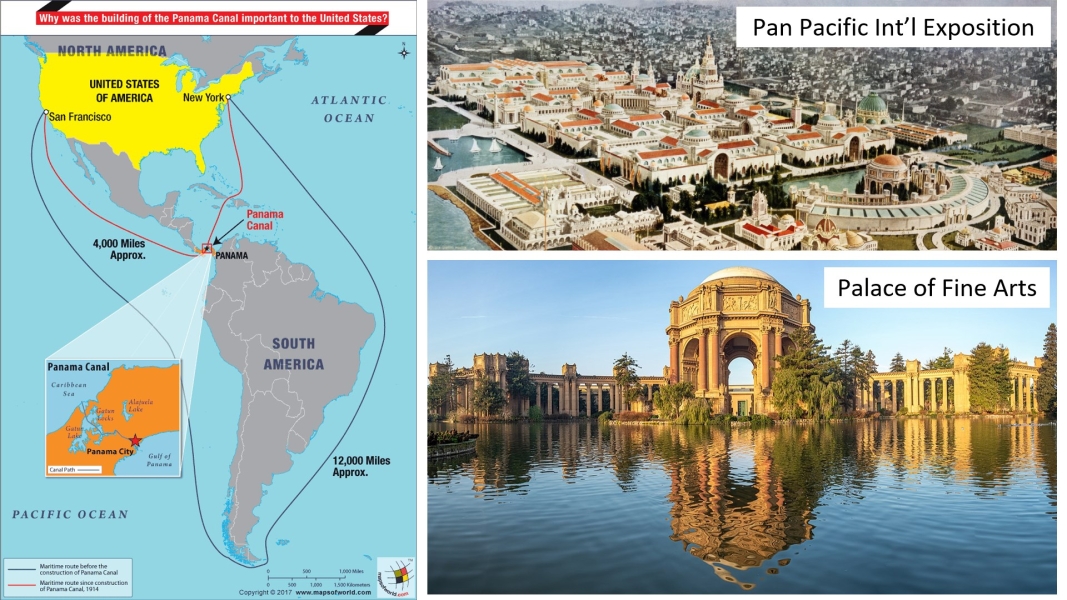 i36746
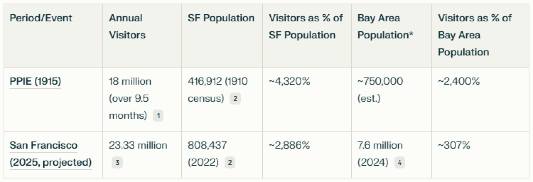 i36747
“Map of San Francisco on sheet 47x54, folded in paper covers 18x8. Copyrighted by August Chevalier, 1915. Shows the "Ground plan of the Panama-Pacific International Exposition. Relief shown by contours. Includes legend. Shows wards, city blocks, streets, railroads, bridges, tunnels, places of interest, important buildings are drawn in vignettes. Includes index to places of interest at the lower panel and index to theatres, railway depots and post offices at upper right. "Car lines" shown in red. Includes index and text on verso. See our other maps of San Francisco by Chevalier, from which this map is taken.” davidrumsey.com
“August Chevalier (fl. c. 1903 – 1932) was a San Francisco based lithographer active in the first decades of the 20th century. Chevalier is a remarkably elusive figure and little is known of his personal or professional life. He is best known for his large and magnificent topographical map of San Francisco boldly known as 'The Chevalier.' His few other maps also, almost exclusively, focus on San Francisco and the surrounding communities.” geographicus.com
San Francisco - 1915 - Peters
This 1915 map created by C. Merriman Peter and the Western Pacific Railway highlights both the extensive railway service to San Francisco, as well as the buildings that had been developed for the Pan Pacific International Exposition, which was a celebration of both the Panama Canal and San Francisco’s recovery from the earthquake and fire of 1906.


This detailed and colorful map was produced to mark the Panama-Pacific International Exposition, a major world’s fair that celebrated San Francisco’s recovery from the 1906 earthquake and fire. The map showcased the city’s streets, city blocks, parks, and crucially, its network of streetcar and trolley lines, centering on Market Street and emphasizing the connectivity of the city during this era of rapid growth.
The map was commissioned and published by the San Francisco Chamber of Commerce, under the direction of its Publicity Committee, as both a functional tool for visitors and a promotional piece highlighting the city’s attractions and infrastructure. Copyrighted in 1914 and printed by Britton & Rey Phototone, the work is a remarkable example of early 20th-century urban cartography, serving as a key artifact of the period. Despite the importance of this map, little is documented about C. Merriman Peter’s personal life or other works, and he appears to be known today chiefly for this contribution to San Francisco’s historical visual record1234.
- http://www.davidrumsey.com/luna/servlet/detail/RUMSEY~8~1~272108~90045908:Peter-s-San-Francisco-locator---The
- https://www.davidrumsey.com/luna/servlet/detail/RUMSEY~8~1~272108~90045908:Peter-s-San-Francisco-locator---The
- https://www.foundsf.org/The_First_Five_Years_of_Muni_through_Maps
- https://archive.org/details/dr_peters-san-francisco-locator--the-birds-eye-view-of-the-exposition-city-8292003
- https://www.mutualart.com/Artist/Peter-St--Clair-Merriman/E91FADEDDFEF42B4/Biography
- https://www.askart.com/artist/Peter_Clair_Merriman/11269781/Peter_Clair_Merriman.aspx
- https://ancestors.familysearch.org/en/LRYM-KXS/charles-merriman-peter-1827-1926
- https://en.wikipedia.org/wiki/Peter_Merriman_(geographer)
- https://en.wikipedia.org/wiki/Peter_Merriman
- https://podcasts.apple.com/se/podcast/peter-merriman-a-humble-approach-to-hospitality/id1440956533?i=1000441875648
- https://www.telegraph.co.uk/news/obituaries/10514050/Air-Commodore-Peter-Merriman-obituary.html
- https://www.mutualart.com/Artist/Peter-St--Clair-Merriman/E91FADEDDFEF42B4
- https://oac.cdlib.org/view?docId=tf9p3012wq&chunk.id=c000192&brand=calispher...
- https://ancestors.familysearch.org/en/LTC8-V2H/peter-clement-mariman-1904-1969
- https://www.societyandspace.org/articles/mobility-space-and-culture-by-peter-merriman
- https://dp.la/item/d1bc3ec0853b45d66172f4c88ace30d5
- https://t2m.org/bookauthors/peter-merriman/
- https://www.oldworldauctions.com/catalog/lot/185/264
- https://www.masshist.org/collection-guides/view/fa0122
- https://www.reddit.com/r/sanfrancisco/comments/qdsj8z/birdseyeview_map_of_san_francisco_by_c_merriman/
[ 2025-07-13 19:38:09 ]
San Francisco, US Coast and Geodetic Survey - from Ann Murphy - 1919
While San Francisco was growing rapidly after the 1906 earthquake and into the 1910s, this 1919 Coast Survey map shows that the Sunset was still sandy and still not entirely developed. My thanks to my colleague Ann Murphy who gave me this map.


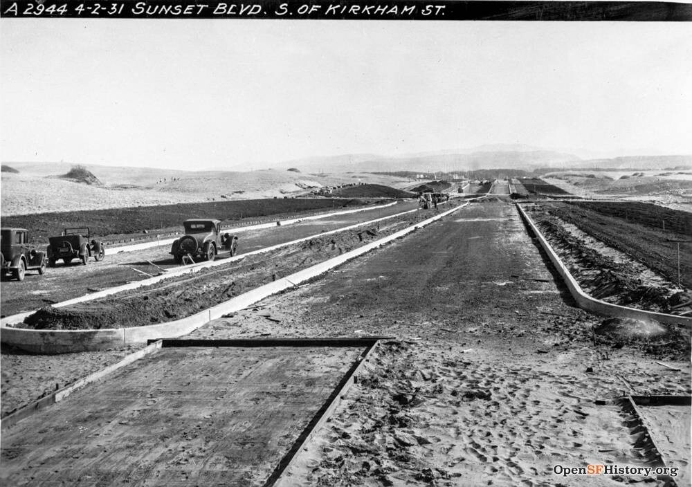
Second of two maps of San Francisco and the Bay Area, made by the US Coast Survey in 1918 and 1919, found in a garage in San Francisco. Thanks to Ann Murphy for sharing these map images.
“Geodesy, is the Earth science of accurately measuring and understanding Earth's geometric shape, orientation in space, and gravitational field. The field also incorporates studies of how these properties change over time and equivalent measurements for other planets.” wikipedia.com
San Francisco - Harrison Godwin - 1927
One of my favorites. Harrison Godwin made this playful map in 1928. It’s filled with history and humor. I strongly encourage you to spend some time on it. It shows Union Square shopping and it jokes about the Sunset sand dunes. Our Mayor Daniel Lurie should also appreciate that Godwin told his audience that San Francisco was the ideal convention city.


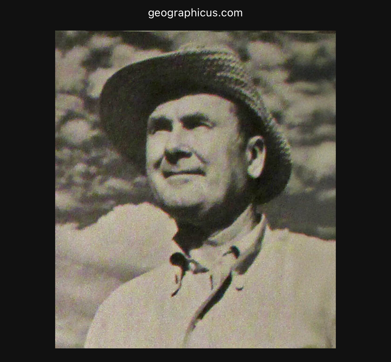
“Unlike many other antique maps of San Francisco, this one is covered in illustrations highlighting points of interest and historical events. The streets are essentially the same and they’re all labeled well enough that you can see if your apartment used to be a cemetery, a slaughterhouse, or an old railroad car barn. The map was originally mass-produced for tourists and I’ve seen a few different copies online. One was found in the forgotten depths of someone’s closet in 2011, and a Redditor mentioned in the comment thread that they had an original framed copy on their wall at home. In 2012, a copy of the map sold on eBay for $1,400.” The Bold Italic
“Harrison Godwin (1899 - 1984) was an American cartoonist and hotelier active in California during the early to middle parts of the 20th century. Harrison was a cartoonist with the Los Angeles Examiner and published two daily strips. With regard to cartographic material he published just three maps, San Francisco, Hollywood and North America, all between the years of 1927 and 1929. The San Francisco and Hollywood maps were first and second maps in a planned series of American cities, each taking some three months to complete. Curiously, no further maps in the series materialized. In addition to his cartoon work Harrison, in partnership with his brother Fred, owned Carmel's La Playa Hotel, where Harrison worked as a manager. Harrison and Fred Godwin and are credited with popularizing Carmel as a tourist destination. Little else is known of his life.” geographicus.com
San Francisco - Citizens Transport Committee - 1928
The 1928 “Map of San Francisco Showing Expiration Dates of Privately Owned Street Railway Franchises” visually documented when the city’s various private streetcar and cable lines would revert to public control as their 25- or 50-year franchises expired. This was significant because San Francisco’s transit was dominated by private companies, whose long-term franchises—granted in the late 19th and early 20th centuries—often hindered municipal expansion and modernization efforts1. By mapping expiration dates, the city and public could anticipate when they might integrate or acquire these lines into the growing Municipal Railway (Muni), which had begun service in 1912. The map thus marked a crucial step toward public ownership and unified city transit2.


This was significant because San Francisco’s transit was dominated by private companies, whose long-term franchises—granted in the late 19th and early 20th centuries—often hindered municipal expansion and modernization efforts1. By mapping expiration dates, the city and public could anticipate when they might integrate or acquire these lines into the growing Municipal Railway (Muni), which had begun service in 1912. The map thus marked a crucial step toward public ownership and unified city transit2.
- https://archives.sfmta.com/cms/rhome/documents/TransitinSanFrancisco-CallwellChronologyweb.pdf
- https://www.streetcar.org/the-peoples-road-muni-1912-1941/
- https://www.trainsandtrams.com/san-francisco-street-railway-map/
- https://www.streetcar.org/brief-history/
- https://www.cablecarmuseum.org/archive/8c/CCMAPpre1906.pdf
- https://www.raremaps.com/gallery/detail/71034/map-of-san-francisco-showing-expiration-dates-of-privately-o-citizens-transportation-committee
- https://bostonraremaps.com/inventory/1928-san-francisco-street-railway/
- https://www.raremaps.com/archive/Maps/United_States/California/San_Francisco_&_Bay_Area?order_by=-issue_year&page=3
- https://www.nps.gov/goga/learn/historyculture/upload/Merrie-Way-and-The-Lands-End-Street-Railways-Abbreviated-CLR.pdf
- https://www.nesssoftware.com/www/sf/sfsjrr.php
San Francisco key map - Harrison Ryker - 1937
1937. People love to look in the mirror, at least when they’re young, and San Francisco was treated to a look at itself in 1937 by Harrison Ryker, who flew over San Francisco and took about 160 photographs, creating an early version of Google Earth.


“Set of 164 black and white negatives of the same Harrison Ryker Aerial 1938 Survey that we scanned for the San Francisco Library (our 5820.000). Negatives have been scanned to positive and the digital files provided by the Western Neighborhoods Project. The database, image processing, and large composite image by David Rumsey.” davidrumsey.com
“The maps were created by Harrison Ryker, an Oakldale-born World War I veteran who studied at U.C. Berkeley. Ryker was an avid photographer and partnered with a number of Oakland Airport-based pilots to take aerial photographs all over the the American West. “In the...Sunset District, the most interesting part is what’s not there,” notes The Richmond District of San Francisco blog. “Blocks and blocks of sand dunes still existed in the heart of the outer Sunset in 1938.”” Aaron Sankin, Huffpost
San Francisco composite - Harrison Ryker - 1937
1937. People love to look in the mirror, at least when they’re young, and San Francisco was treated to a look at itself in 1937 by Harrison Ryker, who flew over San Francisco and took about 160 photographs, creating an early version of Google Earth.
It’s a magnificent picture. And you can still see the last vestiges of the sand dunes I so love.


“Set of 164 black and white negatives of the same Harrison Ryker Aerial 1938 Survey that we scanned for the San Francisco Library (our 5820.000). Negatives have been scanned to positive and the digital files provided by the Western Neighborhoods Project. The database, image processing, and large composite image by David Rumsey.” davidrumsey.com
“The maps were created by Harrison Ryker, an Oakldale-born World War I veteran who studied at U.C. Berkeley. Ryker was an avid photographer and partnered with a number of Oakland Airport-based pilots to take aerial photographs all over the the American West. “In the...Sunset District, the most interesting part is what’s not there,” notes The Richmond District of San Francisco blog. “Blocks and blocks of sand dunes still existed in the heart of the outer Sunset in 1938.”” Aaron Sankin, Huffpost
San Francisco Crissy Field - Harrison Ryker - 1937
1937. One of the 164 images in Harrison Ryker’s precursor to Google Earth. This image shows the airfield that existed for fixed wing aircraft from 1921 to 1974 on the spot we now call Crissy Field. Helicopters used Crissy Field for another twenty years, until 1994.


Years of Use for Crissy Field Airfield
- Crissy Field operated as a U.S. Army airfield from 1921 until 1974. It was officially completed and began operations in 1921, serving as the first Air Coast Defense Station on the West Coast.
- The airfield remained in use for fixed-wing aircraft until 1974, after which it was no longer used for regular flight operations. Later, the site supported helicopter and liaison activities before the base's eventual closure and transfer to the National Park Service in 1994.
Crissy Field's most significant period as an airfield was from its completion in 1921 through the end of fixed-wing operations in 1974.
San Francisco Treasure Island - Ruth Taylor White - 1939
1939. San Francisco’s next phase of growth came with the construction of the Golden Gate Bridge and the Bay Bridge. The Golden Gate International Exposition (GGIE) celebrated those two bridges and was held on the newly created island, from fill, that is Treasure Island. The creator of this map of the GGIE was Ruth Taylor White, who was a rock star in the annals of pictorial artists.



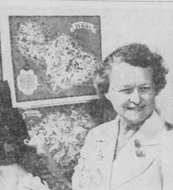
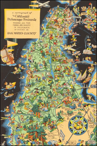 i36713
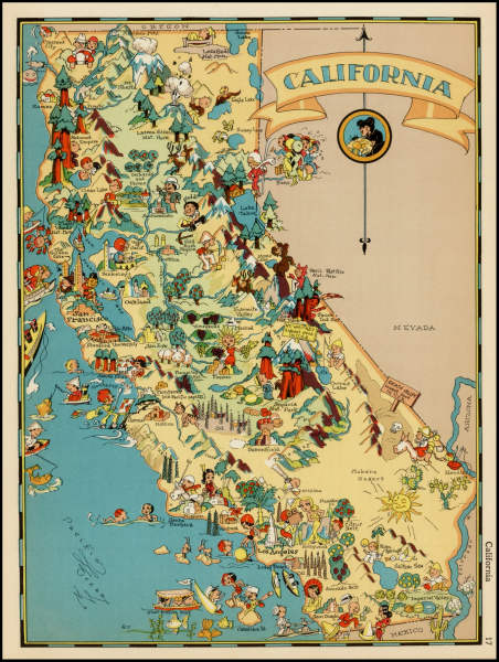 i36712
 i36713
 i36712
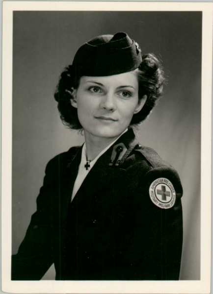 i36748
 i36749
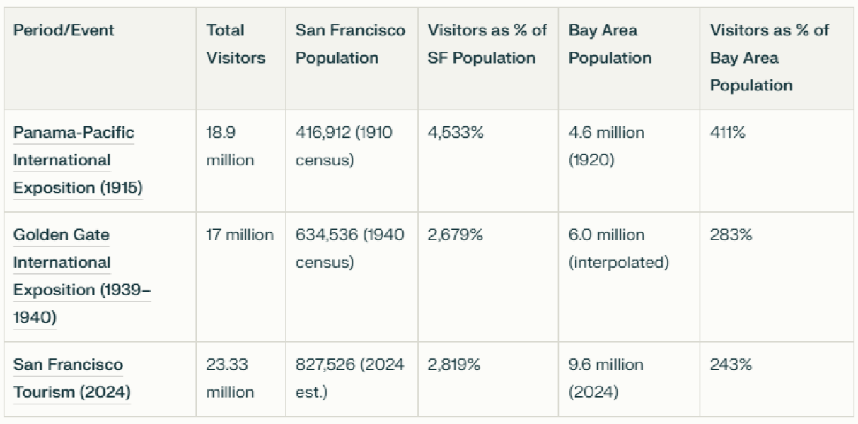 i36750
perplexity | raremaps1 | raremaps2
“San Francisco Treasure Island, by Ruth Taylor White, 1939” is a vibrant pictorial map created for the Golden Gate International Exposition (GGIE), a world’s fair held on Treasure Island in San Francisco Bay. Treasure Island itself was an ambitious feat—an artificial island built from bay sand in 1936–37 to host the exposition, which celebrated the completion of the Golden Gate and Bay Bridges and San Francisco’s emergence as a Pacific gateway123. The fair, running in 1939–40, drew millions with its futuristic architecture and international pavilions.
Ruth Taylor White, a renowned American pictorial mapmaker, was chosen for her whimsical, engaging style, which had already graced tourist maps and atlases nationwide4567. Her selection reflected both her artistic reputation and the era’s growing appreciation for pictorial “carto-graphy” as a way to attract and entertain visitors. White’s map captured the fair’s spirit, illustrating its landmarks, amusements, and international flair in a lively, accessible format.
The map is significant as both a souvenir and a historical document, embodying the optimism of late-1930s San Francisco and the unique vision of a woman artist at a time when the field was largely male-dominated456. White’s work remains a celebrated artifact of the GGIE and Treasure Island’s brief, spectacular moment as a “Magic City”12.
- https://noehill.com/sf/landmarks/cal0987.asp
- https://en.wikipedia.org/wiki/Golden_Gate_International_Exposition
- https://content.ucpress.edu/chapters/12793.ch01.pdf
- https://www.geographicus.com/P/ctgy&Category_Code=whiteruthtaylor
- https://www.lapl.org/collections-resources/blogs/lapl/ruth-taylor-white-great-cartographer-wth-asterisk
- https://www.swaen.com/mapmakers/ruth-taylor-white
- https://www.antiquemapsandprints.com/categories/maps-by-cartographer/taylor-white-ruth
- https://www.raremaps.com/gallery/detail/70375/san-francisco-a-cartograph-of-treasure-island-in-san-fran-taylor-white
- https://collections.lib.uwm.edu/digital/collection/agdm/id/34225/
- https://www.davidrumsey.com/luna/servlet/detail/RUMSEY~8~1~263484~5524258:A-cartograph-of-Treasure-Island-in-?sort=pub_date%2Cpub_list_no%2Cseries_no%2Cseries_no
- https://www.vintagebooksmd.com/pages/books/12405/ruth-taylor/1939-ruth-taylor-white-pictorial-map-of-the-golden-gate-international-exposition?soldItem=true
- https://info.mysticstamp.com/golden-gate-international-exposition_tdih/
- https://www.so-calleddollars.com/Events/Golden_Gate_Exposition.html
- https://www.davidrumsey.com/luna/servlet/detail/RUMSEY~8~1~263491~5524260:Composite-Text--Visitors-guide--Gol
- https://www.abebooks.com/book-search/title/treasure-island/used/map/
- https://www.davidrumsey.com/luna/servlet/detail/RUMSEY~8~1~259477~5522539:Connecticut-
- https://lapl.org/collections-resources/blogs/lapl/ruth-taylor-white-great-cartographer-wth-asterisk
- https://www.treasureislandmuseum.org/youarehere/the-golden-gate-international-exposition
- https://www.foundsf.org/Treasure_Island_Fair:_Golden_Gate_International_Exposition
- https://digital.lib.umd.edu/worldsfairs/result/id/umd:1010
- https://info.mysticstamp.com/wp-content/uploads/02-18-1939-Golden-Gate-Expo.pdf
- https://matchpro.org/Archives/2017/Golden%20Gate%20Expo.pdf
- https://riveramural.org/ggie/
- https://neonatology.net/gallery/exhibitions/golden-gate-exposition-1939/
- https://www.jenisandberg.com/blog/tag/Ruth+Taylor+White
- https://www.geographicus.com/P/AntiqueMap/hawaii-taylor-1935
- https://www.geographicus.com/P/AntiqueMap/kauai-taylor-1931
- https://www.geographicus.com/P/AntiqueMap/philippines-taylor-1935
“Born in 1899, Ruth Taylor and her family, like many, headed persistently west in the late 19th century, moving from East Coast to West in the span of about 20 years and finally settling in California. According to the 1920 US Census, Taylor seemed to be settling into a pretty normal life--she was married to Leonard White and living in Phoenix, Arizona. Leonard was a life insurance salesman. Two kids followed, and so did divorce. With limited information, it’s easy to fill in the gaps and imagine a disastrous mismatch of temperaments, but all we know is that Ruth and her children moved to California and she began working as an illustrator. Ruth’s artistic training is unclear, but her family proved to be very important in her future work. Several of her early jobs were linked to her brother, Frank J. Taylor (1894-1972). Frank was a journalist and writer, served in World War I, and attended Stanford University. That school connection probably helped Ruth earn one of her early commissions, the cover of the November 1927 The Stanford Illustrated Review.” swaen.com
A Merrymaker’s Map of San Francisco - Milt Schenkofsky - 1940
1940. San Francisco was feeling its oats and went too far, taking the city of love and turning it into lewdness and lechery. Milt Shenkofsky celebrated “pixilated philanders” oogling naked women while their fully clothed wives remained in the respectful Sunset.


Raremaps | Perplexity | georgeglazer.com
Milt Schenkofsky was a cartoonist, illustrator, and mapmaker active in the San Francisco Bay Area during the 1930s and 1940s137. Known for his playful and irreverent style, Schenkofsky brought a sense of humor and whimsy to his work, blending art and cartography in unique ways. Among his most celebrated creations is the "Merrymaker’s Map of San Francisco," published around 194025.
This pictorial map, subtitled “A Pilot for Pixilated Philanderers,” offers a humorous, bawdy bird’s-eye view of San Francisco, highlighting the city’s nightlife and entertainment hotspots through witty illustrations and captions64. The map is considered one of the wildest and most entertaining in the San Francisco History Center’s collection, capturing the city’s vibrant and sometimes risqué spirit during that era46.
Beyond maps, Schenkofsky also illustrated books and collaborated on projects such as "Virgin Sturgeon" with Ben Kennedy7. Though not widely known today, his work remains a vivid snapshot of mid-20th-century San Francisco culture, celebrated for its creativity and charm135.
Curious to see what the Merrymaker’s Map looks like or learn more about Schenkofsky’s other works?
Citations:
- https://www.raremaps.com/gallery/detail/68287/merrymakers-map-of-san-francisco-a-pilot-for-pixilated-p-schenkofsky
- https://www.historicpictoric.com/products/historic-map-merrymakers-san-francisco-1940-milt-schenkofsky
- https://www.raremaps.com/gallery/detail/45457/merry-makers-map-of-san-francisco-pilot-for-pixilated-schenkofsky
- https://dk.pinterest.com/pin/sfpubliclibrary-on-instagram-one-of-the-wildest-maps-in-the-san-francisco-history-centers-collection-the-merrymakers-ma--143059725640299251/
- https://www.georgeglazer.com/archives/maps/archive-pictorial/archive-pictorial.html
- https://www.georgeglazer.com/archives/maps/archive-western/merrymakers.html
- https://www.abebooks.co.uk/VIRGIN-STURGEON-Kennedy-Ben-Milt-Schenkofsky/30421496692/bd
- https://www.raremaps.com/mapmaker/4437/Milt_Schenkofsky?order_by=price
- https://www.raremaps.com/archive/Maps/Curiosities/Pictorial_Maps?order_by=-title&page=37
- https://www.raremaps.com/gallery/detail/58452/a-more-or-less-accurate-map-of-the-berkeley-campus-universit-schenkofsky
- https://www.vintagecitymaps.com/product/university-of-california/
- https://www.davidrumsey.com/luna/servlet/view/all?sort=Pub_List_No_InitialSort%2CPub_List_No_InitialSort%2CPub_Date%2CPub_List_No_InitialSort%2CPub_Date&os=130150&pgs=50&cic=RUMSEY~8~1
- https://archiveswest.orbiscascade.org/ark:80444/xv27206
- https://www.raremaps.com/archive/Maps/United_States/California/California?order_by=title&page=13
- https://libsysdigi.library.uiuc.edu/oca/Books2008-06/laborhistoryinun00stro/laborhistoryinun00stro.pdf
- https://pbagalleries.com/auctions/catalog/id/545?cat=4%2C62%2C162&page=2&view=comp
- https://mla.bethelks.edu/mediawiki/index.php/Schenkofsky,_Henry_(b._1882)
- https://pbagalleries.com/auctions/catalog/id/473?page=46&items=10&view=comp
- https://www.raremaps.com/archive/Maps/Curiosities/Pictorial_Maps?order_by=-creator&page=15
- https://bidder-react-stage-pr-7582.liveauctioneers.com/price-result/1939-white-pictorial-map-of-san-francisco-s-treasure/
- https://pbagalleries.com/lot-details/index/catalog/473/lot/155415/Merry-makers-Map-of-San-Francisco?uact=5&aid=473&lid=155505¤t_page=0
- https://www.themaphouse.com/artworks/248302-mitt-schenkofsky-merry-maker-s-map-of-san-francisco-1940/
- https://www.davidrumsey.com/luna/servlet/view/all?sort=date&os=117100
- https://neatlinemaps.com/antiquemap/merry-makers-map-of-san-francisco/
- https://www.davidrumsey.com/luna/servlet/view/all/when/1940?sort=Pub_Date
- https://www.davidrumsey.com/luna/servlet/view/all/what/Pictorial+map/Pocket+Map?sort=series_no&os=50&pgs=50&cic=RUMSEY~8~1
- https://www.raremaps.com/mapmaker/4437/Milt_Schenkofsky?order_by=price
- https://ilab.org/assets/catalogues/catalogs_files_San%20Francisco%20Map%20Fair%20Catalogue%202018.pdf
- https://www.cityofsitka.com/media/Library/Archive%20Links/CL%20Andrews%20ORG.pdf
- https://www.biblio.com/browse_books/author/K/2563014.html
- https://www.historicpictoric.com/products/historic-map-merrymakers-san-francisco-1940-vintage
- https://www.abebooks.com/art-prints/MERRY-MAKERS-MAP-SAN-FRANCISCO-Pilot/30989059006/bd
Answer from Perplexity: https://www.perplexity.ai/search/write-a-200-word-biography-of-j7YXbd.ZQpOvJZC8JiIkeA?utm_source=copy_output
[ 2025-05-08 13:50:14 ]
San Francisco Chinatown and Environs - Ken Cathcart, a Scrapbook Map - 1947
In 1947, San Francisco demonstrated its better side vis a vis the Chinese when Ken Cathcart made this map of Chinatown, which celebrated real people and businesses in Chinatown. Jim Schein wrote a book called Gold Mountain, Big City about Ken and this map.


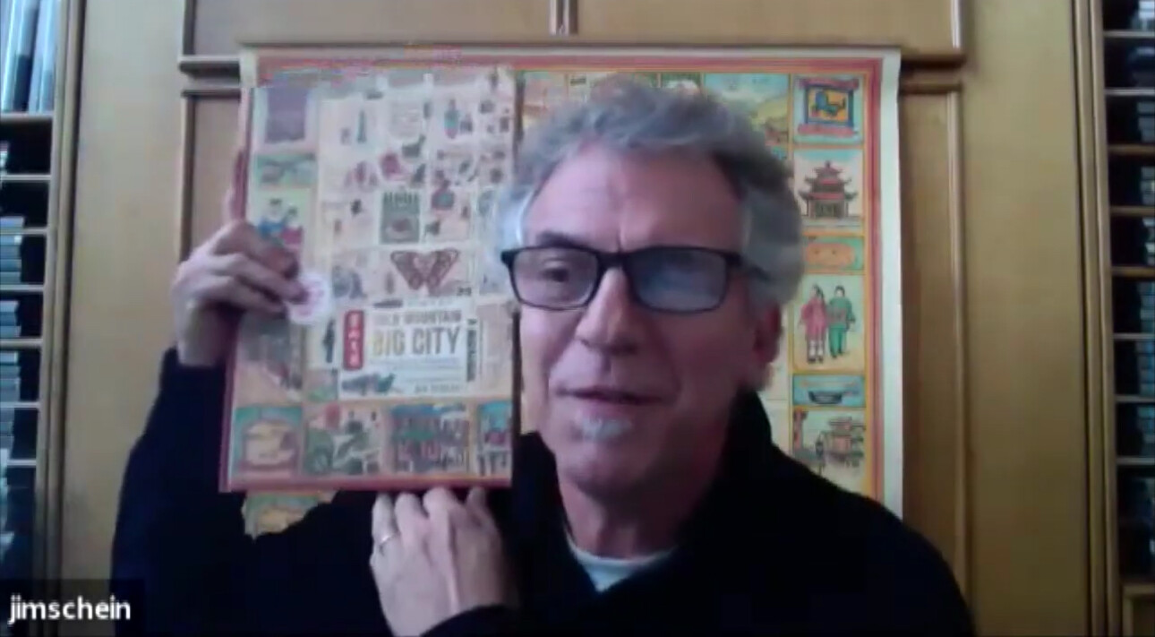
perplexity | Schein & Schein | Link to purchase book
“San Francisco Chinatown and Environs,” created by Ken G. Cathcart in 1947, is a richly detailed pictorial map that captures the vibrant life, history, and culture of San Francisco’s Chinatown at mid-century. Featured in Jim Schein’s book Gold Mountain, Big City, the map was the product of years of Cathcart’s immersion in Chinatown, where he lived and photographed daily life between 1939 and 195512. Drawing from over a thousand images, Cathcart crafted a “scrapbook map” that celebrates a century of Chinese immigration, highlighting the neighborhood’s unique businesses, temples, schools, and social clubs, as well as its colorful festivals and secretive underworld134.
The map’s border is adorned with illustrations of real Chinatown residents, workers, and community leaders, reflecting the diversity and complexity of the neighborhood5. Cathcart’s work is notable for its authenticity—he incorporated community feedback and historical research, capturing both the struggles and triumphs of Chinatown’s residents. The map was later used by the city’s Board of Supervisors to promote Chinatown as a destination, countering negative stereotypes and encouraging tourism1. Through its lively visuals and historical depth, Cathcart’s map remains a unique time capsule, offering an immersive, celebratory, and nuanced portrait of Chinatown’s enduring legacy24.
- http://www.publishersweekly.com/9781944903893
- https://greenapplebooks.com/book/9781944903893
- https://www.youtube.com/watch?v=C2a4cshbTRw
- https://www.youtube.com/watch?v=MLFdrqyJ_YA
- https://www.youtube.com/watch?v=1I3gLS8IR84
- https://digitallibrary.californiahistoricalsociety.org/object/3979
- https://www.asiabookcenter.com/store/p2642/Gold_Mountain,_Big_City:_Ken_Cathcart%C2%92s_1947_Illustrated_Map_of_San_Francisco%C2%92s_Chinatown.html
- https://sfinfilm.com/2020/08/21/ken-cathcarts-chinatown/
- https://www.sup.org/books/asian-american-studies/chinese-san-francisco-1850-1943
- https://sfpl.bibliocommons.com/v2/record/S93C1744369
GOLD MOUNTAIN, BIG CITY: Ken Cathcart’s 1947 Illustrated Map of San Francisco’s Chinatown, by Jim Schein. (Cameron Books, $40.) Based on Cathcart’s impressions of the neighborhood, this stylized cultural map of the largest Chinese community outside of Asia is brought to life by vivid details and photographs.
San Francisco - SF Dept of City Planning - 1948
1948. After Burnham in 1905, San Francisco was not done thinking about what it could do with roads. This dystopian freeway vision was considered in 1948. Thankfully, all of these freeways and a central parking area did not materialize, although a monstrous viaduct in front of the Ferry Building did exist from roughly 1959 to 1991.


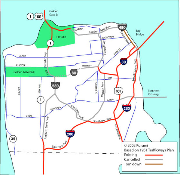 i36751
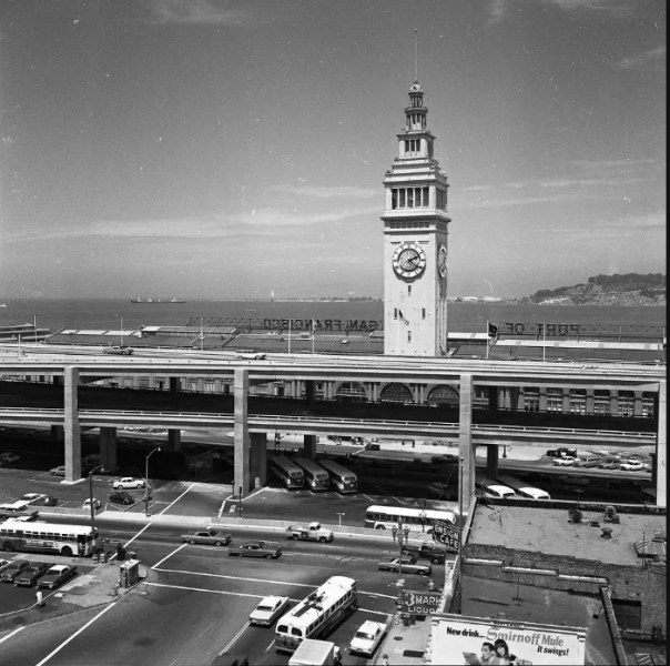 i36763
 i36756
I36756
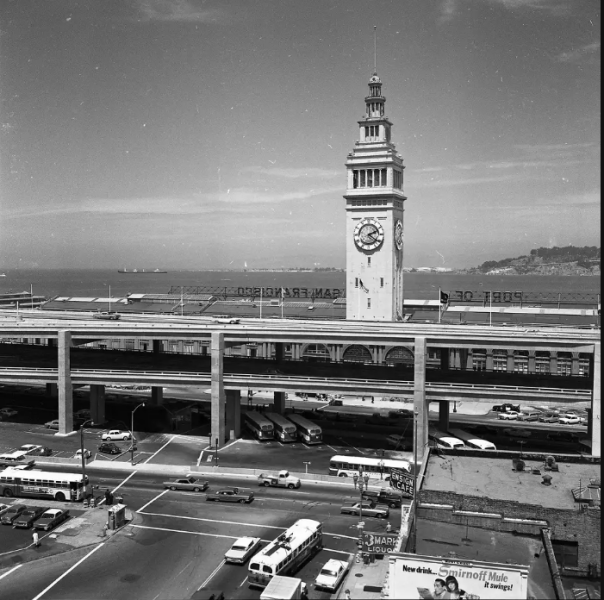 i36757
 i36756
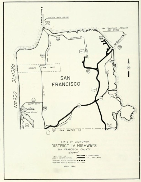 i36752
This map is adapted from the San Francisco Trafficways plan, adopted on July 17, 1951 and amended on May 19, 1955. The city's "Freeway Revolt," a 1959 Board of Supervisors vote to cancel 7 of 10 routes, killed most of the ones shown in gray.
Although the map encompasses most of the freeways once planned, it's a snapshot of a moving target. For example, not shown is a 1940s planned Panhandle Freeway, encompassing the Western Freeway and continuing as a different "Golden Gate Freeway" along Fulton Street to a Great Highway corridor freeway along the shore. See Dan Faigin's page for more information.
… with consultants De Leuw, Cather and Company and Ladislas Segoe, was an ambitious blueprint to transform San Francisco’s transportation infrastructure for the automobile age. The plan’s detailed map proposed an extensive network of eight major freeways—including the Panhandle, Mission, Embarcadero, and Central Freeways—intended to ring and crisscross the city, linking neighborhoods and providing direct connections to the Bay and Golden Gate Bridges1234. It also envisioned a second bridge parallel to the Bay Bridge, major expressways, and parkways, all overlaid on the city’s existing street grid.
The plan responded to postwar growth and severe traffic congestion but prioritized vehicular movement over neighborhood integrity and urban livability. Its publication sparked immediate public concern, and by the late 1950s, widespread opposition—known as the "Freeway Revolt"—halted or canceled many proposed routes, especially those threatening established communities and parks124. Only a few segments, such as the Southern Freeway (now I-280), were completed.
The 1948 map remains a landmark in urban planning history, illustrating both the era’s faith in highways and the power of grassroots activism to reshape city policy toward more sustainable, transit-focused solutions1234.
- https://generalplan.sfplanning.org/I4_Transportation.htm
- https://archive.org/details/dr_san-francisco-comprehensive-trafficways-plan-trafficways-11-plate-8-de-8003001
- https://www.davidrumsey.com/luna/servlet/detail/RUMSEY~8~1~258970~5522255:-San-Francisco--Comprehensive-traff
- https://www.cahighways.org/maps-sf-fwy.html
- https://en.wikipedia.org/wiki/Central_Freeway
- https://www.flickr.com/photos/walkingsf/3897327276
- https://sfplanninggis.org/pim/?tab=Property&search=1948+16th+ave
- https://libraryarchives.metro.net/dpgtl/californiahighways/chpw_1948_novdec.pdf
- https://default.sfplanning.org/publications_reports/SF_Planning_Centennial_Brochure.pdf
- https://www.flickr.com/photos/walkingsf/5379226266
San Francisco - Don Bloodgood - 1952
This image is from 1952, a pictorial map of San Francisco by Don Bloodgood. Like Godwin in 1928, it is an optimistic and carefree homage to San Francisco, the city of Herb Caen, Alfred Hitchcock’s Vertigo, and the San Francisco Seals baseball team.


davidrumsey |davidrumsey |neatlinemaps | raremaps |
“A pictorial map by Don Bloodgood, who produced similar maps of other cities. The map is a reflection of the optimistic and giddy 1950’s, as well as Herb Caen’s fun-loving San Francisco’s.” Tom Paper
“Pictorial maps (also known as illustrated maps, panoramic maps, perspective maps, bird’s-eye view maps, and geopictorial maps) depict a given territory with a more artistic rather than technical style. It is a type of map in contrast to road map, atlas, or topographic map. The cartography can be a sophisticated 3-D perspective landscape or a simple map graphic enlivened with illustrations of buildings, people and animals. They can feature all sorts of varied topics like historical events, legendary figures or local agricultural products and cover anything from an entire continent to a college campus. Drawn by specialized artists and illustrators, pictorial maps are a rich, centuries-old tradition and a diverse art form that ranges from cartoon maps on restaurant placemats to treasured art prints in museums.” wikipedia.org
Thank you!
Jim Schein is Founder of Schein & Schein, a map and print store originally based in North Beach and now online. Jim is also the author of the book Gold Mountain, Big City. nytimes | amazon
Tom Paper, Founder of the website Pixeum, which helps people tell stories with art.


[ 2025-07-25 03:48:29 ]
San Francisco - Stewart and Moore - 2012


“A surreal, literary-based, 60-minute audio tour that uncovers dozens of the vessels still buried beneath San Francisco’s Financial District. / James Marshall’s discovery of gold at Coloma in 1848 set in motion a world-wide migration of fortune-seekers to the gold fields of California. In the first year of the gold rush, over 62,000 of those immigrants came by ship, landing in San Francisco and abandoning their vessels as fast as their legs could carry them. / By 1850, the bay held nearly 600 abandoned brigs, barks, ships, and whalers, left to rot by the starry-eyed Argonauts who had crowded aboard to reach their dreams. For most of the Gold Rush fleet, San Francisco was not only their last voyage, but their final mooring, as scores of those vessels still lie beneath the skyscrapers, restaurants, bars, and plazas of downtown San Francisco.” Tavia Stewart, LJ Moore
San Francisco - Title page - April 18, 2019


“This exhibit was hosted on April 18, 2019, at the offices of Webster Pacific in downtown San Francisco. The date, April 18, was not entirely coincidental as it was the anniversary of the great earthquake and fire of 1906. The exhibit was a pop-up, which meant that it was put up and taken down within a span of six hours. Every image was printed and mounted onto a posterboard and then rested on a portable easel. The exhibit remains available as a popup for venues that have 150 lineal feet of wall-space.”
Tom Paper & Jim Schein
San Francisco exhibit layout - April 18, 2019


“This exhibit was hosted on April 18, 2019, at the offices of Webster Pacific in downtown San Francisco. The date, April 18, was not entirely coincidental as it was the anniversary of the great earthquake and fire of 1906. The exhibit was a pop-up, which meant that it was put up and taken down within a span of six hours. Every image was printed and mounted onto a posterboard and then rested on a portable easel. The exhibit remains available as a popup for venues that have 150 lineal feet of wall-space.”
Tom Paper & Jim Schein
San Francisco exhibition - April 18, 2019
San Francisco exhibition - April 18, 2019
San Francisco exhibition - April 18, 2019
San Francisco exhibition - June 10, 2019
San Francisco exhibition - June 10, 2019
San Francisco exhibition - June 10, 2019
San Francisco exhibition - June 10, 2019
San Francisco exhibition - June 10, 2019
YesSF Headquarters at 220 Montgomery
A Cartographic History of San Francisco - Tom Paper - June 28, 2025


As a part of The California Map Society's Spring Conference, Tom will present his digital collection of maps of San Francisco and what he finds most meaningful about each map. He also hopes to inspire people to explore these maps further on their own at www.pixeum.org.
Thank you! The California Map Society
Place a DOT on the image


