

HIST23D - Student Projects
Step 0 of 0
1
Project 1 - HIST23D
2
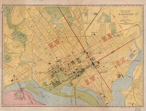
Washington, D.C. - Rand McNally & Co - 1910 - Michael LesStrang
3
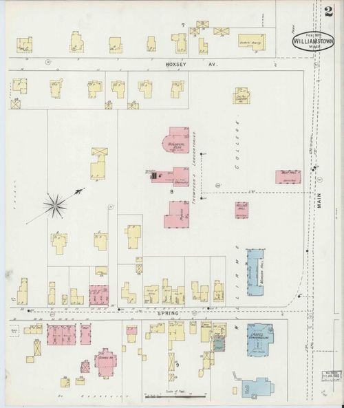
Sanborn Fire Insurance Map, Williamstown - 1895 - Dalton Peters
4
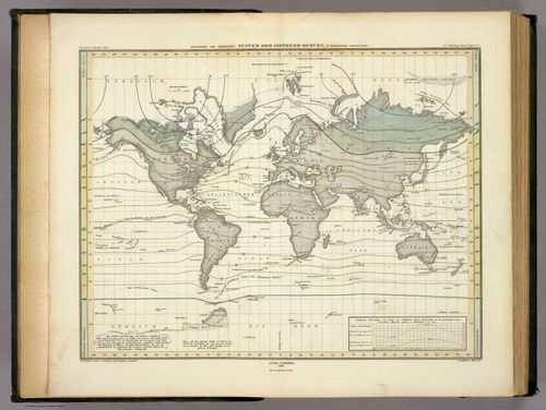
System Der Isotherm-Kurven - Alexander von Humboldt - 1849 - Travis Carroll
5
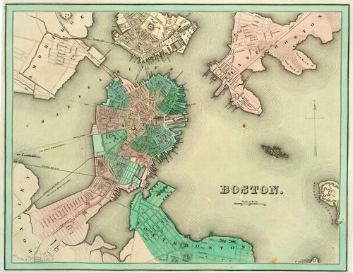
Boston - T.G. Bradford - 1838 - Leighton Calhoun
6
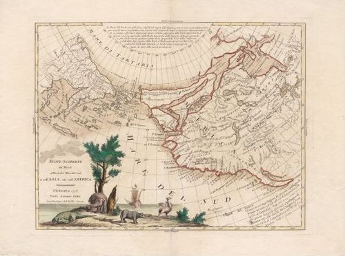
New Discoveries in the North Pacific - Antonio Zatta - 1776 - Josh Frett
7
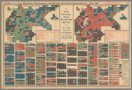
Die Haupt Reichstagswahlen 1871, 1881, 1890, 1903, 1912 - Rudolf Mayer - 1918 - Sayer Theiss
8
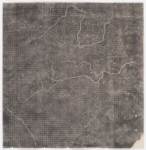
Map of the Traces of Yu - Anonymous - 1136 - Felicia Peng
9
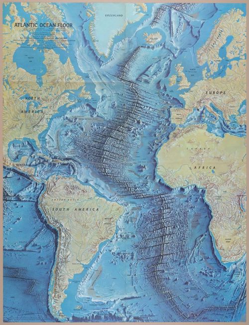
The Atlantic Ocean Floor - Tharp, Heezen, and Berann - 1968 - Santiago Ferris
10
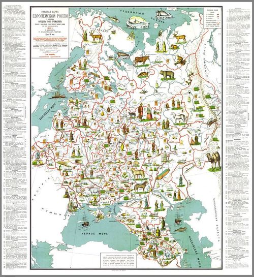
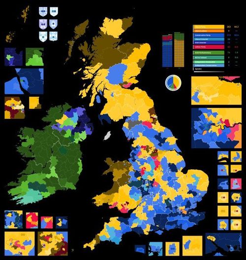
Wall Map of European Russia With Images of Peoples and Their Crafts - Nikolai Shipov - 1908 - Tekla Modebadze
11
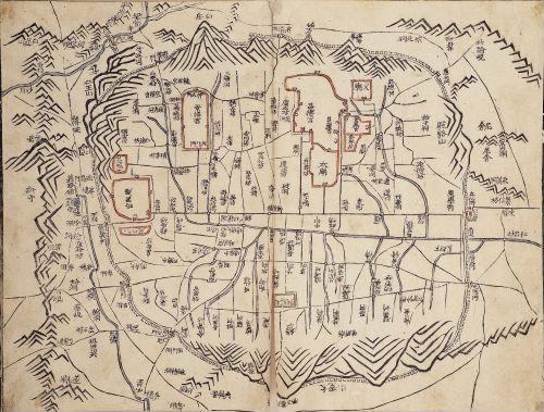
Daedongyeojido (Seoul) - Gim Jeongho - 1861 - Jiwon Kim
12
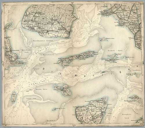
Composite: 36. Fohr. (Germany) - Reichsamt fur Landesaufnahme - 1893 - Noah Peters
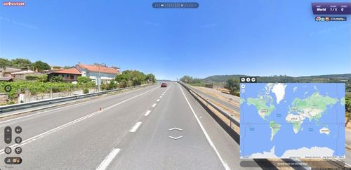
13
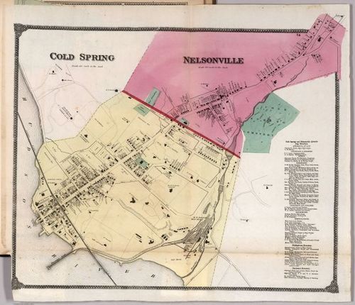
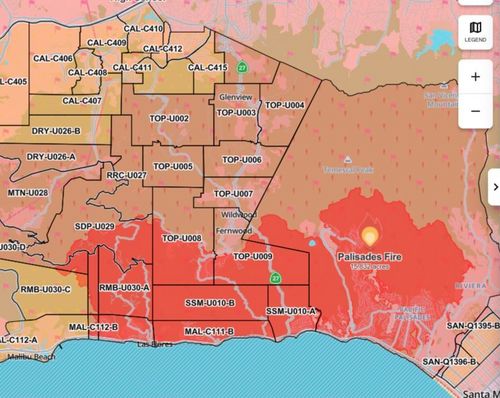
Cold Spring, Nelsonville, NY - Putnam County Atlas - Frederick William Beers - 1867 - Matthew Nachamkin
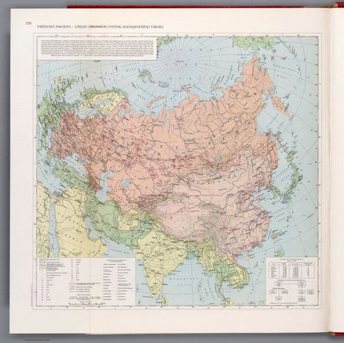
14
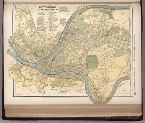
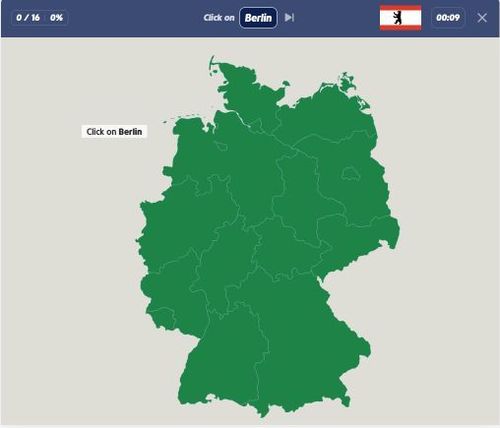
Map of Pittsburg and Allegheny, 95 - D. Appleton & Co. - 1891 - Michael Gredler
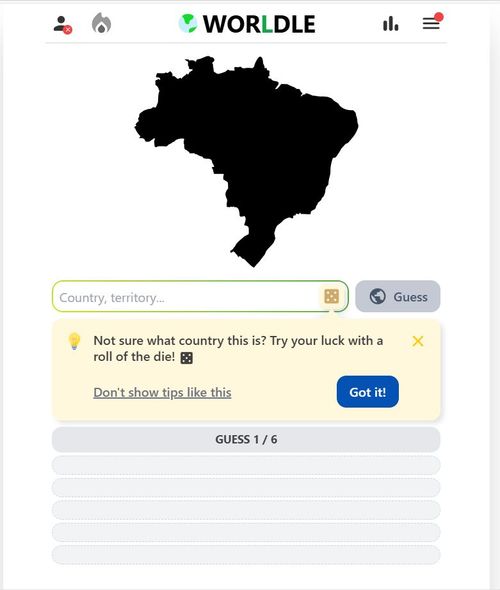
15
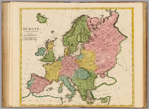
Europe - Mathew Carey - 1815 - Raphael Enriquez
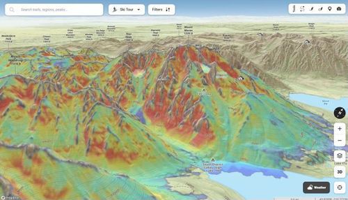
16
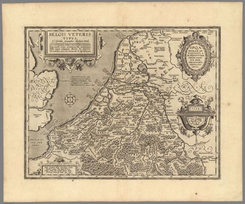
Belgii Veterus Typus - Abraham Ortelius - 1594 - Dilan Fernandes
17
Project 2 - HIST23D
18
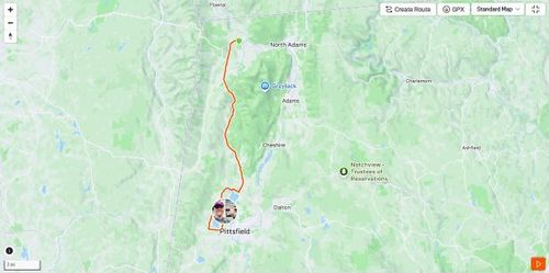
Map of Williams College to Lake Onota - Dalton Peters
19
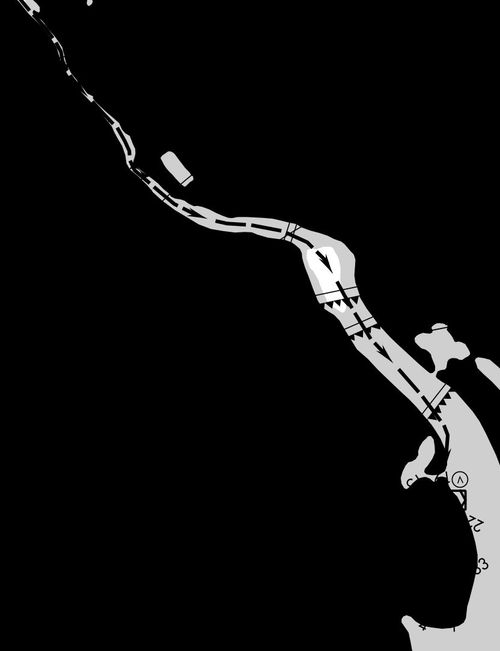
DCA Airport River Visual Approach - Michael LesStrang
20
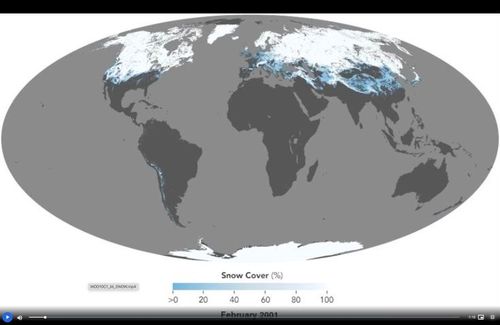
Felicia Peng - Snow cover
21
Sayer Theiss - December 1910 UK General Election
22

eBird: Explore - Travis Carroll
23
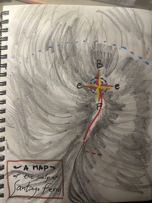
Santiago Ferris - A map of my scalp
24
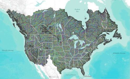
Josh Frett - HydroSHEDS (DIR) - Drainage directions at 15s resolution - North America
25
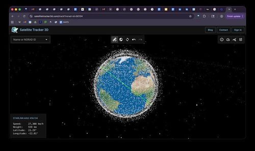
Noah Peters - Satellite Maps
26
Geoguessr Screenshot - Matthew Nachamkin
27
Jiwon Kim - Palisades Fire as seen on Watch Duty
28
Czech Cold War Map - Raphael Enriquez
29
Michael Gredler - Seterra states of Germany
30
Michael Gredler - Worldle Map game 1/29/26
31
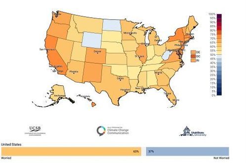
Tekla Modebadze - Estimated % of adults who are somewhat or very worried about global warming (nat'l avg. 63%), 2024
32
Leighton Calhoun - onX backcountry- slope/avalanche risk predictor
33
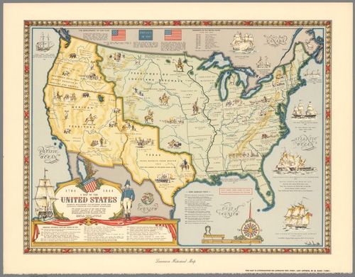
"A Map of the United States Showing Boundaries Established..." - Karl Smith - 1958 - Dilan Fernandes
Place a DOT on the image