

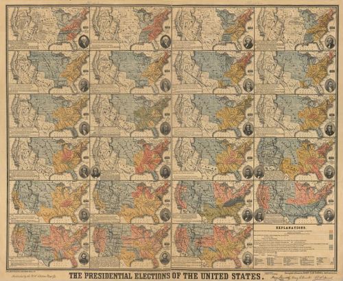
US Election Maps - 1789 to 1876
0 of 0
Click here to enter exhibit
US Election Maps - 1789 to 1876
One map for now, but soon to be an exhibit of historical election maps. Tom Paper 11/4/2020
Tags: Historical Election Maps Election Maps
Categories:
What Topic
US Elections
What Type
Maps
Where
United States
When
C19
Who Creator
Henry Clay Donnell
Who Collector
Tom Paper
Curators:
tomcurator(@tomcurator)
Start screensaver
Please Choose seconds per image
Start Exhibit Story at specific step
Start Run of Show at specific story
Loop Exhibit Story
Choose duration for A step
Choose duration for B step
Choose zoom-in animation time
Choose zoom-out animation time
Finalise exhibit story
| Step & Preview | Auto-play | Pan | Line | No zoom-out | Actions |
|---|
Place a DOT on the image