

Islamic Maps from the Collection of Karen Pinto
Step 0 of 0
1
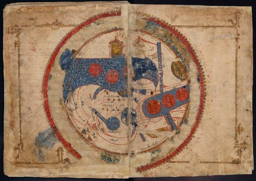
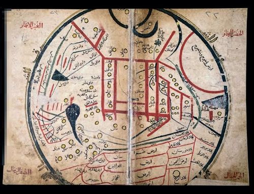
Classic KMMS world map, “Ṣūrat al-Arḍ” (Picture of the World) - 1193
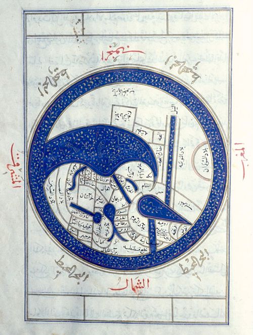
2
Suleymaniye AS-2971a World n4000 cropped
3
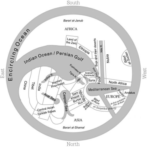
KMMS-World-Template
4
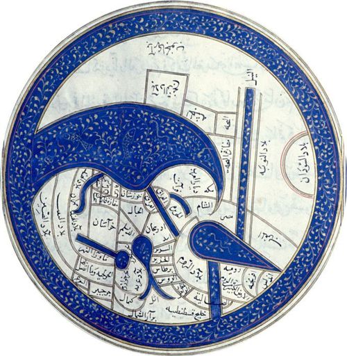
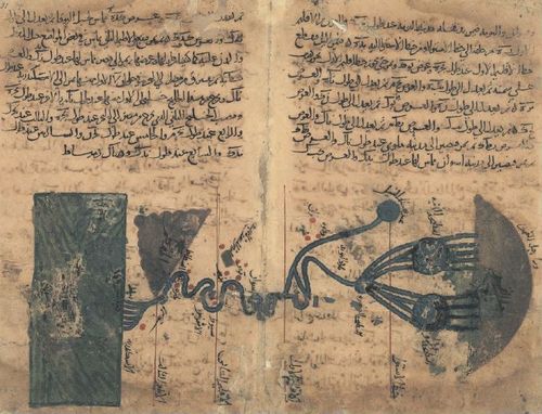
Close up TKS A2830 World Map
5
Topkapi Saray Ahmet 2830 World Map
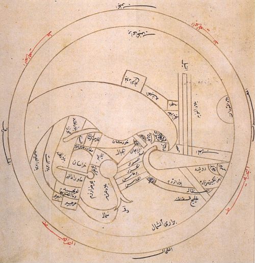
6
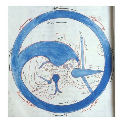
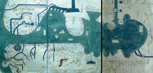
Twisted World
7
BL KMMS World Map
8
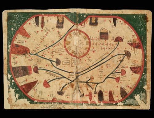
Mughal KMMS World Map
9
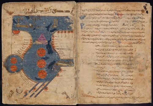
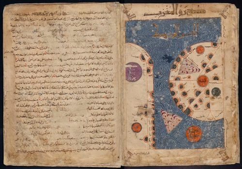
Leiden UBLOHS Or 3101 p032-33
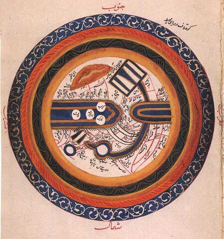
10
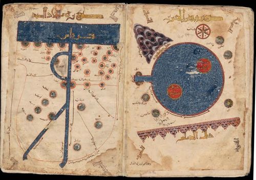
Copy of LEI-Or3101-Med-LD trans
11
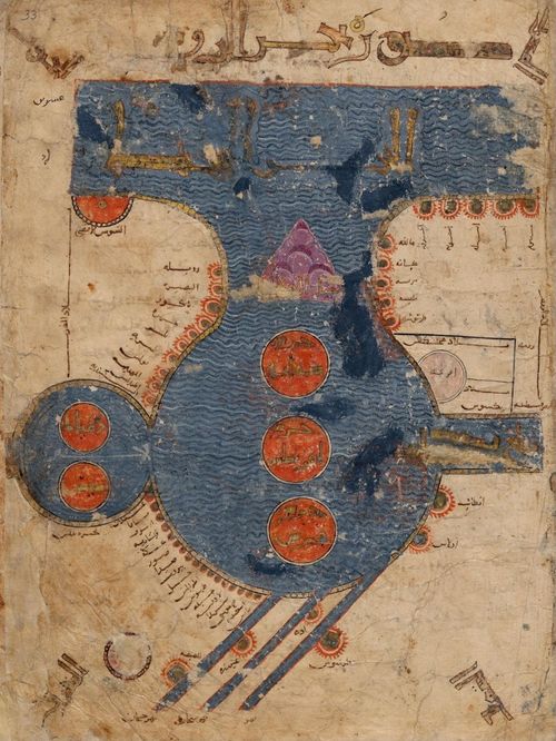
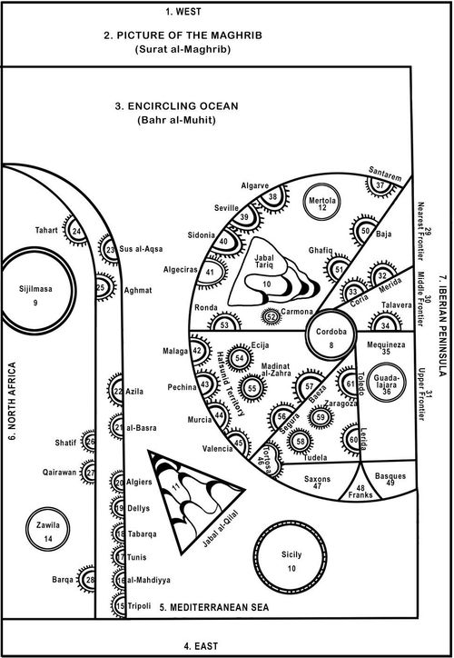
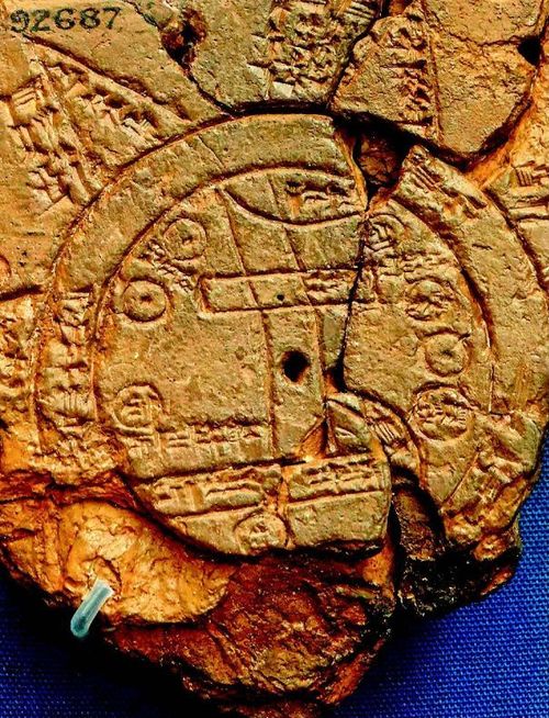
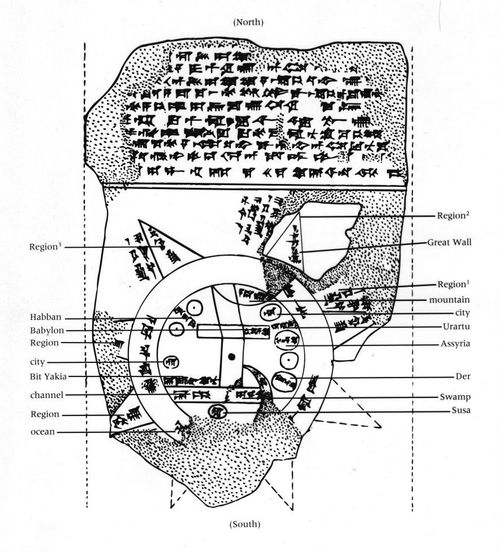
Leiden Mediterranean
12
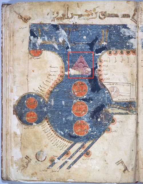
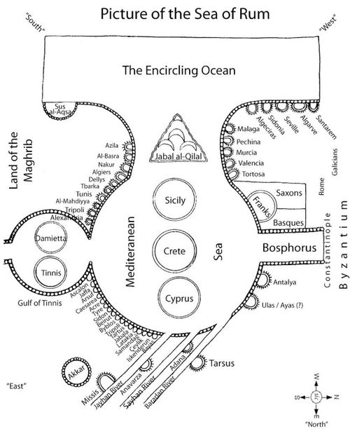
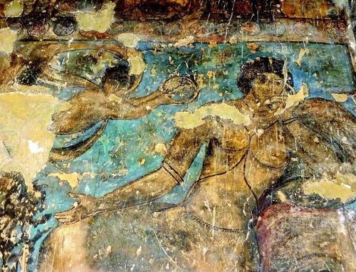
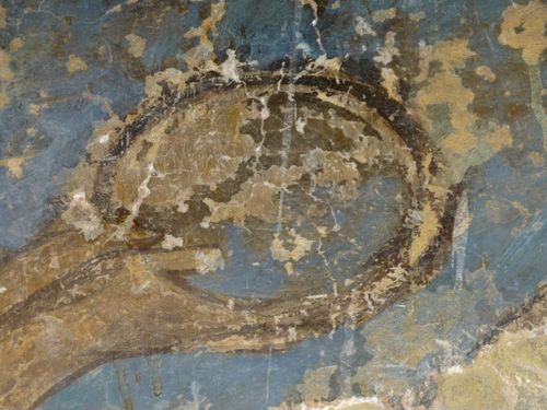
Leiden Mediterranean Map
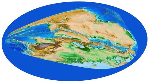
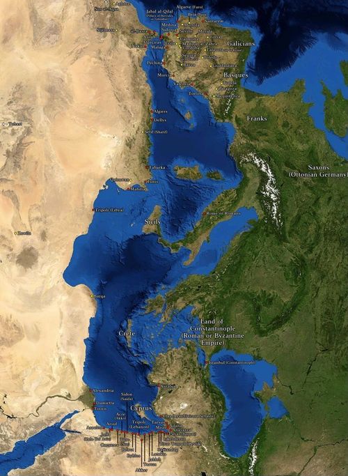
13

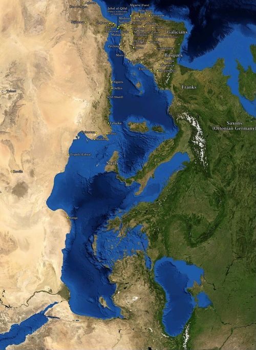
Mediterranean Map - Modern Equivalent
14
Midieval Islamic Maps Encyclopedia
15
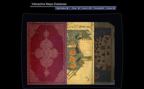
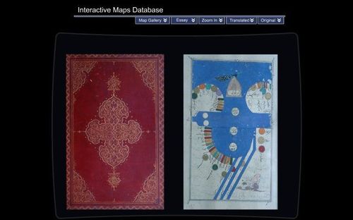
Pinto MIME Mss Display
16
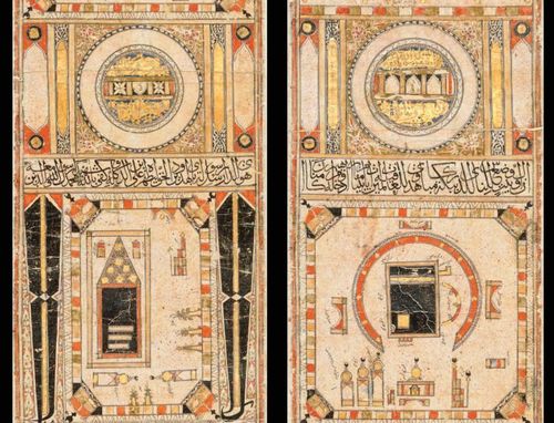
Pinto-MIME Timurid Med
17
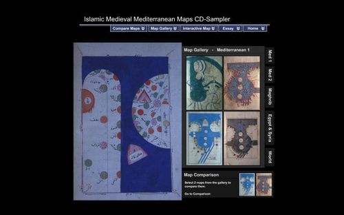
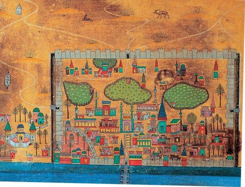
Pinto MIME Gallery
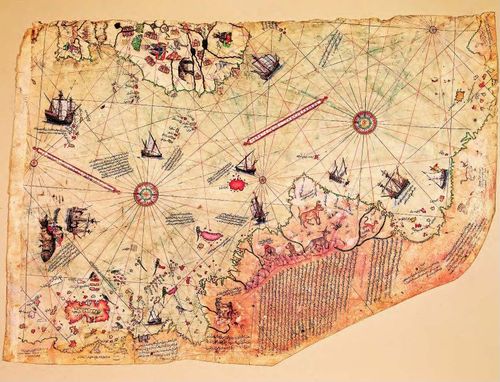
18
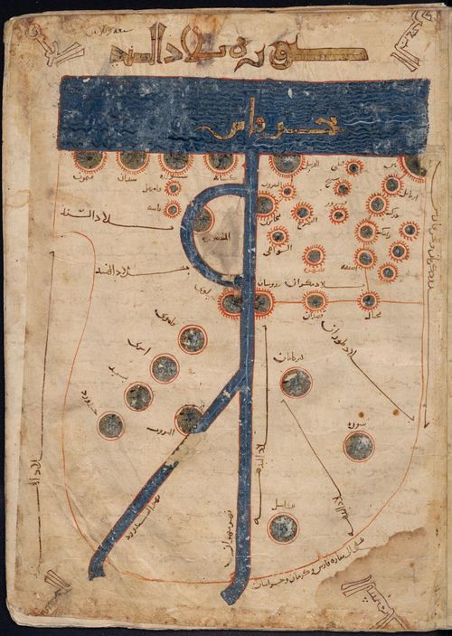
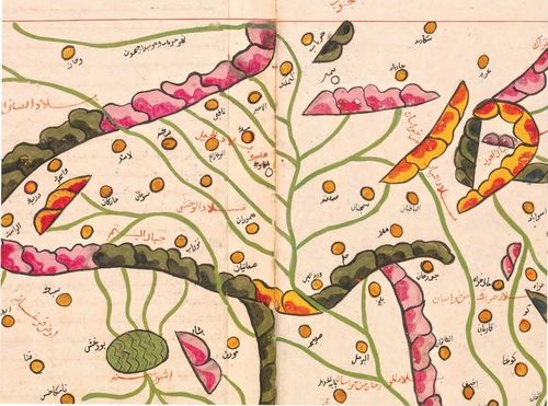
KMMS Leiden Maghrib Map
19
Line-drawing of KMMS Maghrib Map
20
Maghrib Map - Modern Equivalent
21
Leiden Sindh Map
22

AramcoWorld Calendar 2020
23
january - babylonian map
24
Babylon line drawing
25
February - moon
26
Close-up of Moon Image in Qusayr ‘Amra, Jordan
27

Star Chart Fresco in the Cupola of Quṣayr ‘Amra. (Karen Pinto’s photograph.)
28
March - nile
29
April - world languages
30
Earliest Mimetic Map of the Mediterranean from 1086 CE
31
June - Curiosities
32
July - scroll
33
August - Hajj vignettes
34
September - al idrisi
35
October - Pictorial
36
November - Piri Reis
37
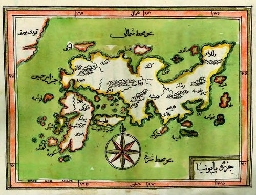
December - Japan
38

Modern Combined Map
39

Modern Combined Map - Maghrib Priority
40
Modern Combined Map - Mediterranean Priority
Place a DOT on the image