

San Francisco Historic Maps
Step 0 of 0
1
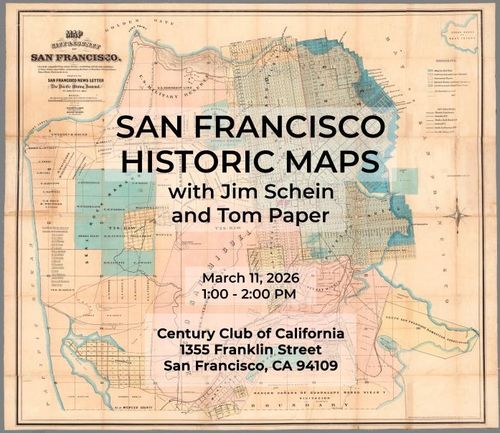
San Francisco Historic Maps at the Century Club of California - March 11, 2026
2
![[ 2026-03-12 01:12:58 ]](https://iiif.pixeum.org/iiif/3/1773278004_69b21334a23fc/full/500,/0/default.jpg)
[ 2026-03-12 01:12:58 ]
3
![[ 2026-03-12 01:13:25 ]](https://iiif.pixeum.org/iiif/3/1773278038_69b21356eaa57/full/500,/0/default.jpg)
[ 2026-03-12 01:13:25 ]
4
![[ 2026-03-12 01:13:59 ]](https://iiif.pixeum.org/iiif/3/1773278054_69b21366de34b/full/500,/0/default.jpg)
[ 2026-03-12 01:13:59 ]
5
![[ 2026-03-12 01:14:15 ]](https://iiif.pixeum.org/iiif/3/1773278067_69b213736a246/full/500,/0/default.jpg)
[ 2026-03-12 01:14:15 ]
6
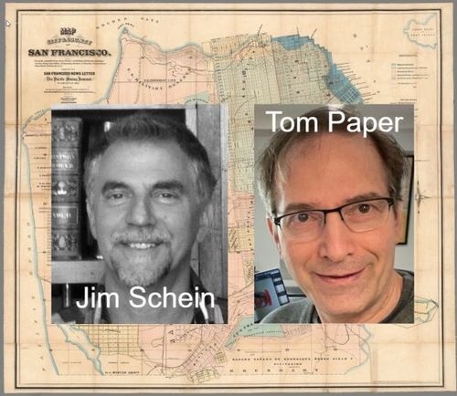
Jim Schein and Tom Paper
7
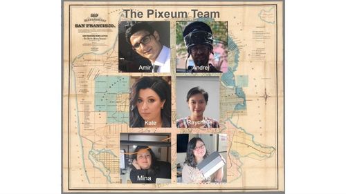
The Pixeum Team
8
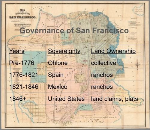
Governance of San Francisco
9
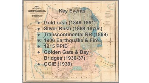
Key Events in San Francisco History
10
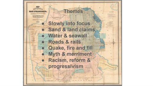
Historic Challenges to San Francisco
11
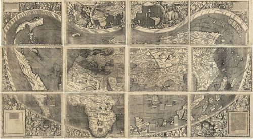
The World - Waldseemueller - 1507
12
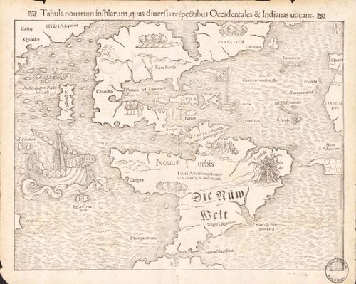
North and South America - Munster - 1559
13
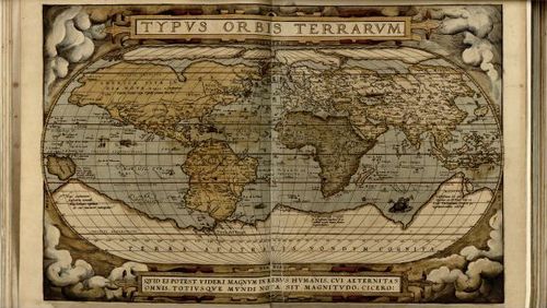
Typus Orbus Terrarum - Ortelius - 1570
14
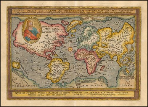
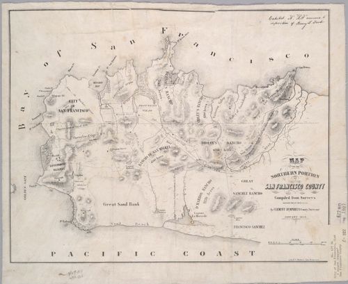
The World - Quad and Bussemacher - 1600
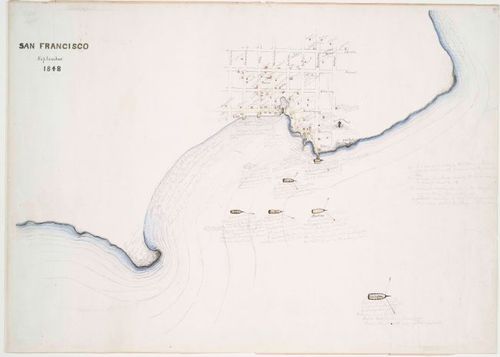
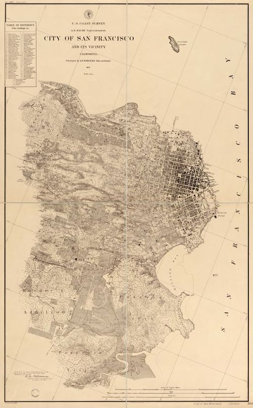
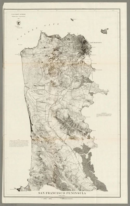
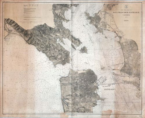
15
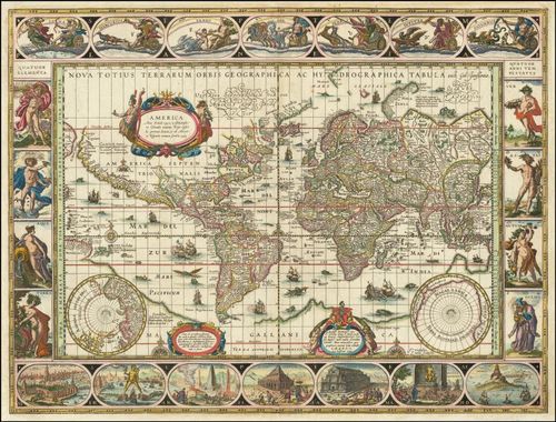
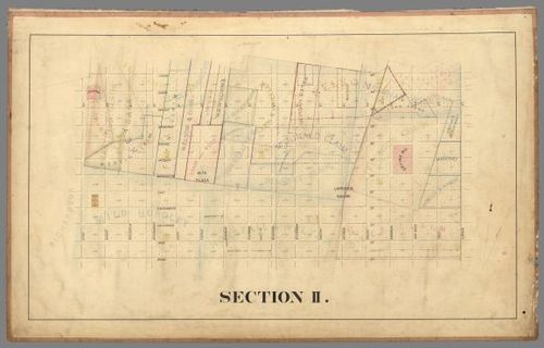
Nova Totius Terrarum Orbis Geographica Ac Hydrographica Tabula - Willem Janszoon Blaeu - 1606
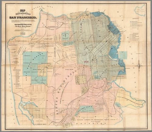
16
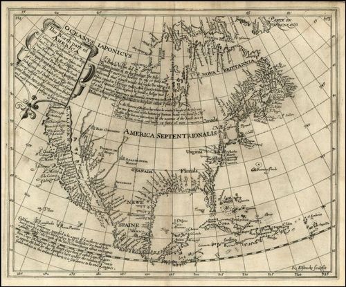
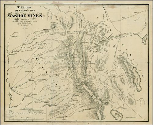
North America - Henry Briggs - 1625
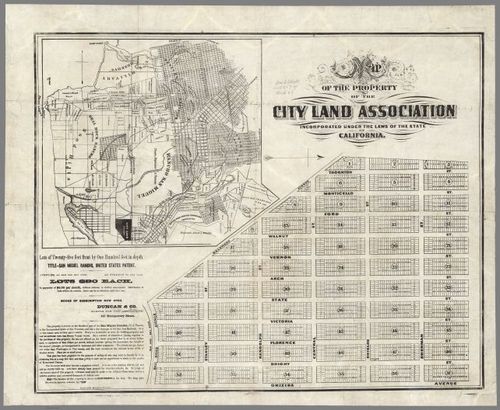
17
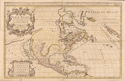
North America - Berry & Sanson - 1680
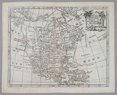
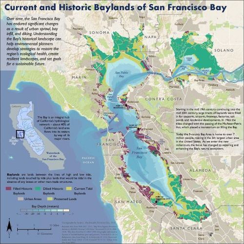
18
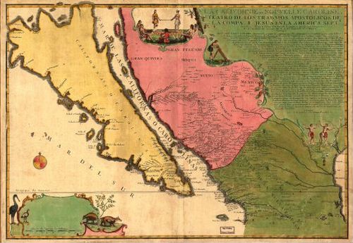
La Californie ou Nouvelle Caroline - Nicolas de Fer - 1720
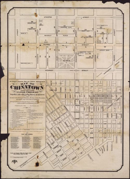
19
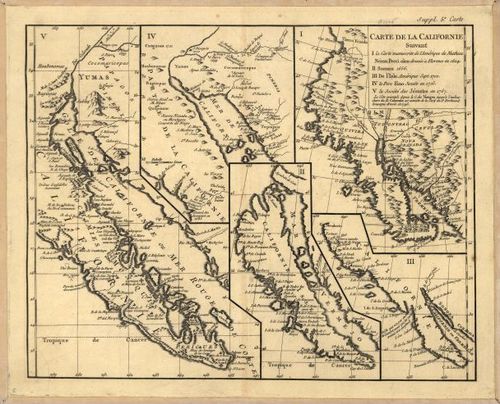
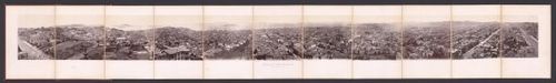
Variations of California - Vaugondy - 1770
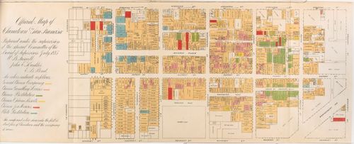
20
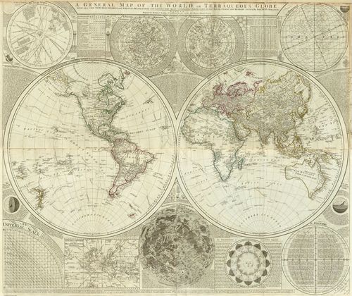
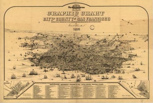
The World - Samuel Dunn - 1787
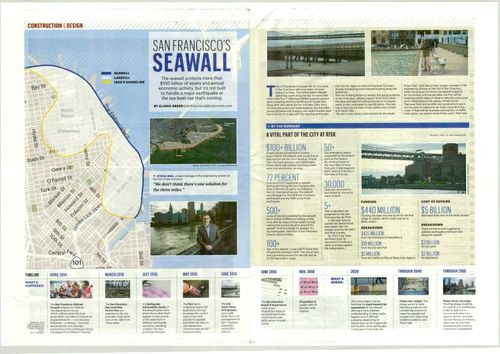
21
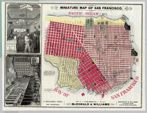
North America & Mer De L'Ouest - 1786
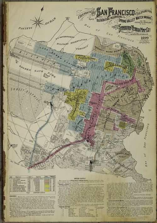
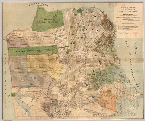
22
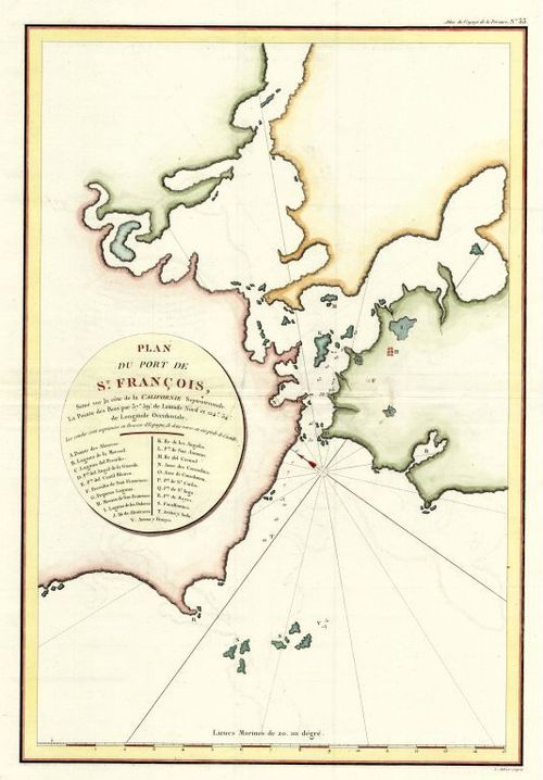
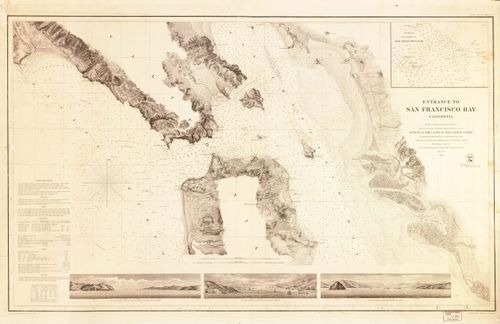
San Francisco Bay - La Perouse - mapped in 1786 - published in 1797
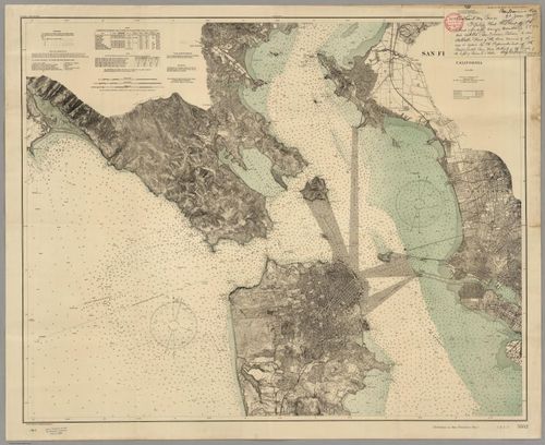
23
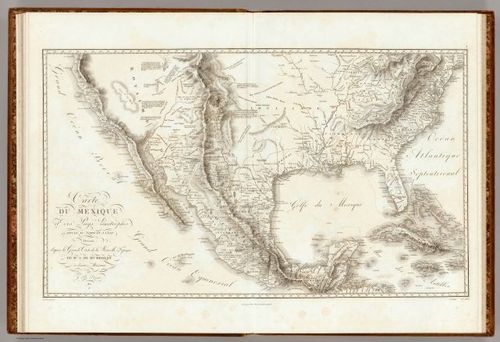
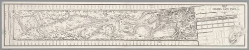
Mexico - Alexander von Humboldt - 1811
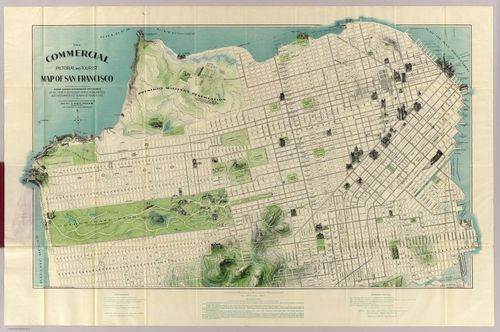
24
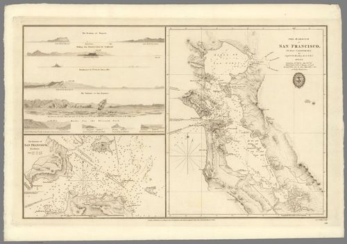
San Francisco Bay - Captain F.W. Beechey - 1827
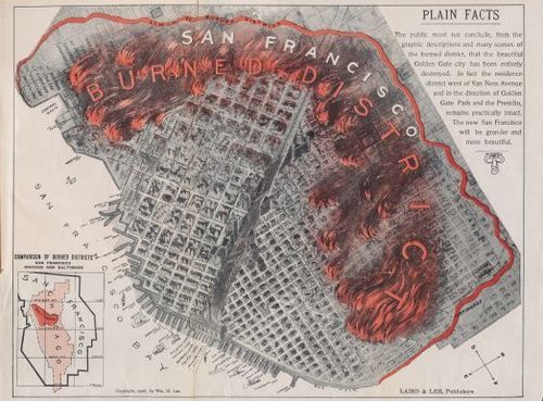
25
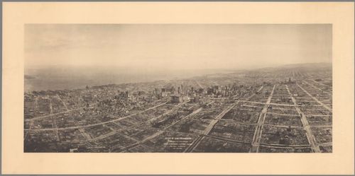
San Francisco Harbor - Augustus Harrison - 1848
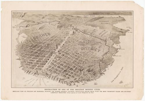
26
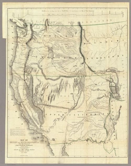
Western North America - John Charles Fremont - 1848
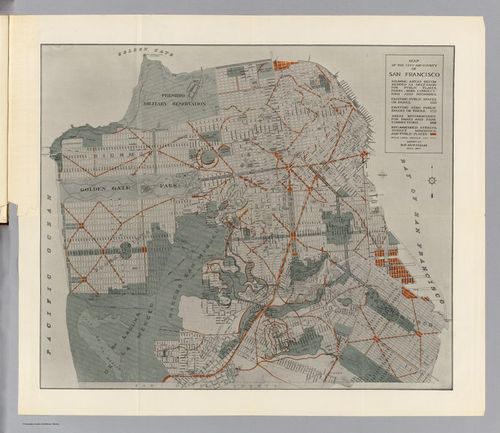
27
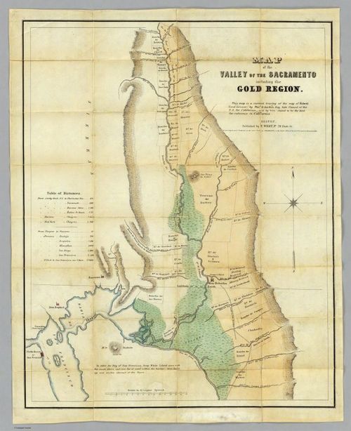
San Francisco & Gold Country - Bidwell & Larkin - 1849
28
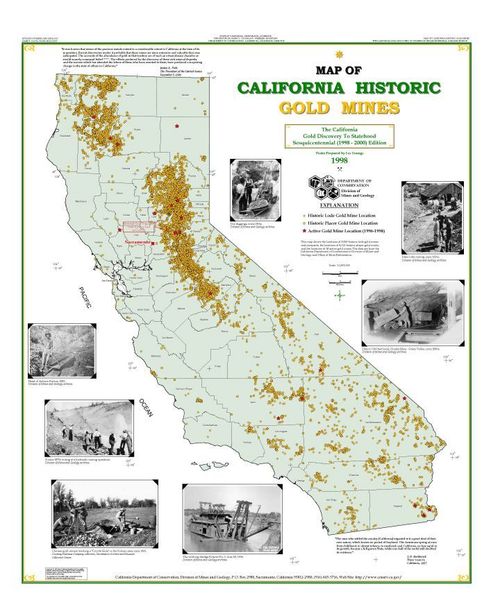
California Historic Gold Mines - 1998
29
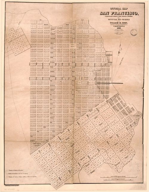
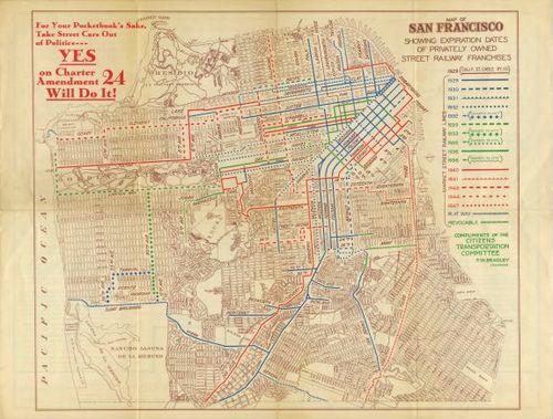
San Francisco - William Eddy - 1849
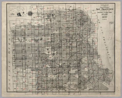
30
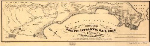
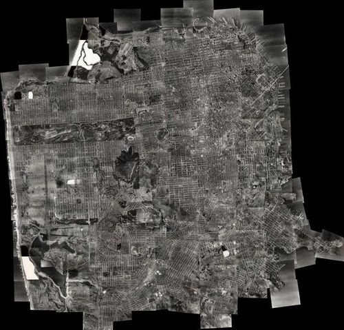
San Francisco Bay - William J. Lewis - 1851
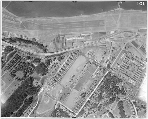
31
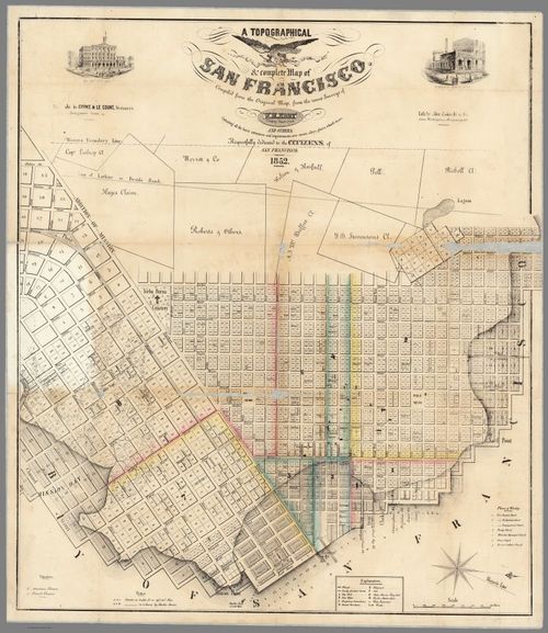
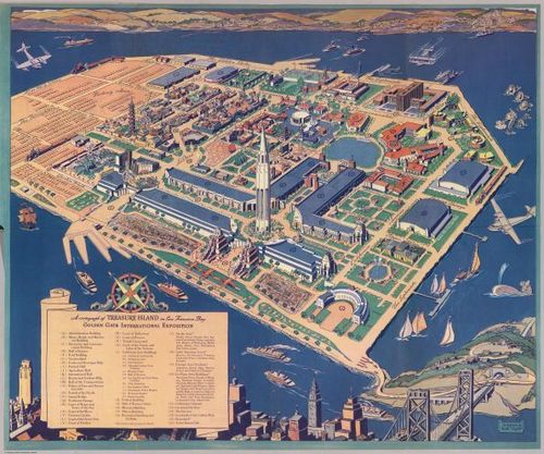
San Francisco - William Eddy - 1852
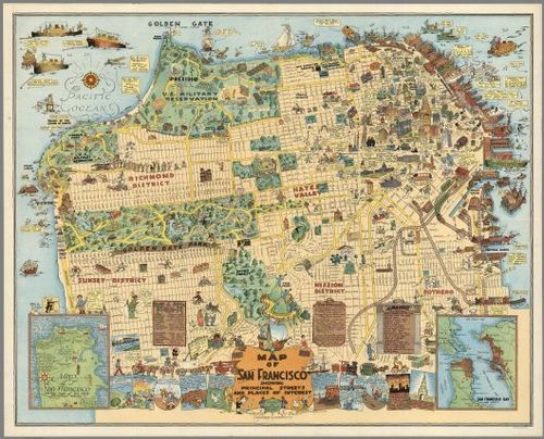
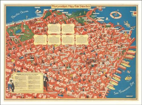
32
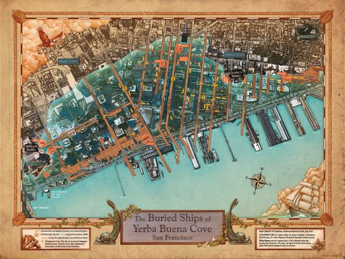
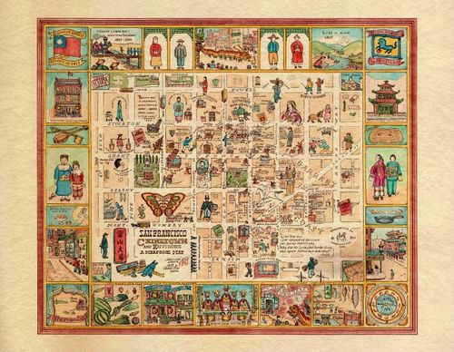
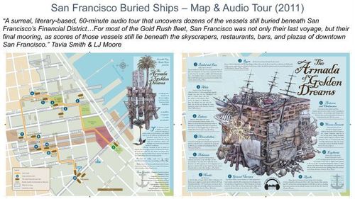
San Francisco Buried Ships - Michael Warner - 2017
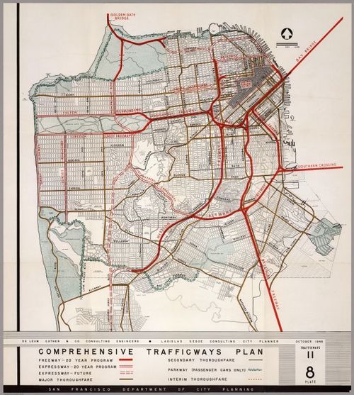
33
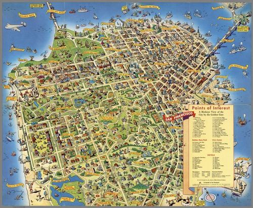
San Francisco - Clement Humphreys - 1853
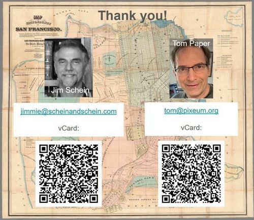
34
San Francisco - US Coast Survey - 1857
35
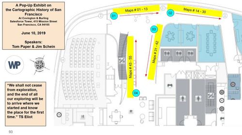
San Francisco Western Addition Land Claims - anonymous - 1858
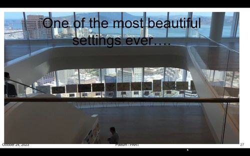
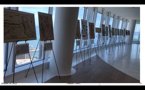
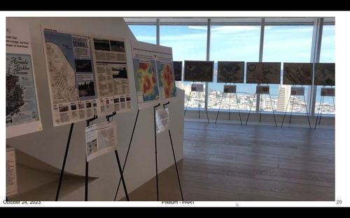
36
San Francisco Bache - 1859
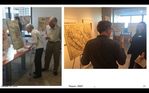
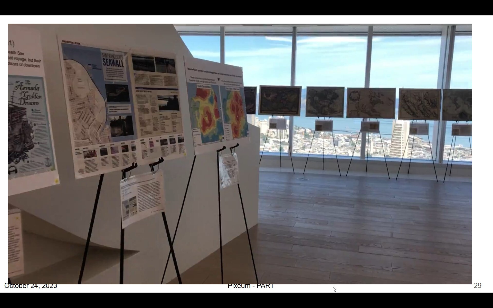
37
De Groot's Map of the Washoe Mines - 1860
38
San Francisco - City Land Association - 1860
39
San Francisco - Butler - 1864
40
Current and Historic Baylands of San Francisco Bay - MacDonald - 2016
41
San Francisco - US Coast Survey - 1869
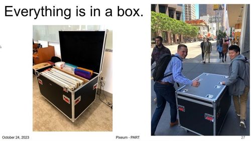
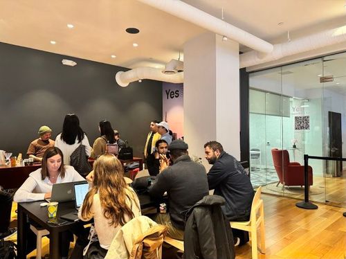
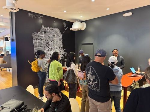
42
San Francisco Chinatown - Henry Josiah West - 1872
43
Panorama of San Francisco, From California -St. Hill - Eadward Muybridge - 1877
44
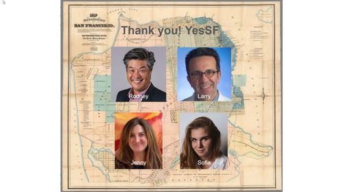
San Francisco Chinatown - Board of Supervisors, Farwell, Kunkler & Pond - 1885
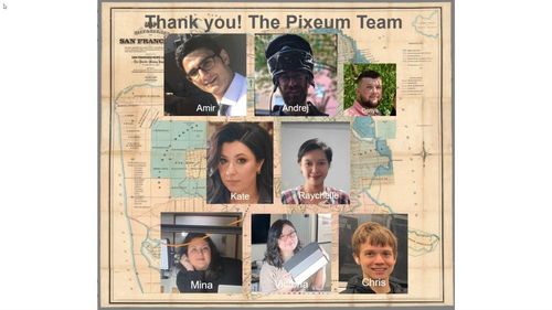
45
San Francisco - Frederick Marriott - 1875
46
San Francisco Seawall - SF Business Times - 2019
47
San Francisco - McDonald and Williams - 1879
48
San Francisco Water Supply - Sanborn Map Company - 1899
49
San Francisco - Grunskey - 1899
50
San Francisco - US Coast Survey - 1903
51
San Francisco Golden Gate Park - Britton & Rey - 1903
52
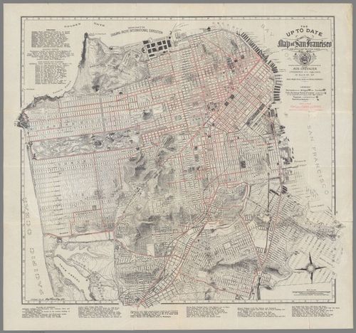
San Francisco - Chevalier - 1904
53
San Francisco - Daniel Burnham - 1905
54
San Francisco - William H. Lee - 1906
55
San Francisco - Lawrence - 1906
56
San Francisco - Pettit - 1906
57
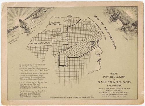
San Francisco - A. H. M. Davies - 1906
58
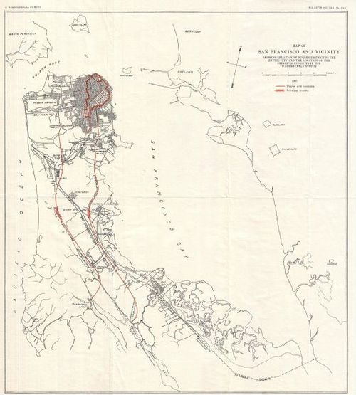
San Francisco - US Geological Survey - 1907
59
San Francisco - Chevalier - 1915 B&W
60
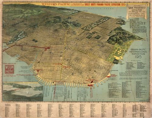
San Francisco - 1915 - Peters
61
San Francisco, US Coast and Geodetic Survey - from Ann Murphy - 1919
62
San Francisco - Harrison Godwin - 1927
63
San Francisco - Citizens Transport Committee - 1928
64
San Francisco key map - Harrison Ryker - 1937
65
San Francisco composite - Harrison Ryker - 1937
66
San Francisco Crissy Field - Harrison Ryker - 1937
67
San Francisco Treasure Island - Ruth Taylor White - 1939
68
A Merrymaker’s Map of San Francisco - Milt Schenkofsky - 1940
69
San Francisco Chinatown and Environs - Ken Cathcart, a Scrapbook Map - 1947
70
San Francisco - SF Dept of City Planning - 1948
71
San Francisco - Don Bloodgood - 1952
72
Thank you!
73
San Francisco - Stewart and Moore - 2012
74
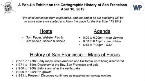
San Francisco - Title page - April 18, 2019
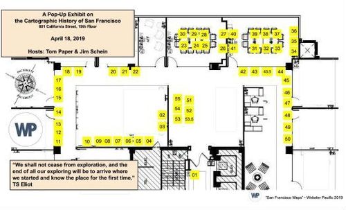
75
San Francisco exhibit layout - April 18, 2019
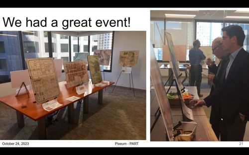
76
San Francisco exhibition - April 18, 2019
77
San Francisco exhibition - April 18, 2019
78

San Francisco exhibition - April 18, 2019
79
San Francisco exhibition - June 10, 2019
80
San Francisco exhibition - June 10, 2019
81
San Francisco exhibition - June 10, 2019
82
San Francisco exhibition - June 10, 2019
83
San Francisco exhibition - June 10, 2019
84
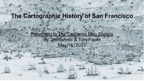
San Francisco Cartographic History Title Page
85
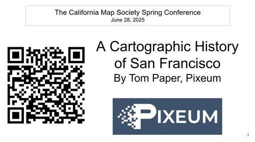
A Cartographic History of San Francisco - Tom Paper - June 28, 2025
86
![[ 2025-06-28 21:43:55 ]](https://iiif.pixeum.org/iiif/3/1751147050/full/500,/0/default.jpg)
[ 2025-06-28 21:43:55 ]
87
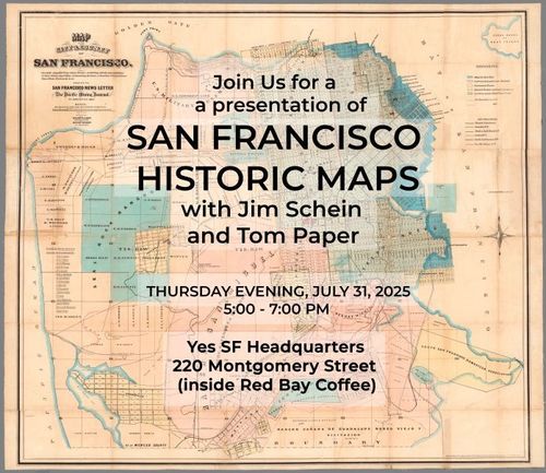
San Francisco Historic Maps - July 31, 2025, 5-7pm
88
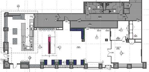
YesSF HQ Floorplan
89
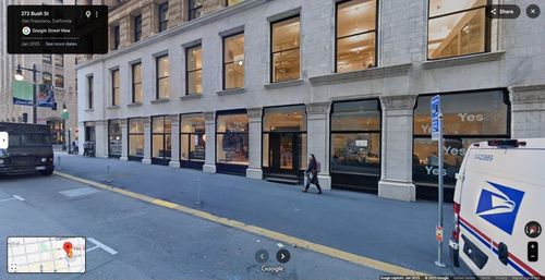
YesSF Headquarters at 220 Montgomery
90
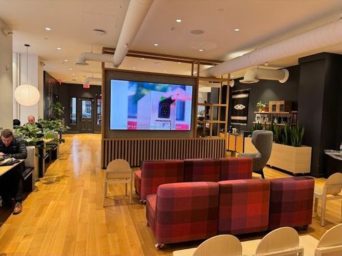
YesSF
91
YesSF
92
YesSF
93
Thank you! YesSF
94
Thank you! The Pixeum Team
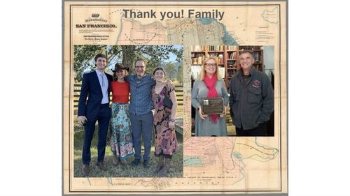
95
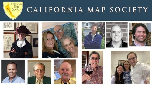
Thank you! Family
96
Thank you! The California Map Society
97
![[ 2025-07-30 17:25:36 ]](https://iiif.pixeum.org/iiif/3/1753896350/full/500,/0/default.jpg)
[ 2025-07-30 17:25:36 ]
98
![[ 2025-07-30 17:25:54 ]](https://iiif.pixeum.org/iiif/3/1753896388/full/500,/0/default.jpg)
[ 2025-07-30 17:25:54 ]
99
![[ 2025-07-30 17:26:31 ]](https://iiif.pixeum.org/iiif/3/1753896474/full/500,/0/default.jpg)
[ 2025-07-30 17:26:31 ]
100
![[ 2025-07-30 17:27:57 ]](https://iiif.pixeum.org/iiif/3/1753896495/full/500,/0/default.jpg)
[ 2025-07-30 17:27:57 ]
101
![[ 2025-07-30 17:28:26 ]](https://iiif.pixeum.org/iiif/3/1753896536/full/500,/0/default.jpg)
[ 2025-07-30 17:28:26 ]
102
![[ 2025-07-30 17:28:57 ]](https://iiif.pixeum.org/iiif/3/1753896560/full/500,/0/default.jpg)
[ 2025-07-30 17:28:57 ]
103
![[ 2025-07-31 01:37:24 ]](https://iiif.pixeum.org/iiif/3/1753925954/full/500,/0/default.jpg)
[ 2025-07-31 01:37:24 ]
104
![[ 2025-08-07 18:49:53 ]](https://iiif.pixeum.org/iiif/3/1754592613/full/500,/0/default.jpg)
[ 2025-08-07 18:49:53 ]
105
![[ 2025-08-07 18:50:13 ]](https://iiif.pixeum.org/iiif/3/1754592634/full/500,/0/default.jpg)
[ 2025-08-07 18:50:13 ]
106
![[ 2025-08-07 18:50:35 ]](https://iiif.pixeum.org/iiif/3/1754592645/full/500,/0/default.jpg)
[ 2025-08-07 18:50:35 ]
107
![[ 2025-08-07 18:50:46 ]](https://iiif.pixeum.org/iiif/3/1754592654/full/500,/0/default.jpg)
[ 2025-08-07 18:50:46 ]
108
![[ 2025-08-07 18:50:55 ]](https://iiif.pixeum.org/iiif/3/1754592667/full/500,/0/default.jpg)
[ 2025-08-07 18:50:55 ]
109
![[ 2025-08-07 18:51:07 ]](https://iiif.pixeum.org/iiif/3/1754592676/full/500,/0/default.jpg)
[ 2025-08-07 18:51:07 ]
110
![[ 2025-08-07 18:51:17 ]](https://iiif.pixeum.org/iiif/3/1754592686/full/500,/0/default.jpg)
[ 2025-08-07 18:51:17 ]
111
![[ 2025-08-07 18:51:26 ]](https://iiif.pixeum.org/iiif/3/1754592694/full/500,/0/default.jpg)
[ 2025-08-07 18:51:26 ]
112
![[ 2025-08-07 18:51:35 ]](https://iiif.pixeum.org/iiif/3/1754592703/full/500,/0/default.jpg)
[ 2025-08-07 18:51:35 ]
113
![[ 2025-08-09 18:55:01 ]](https://iiif.pixeum.org/iiif/3/1754765731/full/500,/0/default.jpg)
[ 2025-08-09 18:55:01 ]

Place a DOT on the image