

The Atlantic Neptune
Step 0 of 0
1
E89 - The Atlantic Neptune Published for the use of the Royal Navy
2
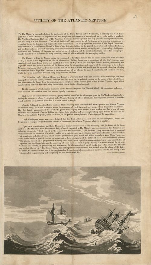
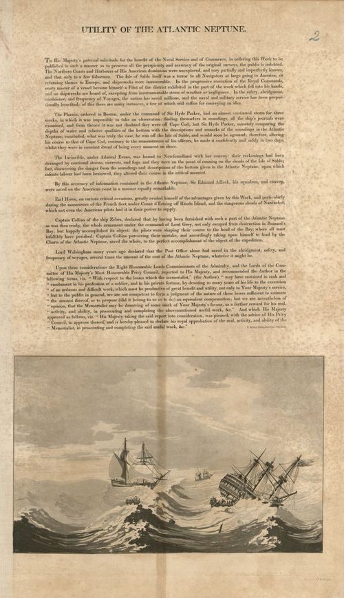
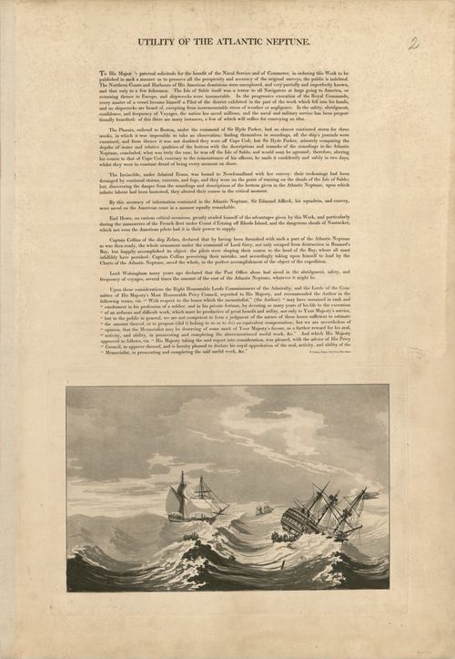
E89 - Utility of the Atlantic Neptune
3
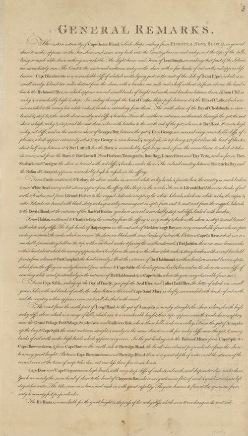
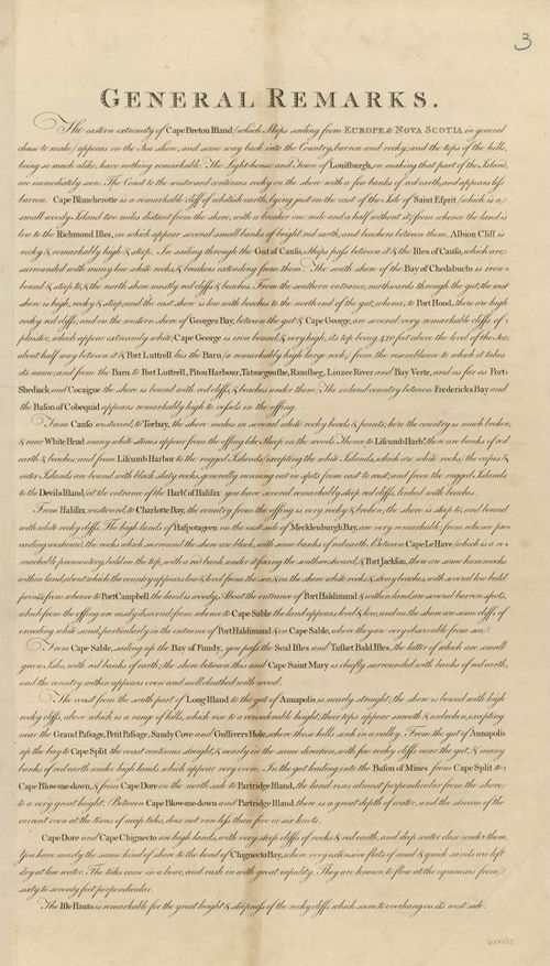
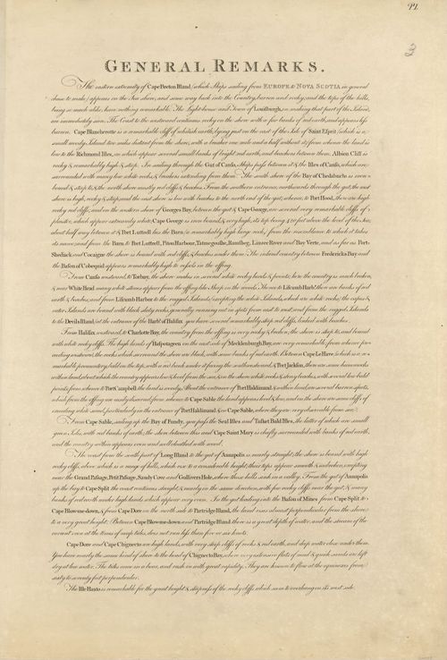
E89 - The Atlantic Neptune General Remarks
4
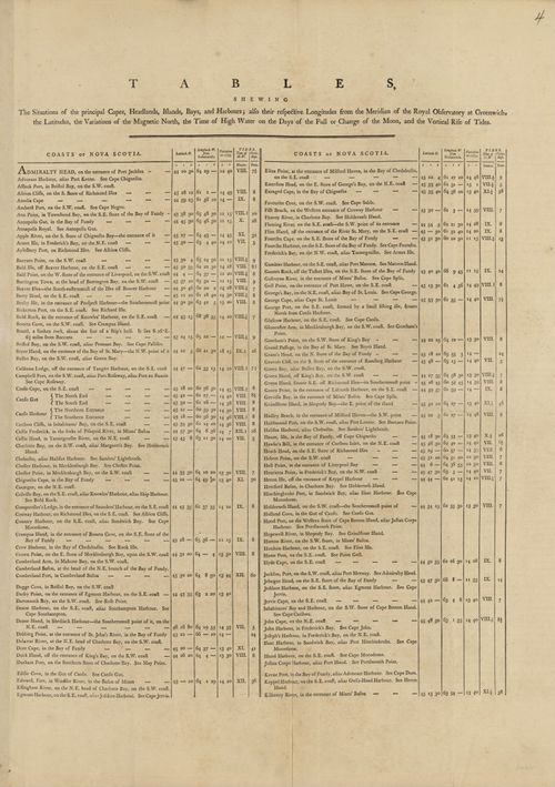
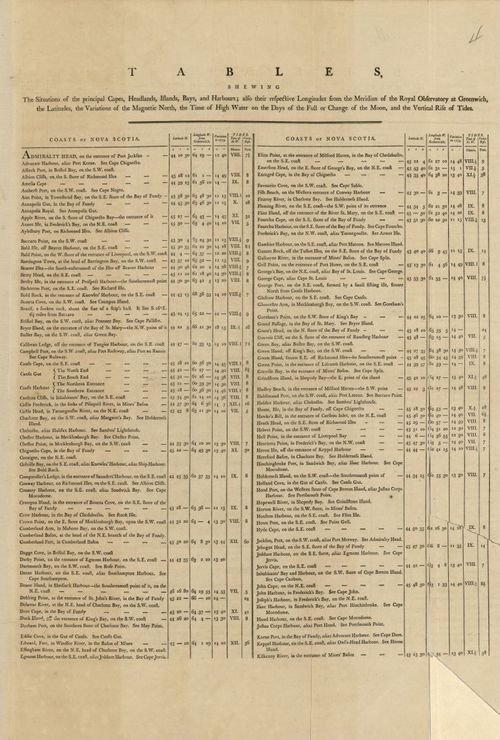
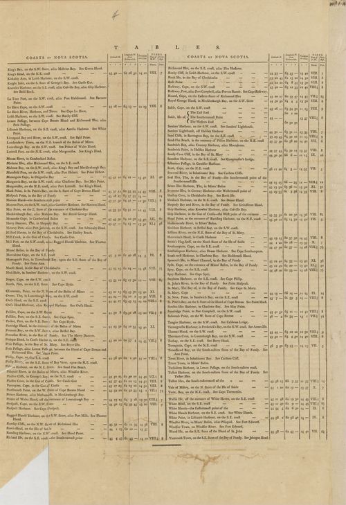
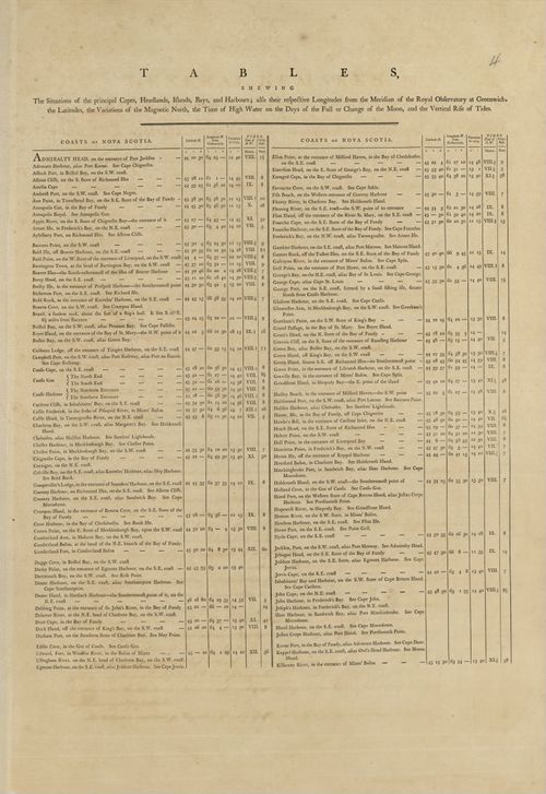
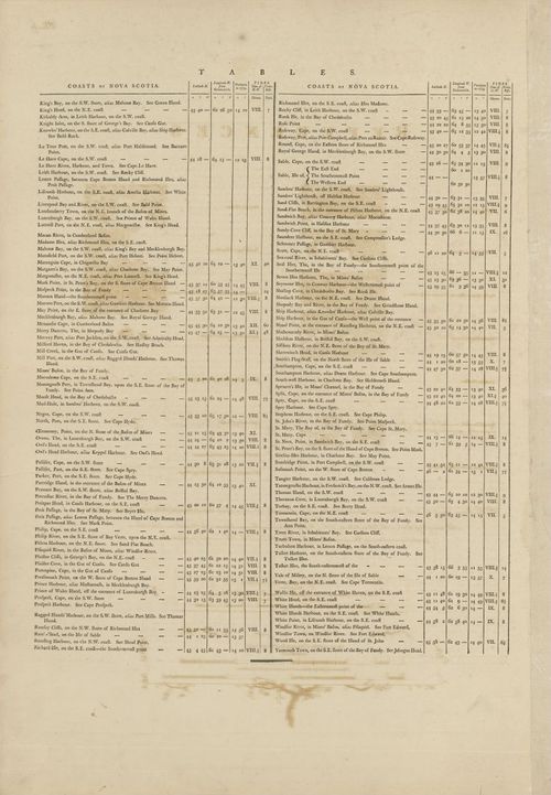
E89 - The Coasts and Harbours Table Chart No1
5
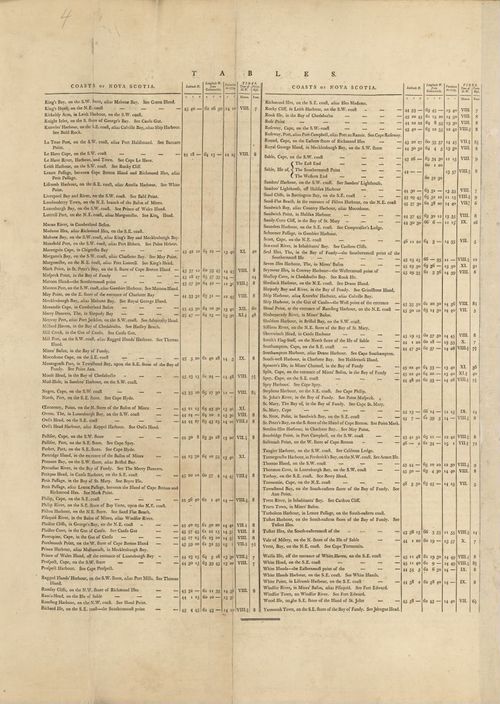
E89 - The Coasts and Harbours Table Chart No2
6
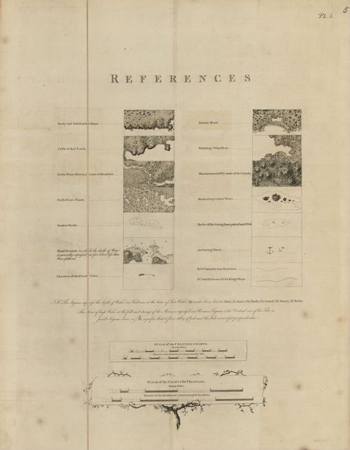
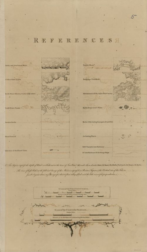
E89 - The Atlantic Neptune References Page
7
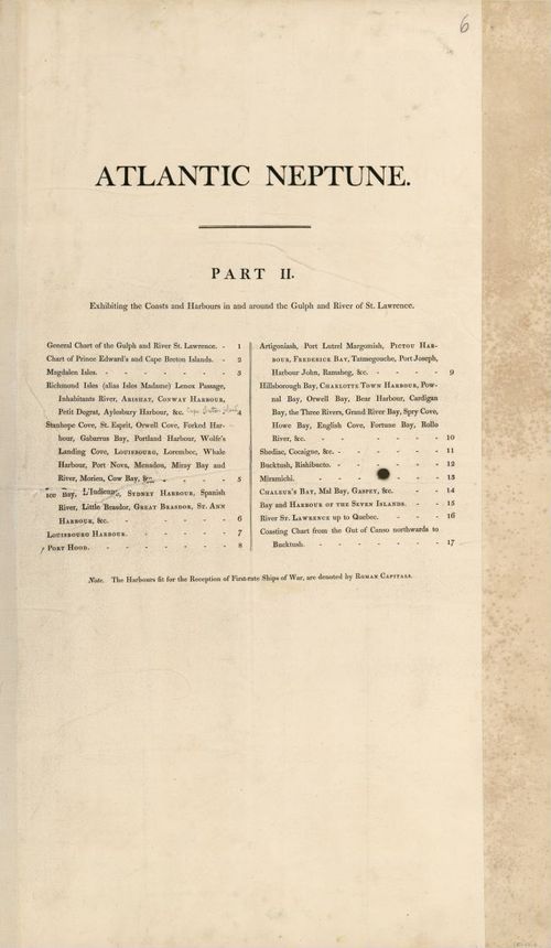
E89 - The Atlantic Neptune Part 1 Page
8
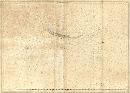
E89 - Isle of Sable
9

E89 - Remarks on the Isle of Sable
10
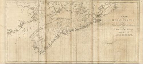
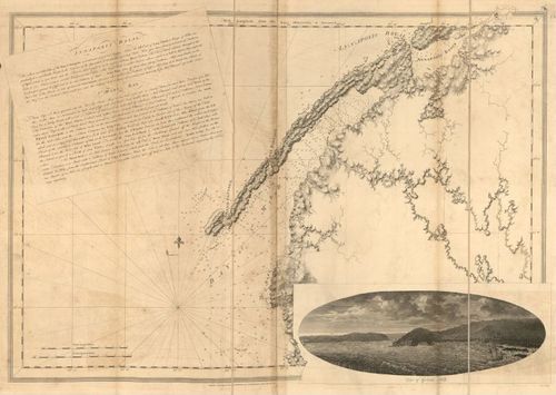
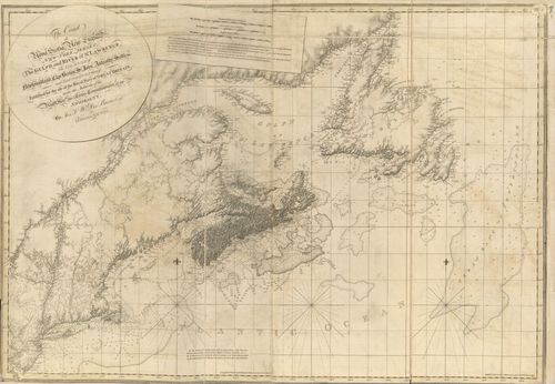
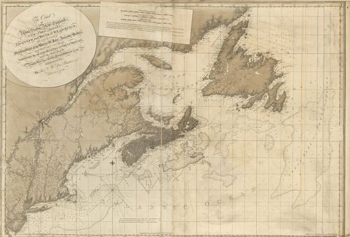
E89 - A Chart of Nova Scotia
11
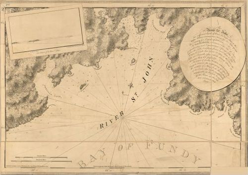
E89 - The River St John
12
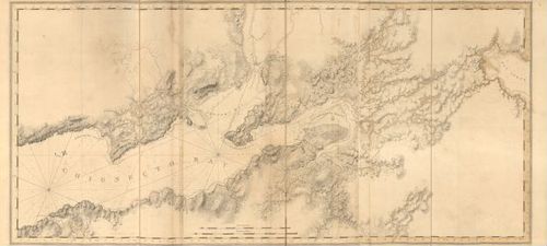
E89 - The Isthmus of Nova Scotia
13
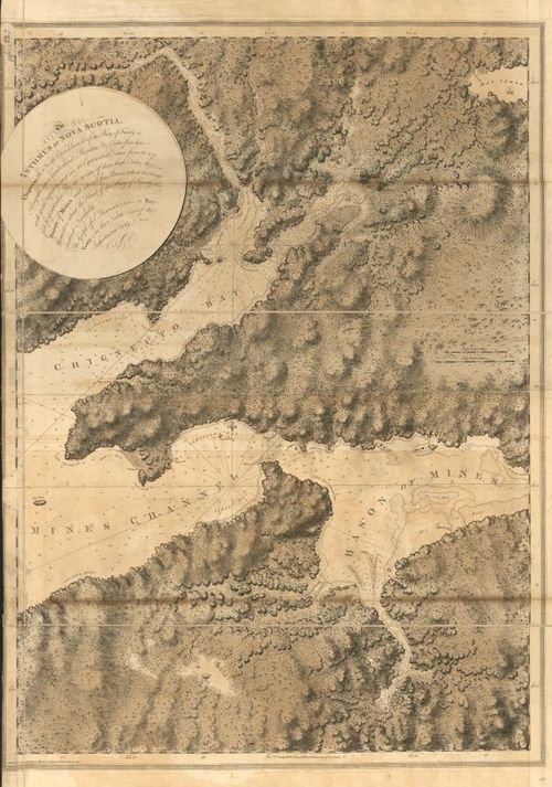
E89 - Chignecto Bay
14
E89 - Annapolis Royal St Marys Bay
15
E89 - South East Part of The Bay of Fundy
16
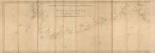
E89 - The South West Coast of the Peninsula of Nova Scotia
17
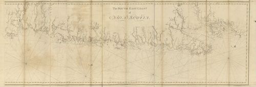
E89 - The South East Coast of Nova Scotia
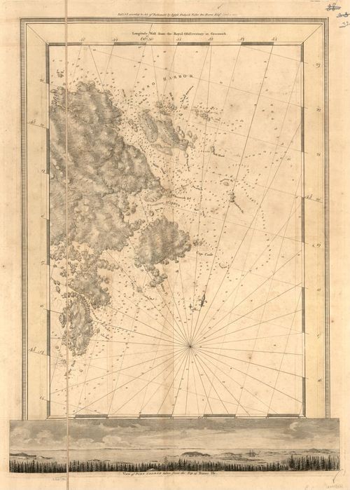
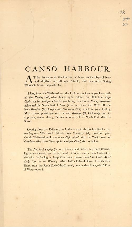
18
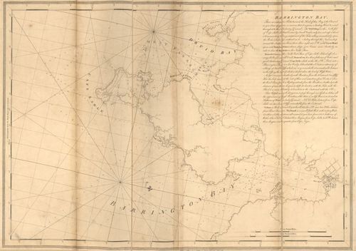
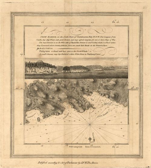
E89 - Barrington Bay
19
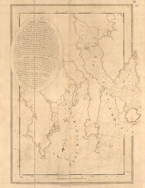
E89 - Port Amherst and Port Haldimand
20
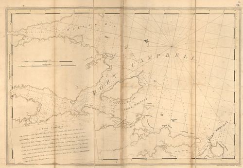
E89 - Port Campbell
21
E89 - Port Mills Port Mansfield and Gambier Harbour
22
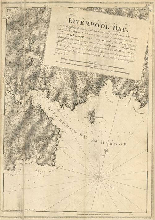
E89 - Liverpool Bay and Harbor
23
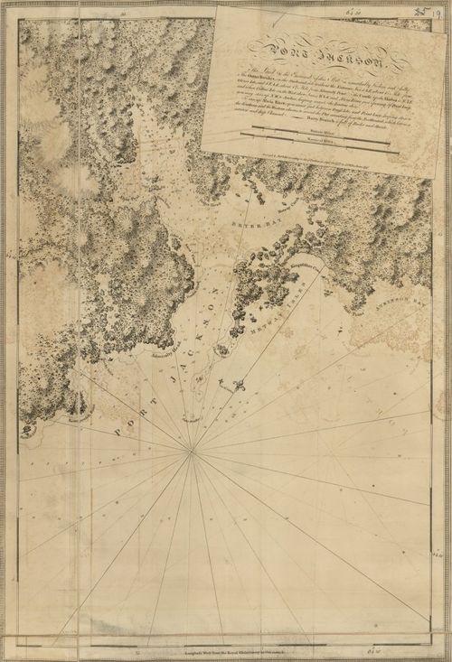
E89 - Port Jackson
24
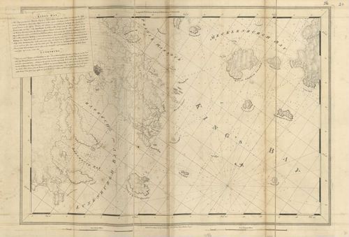
E89 - Kings Bay Lunenburg
25
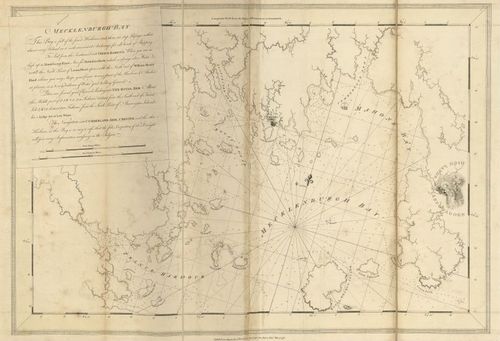
E89 - Mecklenburgh Bay
26
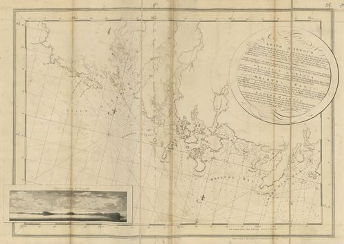
E89 - Leith Harbour Prospect Harour Bristol Bay and Sambro Harbour
27
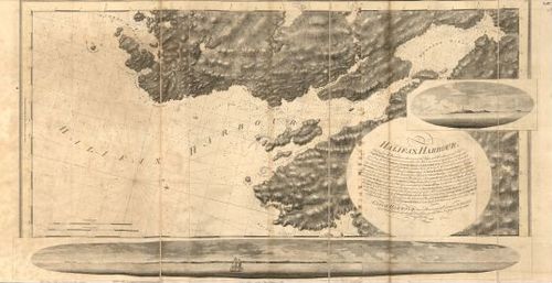
E89 - Halifax Harbour
28
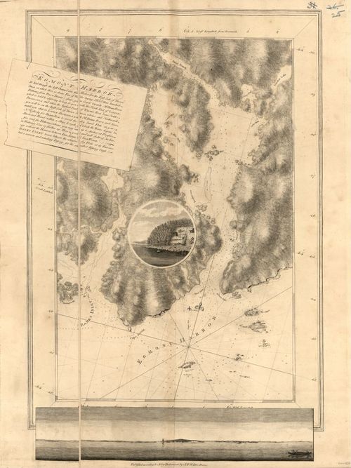
E89 - Egmont Harbor
29
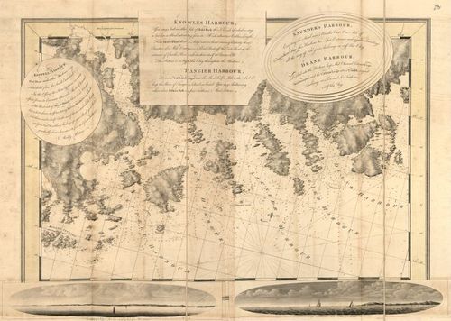
E89 - Keppell Knowles Tangier Saunders and Deane Harbour
30
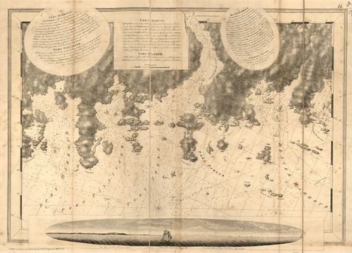
E89 - Spry Harbour Port Pallissner Port North Port Parker Beaver Harbour Fleming River
31
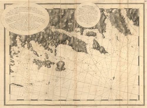
E89 - White Islands Harbour Port Stephens Liscomb Harbour Houlton Harbour and River St Mary
32
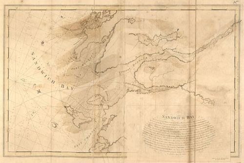
E89 - Sandwich Bay
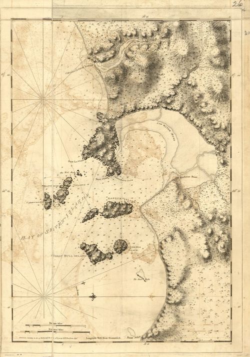
33
E89 - Tor Bay
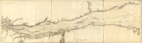
34
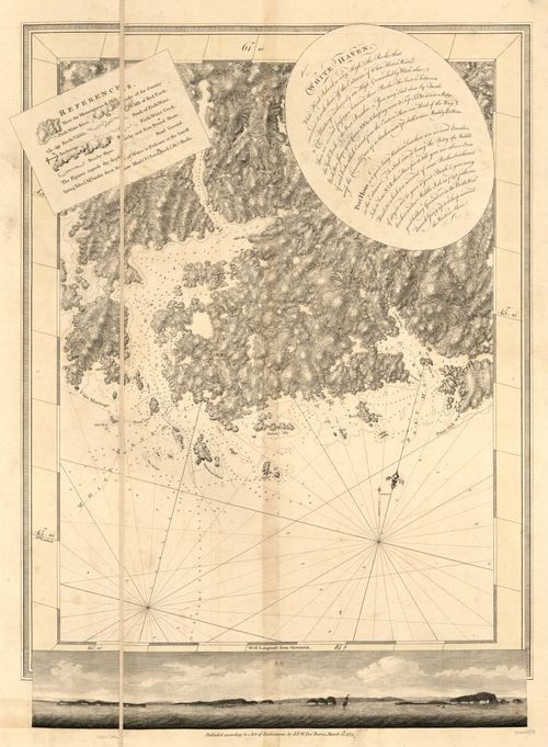
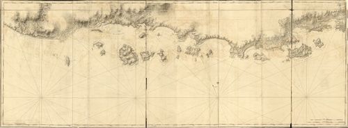
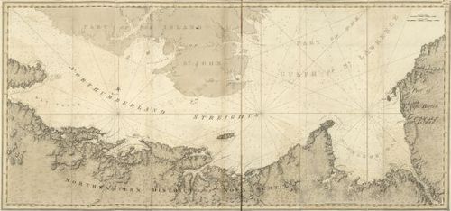
E89 - White Haven
35
E89 - Candso Harbor Map
36
E89 - Candso Harbor
37
E89 - Crow Harbor
38
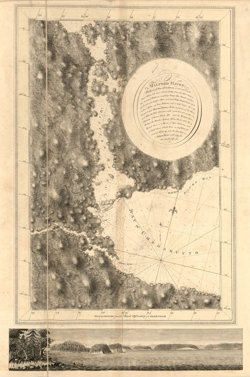
E89 - Bayof Chedabucto
39
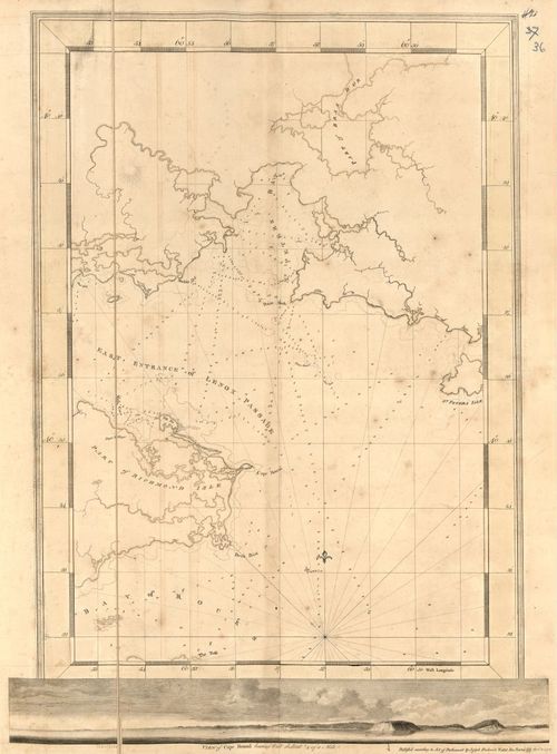
E89 - East Entrance of Lenox Passage
40
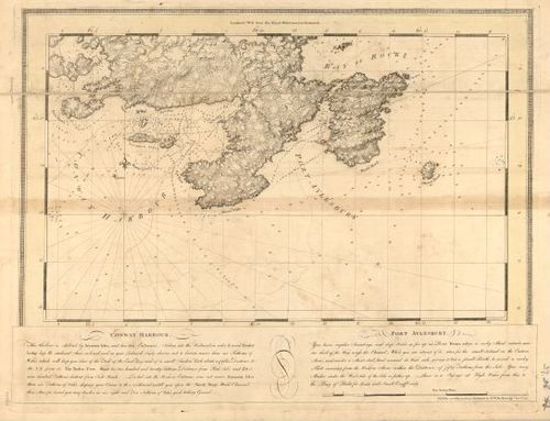
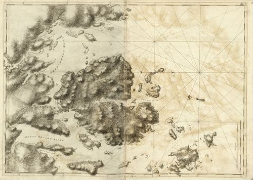
E89 - Conway Harbour and Port Aylesbury
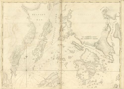
41
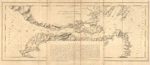
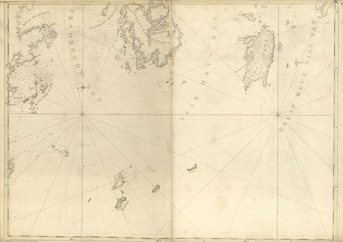
E89 - The Gut of Canso
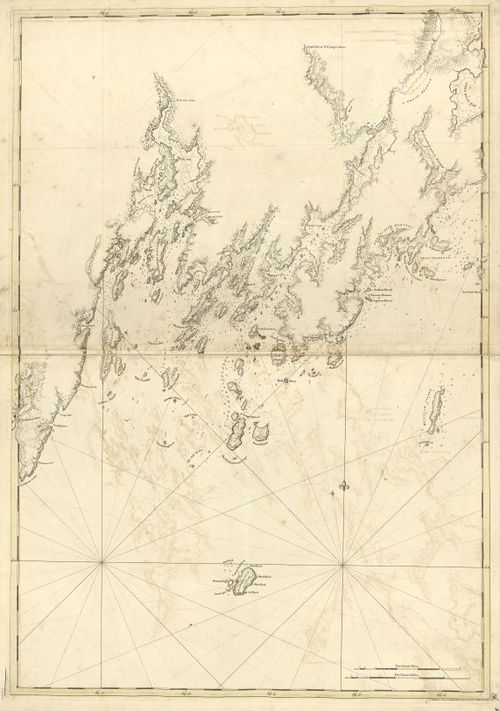
42
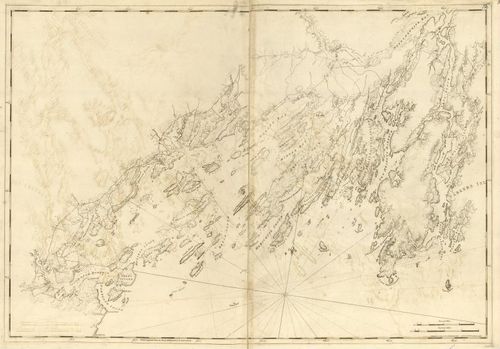
E89 - The Atlantic Neptune Published for the Use of the Royal Navy of Great Britain
43
E89 - Utility of the Atlantic Neptune 2
44
E89 - General Remarks
45
E89 - The Coasts of Nova Scotia Table Chart No1
46
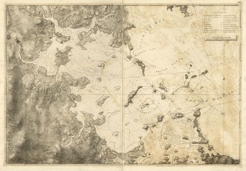
E89 - The Coasts of Nova Scotia Table Chart No2
47
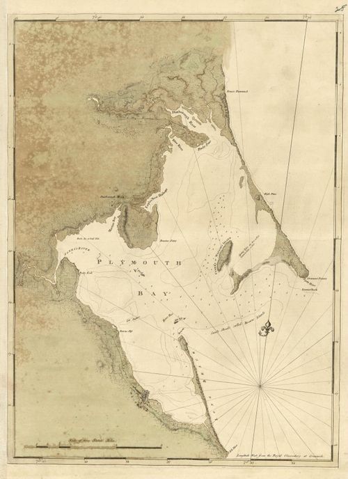
E89 - References Map and Scale of the Coasting Charts
48
E89 - The Atlantic Neptune Part 2 Page
49
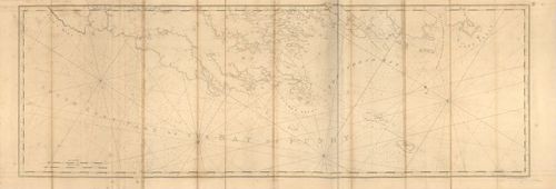
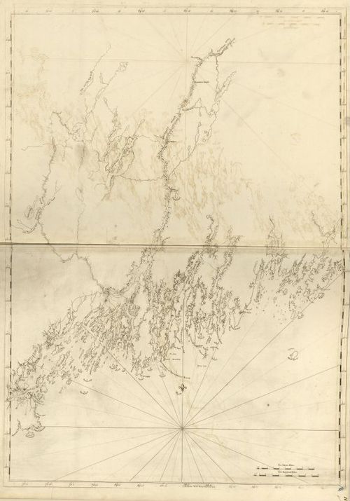
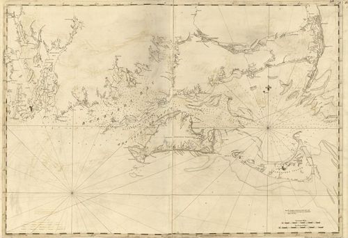
E89 - The Coast of Nova Scotia New England Ne York Jersey The Gulph and River of St Lawrence The Islands of Newfoundland Cape Brton St John Antecofty Sable and Soundings
50
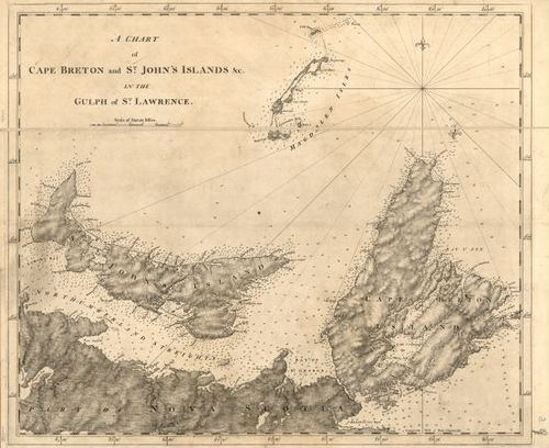
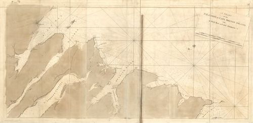
E89 - A Chart of Cape Breton and St John Islands in the Gulf of St Lawrence
51
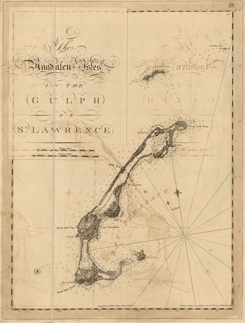
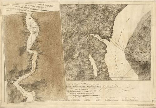
E89 - The Magdalen Isles in the Gulph of St Lawrence
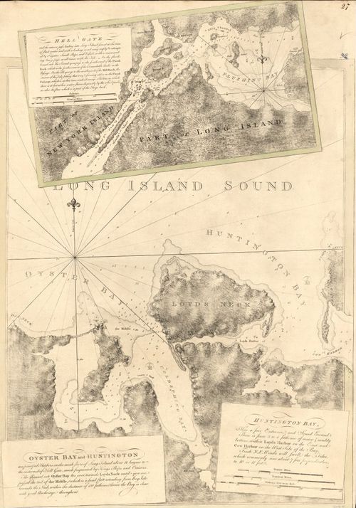
52
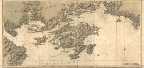
E89 - Part of Cape Breton Island
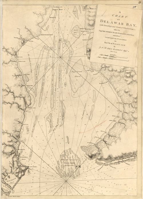
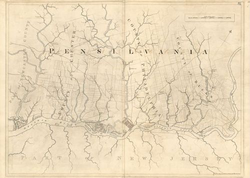
53
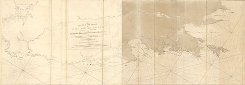
E89 - The South East Coast of Cape Breton Island
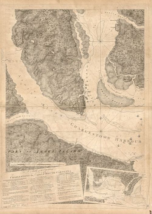
54
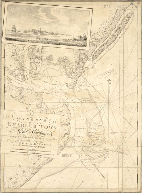
E89 - A Chart of the North East Coast of Cape Breton Island
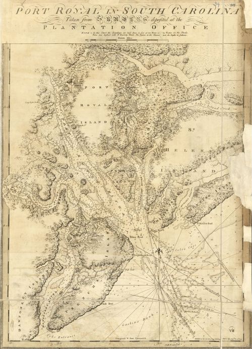
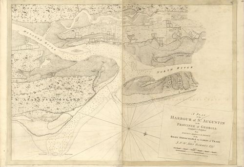
55
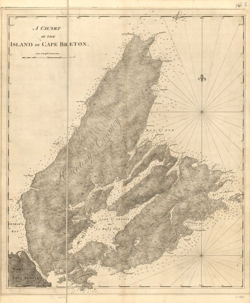
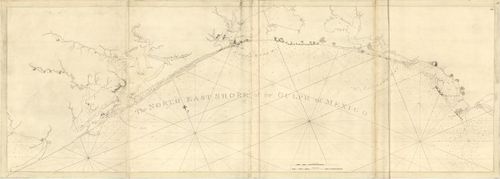
E89 - A Chart of Cape Breton Island
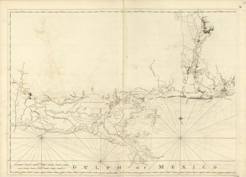
56
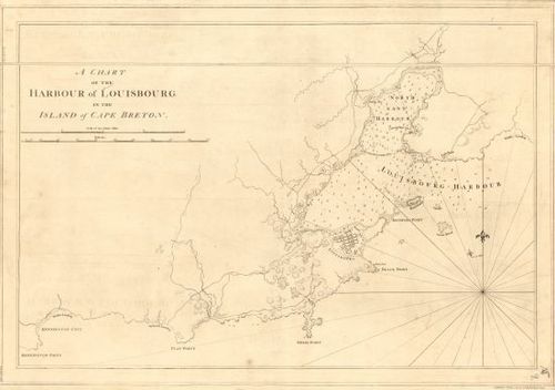
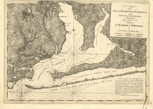
E89 - A Chart of The Harbour of Louisbourg in the Island of Cape Breton
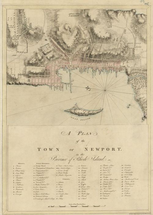
57
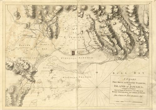
E89 - Port Hood
58
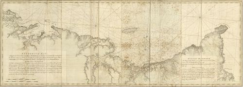
E89 - Frederick Bay and Pictou Harbour
59
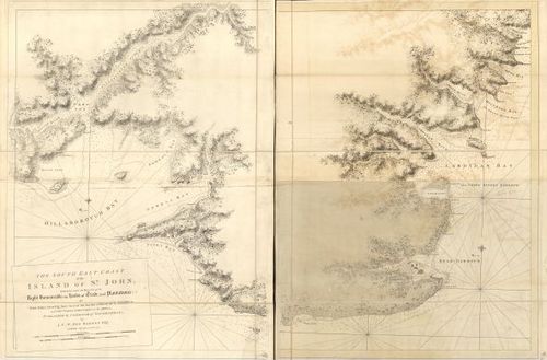
E89 - The East Coast of the Island of St John
60
E89 - Part of the Island of St John
61
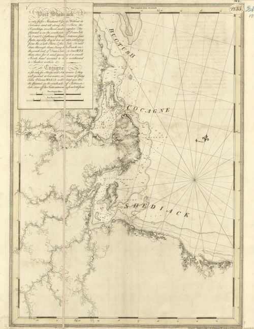
E89 - Port Shediack Cocagne
62
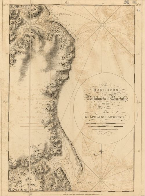
E89 - The Harbours of Rishibucto and Buctush on the West Shore of the Guph of St Lawrence
63
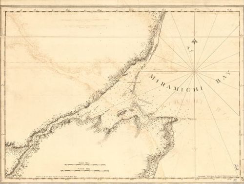
E89 - Miramachi Bay
64
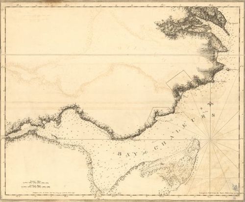
E89 - Bay of Chaleurs
65
E89 - Bay of Gaspee nad Maul
66
E89 - Bay of Seven Islands
67
E89 - Mingan Harbour
68
E89 - River of St Lawrence
69
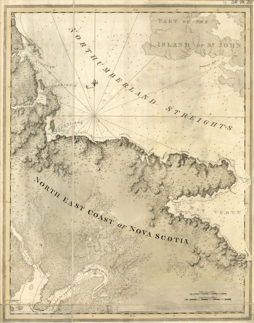
E89 - Northhumberland Streights
70
E89 - The Atlantic Neptune Published for the use of the Royal Navy Great Britain
71
E89 - Utility of the Atlantic Neptune 3
72
E89 - General Remarks 3
73
E89 - The Coasts and Harbours of Nova Scotia Table Chart No1
74
E89 - The Coasts and Harbours of Nova Scotia Table Chart No2
75
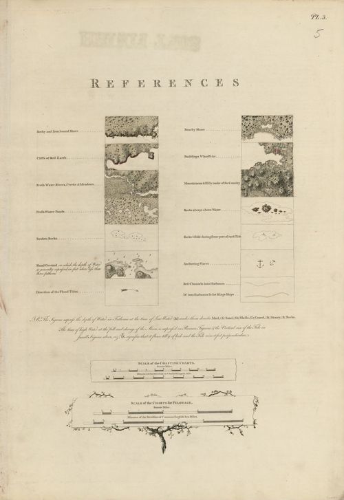
E89 - References Map and Scale of the Coasting Charts 2
76
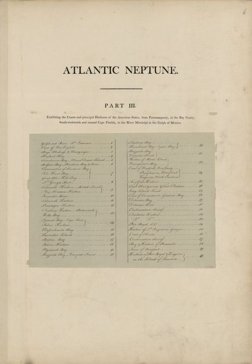
E89 - Atlantic Neptune Part 3 Page
77
E89 - The Coast of Nova Scotia New England Ne York Jersey The Gulph and River of St Lawrence The Islands of Newfoundland Cape Brton St John Antecofty Sable and Soundings Map
78
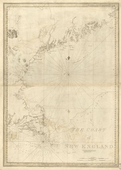
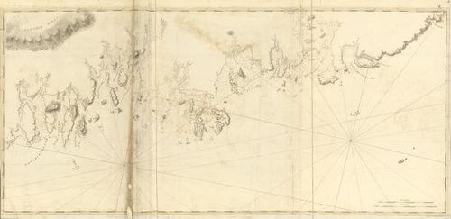
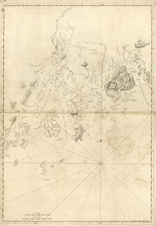
E89 - The Coast of New England
79
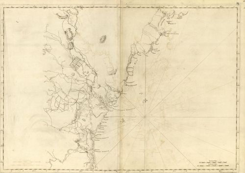
E89 - Mechiass Bay
80
E89 - Deer Island
81
E89 - Mount Desart River
82
E89 - Belfast Bay
83
E89 - Isle Haut Bay
84
E89 - St George River
85
E89 - Mericonig Sound
86
E89 - Sheepscutt River
87
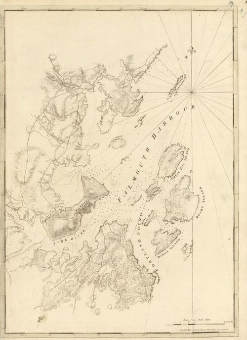
E89 - Falmouth Harbour
88
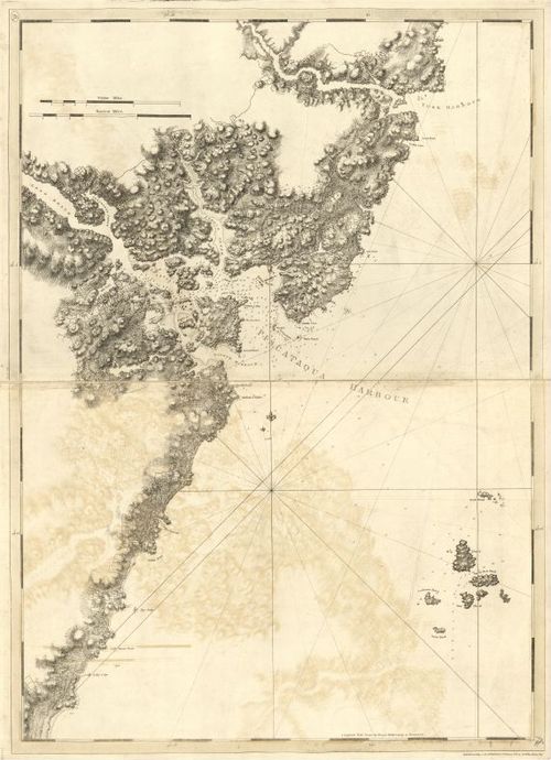
E89 - Piscataqua Harbour
89
E89 - Piscataqua Harbour Map
90
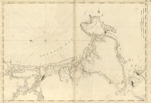
E89 - Ipswich Bay
91
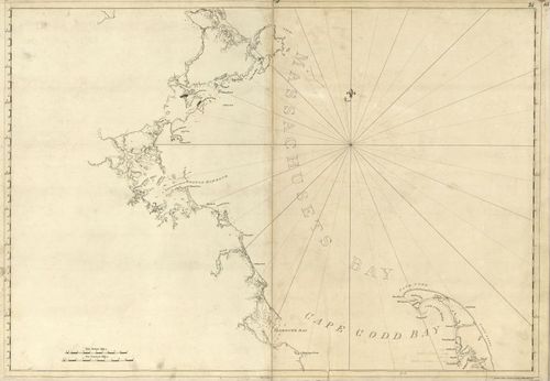
E89 - Massachusets Bay
92
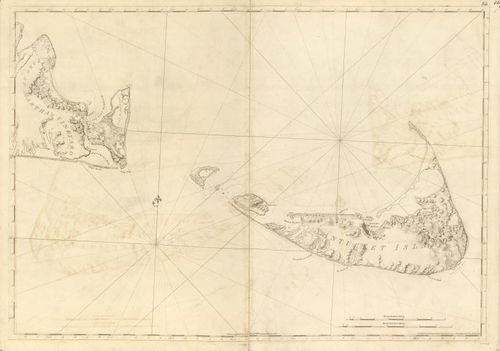
E89 - Nantucket Island
93
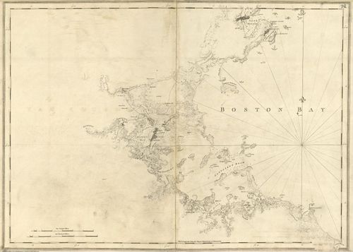
E89 - Boston Bay
94
E89 - Boston Harbour
95
E89 - Plymouth Bay
96
E89 - Buzzards Bay
97
E89 - Hampstead Bay
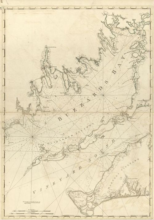
98
E89 - Vineyard Sound
99
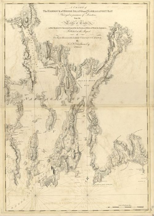
E89 - A Chart of The Harbour of Rhode Island and Narraganset Bay
100
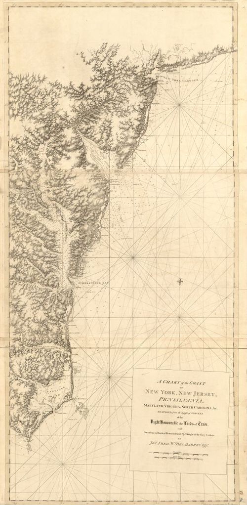
E89 - A Chart of the Coast New York New Jersey Pensilvania
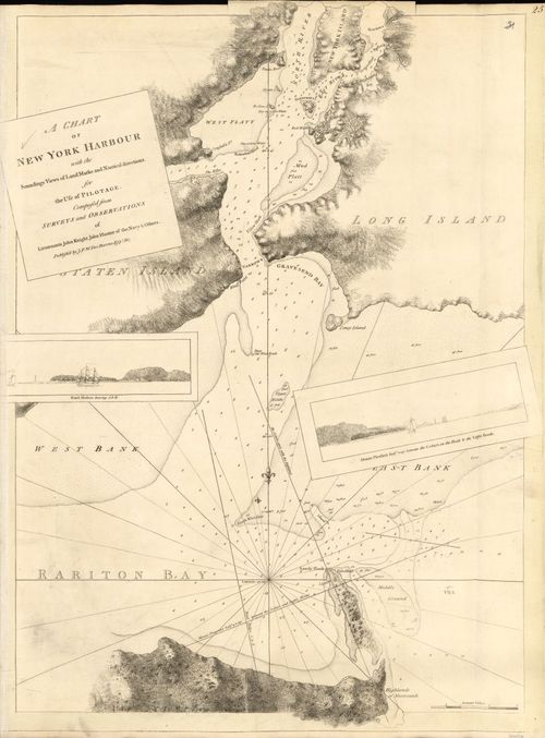
101
E89 - A Chart of New York Harbour
102
E89 - Part of Hudsons River
103
E89 - Long Island Sound
104
E89 - Block Island Shelter Island Gardners Island Map
105
E89 - A Chart of Delawar Bay
106
E89 - Pensilvania Chart
107
E89 - Part of James Island
108
E89 - The Harbour of Charles Town in South Carolina
109
E89 - Port Royal in South Carolina
110
E89 - A Plan of the Harbour of St Augustin
111
E89 - The North Est Shore of the Gulph of Mexico
112
E89 - Gulph of Mexico
113
E89 - A Chart of the Bay and Harbour of Pensacola
114
E89 - A Plan of the Town of Newport
115
E89 - A Chart of Port Royal and Kingston Harbour in the Island of Jamaica
116
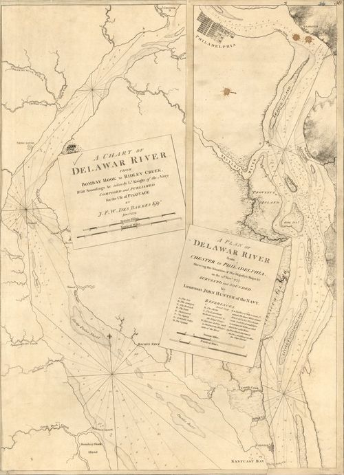
E89 - A Chart and Plan of Delawar River
Place a DOT on the image