Visscher Atlas of 1690
Step 0 of 0
1

2

3

4

5

6

7

8

9

10

11

12

13

14

15

16

17

18

19

20

21

22

23

24

25

26

27

28

29

30

31

32

33

34

35

36

37

38

39

40

41

42

43

44

45

46

47

48

49

50

51

52

53

54

55

56

57

58

59

60

61

62

63

64

65

66

67

68

69

70

71

72

73

74

75

76

77

78

79

80

81

82

83

84

85

86

87

88

89

90

91

92

93

94

95

96

97

98

99

100

101

102

103

104

105

106

107

108

109

110

111

112

113

114

115

116

117

118

119

120

121

122

123

124

125

126

127

128

129

130

131

132

133

134

135

136

137

138

139

140

141

142

E86.a1 - The Visscher Atlas of 1690
E86 - Syndics of the Drapers' Guild - 1662 by Rembrandt
The Sampling Officials, also called Syndics of the Drapers’ Guild, is a 1662 oil painting by Rembrandt. It is currently owned by the Rijksmuseum in Amsterdam. It has been described as his "last great collective portrait". The men (with the exception of Bel who is an attendant as indicated by his calotte) are drapers who were elected to assess the quality of cloth that weavers offered for sale to members of their guild. Wikipedia
E86.a2 - Important Dates in Dutch History
https://docs.google.com/presentation/d/13rUiCASs7p...
https://www.slideshare.net/guest071bd2/netherlands-powerpoint
E86.a3 - Treaty of Tordesillas
E86.a4 -Cantino Planisphere
https://docs.google.com/presentation/d/13rUiCASs7p...
E86.a5 - Spanish and Portugese Empires
E86.a6 - The Dutch Empire
E86.a7 - The VOC - The Dutch East India Company
E86.a8 - Dutch Cartographers of the 17th Century
https://docs.google.com/presentation/d/13rUiCASs7p...
https://www.hollstein.com/index/published-the-de-j... - De Jode was a dynasty spanning 4 generations.
https://www.swaen.com/mapmaker.php
https://www.geographicus.com/P/RareMaps/dewit
https://www.rijksmuseum.nl/en/collection/RP-P-1903-A-23539 - Danckerts ship image
E86.a9 - Three Generations of Visschers
https://docs.google.com/presentation/d/13rUiCASs7p...
https://en.wikipedia.org/wiki/Claes_Jansz._Visscher
https://en.wikipedia.org/wiki/Nicolaes_Visscher_I
https://en.wikipedia.org/wiki/Nicolaes_Visscher_II
https://www.abebooks.com/Leo-Belgicus-DOETECUM-Johan-Visscher-Amsterdam/21185831003/bd
E86.a10 - The Talents of Mapmakers
E86 - Atlas Minor sive Geographia Compendiosa, qua Orbis Terrarum
E86 - Atlas minor sive totius orbis terrarum contracta
E86 - Atlas minor sive totius orbis terrarum contracta
E86 - Novissima Totius Terrarum Orbis Tabula, Auctore Nicolao Visscher
E86 - Nova Totius Terrarum Orbis geographica ac hydrographica tabula
From David Rumsey: "Hand colored in outline map of the world on Mercator's projection. surrounding the map include twelve Roman emperors at the top and bottom, with six groups of national figures and eight vignettes of principal cities at the sides, in the corners are female allegorical representations of the continents: Europa, Asia, America and Africa. Map showing discoveries around the Hudson Bay and the course of the St. Lawrence river. River extending to a small lake in the middle of North America. Tierra del Fuego is shown as a distinct landmass. The Straits of le Maire and Magellan, with the massive Magellanica Sive Terra Australis Incognita, California Coastline appears, heading north toward the Straits of Annian. Decorative cartouche in the upper left tells of the discovery of America by Columbus. Also showing cities and towns, vignettes of ships and sea monsters, rivers, lakes and mountains. Relief shown pictorially. The error of the date of 1592 for the discovery of America by Columbus indicates that this is a very early state of the map, perhaps the first."
E86 - Nova et accurata Poli Arctici
E86 - Typus Maritimus Groenlandiae, Islandiae, Freti Davidis
E86 - Europa delineata et recens edita per Nicolaum Visscher
E86 - Nova totius Angliae, Scotiae, et Hiberniae
E86 - Scotia Regnum : divisum in partem
E86 - A new mapp of the Kingdome of England
E86 - Regnum Hiberniae
E86 - Moscoviae seu Russiae Magnae Generalis Tabula
E86 - Russiae vulgo Moscovia dictae, partes septentrionalis et orientalis
E86 - Moscoviae, Pars Australis
E86 - Tabula nova totius regni Poloniae
E86 - Tabula Prussiae eximia cura conscripta
E86 - Tabula exactissima Regnorum Sueciae et Norvegiae
E86 - Norvegia regnum
E86 - Regni Daniae : Novissima et accuratissima tabula
E86 - Holsatiae Tabula Generalis
E86 - S. Imperium Romano-Germanicum
E86.22 - Circulus Saxoniae Inferioris
E86 - Ducatus Bremae et Ferdae
E86 - Ducatus Brunsvicensis fereque Lunaeburgensis
E86 - Electoratus Brandenburgi
E86 - Pomeraniae ducatus tabulam
E86 - Circuli Saxoniae superioris
E86 - Totius Circuli Westphalici
E86 - Totius Circuli Westphalici : accurata descriptio
E86 - Novissima et accuratissima XVII provinciarum Germaniae Inferioris delineatio
E86 - Belgium Foederatum
E86 - Tabula Frisia, Groninga
E86 - Typus Frisiae Orientalis
E86 - Groningae et Omlandiae Dominium
E86 - Dominii Frisiae Tabula, inter Flevum et Lavicum
E86 - Transisalania Provincia : Vulgo Over-yssel
E86 - Novissima comitatus Zutphaniae
E86 - Ducatus Geldria et Zutphania comitatus
E86 - Ultraiectini Dominii Tabula
E86 - Comitatus Hollandiae tabula
E86 - Noordt Hollandt
E86 - Rhenolandia, Amstelandia et circumjacentia
E86 -Hollandiae pars meridionalior
E86 - Delflandia, Schielandia
E86 -Comitatus Zelandiae
E86 - Walchria Insula Zelandiae.
E86 - Belgii Regii tabula
E86 - Flandriae Comitatus
E86.50 - Marchionatus Sacri Romani Imperii
E86 - Mechlinia dominium et Aerschot ducatus
E86 - Tabula Ducatus Brabantiae
E86 - Leodiensis Episcopatus
E86 - Limburgi Ducatus et Comitatus Valckenburgi
E86 - Ducatus Lutzenburgi
E86 - Comitatus Namurci
E86 - Comitatus Hannoniae et Archiepiscopatus Cameracensis Tabula
E86 - Geographica Artesiae comitatus tabula
E86 - Juliacensis, Cliviensis et Montensis Ducatus
E86 - Coloniensis Archiepiscopatus
E86 - Archiepiscopatus Trevirensis
E86 - Nova Et Accurata Moguntini Archiepiscopatus delineatio
E86 -Exactissima Palatinatus Rheni ac Ducatus Bipontini tabula
E86 - Circulus Franconicus
E86 - Regnum Bohemia
E86.66 - Silesiae Ducatus
E86.67 - Terra Australis Incognita : Polus Antarcticus
E86.68 - Totius Regni Hungariae et adjacentium Regionum Tabula
E86.69 - Circuli Austriaci pars septentrionalis
E86.70 - Viennense Territorium
E86.71 - Palatinatus Bavariae
E86.72 - Bavaria Ducatus
E86.73 - Circulus Suevicus
E86.74 - Danubius fluvius Europae maximus, a fontibus ad ostia
E86.75 - Utriusque Alsatiae, Ducatus Dupontii et Spirensis Episcopatus
E86.76 - Landgraviatus Alsatiae Inferioris Novissima Tabula
E86.77 - Superioris Alsatiae nec non Brisigaviae et Suntgaviae Geographica Tabula
E86.78 - Exactissima Helvetiae
E86.79 - Rhenus fluviorum Europae celeberrimus
E86.80 - Gallia Vulgo La France
E86.81 - Picardia vera et inferior
E86.82 - Normandia Ducatus
E86.83 - Le Govvernement De L'Isle De France
E86.84 - Champaigne et Brie etc.
E86.85 - Lotharingia Ducatus Nova descriptio
E86.86 - Utriusque Burgundiae tum Ducatus tum Comitatus Descriptio
E86.87 - Duche de Bretaigne
E86.88 - Pictaviae Ducatus Descriptio, Vulgo Le Pais De Poictou
E86.89 - Description du Guienne
E86.90 - Languedoc
E86.91 - Nova et accurata Descriptio Delphinatus vulgo Dauphine
E86.92 - Comte et gouvernement de Provence
E86.93 - Hispaniae et Portugalliae Regna
E86.94 - Accuratissima principatus Cataloniae
E86.95 - Utriusque Castiliae nova descriptio
E86.96 - Valentia Regnum
E86.97 - Granata et Murcia Regna
E86.98 - Portugalliae et Algarbiae Regna
E86.99 - Totius Italiae tabula
E86.100 - Sabaudia Ducatus : Savoye
This area was known as the Duchy of Savoy for about 430 years, from 1416 to 1847.
E86.101 - Ducato overo Territorio Di Milano
E86.102 - Liguria, o stato della republica di Genova
E86.103 - Accuratissima Dominii Veneti in Italia
E86.104 - Status Ecclesiasticus et Magnus Ducatus Thoscanae
E86.105 - Toscana inferiore
E86.106 - Regnum Neapolis
E86.107 - Regnum Siciliae Cum circumiacentibus Regnis et Insulis
E86.108 - Asiae nova delineatio
E86.109 - Turcicum imperium
E86.110 - Exactissima totius Archipelagi
E86.111 - Peloponnesus hodie Morea
E86.112 - Insula Candia, olim Creta
Crete was part of the Kingdom of Venice, for about 450 years, from 1212 to 1669. I'm guessing that the image on the top of the page is of the battle in which the Ottoman Empire took control of what was called Candia.
E86.113 - Terra Sancta, sive Promissionis, olim Palestina
E86.114 - Nova Persiae, Armeniae, Natoliae, et Arabiae
E86.115 - Magnae Tartariae, Magni Mogolis Imperii, Japoniae et Chinae
E86.116 - Indiae Orientalis nec non Insularum Adiacentium
E86.117 - Nova et accurata Iaponiae Terrae Esonis
E86.118 - Imperii Sinarum Nova Descriptio
E86.119 - Africae Accurata Tabula
E86.120 - Barbaria
E86.121 - Fezzae et Marocchi
E86.122 - Guinea
E86.123 - Novissima et accuratissima totius Americae
E86.124 - America Septentrionalis
E86.125 - Novi Belgii Novaeque Angliae Nec Non partis Virginiae Tabula
Steve Hanon gave a presentation, on video below, on the Visscher map of New England at the GLAM meeting (part of the California Map Society) on August 22, 2020.
E86.126 - Insulae Americanae in Oceano Septentrionali cum terris adiacentibus
E86.127 - Americae Pars Meridionalis
E86.128 - Guiana siue Amazonum regio
E86.129 - Accuratissima Brasiliae tabula
E86.130 - Tabula Magellanica
E86 - Justus Dankerts
Nuewe tafel voor alle Lief hebbers en Zeevaarende persoonen vertoonende een Oorloghs-schip (...), anonymous, 1709 (translation: New table for all lovers and seafaring persons displaying a war ship)
Place a DOT on the image


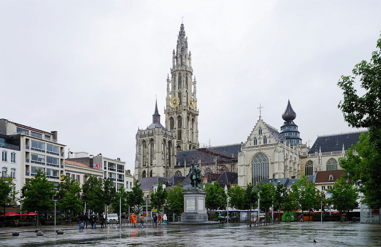
 Modern-day "Cathedral of Our Lady"


No dots yet