

Jabal al-Qilal: Mediterranean Mystery Mountain Island
Step 0 of 0
1

2
3
4
5
6
7
8
9
10
11
12
13
14
15
16
17
18
19

20
21
22
23
24
25
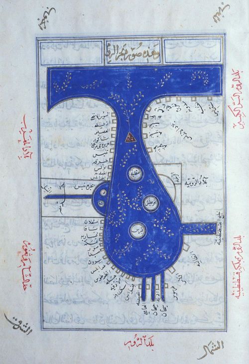
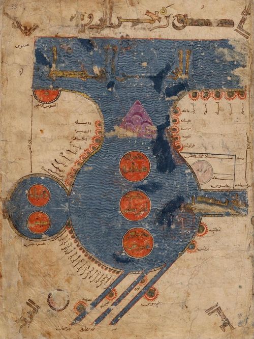
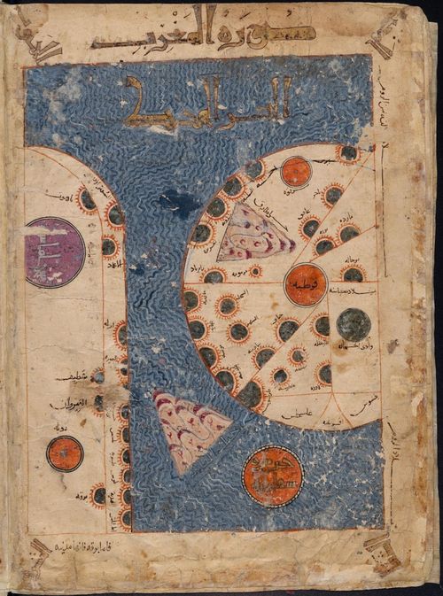
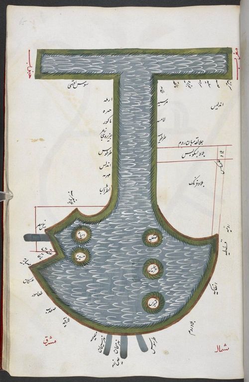
Late 12th-century Islamic Map of the Mediterranean Belonging to Frederick II from al-Istakhri’s Kitāb al-Masālik wa al-Mamālik (Book of Routes and Realms) abbreviated to KMMS. Courtesy: Leiden University Libraries. Codex Or. 3101, fol. 33. 589 AH / 1193 CE. Gouache and ink on paper. 34 × 26 cm.
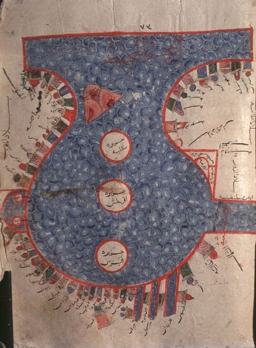
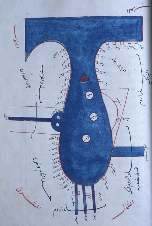
13th Century Mamluk Rendition of KMMS Mediterranean Map (Photo: Karen Pinto)
Topkapı Sarayı Müzesi Kütüphanesi, Istanbul, MS. Ahmet 3348, fol. 37a, 684 A. H./1285 C. E.
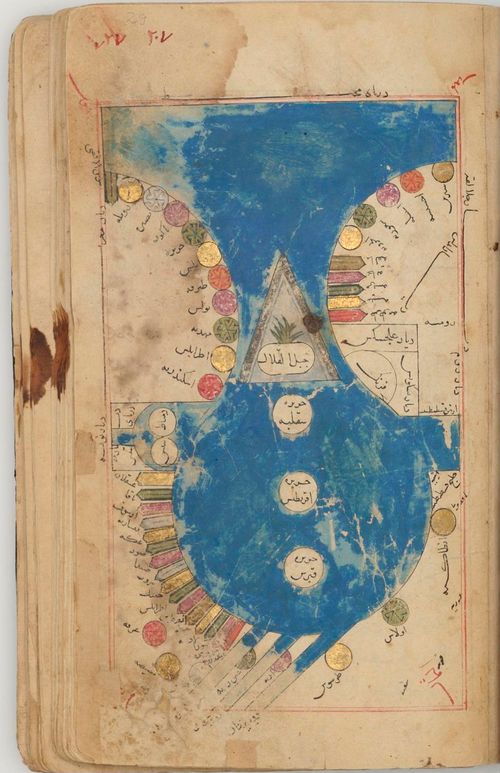
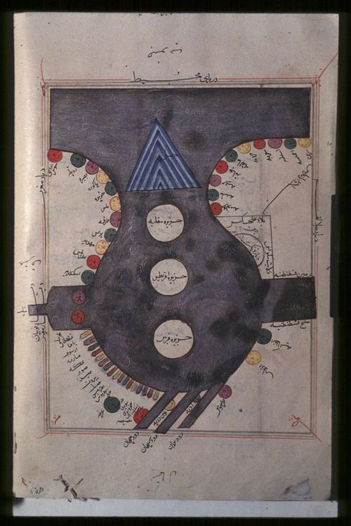
Early 14th century Persian KMMS Mediterranean map Iran, perhaps Isfahan, 706 AH (1306-07 AD), Khalili MSS 972, ink, gold, silver and opaque watercolour on paper, 120 folios 25 x 15 cm.
British Library_Ethe 707_KMMS Med Map_ca. 14th Century
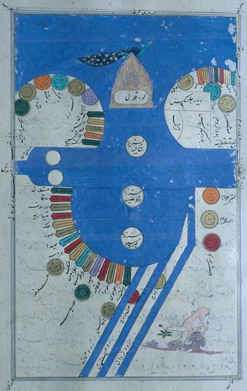
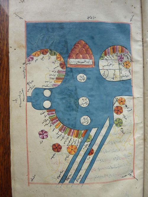
Late 14th/ early 15th century Persian Timurid Mediterranean Map (Photo: Karen Pinto)
Early 15th Century Aqqoyunlu map of the Mediterranean (Photo: Karen Pinto)
Late 15th Century Ottoman KMMS Med Map, Sülemaniye Camii Kütüphanesi, Aya Sofya 2613. ca. 1473 (Photo Karen Pinto)
Late 17th century copy of KMMS Mediterranean map possibly Safavid. TKS R1646, 1075/1664-65. 21.6 cm x 18.1 cm
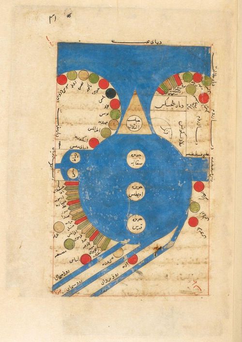
St-Petersburg Oriental Institute, Ms. C-610: Persian Copy of Mediterranean Map, 16/17th century (Photo: Karen Pinto)
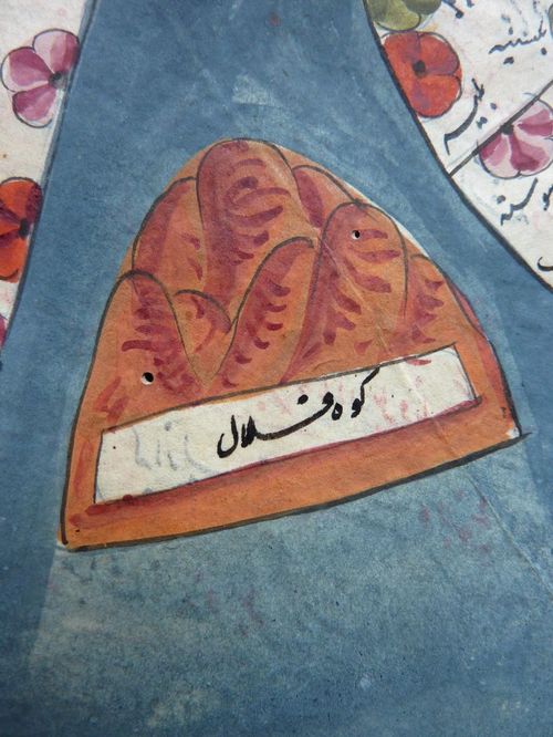
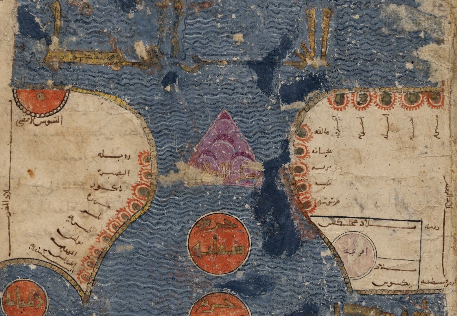
St. Petersburg Med Map with Close-up of Jabal al-Qilal
Photo taken by Karen Pinto
Interactive Late 12th-century Islamic Map of the Mediterranean Belonging to Frederick II from al-Istakhri’s Kitāb al-Masālik wa al-Mamālik (Book of Routes and Realms) abbreviated to KMMS. Courtesy: Leiden University Libraries. Codex Or. 3101, fol. 33. 589 AH / 1193 CE. Gouache and ink on paper. 34 × 26 cm.
DUPLICATED
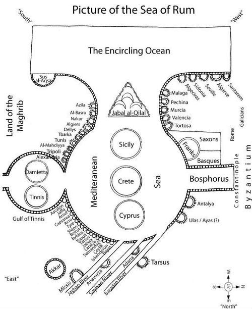
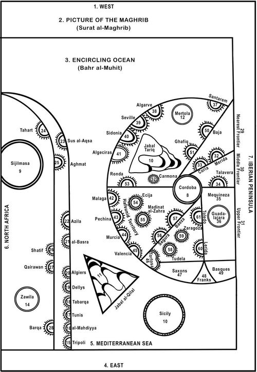
Leiden Mediterranean Map - Line Drawing Translation
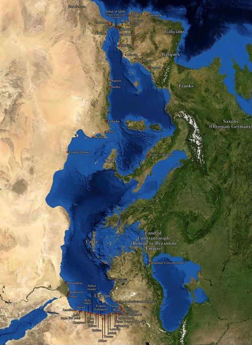
Leiden Mediterranean Map - Modern Equivalent
DUPLICATED
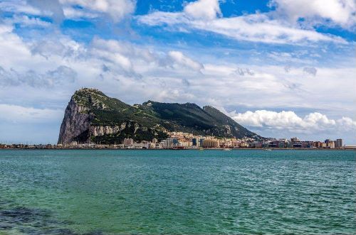
Gibralter Photo
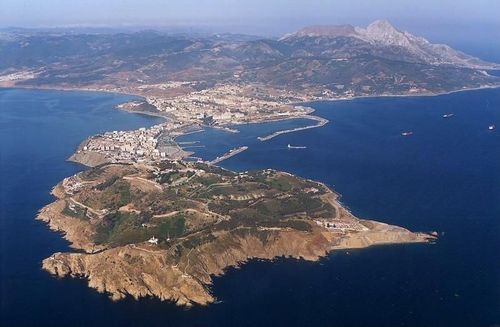
Ceuta Photo
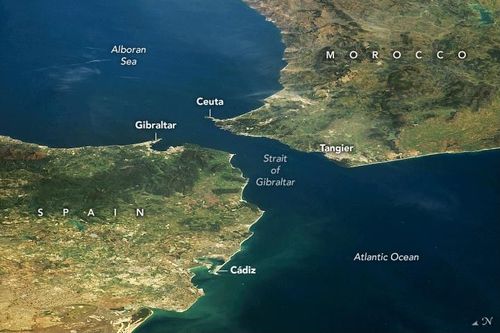
NASA photography showing the location of Gibralter and Ceuta in relation to the Straits of Gibralter
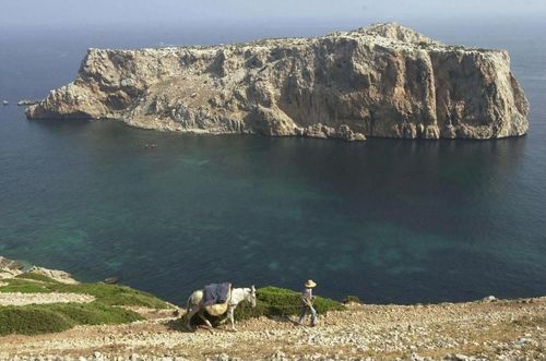
Isla de Perejil
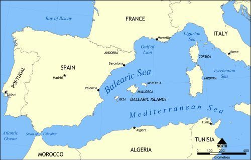
Balearic Islands represent another possibility
Ibiza is indeed a tempting possibility
Leiden KMMS 3101 Maghrib Map
DUPLICATED
Leiden KMMS 3101 Maghrib Map - Line Drawing
DUPLICATED
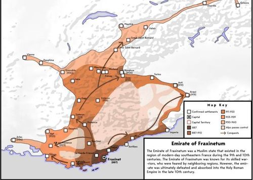
Emirate of Fraxinetum
19th century Mughal Med Map copy. British Library Ms. Add 23542
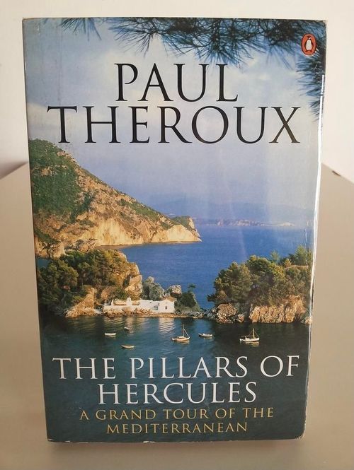
Paul Theroux “Pillars of Hercules: Grand Tour of Mediterranean” book cover
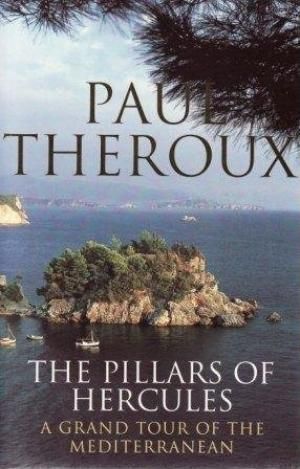
Theroux Pillars of Hercules Take 2
Place a DOT on the image