

HIST23D - Playground - January 2026
Step 0 of 0
1

Self Drawn Map
2

Bad Design
3

Gerry-mandering
4

Digital Humanities
5

Islamic Maps
6

Asian Maps
7

Good Design
8

Maps on Campus
9

Historical Speculation
10

Data Visualization
11

Early Maps
12

First Map
13
![[ 2026-01-06 16:06:47 ]](https://iiif.pixeum.org/iiif/3/1767715635/full/500,/0/default.jpg)
[ 2026-01-06 16:06:47 ]
14
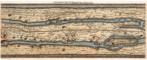
![[ 2026-01-06 16:10:32 ]](https://iiif.pixeum.org/iiif/3/1767715845/full/max/0/default.jpg)
[ 2026-01-06 16:10:32 ]
15
![[ 2026-01-06 16:11:14 ]](https://iiif.pixeum.org/iiif/3/1767715883/full/max/0/default.jpg)
[ 2026-01-06 16:11:14 ]
16
Leighton Calhoun - Peutinger Table
17
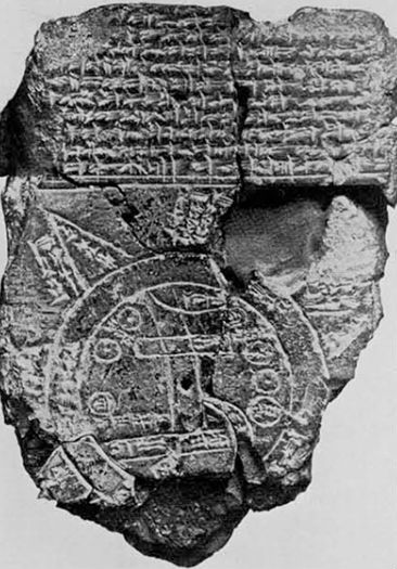
Babylonia Map of the World
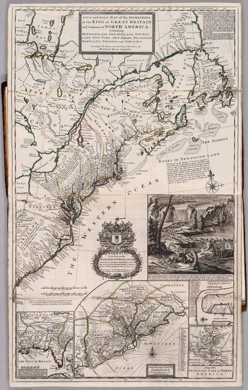
18
![[ 2026-01-06 16:12:49 ]](https://iiif.pixeum.org/iiif/3/1767716009/full/500,/0/default.jpg)
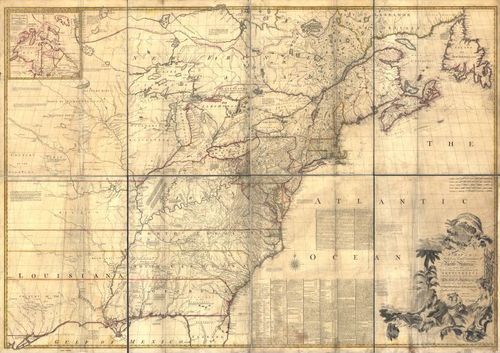
[ 2026-01-06 16:12:49 ]
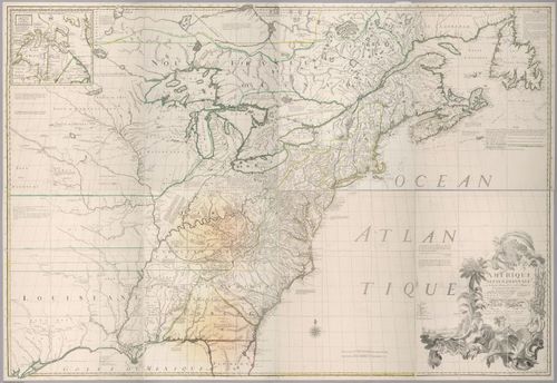
19
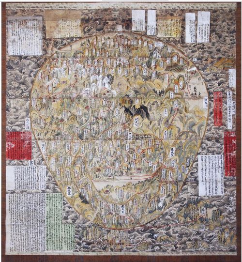
![Cosmas Indicopleustes [ 2026-01-06 16:12:05 ]](https://iiif.pixeum.org/iiif/3/1767716019/full/500,/0/default.jpg)
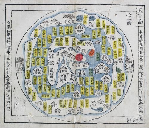
Cosmas Indicopleustes [ 2026-01-06 16:12:05 ]
20
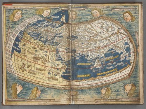
Ptolemaic map
21
![[ 2026-01-06 16:15:48 ]](https://iiif.pixeum.org/iiif/3/1767716209/full/500,/0/default.jpg)
[ 2026-01-06 16:15:48 ]
22

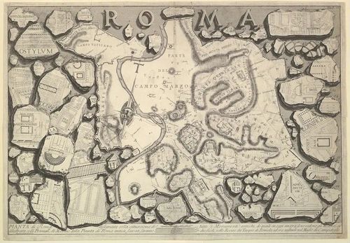
Turin Papyrus Map
23
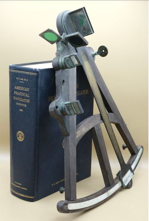
Octant
24

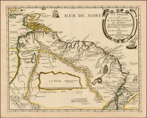
Sextant
25
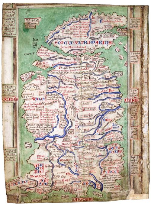
Map by Matthew Paris
26
Severan Marbles
27
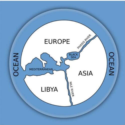
The First World Map - by Anaximander
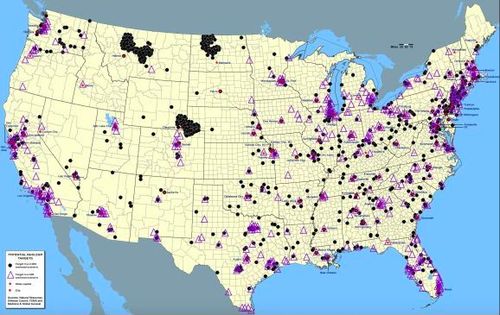
28
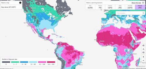
![[ 2026-01-07 16:13:30 ]](https://iiif.pixeum.org/iiif/3/1767802584/full/500,/0/default.jpg)
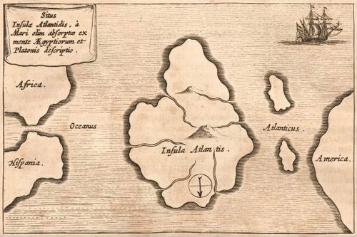
[ 2026-01-07 16:13:30 ]
29

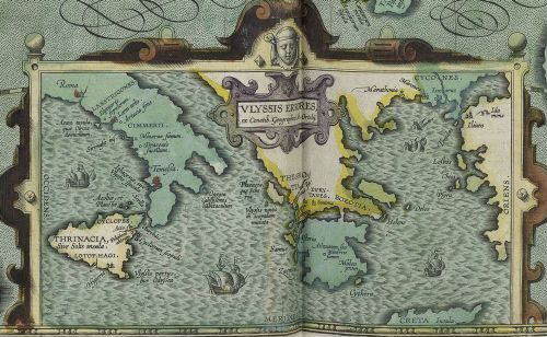
Longitude by Jupiter's Moons
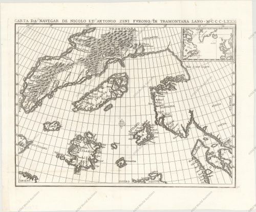
30

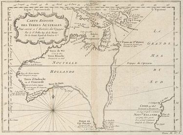
Tabula Peutingeriana
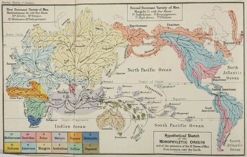
31
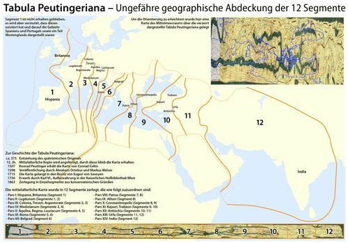
Extends of the Tabula Peutingeria - Peutinger Table
32
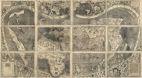
The World - Waldseemueller - 1507DUPLICATED
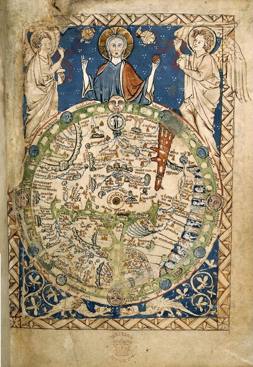
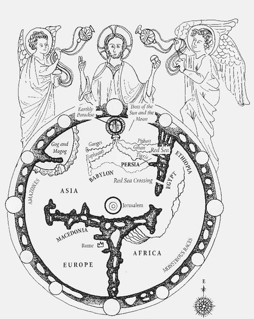
33
Psalter Map - artist unknown - 1265DUPLICATED
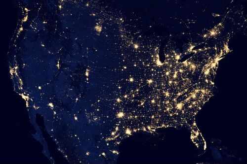
34
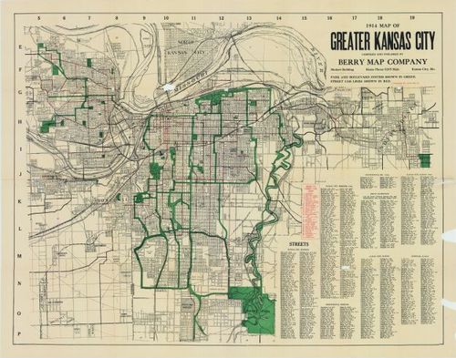
2025-08-26 14:49:48DUPLICATED
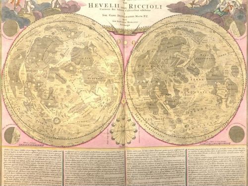
35
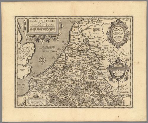
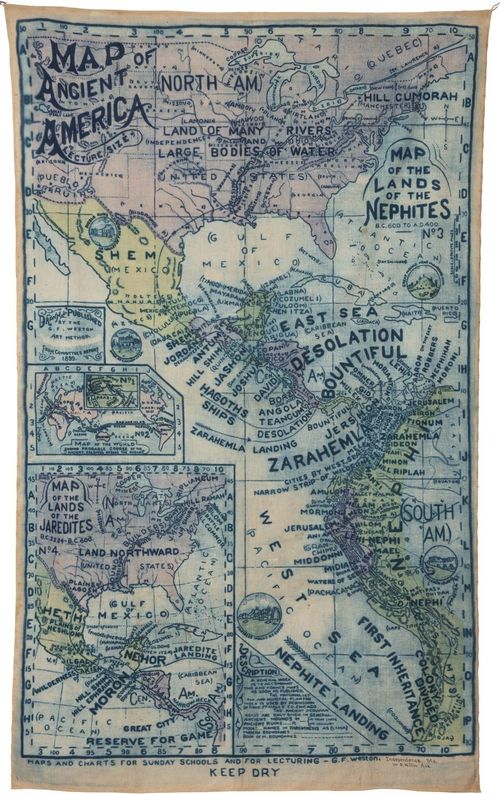
Belgii Veterus Typus - Abraham Ortelius - 1594 - Dilan Fernandes
36
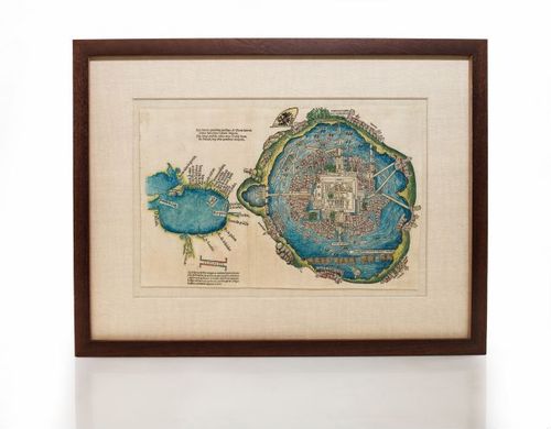
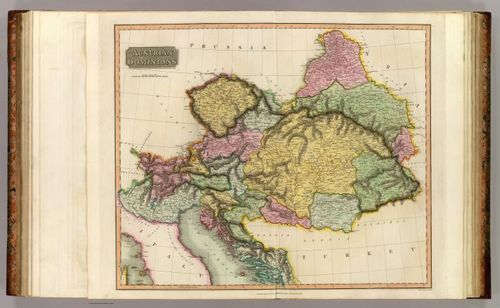
Cortez Map - 1524
37
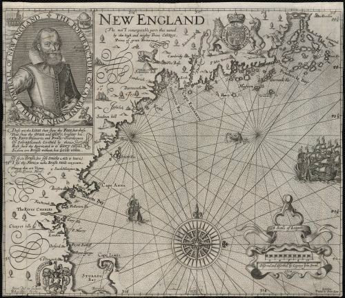
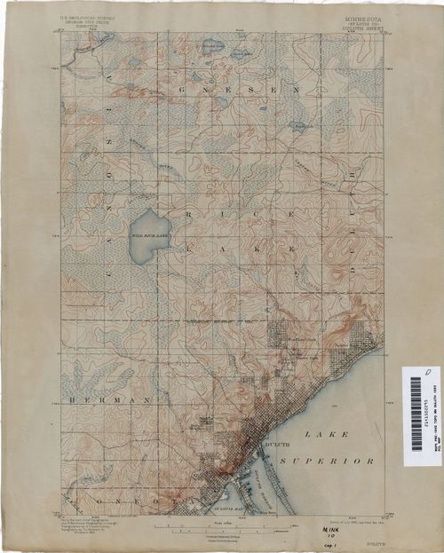
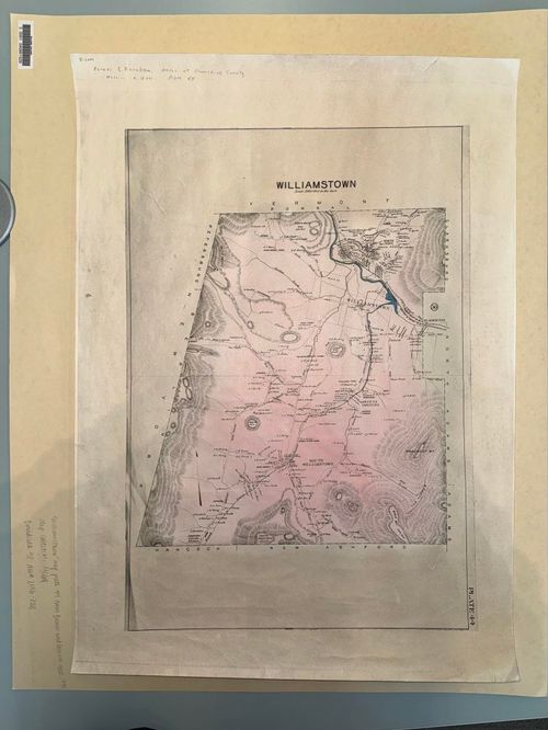
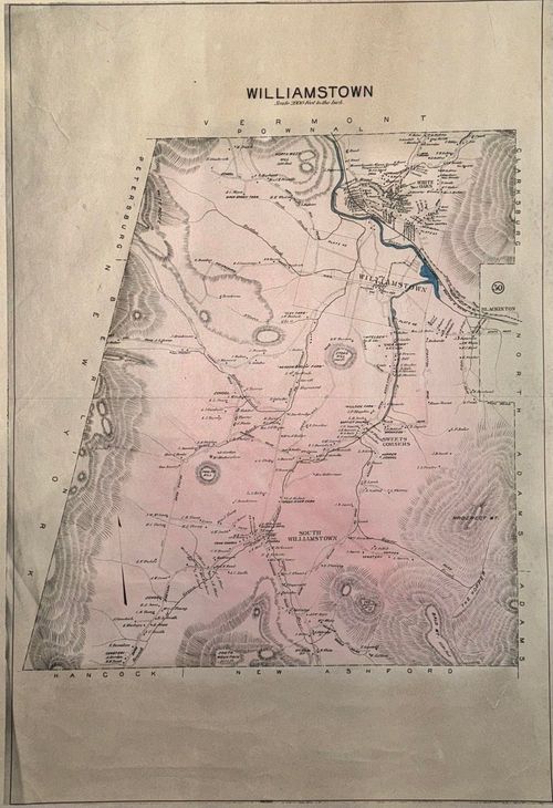
Map of New England - John Smith - 1616
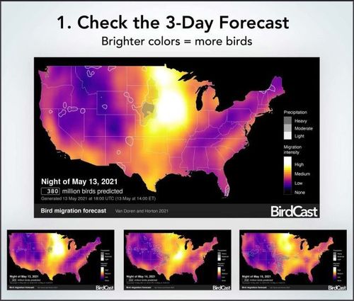
38
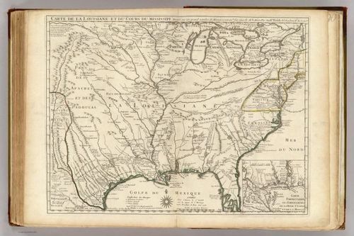
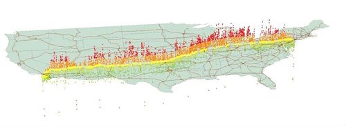
Louisiana - Guillaume de L’Isle - 1718
39
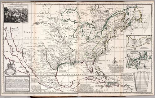
Parts of America Claimed by France - Herman Moll - 1720
40
The Beaver Map - Herman Moll - 1732
41
Mitchell Map - 1775
42
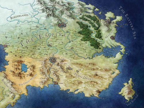
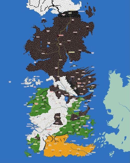
Mitchell Map - 1775
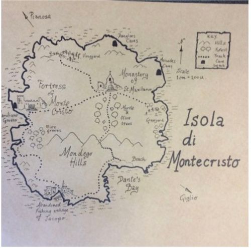
43
Gotenjikuzu
44
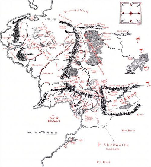
Cheonhado map - map of the world beneath the heavens - 18th/19th C
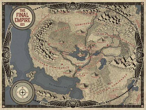
45
"Yu Ji Tu" or "Map of the Tracks of Yu" - 1137
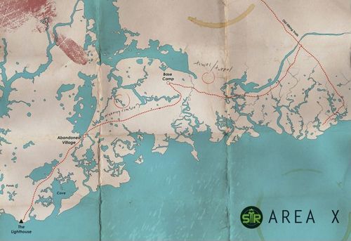
46
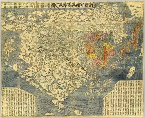
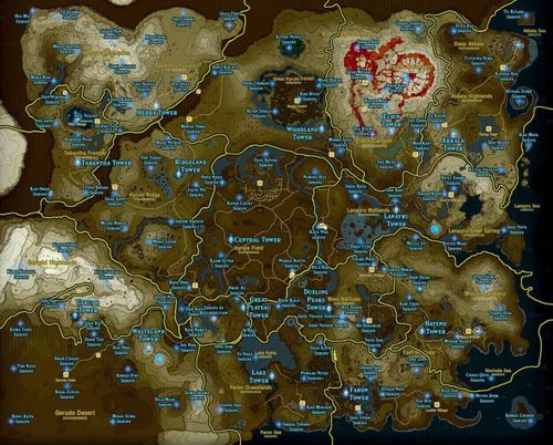
Japanese Buddhist world map, titled Nansenbushu Bankoku Shoka No Zu - 1710
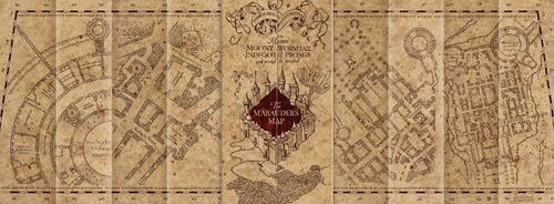
47
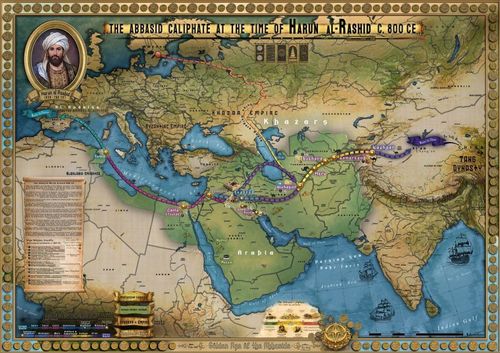
Abbasid Caliphate At the Time of Harun al-Rashid_The Golden Age of Abbasids - Mai Ghaly El-Gazzar - 2026
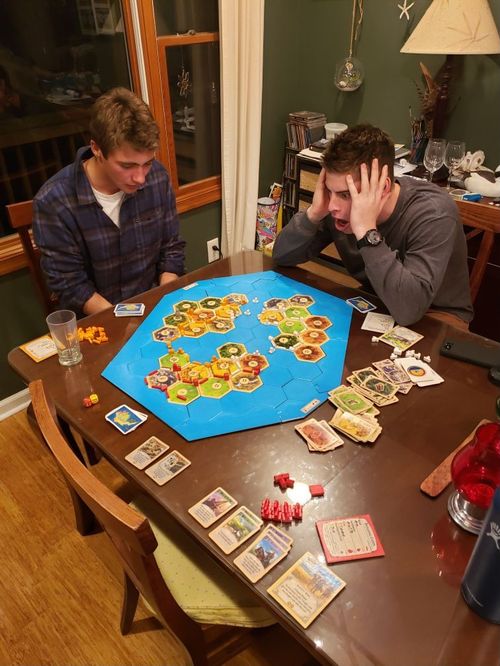
48
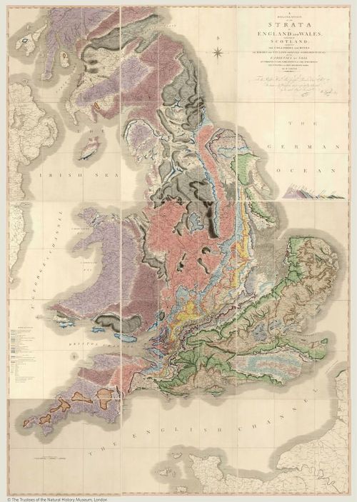
Strata of United Kingdom - William Smith - 1815
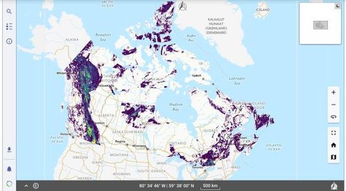
49
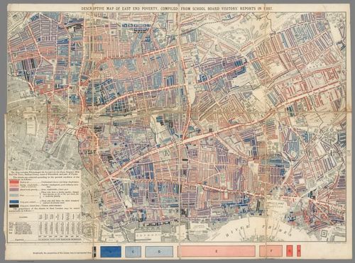
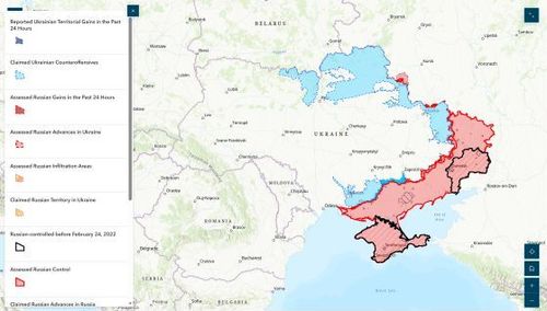
Poverty Map of London - Booth - 1889
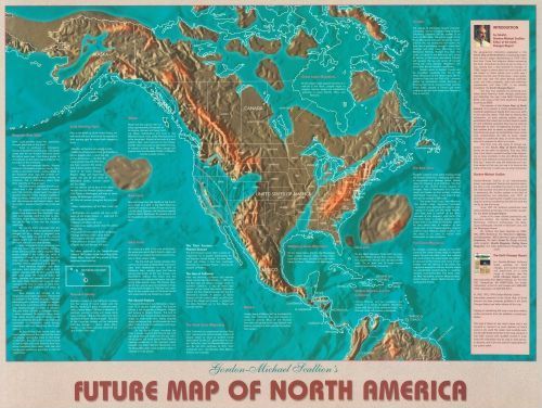
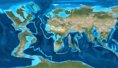
50
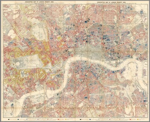
Poverty Map of London - Booth - 1889
51
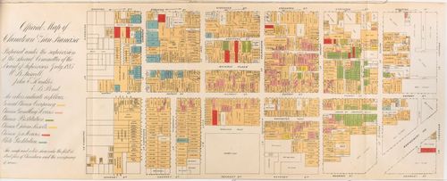
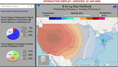
San Francisco Chinatown - Board of Supervisors - 1885
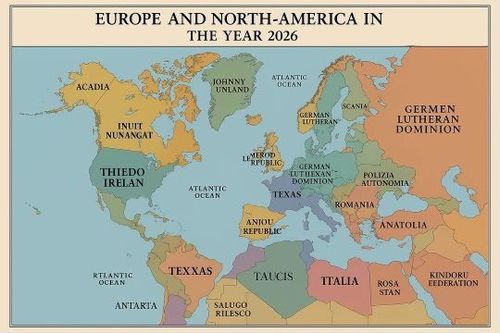
52
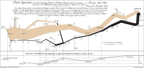
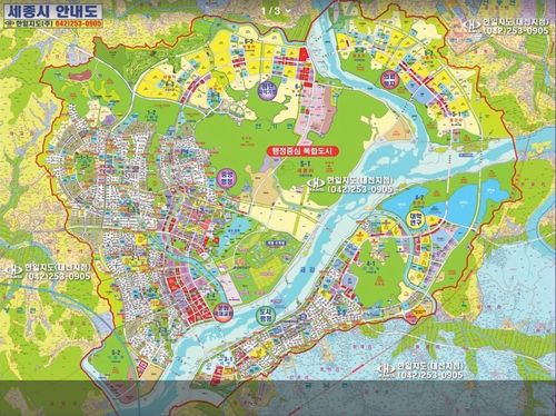
The Minard Map of Napolean's March - 1869DUPLICATED
53
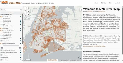
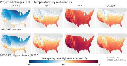
NYC Street Map - 2026DUPLICATED
54

Speculation
55
Map of El Dorado - Raphael
56
Map with Frisland - 1561Section of an atlas made by PtolemyMatthew Nachamkin
57
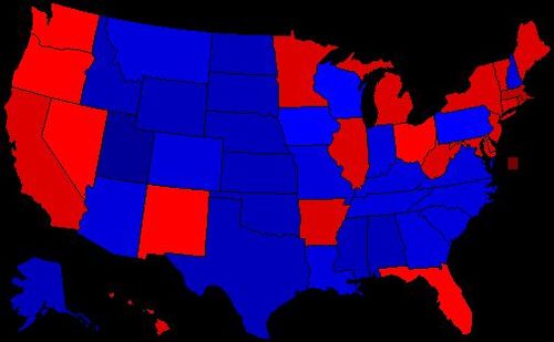
Sayer - 2008 presidential election predicted on April 30, 2008
58
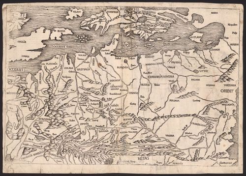
Map of Europe by Hartman Schedel - Dilan Fernandes
59
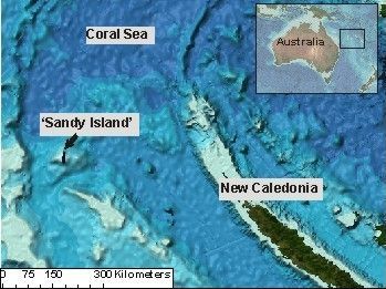
sandy island- speculation - Leighton
60

Felicia - Tokyo Subway Linemap
61
Noah - The Odyssey Modern
62
Michael LesStrang - Map of Potential US Nuclear Targets
63
Josh Frett - Days Above 35 degrees C (95 degrees F)
64
Jiwon Kim - Map of Atlantis
65
Dalton Peters - False Doomsday Prediction of California
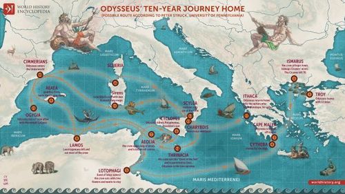
66
Noah - "Ulyssis Errores" - abraham ortelius 1579?
67
Michael Gredler - Map that includes "Frisland"
68
Tekla Modebadze - World's First Map of Australia
69
Santiago Ferris - Lemuria
70

Any Map
71
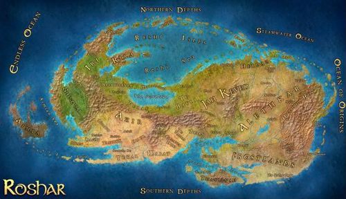
Jiwon Kim - Map of Roshar
72
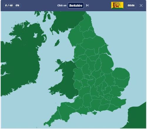
Michael Gredler - Counties of England on Seterra
73
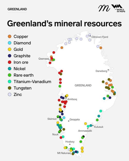
Leighton Calhoun - mineral map of greenland https://www.reddit.com/r/Maps/
74
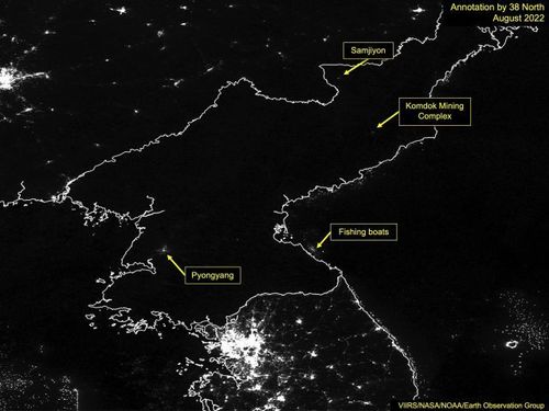
Michael LesStrang - North Korea at Night
75
Matthew Nachamkin - City Lights of the United States - 2012 - NASA
76
Dalton - 1914 Map of Greater Kansas City
77
Felicia - Selenographia by Johannes Hevelius - 1647
78
Sayer Theiss - Map of Ancient America - George Weston - 1899
79

Habsburg Domains- Raphael Enriquez
80
Austrian Domains - John Thomson - 1816 - Dilan Fernandes
81
![Sayer Theiss - 1854 U.S. House of Representatives elections [ 2026-01-22 16:10:21 ]](https://iiif.pixeum.org/iiif/3/1769098462_69724cde289ea/full/500,/0/default.jpg)
Sayer Theiss - 1854 U.S. House of Representatives elections [ 2026-01-22 16:10:21 ]
82
Perry-Castañeda Library Map Collection - Minnesota Historical Topographic Maps - Duluth
83
Travis Carroll - BirdCast
84
Cannonball run speed map - Noah Peters
85
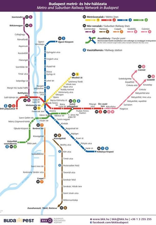
Budapest Subway system
86

Maps in Fiction
87
Fallout World Map- Raphael
88
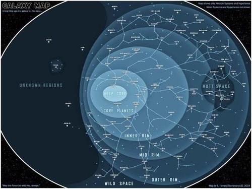
Map of Star Wars Galaxy - Michael L
89
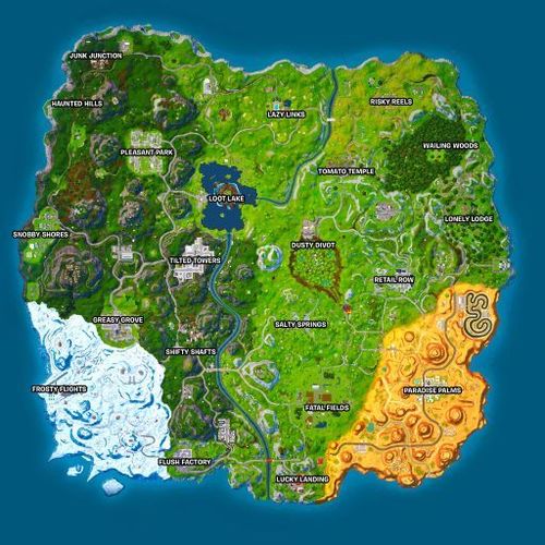
Fortnite OG Map Season 7 Leighton
90
Michael Gredler - Map of An Ember in The Ashes world - Michael G
91

Map of the Kanto Region - Dalton
92
Westeros - Game of Thrones
93
Felicia Peng - Count of Monte Cristo treasure map
94
![StarTrek [ 2026-01-28 15:26:10 ]](https://iiif.pixeum.org/iiif/3/1769613983_697a2a9f70dc3/full/500,/0/default.jpg)
StarTrek [ 2026-01-28 15:26:10 ]
95
Map of the Continents featured in the Belgariad by David Eddings - Dilan Fernandes
96
Map of Middle Earth - Lord of the Rings - Josh
97
Jiwon Kim - Map of Scadrial
98
![U.S. State of Alberta [ 2026-01-28 15:30:32 ]](https://iiif.pixeum.org/iiif/3/1769614338_697a2c029270e/full/500,/0/default.jpg)
U.S. State of Alberta [ 2026-01-28 15:30:32 ]
99
santiago ferris - natalie portman - annhilation
100
Breath of the Wild Map - Noah Peters
101
The Marauder's Map - Harry PotterMatthew Nachamkin
102
![altworldmap 1936 [ 2026-01-28 15:42:57 ]](https://iiif.pixeum.org/iiif/3/1769615005_697a2e9dbc3d3/full/500,/0/default.jpg)
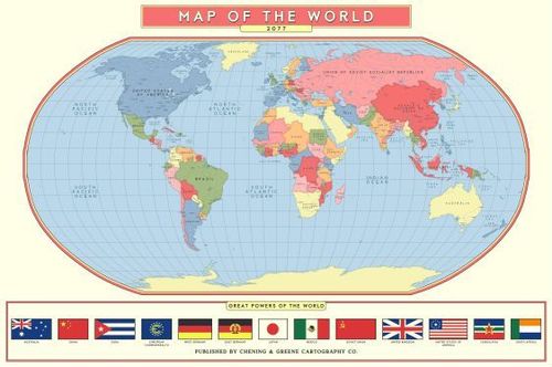
altworldmap 1936 [ 2026-01-28 15:42:57 ]
103
Catan Map - Travis Carroll
104

Modern Day Speculation
105
Prospectivity model for clastic-dominated zinc deposits, Leighton Calhoun
106
Map of Russian Occupied Territory in the Russo-Ukrainian War - Dilan Fernandes
107
How Earth may look in 200 million years - Tekla
108

Strange Infographic - Dalton
109
THE OCEAN Michael Gredler
110
National Weather Service Climate Prediction Center Feb 4 - Feb 10 (8 to 14 day outlook)Matthew Nachamkin
111
Europe and North America 2026- Raphael
112
Jiwon Kim - Map of Sejong
113

Felicia Peng - Saudi Arabia The Line
114
Projected Temperature Change in US - Travis Carroll
115
![World Population 2100 [ 2026-01-29 15:05:56 ]](https://iiif.pixeum.org/iiif/3/1769699239_697b77a7d22f4/full/500,/0/default.jpg)
World Population 2100 [ 2026-01-29 15:05:56 ]
116
WHM Guided Tour Map Test
117
Cropped 1894 Map for WHM
Place a DOT on the image