Panoramic Minnesota

0 of 0

0 of 0

Click here to enter exhibit

Exhibit story


Image Title -


Step 0 of 0

e66 |

Dot story


Image Title -


Step 0 of 0

e66 |

1

E66 - Panoramic Maps & Panoramic Minnesota - A01

2

E66 - Panoramic Maps & Panoramic Minnesota - A02

3

E66 - Panoramic Maps & Panoramic Minnesota - A03

4

E66 - Panoramic Maps & Panoramic Minnesota - A04

5

E66 - Panoramic Maps & Panoramic Minnesota - A05

6

E66 - Panoramic Maps & Panoramic Minnesota - A06

7

E66 - Panoramic Maps & Panoramic Minnesota - A07

8

E66 - Panoramic Maps & Panoramic Minnesota - A08

9

E66 - Panoramic Maps & Panoramic Minnesota - A09

10

E66 - Panoramic Maps & Panoramic Minnesota - A10

11

E66 - Panoramic Maps & Panoramic Minnesota - A11

12

E66 - Panoramic Maps & Panoramic Minnesota - A12

13

E66 - Panoramic Maps & Panoramic Minnesota - A13

14

E66 - San Francisco, by Marriott Britton Rey, 1875

15

E66 - Jerusalem by Hogenberg 1575

16

E66 - Civitas Hierusalem - Giovanni Francesco Camocio - 1570 from Martin van Brauman

17

E66 - An Illustrated Historical Atlas of the State of Minnesota - Alfred Theodore Andreas - 1874

18

E66 - Birds Eye View of Austin Mower County Minnesota - Ruger and Stoner - 1870

19

E66 - Birds Eye View of Anoka County Minnesota - Ruger Albert - 1869

20

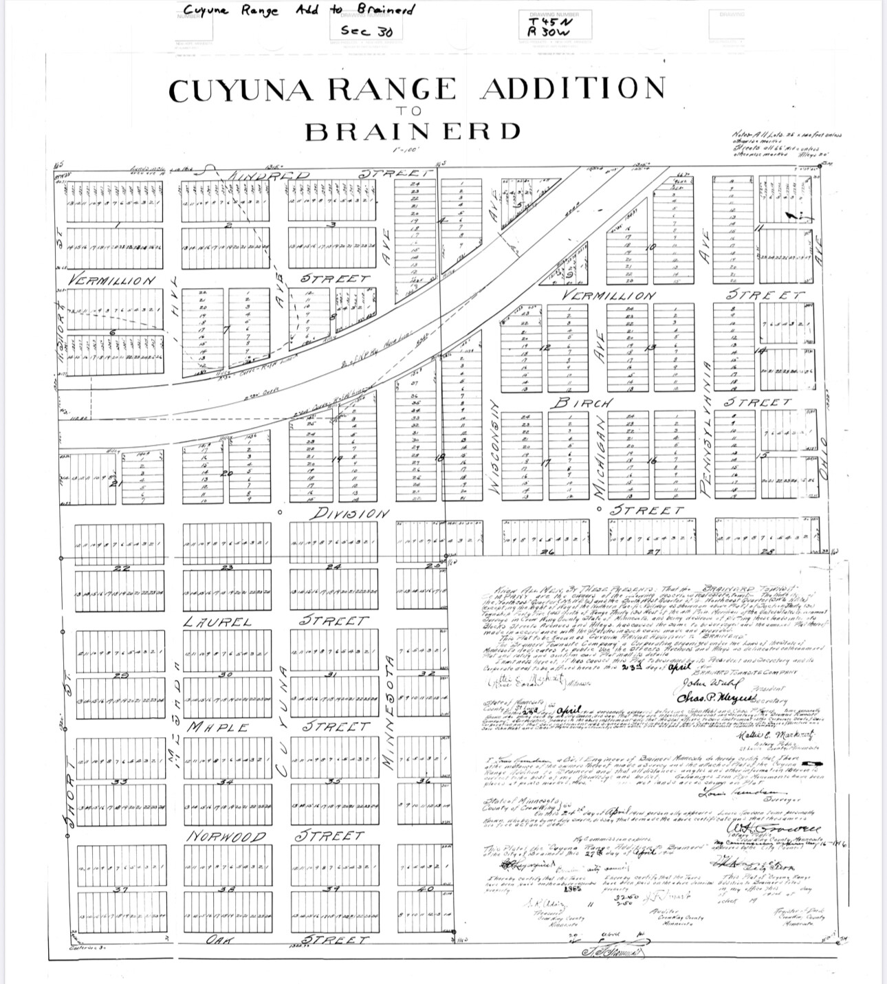
E66 - Brainerd City of Mines -  Arthur G McCoy - 1914
E66 - Brainerd City of Mines - Arthur G McCoy - 1914

21

E66 - View of Duluth Minnesota - 1883

22

E66 - Perspective Map of Duluth Minnesota - 1887

23

E66 - Perspective Map of Duluth Minnesota - 1893

24

E66 - The Twin Ports Superior Wisconsin Duluth Minnesota - Henry Wellge - 1915

25

E66 - Birds Eye View of the City of Faribault Rice County Minnesota - Albert Ruger - 1869

26

E66 - Birds Eye View of the City of Hastings Dakota Co Minnesota - Albert Ruger - 1867

27

E66 - Birds Eye View of the city of Mankato Blue Earth County Minnesota -1870

28

E66 - Lake City Wabasha Co Minnesota - Albert Ruger - 1867

29

E66 - Birds Eye View of Luverne County Seat of Rock County Minnesota - 1883

30

E66 - Minneapolis and Saint Anthony Minnesota - Albert Ruger - 1867

31

E66 - Panorama of Minneapolis Minnesota - 1873

32

E66 - Minneapolis Minnesota - 1874

33

E66 - Panoramic View of the City of Minneapolis Minnesota - 1879

34

E66 - Minneapolis Minnesota - 1885

35

E66 - Birds Eye View of Minneapolis Minnesota - 1891

36

E66 - Birds Eye View of the City of Minneapolis Minnesota - 1891

37

E66 - Birds Eye View of New Ulm Brown County Minnesota - 1870

38

E66 - Birds Eye View of Northfield Rice County Minnesota -1869

39

E66 - Birds Eye View of Owatonna Steele County Minnesota - 1870

40

E66 - Birds Eye View of the City of Redwing Coodhue Co Minnesota - 1868

41

E66 - Panoramic view of the City of Red Wing Goddhue Co Minnesota - 1880

42

E66 - Birds Eye View of the City  of Rochester Olmsted County Minnesota - 1869
E66 - Birds Eye View of the City of Rochester Olmsted County Minnesota - 1869

43

E66 - Birds Eye View of the City  of Saint Cloud Stearns County Minnesota - 1869
E66 - Birds Eye View of the City of Saint Cloud Stearns County Minnesota - 1869

44

E66 - City of St Paul Capital of Minnesota - 1853

45

E66 - Saint Paul Minnesota - 1867

46

E66 - Panorama of St Paul Minnesota - 1873

47

E66 - View of St Paul Minnesota - 1874

48

E66 - St Paul Minnesota State Capital and County Seat of Ramsey Co - 1883

49

E66 - St Paul Minnesota Ice Palace and Winter Carnival Souvenir - 1888

50

E66 - Birds Eye View of St Paul Looking West from Daytons Bluff - 1893

51

E66 - St Paul Minnesota - 1906

52

E66 - Birds Eye View of the City of Saint Peter Nicollet County Minnesota - 1870

53

E66 - Birds Eye View of Shakopee Scott County Minnesota - 1869

54

E66 - Birds Eye View of the City of Stillwater Washington County Minnesota - 1870

55

E66 - Birds Eye View of the City of Winona Minnesota - 1867

56

E66 - Map of Winona County Minnesota - LG Bennett - 1867

57

E66 - Winona Minnesota - 1874

58

E66 - Winona Minnesota - 1889
Image 1 of 58 | e66 | i739 | 1920x1080px E66 - Panoramic Maps & Panoramic Minnesota - A01
0
Image 2 of 58 | e66 | i740 | 1920x1080px E66 - Panoramic Maps & Panoramic Minnesota - A02
0
Image 3 of 58 | e66 | i741 | 1920x1080px E66 - Panoramic Maps & Panoramic Minnesota - A03
0
Image 4 of 58 | e66 | i742 | 1920x1080px E66 - Panoramic Maps & Panoramic Minnesota - A04
0
Image 5 of 58 | e66 | i743 | 1920x1080px E66 - Panoramic Maps & Panoramic Minnesota - A05
0
Image 6 of 58 | e66 | i744 | 1920x1080px E66 - Panoramic Maps & Panoramic Minnesota - A06
0
Image 7 of 58 | e66 | i745 | 1920x1080px E66 - Panoramic Maps & Panoramic Minnesota - A07
0
Image 8 of 58 | e66 | i746 | 1920x1080px E66 - Panoramic Maps & Panoramic Minnesota - A08
0
Image 9 of 58 | e66 | i747 | 1920x1080px E66 - Panoramic Maps & Panoramic Minnesota - A09
0
Image 10 of 58 | e66 | i748 | 1920x1080px E66 - Panoramic Maps & Panoramic Minnesota - A10
0
Image 11 of 58 | e66 | i749 | 1920x1080px E66 - Panoramic Maps & Panoramic Minnesota - A11
0
Image 12 of 58 | e66 | i750 | 1920x1080px E66 - Panoramic Maps & Panoramic Minnesota - A12
0
Image 13 of 58 | e66 | i751 | 1920x1080px E66 - Panoramic Maps & Panoramic Minnesota - A13
0
Image 14 of 58 | e66 | i736 | 9648x6480px E66 - San Francisco, by Marriott Britton Rey, 1875

“Graphic chart of the city and county of San Francisco respectfully dedicated to the leading interests of California and the Pacific coast. The city of San Francisco was incorporated in 1850, and later grew to become one of the most famous cities in the US. The California Gold Rush in 1848 saw the city's population increase from 1,000 to 25,000 over the course of a year. This map published in 1875 by Frederick Marriott of Britton, Rey & Co. from a drawing by L.R. Townsend, E. Wyneken and J. Mendenhall is oriented with north toward the lower right. There are 188 different points-of-interest that are located on this map.” worldmapsonline.com

wikipedia.org loc.gov

Link to Google Slide Deck

0
Image 15 of 58 | e66 | i737 | 12559x10326px E66 - Jerusalem by Hogenberg 1575

Image from the Leonard and Juliet Rothman Holy Lands Map Collection, a collection of 956 maps, atlases, and books of the Holy Lands from the 16th to the 20th century published primarily in Europe and the United States. Stanford Library

Link to Google Slide Deck

0
Image 16 of 58 | e66 | i738 | 6000x4000px E66 - Civitas Hierusalem - Giovanni Francesco Camocio - 1570 from Martin van Brauman
0
Image 17 of 58 | e66 | i694 | 3752x4496px E66 - An Illustrated Historical Atlas of the State of Minnesota - Alfred Theodore Andreas - 1874
0
Image 18 of 58 | e66 | i698 | 7128x5744px E66 - Birds Eye View of Austin Mower County Minnesota - Ruger and Stoner - 1870
0
Image 19 of 58 | e66 | i697 | 6992x5728px E66 - Birds Eye View of Anoka County Minnesota - Ruger Albert - 1869
0
Image 20 of 58 | e66 | i699 | 8512x6400px E66 - Brainerd City of Mines - Arthur G McCoy - 1914
0
Image 21 of 58 | e66 | i700 | 13040x5360px E66 - View of Duluth Minnesota - 1883

Library of Congress

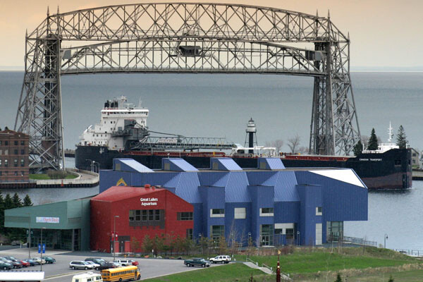
Duluth has maintained growth and prosperity as a port town, with a current city population of 85,618 and metropolitan population of 278,799. Resting on the edge of Lake Superior, Duluth continues to have access to the Atlantic Ocean via the Great Lakes Waterway and St. Lawrence Seaway. Originally inhabited by the Ojibwe, fur traders began acquiring the land, and established their permanence with the 1854 Ojibwe Land Cession Treaty.

0
Image 22 of 58 | e66 | i701 | 12448x6720px E66 - Perspective Map of Duluth Minnesota - 1887
0
Image 23 of 58 | e66 | i702 | 19047x11284px E66 - Perspective Map of Duluth Minnesota - 1893
0
Image 24 of 58 | e66 | i696 | 11195x5688px E66 - The Twin Ports Superior Wisconsin Duluth Minnesota - Henry Wellge - 1915
0
Image 25 of 58 | e66 | i703 | 8944x6992px E66 - Birds Eye View of the City of Faribault Rice County Minnesota - Albert Ruger - 1869
0
Image 26 of 58 | e66 | i704 | 8352x6544px E66 - Birds Eye View of the City of Hastings Dakota Co Minnesota - Albert Ruger - 1867
0
Image 27 of 58 | e66 | i707 | 8448x6960px E66 - Birds Eye View of the city of Mankato Blue Earth County Minnesota -1870
0
Image 28 of 58 | e66 | i705 | 8352x6496px E66 - Lake City Wabasha Co Minnesota - Albert Ruger - 1867
0
Image 29 of 58 | e66 | i706 | 6944x4760px E66 - Birds Eye View of Luverne County Seat of Rock County Minnesota - 1883
0
Image 30 of 58 | e66 | i708 | 8958x6840px E66 - Minneapolis and Saint Anthony Minnesota - Albert Ruger - 1867
0
Image 31 of 58 | e66 | i713 | 7864x2744px E66 - Panorama of Minneapolis Minnesota - 1873
0
Image 32 of 58 | e66 | i735 | 9332x5825px E66 - Minneapolis Minnesota - 1874
0
Image 33 of 58 | e66 | i709 | 10352x6512px E66 - Panoramic View of the City of Minneapolis Minnesota - 1879
0
Image 34 of 58 | e66 | i710 | 13152x9408px E66 - Minneapolis Minnesota - 1885
0
Image 35 of 58 | e66 | i711 | 13248x9344px E66 - Birds Eye View of Minneapolis Minnesota - 1891
0
Image 36 of 58 | e66 | i712 | 6384x4576px E66 - Birds Eye View of the City of Minneapolis Minnesota - 1891
0
Image 37 of 58 | e66 | i714 | 6384x5136px E66 - Birds Eye View of New Ulm Brown County Minnesota - 1870
0
Image 38 of 58 | e66 | i715 | 7008x5680px E66 - Birds Eye View of Northfield Rice County Minnesota -1869
0
Image 39 of 58 | e66 | i716 | 6976x5824px E66 - Birds Eye View of Owatonna Steele County Minnesota - 1870
0
Image 40 of 58 | e66 | i717 | 8128x6432px E66 - Birds Eye View of the City of Redwing Coodhue Co Minnesota - 1868
0
Image 41 of 58 | e66 | i718 | 8240x5616px E66 - Panoramic view of the City of Red Wing Goddhue Co Minnesota - 1880
0
Image 42 of 58 | e66 | i719 | 7232x6400px E66 - Birds Eye View of the City of Rochester Olmsted County Minnesota - 1869
0
Image 43 of 58 | e66 | i720 | 7840x6480px E66 - Birds Eye View of the City of Saint Cloud Stearns County Minnesota - 1869
0
Image 44 of 58 | e66 | i727 | 6608x4832px E66 - City of St Paul Capital of Minnesota - 1853
0
Image 45 of 58 | e66 | i722 | 8879x6920px E66 - Saint Paul Minnesota - 1867
0
Image 46 of 58 | e66 | i728 | 8016x2832px E66 - Panorama of St Paul Minnesota - 1873
0
Image 47 of 58 | e66 | i729 | 9408x4912px E66 - View of St Paul Minnesota - 1874
0
Image 48 of 58 | e66 | i723 | 12384x8160px E66 - St Paul Minnesota State Capital and County Seat of Ramsey Co - 1883
0
Image 49 of 58 | e66 | i724 | 9040x5392px E66 - St Paul Minnesota Ice Palace and Winter Carnival Souvenir - 1888
0
Image 50 of 58 | e66 | i725 | 3312x2552px E66 - Birds Eye View of St Paul Looking West from Daytons Bluff - 1893
0
Image 51 of 58 | e66 | i726 | 9888x5600px E66 - St Paul Minnesota - 1906
0
Image 52 of 58 | e66 | i721 | 7112x5808px E66 - Birds Eye View of the City of Saint Peter Nicollet County Minnesota - 1870
0
Image 53 of 58 | e66 | i730 | 7088x5480px E66 - Birds Eye View of Shakopee Scott County Minnesota - 1869
0
Image 54 of 58 | e66 | i731 | 8240x6560px E66 - Birds Eye View of the City of Stillwater Washington County Minnesota - 1870
0
Image 55 of 58 | e66 | i732 | 9041x6968px E66 - Birds Eye View of the City of Winona Minnesota - 1867
0
Image 56 of 58 | e66 | i695 | 6464x3552px E66 - Map of Winona County Minnesota - LG Bennett - 1867
0
Image 57 of 58 | e66 | i733 | 9232x5856px E66 - Winona Minnesota - 1874
0
Image 58 of 58 | e66 | i734 | 12224x5792px E66 - Winona Minnesota - 1889
0

E66 - Panoramic Maps & Panoramic Minnesota - A01

0
Image 1 of 58
e66
i739
1920x1080px

E66 - Panoramic Maps & Panoramic Minnesota - A02

0
Image 2 of 58
e66
i740
1920x1080px

E66 - Panoramic Maps & Panoramic Minnesota - A03

0
Image 3 of 58
e66
i741
1920x1080px

E66 - Panoramic Maps & Panoramic Minnesota - A04

0
Image 4 of 58
e66
i742
1920x1080px

E66 - Panoramic Maps & Panoramic Minnesota - A05

0
Image 5 of 58
e66
i743
1920x1080px

E66 - Panoramic Maps & Panoramic Minnesota - A06

0
Image 6 of 58
e66
i744
1920x1080px

E66 - Panoramic Maps & Panoramic Minnesota - A07

0
Image 7 of 58
e66
i745
1920x1080px

E66 - Panoramic Maps & Panoramic Minnesota - A08

0
Image 8 of 58
e66
i746
1920x1080px

E66 - Panoramic Maps & Panoramic Minnesota - A09

0
Image 9 of 58
e66
i747
1920x1080px

E66 - Panoramic Maps & Panoramic Minnesota - A10

0
Image 10 of 58
e66
i748
1920x1080px

E66 - Panoramic Maps & Panoramic Minnesota - A11

0
Image 11 of 58
e66
i749
1920x1080px

E66 - Panoramic Maps & Panoramic Minnesota - A12

0
Image 12 of 58
e66
i750
1920x1080px

E66 - Panoramic Maps & Panoramic Minnesota - A13

0
Image 13 of 58
e66
i751
1920x1080px

E66 - San Francisco, by Marriott Britton Rey, 1875

“Graphic chart of the city and county of San Francisco respectfully dedicated to the leading interests of California and the Pacific coast. The city of San Francisco was incorporated in 1850, and later grew to become one of the most famous cities in the US. The California Gold Rush in 1848 saw the city's population increase from 1,000 to 25,000 over the course of a year. This map published in 1875 by Frederick Marriott of Britton, Rey & Co. from a drawing by L.R. Townsend, E. Wyneken and J. Mendenhall is oriented with north toward the lower right. There are 188 different points-of-interest that are located on this map.” worldmapsonline.com

wikipedia.org loc.gov

Link to Google Slide Deck

0
Image 14 of 58
e66
i736
9648x6480px

E66 - Jerusalem by Hogenberg 1575

Image from the Leonard and Juliet Rothman Holy Lands Map Collection, a collection of 956 maps, atlases, and books of the Holy Lands from the 16th to the 20th century published primarily in Europe and the United States. Stanford Library

Link to Google Slide Deck

0
Image 15 of 58
e66
i737
12559x10326px

E66 - Civitas Hierusalem - Giovanni Francesco Camocio - 1570 from Martin van Brauman

0
Image 16 of 58
e66
i738
6000x4000px

E66 - An Illustrated Historical Atlas of the State of Minnesota - Alfred Theodore Andreas - 1874

0
Image 17 of 58
e66
i694
3752x4496px

E66 - Birds Eye View of Austin Mower County Minnesota - Ruger and Stoner - 1870

0
Image 18 of 58
e66
i698
7128x5744px
E66 - Birds Eye View of Anoka County Minnesota - Ruger Albert - 1869
0
Image 19 of 58
e66
i697
6992x5728px
E66 - Brainerd City of Mines - Arthur G McCoy - 1914
0
Image 20 of 58
e66
i699
8512x6400px
E66 - View of Duluth Minnesota - 1883

Library of Congress

Duluth has maintained growth and prosperity as a port town, with a current city population of 85,618 and metropolitan population of 278,799. Resting on the edge of Lake Superior, Duluth continues to have access to the Atlantic Ocean via the Great Lakes Waterway and St. Lawrence Seaway. Originally inhabited by the Ojibwe, fur traders began acquiring the land, and established their permanence with the 1854 Ojibwe Land Cession Treaty.

0
Image 21 of 58
e66
i700
13040x5360px
E66 - Perspective Map of Duluth Minnesota - 1887
0
Image 22 of 58
e66
i701
12448x6720px
E66 - Perspective Map of Duluth Minnesota - 1893
0
Image 23 of 58
e66
i702
19047x11284px
E66 - The Twin Ports Superior Wisconsin Duluth Minnesota - Henry Wellge - 1915
0
Image 24 of 58
e66
i696
11195x5688px
E66 - Birds Eye View of the City of Faribault Rice County Minnesota - Albert Ruger - 1869
0
Image 25 of 58
e66
i703
8944x6992px
E66 - Birds Eye View of the City of Hastings Dakota Co Minnesota - Albert Ruger - 1867
0
Image 26 of 58
e66
i704
8352x6544px
E66 - Birds Eye View of the city of Mankato Blue Earth County Minnesota -1870
0
Image 27 of 58
e66
i707
8448x6960px
E66 - Lake City Wabasha Co Minnesota - Albert Ruger - 1867
0
Image 28 of 58
e66
i705
8352x6496px
E66 - Birds Eye View of Luverne County Seat of Rock County Minnesota - 1883
0
Image 29 of 58
e66
i706
6944x4760px
E66 - Minneapolis and Saint Anthony Minnesota - Albert Ruger - 1867
0
Image 30 of 58
e66
i708
8958x6840px
E66 - Panorama of Minneapolis Minnesota - 1873
0
Image 31 of 58
e66
i713
7864x2744px
E66 - Minneapolis Minnesota - 1874
0
Image 32 of 58
e66
i735
9332x5825px
E66 - Panoramic View of the City of Minneapolis Minnesota - 1879
0
Image 33 of 58
e66
i709
10352x6512px
E66 - Minneapolis Minnesota - 1885
0
Image 34 of 58
e66
i710
13152x9408px
E66 - Birds Eye View of Minneapolis Minnesota - 1891
0
Image 35 of 58
e66
i711
13248x9344px
E66 - Birds Eye View of the City of Minneapolis Minnesota - 1891
0
Image 36 of 58
e66
i712
6384x4576px
E66 - Birds Eye View of New Ulm Brown County Minnesota - 1870
0
Image 37 of 58
e66
i714
6384x5136px
E66 - Birds Eye View of Northfield Rice County Minnesota -1869
0
Image 38 of 58
e66
i715
7008x5680px
E66 - Birds Eye View of Owatonna Steele County Minnesota - 1870
0
Image 39 of 58
e66
i716
6976x5824px
E66 - Birds Eye View of the City of Redwing Coodhue Co Minnesota - 1868
0
Image 40 of 58
e66
i717
8128x6432px
E66 - Panoramic view of the City of Red Wing Goddhue Co Minnesota - 1880
0
Image 41 of 58
e66
i718
8240x5616px
E66 - Birds Eye View of the City of Rochester Olmsted County Minnesota - 1869
0
Image 42 of 58
e66
i719
7232x6400px
E66 - Birds Eye View of the City of Saint Cloud Stearns County Minnesota - 1869
0
Image 43 of 58
e66
i720
7840x6480px
E66 - City of St Paul Capital of Minnesota - 1853
0
Image 44 of 58
e66
i727
6608x4832px
E66 - Saint Paul Minnesota - 1867
0
Image 45 of 58
e66
i722
8879x6920px