“Unlike many other antique maps of San Francisco, this one is covered in illustrations highlighting points of interest and historical events. The streets are essentially the same and they’re all labeled well enough that you can see if your apartment used to be a cemetery, a slaughterhouse, or an old railroad car barn. The map was originally mass-produced for tourists and I’ve seen a few different copies online. One was found in the forgotten depths of someone’s closet in 2011, and a Redditor mentioned in the comment thread that they had an original framed copy on their wall at home. In 2012, a copy of the map sold on eBay for $1,400.” The Bold Italic
“Harrison Godwin (1899 - 1984) was an American cartoonist and hotelier active in California during the early to middle parts of the 20th century. Harrison was a cartoonist with the Los Angeles Examiner and published two daily strips. With regard to cartographic material he published just three maps, San Francisco, Hollywood and North America, all between the years of 1927 and 1929. The San Francisco and Hollywood maps were first and second maps in a planned series of American cities, each taking some three months to complete. Curiously, no further maps in the series materialized. In addition to his cartoon work Harrison, in partnership with his brother Fred, owned Carmel's La Playa Hotel, where Harrison worked as a manager. Harrison and Fred Godwin and are credited with popularizing Carmel as a tourist destination. Little else is known of his life.” geographicus.com
Hi! My name is Minnie Pozefsky and I’m a sophomore at Williams studying Chemistry and History.
I love the way this map shows such a detailed, three-dimensional view of the city. The green spaces are emphasized and the depiction of each specific building is so intricate. I also found it really interesting how there is barely any text on the map- it encourages the viewer to think about how the line between mapping and artwork is blurry.
Thank you so much for taking the time to come speak to our class! I have really enjoyed looking through and analyzing many of the maps in your collection- thank you for making this available to us and to the rest of the world!
My name is Lucy. I am studying economics and public health.
I like this map because it taught me about Emma Willard, an important figure for women’s education. I was also reminded that maps can be made of history for the sole purpose of teaching.
Thank you David Rumsey for your continued generosity, curiosity, and artistic drive of maps.
This is a beautiful map made for the New York Sunday News in August of 1944. It charts what was believed to be the path of human migration in prehistoric and historic times. The map is wrong, as it does not correctly identify Africa as the continent where humans first arose. Our scientific knowledge has changed so much and so has our perception of the world. I love how this map identifies how humans are forever learning and changing our views. Thank you for your website and its ability to show this major change in human history: how we see the world we live in.
Cape Cod: Barnstable County Massachusetts - 1931 - Kate Keenan
Image 15 of 16 | e652 | i32503 | 1526x1052px
Cape Cod: Barnstable County Massachusetts - 1931 - Kate Keenan
Hi David, my name is Kate Keenan and I study Psychology at Williams.
I chose a map of Cape Cod because I grew up going here in the summer and I have great memories with my family in many of these towns. I like this map in particular because it uses a beautiful blue color for the ocean that contrasts with the land, and I think that the towns and ships are depicted in great detail which I appreciate. There are many artistic elements that caught my eye on this map.
Thanks for everything that you have done for the map community!
“Unlike many other antique maps of San Francisco, this one is covered in illustrations highlighting points of interest and historical events. The streets are essentially the same and they’re all labeled well enough that you can see if your apartment used to be a cemetery, a slaughterhouse, or an old railroad car barn. The map was originally mass-produced for tourists and I’ve seen a few different copies online. One was found in the forgotten depths of someone’s closet in 2011, and a Redditor mentioned in the comment thread that they had an original framed copy on their wall at home. In 2012, a copy of the map sold on eBay for $1,400.” The Bold Italic
“Harrison Godwin (1899 - 1984) was an American cartoonist and hotelier active in California during the early to middle parts of the 20th century. Harrison was a cartoonist with the Los Angeles Examiner and published two daily strips. With regard to cartographic material he published just three maps, San Francisco, Hollywood and North America, all between the years of 1927 and 1929. The San Francisco and Hollywood maps were first and second maps in a planned series of American cities, each taking some three months to complete. Curiously, no further maps in the series materialized. In addition to his cartoon work Harrison, in partnership with his brother Fred, owned Carmel's La Playa Hotel, where Harrison worked as a manager. Harrison and Fred Godwin and are credited with popularizing Carmel as a tourist destination. Little else is known of his life.” geographicus.com
Hi! My name is Minnie Pozefsky and I’m a sophomore at Williams studying Chemistry and History.
I love the way this map shows such a detailed, three-dimensional view of the city. The green spaces are emphasized and the depiction of each specific building is so intricate. I also found it really interesting how there is barely any text on the map- it encourages the viewer to think about how the line between mapping and artwork is blurry.
Thank you so much for taking the time to come speak to our class! I have really enjoyed looking through and analyzing many of the maps in your collection- thank you for making this available to us and to the rest of the world!
My name is Lucy. I am studying economics and public health.
I like this map because it taught me about Emma Willard, an important figure for women’s education. I was also reminded that maps can be made of history for the sole purpose of teaching.
Thank you David Rumsey for your continued generosity, curiosity, and artistic drive of maps.
This is a beautiful map made for the New York Sunday News in August of 1944. It charts what was believed to be the path of human migration in prehistoric and historic times. The map is wrong, as it does not correctly identify Africa as the continent where humans first arose. Our scientific knowledge has changed so much and so has our perception of the world. I love how this map identifies how humans are forever learning and changing our views. Thank you for your website and its ability to show this major change in human history: how we see the world we live in.
Cape Cod: Barnstable County Massachusetts - 1931 - Kate Keenan
Hi David, my name is Kate Keenan and I study Psychology at Williams.
I chose a map of Cape Cod because I grew up going here in the summer and I have great memories with my family in many of these towns. I like this map in particular because it uses a beautiful blue color for the ocean that contrasts with the land, and I think that the towns and ships are depicted in great detail which I appreciate. There are many artistic elements that caught my eye on this map.
Thanks for everything that you have done for the map community!
This exhibit is a "thank you" to David Rumsey, from the Williams College HIST23 maps class, for all you have done for the world of mapping.
Dots count
1
1
tomadmin
(@tomadmin)
Jan 26 2025
0.11
0.41
Hi, David, This is Tom Paper, the instructor of HIST23 Maps: Past, Present & Future; I majored in Econ & Envi, and I love maps of canals and passages.
I love this map because it's a happy map of San Francisco, where I live, and because I learned from it that the first ship that sailed the entire NW passage resided on Ocean Beach for many years.
Thank you, David, for all that you have done to help people love maps!
My name is Lucy Kossuth and I plan to major in Environmental Studies. I like this map because I live on the coast of Maine and I found it intriguing how place names have changed over time and which have stayed the same.
Dots count
1
1
Jake Padilla
(@jake_padilla)
Jan 28 2025
0.52
0.33
I'm Jake, I'm a political science major at Williams College and a student in History 23. Although this is a map of soil profiles, the top horizon of the ground, it accurately corresponds to the geologic composition of the Connecticut River Valley - a Mesozoic subduction zone (leading to the river), and the rise of the mountains to either side as one gets out of the Pioneer Valley. This powerfully reflects that even over 100 years ago, science was already quite advanced before the technology of today. Thank you for sharing these with the world.
My name is Logan Valkama, I'm a sophomore here at Williams studying Psychology and Art History. I picked this map due to its prevalence to the state of Alaska and how it depicts some of the best parts of the state. I also used this map as the main subject topic for my first project. Your website and what you've done for the mapping community is amazing, and it's unlocked so much potential for all of us.
Dots count
1
1
Nathan Rodi
(@nzr1)
Jan 28 2025
0.31
0.3
My name is Nathan Rodi, I am a sophomore pursuing a double major in Economics and Computer Science. I like this map because growing up the Lord of the Rings and Hobbits books were my favorite to read. I could look at this map for hours appalled by the level of detail that Tolkien put into creating his world. Thank you, David Rumsey, I appreciate you taking the time to talk with us and teach us your knowledge about maps. Your collection has helped us broaden our insight about the world of Maps.
Dots count
1
1
Christopher Hughes
(@chughes)
Jan 28 2025
0.26
0.46
Hello David, my name is Christopher Hughes, and I am a freshman at Williams intending to study economics. I am from Seattle, Washington and am fascinated by this map. Not only are the colors incredible and the map eye-catching, the level of detail is amazing to see, and I enjoy seeing what has changed in the city I call home. I am very grateful for your devotion to sharing your wonderful collection with the world. Thank you!
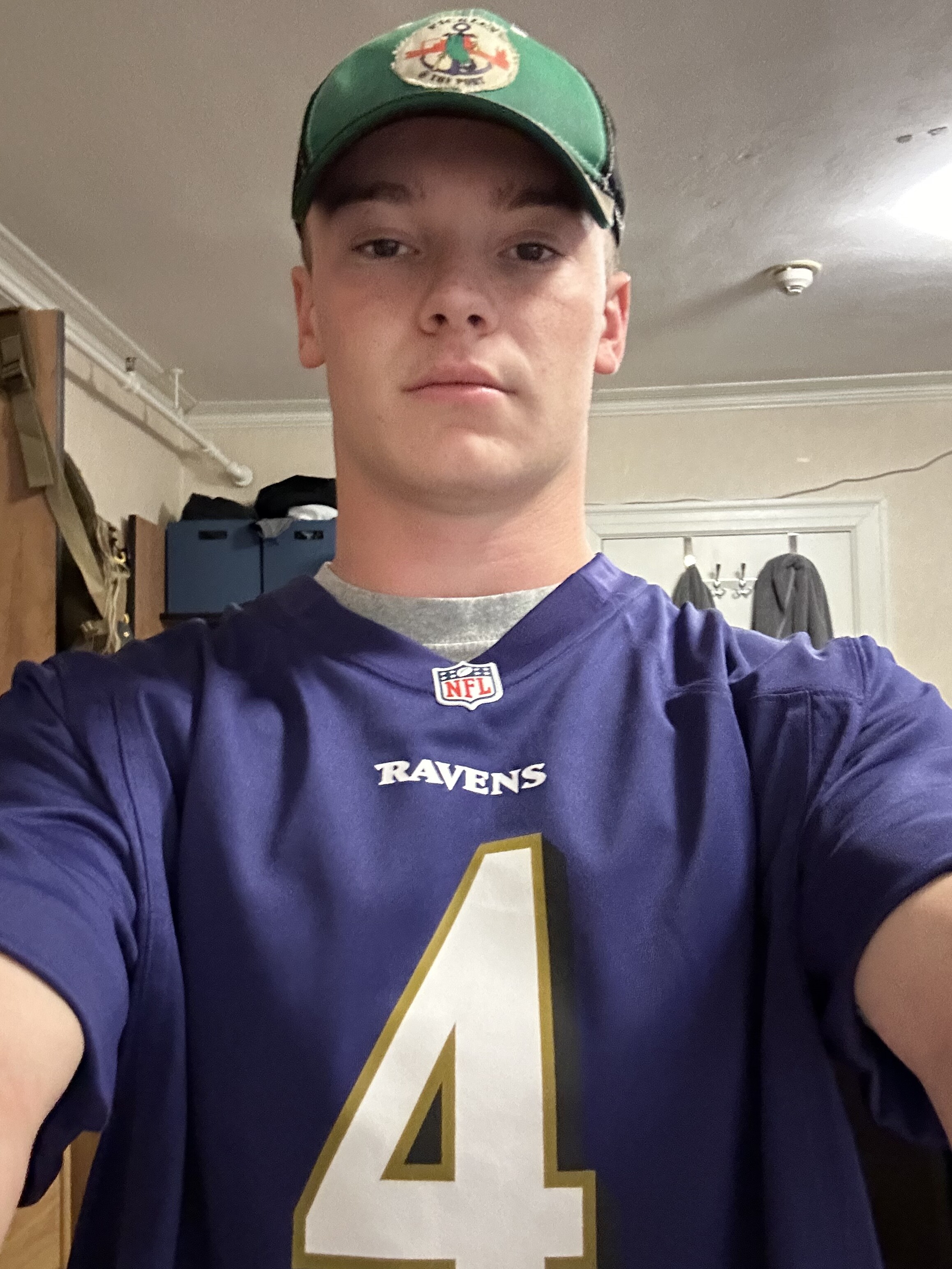
I like this map because it shows two of my favorite cities in great detail. I'm from the Annapolis area and went to school in downtown Annapolis as pictured above. I also spend a lot of time in Baltimore City as my parents have a business there and I attend a lot of sports games. So these are two places that are close to my heart and the map being published by Shell was something that was kind of weird and unique to me.
Dots count
1
1
Aidan
(@aidan448)
Jan 28 2025
0.47
0.31
I'm Aidan, a prospective Political Science major in my first year at Williams. I like this map because I'm interested in history, and this map hints at a whole civilization worth of history that we only have minimal records of before it was destroyed. This map provides a rare glimpse of what this Mesoamerican empire might have bee like.
Thank you for documenting and making public countless maps like these that enable anyone to explore their interests on your website.
Dots count
1
1
Zainab Saleem
(@Zainab)
Jan 28 2025
0.09
0.74
Hello David, my name is Zainab and I am a freshman here at Williams. This map shows a very detailed profile of Asia which makes it convenient for people to study individual areas more closely and compare it across other maps. I find this map fascinating because it balances visual appeal and detail in an exemplary way. It is also interesting to see how boundaries of nations have changed over the last 100 years. Thank you so much for your effort to make maps accessible to everyone!
Dots count
1
1
Minnie Pozefsky
(@minniepoz)
Jan 28 2025
0.73
0.58
Hi! My name is Minnie Pozefsky and I’m a sophomore at Williams studying Chemistry and History.
I love the way this map shows such a detailed, three-dimensional view of the city. The green spaces are emphasized and the depiction of each specific building is so intricate. I also found it really interesting how there is barely any text on the map- it encourages the viewer to think about how the line between mapping and artwork is blurry.
Thank you so much for taking the time to come speak to our class! I have really enjoyed looking through and analyzing many of the maps in your collection- thank you for making this available to us and to the rest of the world!
Dots count
1
1
Lucy Everett
(@lucyeve)
Jan 28 2025
0.05
0.05
My name is Lucy. I am studying economics and public health.
I like this map because it taught me about Emma Willard, an important figure for women’s education. I was also reminded that maps can be made of history for the sole purpose of teaching.
Thank you David Rumsey for your continued generosity, curiosity, and artistic drive of maps.
Dots count
1
1
Jamie Woods
(@JamieW123)
Jan 28 2025
0.16
0.35
This is a beautiful map made for the New York Sunday News in August of 1944. It charts what was believed to be the path of human migration in prehistoric and historic times. The map is wrong, as it does not correctly identify Africa as the continent where humans first arose. Our scientific knowledge has changed so much and so has our perception of the world. I love how this map identifies how humans are forever learning and changing our views. Thank you for your website and its ability to show this major change in human history: how we see the world we live in.
Dots count
1
1
Alex FF
(@alexfff)
Jan 28 2025
0.68
0.29
Hi David, I am Alex, a student in Tom Paper's history class. I want to say thank you for your dedication to maps! This map is important to me because I live in New York and spend a lot of time on the Long Island Rail Road. It is really interesting on this map to see the beginnings of transportation infrastructure in Long Island. Its amazing how quickly it populated!
Dots count
1
1
Kate Keenan
(@Katekeenan)
Jan 28 2025
0.3
0.18
Hi David, my name is Kate Keenan and I study Psychology at Williams.
I chose a map of Cape Cod because I grew up going here in the summer and I have great memories with my family in many of these towns. I like this map in particular because it uses a beautiful blue color for the ocean that contrasts with the land, and I think that the towns and ships are depicted in great detail which I appreciate. There are many artistic elements that caught my eye on this map.
Thanks for everything that you have done for the map community!
Dots count
1
1
Ben
(@mcgrawb22)
Jan 28 2025
0.21
0.84
Hi David, this is Ben McGraw and I study Political Economy and Chinese at Williams.
I chose this map of Florida because I grew up in Jacksonville, which is located in Northeast Florida. I think this map is particularly interesting due to its inclusion of townships, giving a better and fuller picture of what Florida was like/who was in Florida in 1890.
Thank you for everything you have done to inspire others and make maps for accessible for all!