

Passion & Conflict: Islamicate Maps of the Maghrib / ‘the West’ (Iberian Peninsula and North Africa)
Step 0 of 0
1
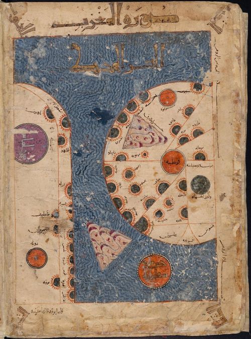
Leiden KMMS 3101 Maghrib Map
2
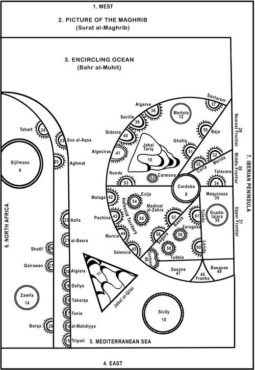
Leiden KMMS 3101 Maghrib Map - Line Drawing
3
![[ 2025-01-09 12:19:03 ]](https://iiif.pixeum.org/iiif/3/1736425151/full/500,/0/default.jpg)
[ 2025-01-09 12:19:03 ]
4
Surat al-Maghrib = Typical Medieval Islamicate map of ‘the West’ — i.e. Iberian Peninsula and North Africa
Leiden KMMS 3101 Maghrib Map
Leiden KMMS 3101 Maghrib Map - Line Drawing
[ 2025-01-09 12:19:03 ]
Surat al-Maghrib = Typical Medieval Islamicate map of ‘the West’ — i.e. Iberian Peninsula and North Africa
Place a DOT on the image