Malta Seige Map - The Four States
Exhibit story
Image Title -
Step 0 of 0
e622 |
Dot story
Image Title -
Step 0 of 0
e622 |
1
2
![[ 2025-01-06 12:45:09 ]](https://pxpbstrg.s3.us-west-1.amazonaws.com/images/thumbs/1736167523.jpg)
3
![[ 2025-01-06 12:48:59 ]](https://pxpbstrg.s3.us-west-1.amazonaws.com/images/thumbs/1736167753.jpg)
4
![[ 2025-01-07 03:18:55 ]](https://pxpbstrg.s3.us-west-1.amazonaws.com/images/thumbs/1736219952.jpeg)
5
![[ 2025-01-07 03:19:19 ]](https://pxpbstrg.s3.us-west-1.amazonaws.com/images/thumbs/1736219998.jpeg)
6
![[ 2025-01-07 03:20:06 ]](https://pxpbstrg.s3.us-west-1.amazonaws.com/images/thumbs/1736220025.jpeg)
7
![[ 2025-01-07 03:20:32 ]](https://pxpbstrg.s3.us-west-1.amazonaws.com/images/thumbs/1736220045.jpeg)
8
![[ 2025-01-07 03:20:52 ]](https://pxpbstrg.s3.us-west-1.amazonaws.com/images/thumbs/1736220069.jpeg)
9
![[ 2025-01-07 03:21:59 ]](https://pxpbstrg.s3.us-west-1.amazonaws.com/images/thumbs/1736220132.jpeg)
10
![[ 2025-01-07 03:21:37 ]](https://pxpbstrg.s3.us-west-1.amazonaws.com/images/thumbs/1736220111.jpeg)
11
![[ 2025-01-07 03:21:15 ]](https://pxpbstrg.s3.us-west-1.amazonaws.com/images/thumbs/1736220090.jpeg)
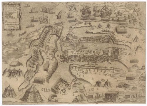
State 2 of the Malta Seige Map
Drawing of the Port of Malta, as it is at present besieged by the Turks, drawn from other drawings sent by Malta with fidelisms, with the note of the camp of infidels and other particulars, which up to now have not been seen.
Cartographer: Camocio, Giovanni Francesco
Source: Charles University
CAMOCIO, Giovanni Francesco a Libraria della Piramide (Benátky, Itálie). Disegno del Porto di Malta, come al[abaster] presente si troua assediato da turchi, cauato da altri disegni mandate da Malta fidelisimi, con la nota del campo d’infideli et altri particolari, che fin qui non mandate da Malta fidelisimi, con la nota campo d’infideli et altri particolari, che fin qui non si sono ueduti. [ca 1:10 000]. 1,7 cm = misura di passa 100 a piedi 5 p.[er] passo'. In Venetia: alla libraria d[e]lla piramid[e], [1565]. 1 mapa : mědiryt, čb. ; 32,5 x 46 cm na listu 33 x 46 cm, p. 1. Available also from: https://kramerius.cuni.cz/uk/uuid/uuid:784bdc92-4d55-11ec-89a0-fa163e4ea95f
PhDr. et Mgr. Eva Novotná, Ph.D.
Mapová sbírka, Knihovna geografie
Přírodovědecká fakulta UK
Albertov 6, 128 00 Praha 2
Nové:
Kalvoda, J., Novotná, E. eds. (2024). The Nature of Geomorphological Hazards in the Nepal Himalaya. Cham: Springer Nature, 2024. 421 p., 240 il. Geoenvironmental Disaster Reduction. https://doi.org/10.1007/978-3-031-58421-3
Novotná, E. (2024). Development of the Map Representation of the Nepal Himalaya Up to the End of Nineteenth Century. In: Kalvoda, J., Novotná, E. (eds) The Nature of Geomorphological Hazards in the Nepal Himalaya. Geoenvironmental Disaster Reduction. Springer, Cham. https://doi.org/10.1007/978-3-031-58421-3_3
[ 2024-11-01 23:16:07 ]
Place a DOT on the image