

Harmony Masks Conflict: The Mediterranean in the Medieval Islamic Imagination - Karen Pinto
Step 0 of 0
1
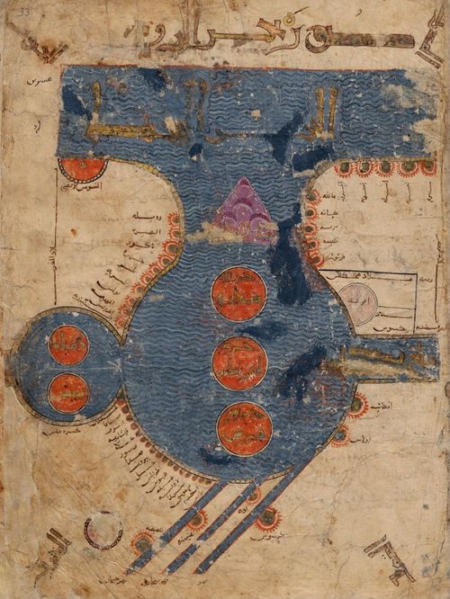
12th-century Islamic Map of the Mediterranean Belonging to Frederick II
2
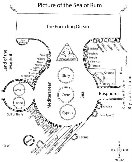
Leiden Mediterranean Map - Translated
3
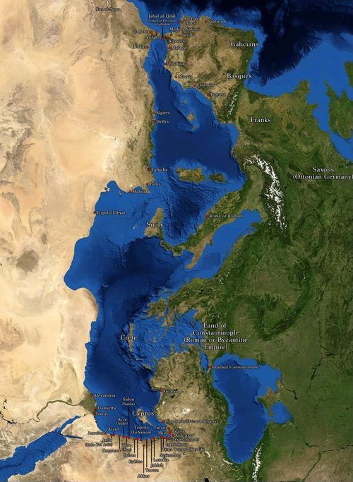
Leiden Mediterranean Map - Modern Equivalent
Place a DOT on the image