San Francisco Giants Maritime Bay Cruise
Step 0 of 0
1

2

3

4

5

6

7

8

9

10

11

12

13

14

15

16

17

18

19

20
![[ 2025-08-06 00:39:52 ]](https://pxpbstrg.s3.us-west-1.amazonaws.com/images/thumbs/1754440910.jpg)
21

22

23

24

25

26

27

28

29

30

31

32

33

34

35

36

37

38

39

40

41

42

43

44

45

46

47

48

49

50

51

52

53

54

55

E50 - San Francisco Giants Enterprises
Welcome to the San Francisco Giants world class waterfront enterprises! At the intersection of sports, entertainment, meetings, events, tourism and hospitality, Giants Enterprises provides the rare combination of people and places to create new memories and great impressions. You can journey on the luxurious California Spirit around the San Francisco Bay and experience the rich history of the Bay Area. Beginning at Pier 40, right next door to the famous AT&T ballpark, home to the San Francisco Giants, you’ll cruise under the Bay Bridge, past Alcatraz, around Angel Island and Tiburon, see Sausalito, cruise under the Golden Gate Bridge, and then return alongside Fisherman’s Wharf, before heading back to Pier 40 and a magnificent view of the ballpark.
E50 - Map of Cruise Route SF Giants
E50 - 1781 Canizares Map of San Francisco Bay
E50 - 1833 San Francisco Bay Map by Beechey
Early seafaring explorers from Spain, France and England sailed their ships along the West coast of America and often past the entrance to San Francisco Bay because it was shrouded in fog. Originally settled by Ohlone-speaking Yelamu tribe, San Francisco would be mapped by Spanish explorer Don Gaspar de Portolá in 1769 and later become a Spanish colony in 1776, with missions established throughout the area. Once the Bay had been properly explored and mapped out for navigation, Europeans began to settle within its boundaries and take advantage of the many natural resources they discovered. In 1821, Mexico gained independence from Spain and they renamed the small port town Yerba Buena. As seen in this detailed map, sailing into the Bay became easier with the aid of images like this one from 1833. It would not be until the end of the Mexican-American War in 1848 that the Bay and surrounding areas became part of the United States.
“Very rare and important chart of San Francisco Bay, the result of the first scientific mapping of the Bay. The chart had a wide influence upon later maps of the area. The chart, with copies and adaptations of it, served to the end of the Mexican period and formed the substantial basis of the earliest ones produced under the American regime. It was deficient only in the region beyond Carquinez Strait. The chart of the entrance contains additional hydrographic data pertinent to entering the port and reaching the chief places of anchorage. Accompanying the chart are elevation views depicting the approaches to the bay and the hazards to navigation.” davidrumsey.com
E50 - Timeline of Early San Francisco History
E50 - 1848 Yerba Buena Cove JC Ward
1848 Pre Gold Rush San Francisco - JC Ward
Here we can see the bucolic Yerba Buena Cove before the San Francisco Gold Rush began in earnest. In fact, San Francisco was named after this local "good flower" from the mint family, and had a population of only a few hundred persons on average during the Mexican era from 1821-1848. As the main port for ships coming into the Bay, Yerba Buena Cove is now the area of present-day downtown San Francisco and is one of the first places you will see while on this cruise.
E50 - 1850 Map San Francisco with Apollo Store Ship
Yerba Buena cove, also swelled with ships. The frenzy was so great that many ships would dock in Yerba Buena cove and then be left behind by the crew and the owners, who were all seeking their fortune in the hills.
E50 - Yerba Buena
https://plantright.org/better-plants/clinopodium-d...
http://www.anzahistorictrail.org/juniorrangers/exp...
https://www.calflora.org/cgi-bin/species_query.cgi...
https://en.wikipedia.org/wiki/Clinopodium_douglasi...
https://en.wikipedia.org/wiki/Yerba_Buena,_Califor...
E50 - 1848 Gold Region Larkin
David Rumsey Library @ Stanford
This map is important because it was the first one to be widely printed and show the locations of gold mines in California. Made by an enterprising merchant and later U.S. Consul to the Republic of California, Thomas Oliver Larkin spurred the Gold Rush of 1849 and forever altered the course of history in the San Francisco Bay.
E50 - Gold Rush
Don Brown gold rush image used with permission of Don Brown.
E50 - 1850 San Francisco Post Office
NYPL 1850 San Francisco Post Office
The discovery of gold in 1849 completely transformed the city. San Francisco was overrun with people seeking their fortune in the eastern hills across the Bay. The city's sleepy population swelled from 800 to 25,000 in a matter of months. This image shows a post office swarmed by individuals hoping to change their lives with a nugget of gold. Over 300,000 prospectors came to the Bay area during the period of 1848-1852, with half of them arriving by sea. During this time, California began to build its infrastructure and officially became a State in the Union on September 9th, 1850.
E50 California joins the Union September 9, 1850
E50 - 1852 Tall Ships in Yerba Buena Cove
From the collection of Jim Schein, https://www.scheinandschein.com/
Panel #3: https://www.foundsf.org/index.php?title=Yerba_Buen...
San Francisco Hotel Niantic - 1850
E50 - 2017 San Francisco Buried Ships Michael Warner
"Beneath contemporary streets of San Francisco lie the remains of many sailing ships that brought people to San Francisco during the gold rush that began in 1849. The ships have different stories, but many were used at storage as the city's shoreline was expanded outward around them by landfill--some of these and other abandoned ships burned in fires and were buried afterward." San Francisco Maritime National Historic Park
Image in the public domain per Michael Warner.
E50 - Buried Ships of Downtown San Francisco
https://thebolditalic.com/what-lies-beneath-the-bu...
Image of ship General Harrison used with permission of James Delgado.
E50 - Alexander Cartwright
E50 - San Francisco Ballparks 1
E50 - San Francisco Ballparks Map
https://en.wikipedia.org/wiki/Baseball_(ball)
Portsmouth Square: https://ourgame.mlblogs.com/the-knickerbockers-san...
Recreation Grounds: https://en.wikipedia.org/wiki/Recreation_Park_(San_Francisco)
Haight Street Grounds: https://hoodline.com/2016/03/the-forgotten-history...
Central Park: https://www.foundsf.org/index.php?title=View_South...
Ewing Field: https://www.foundsf.org/index.php?title=Ewing_Fiel...
Seals Stadium: SF Giants
Candlestick Park: SF Giants
Oracle Park: https://en.wikipedia.org/wiki/Oracle_Park#/
E50 - San Francisco Ballparks 2
Ewing Field: https://www.foundsf.org/index.php?title=Ewing_Fiel...
Seals Stadium: SF Giants
Candlestick Park: SF Giants
Oracle Park: Wikipedia https://en.wikipedia.org/wiki/Oracle_Park#/
E50 - Bay Bridge Construction
Bay Bridge under construction 1935
E50 - Treasure Island Construction and Possible Use
image on left: iStockphoto
image on right: https://en.wikipedia.org/wiki/Treasure_Island,_San...
E50 - San Francisco Treasure Island 1939 Ruth Taylor White
“Born in 1899, Ruth Taylor and her family, like many, headed persistently west in the late 19th century, moving from East Coast to West in the span of about 20 years and finally settling in California. According to the 1920 US Census, Taylor seemed to be settling into a pretty normal life--she was married to Leonard White and living in Phoenix, Arizona. Leonard was a life insurance salesman. Two kids followed, and so did divorce. With limited information, it’s easy to fill in the gaps and imagine a disastrous mismatch of temperaments, but all we know is that Ruth and her children moved to California and she began working as an illustrator. Ruth’s artistic training is unclear, but her family proved to be very important in her future work. Several of her early jobs were linked to her brother, Frank J. Taylor (1894-1972). Frank was a journalist and writer, served in World War I, and attended Stanford University. That school connection probably helped Ruth earn one of her early commissions, the cover of the November 1927 The Stanford Illustrated Review.” swaen.com
E50 - Pan Am Clipper
Upper left and lower left: https://www.foundsf.org/index.php?title=The_China_... and Collection of San Francisco Airport Museums
Upper right: https://www.loc.gov/resource/ds.13935/
Lower right: https://en.wikipedia.org/wiki/Boeing_314_Clipper
E50 - 1833 San Francisco Bay Map by Beechey
Early seafaring explorers from Spain, France and England sailed their ships along the West coast of America and often past the entrance to San Francisco Bay because it was shrouded in fog. Originally settled by Ohlone-speaking Yelamu tribe, San Francisco would be mapped by Spanish explorer Don Gaspar de Portolá in 1769 and later become a Spanish colony in 1776, with missions established throughout the area. Once the Bay had been properly explored and mapped out for navigation, Europeans began to settle within its boundaries and take advantage of the many natural resources they discovered. In 1821, Mexico gained independence from Spain and they renamed the small port town Yerba Buena. As seen in this detailed map, sailing into the Bay became easier with the aid of images like this one from 1833. It would not be until the end of the Mexican-American War in 1848 that the Bay and surrounding areas became part of the United States.
“Very rare and important chart of San Francisco Bay, the result of the first scientific mapping of the Bay. The chart had a wide influence upon later maps of the area. The chart, with copies and adaptations of it, served to the end of the Mexican period and formed the substantial basis of the earliest ones produced under the American regime. It was deficient only in the region beyond Carquinez Strait. The chart of the entrance contains additional hydrographic data pertinent to entering the port and reaching the chief places of anchorage. Accompanying the chart are elevation views depicting the approaches to the bay and the hazards to navigation.” davidrumsey.com
E50 - Alcatraz
E50 - Angel Island
https://en.wikipedia.org/wiki/Angel_Island_Immigra...
E50 - Tiburon
E50 - Muir Woods
E50 - Sausalito
E50 - Golden Gate Bridge
San Francisco - Chevalier - 1915 B&W
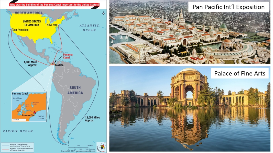
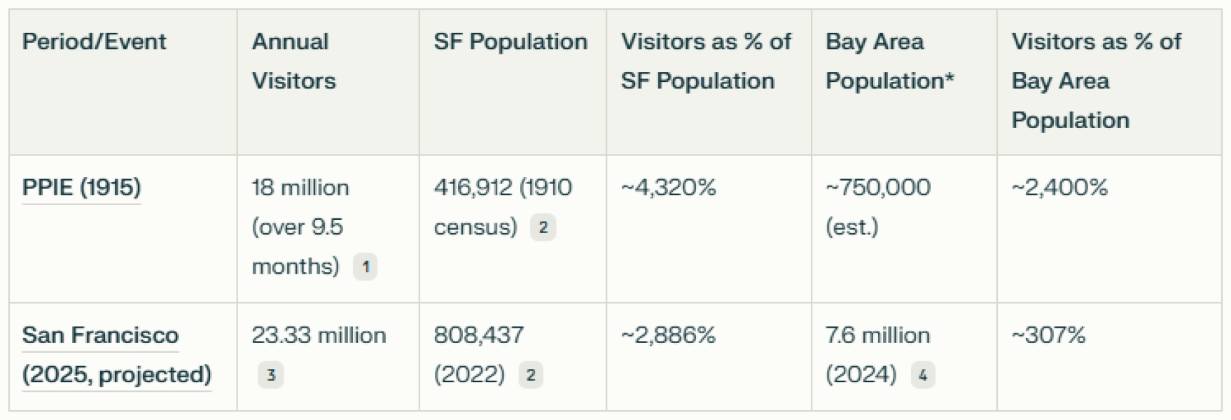
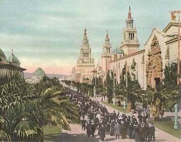
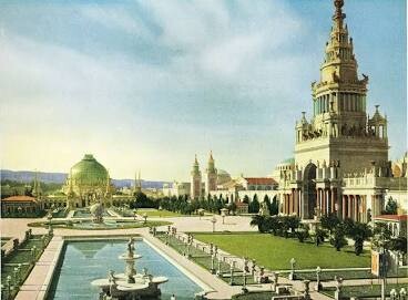
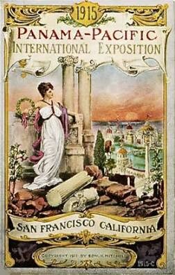
1915 by August Chevalier. San Francisco recovered brilliantly from the 1906 earthquake and fire. In less than 10 years, San Francisco had been rebuilt and hosted a world exposition celebrating the Panama Canal and the rebirth of San Francisco. Over 19million people visited San Francisco during the PPIE. Today, San Francisco gets about 24 million visitors per year.


 i36746
 i36747
“Map of San Francisco on sheet 47x54, folded in paper covers 18x8. Copyrighted by August Chevalier, 1915. Shows the "Ground plan of the Panama-Pacific International Exposition. Relief shown by contours. Includes legend. Shows wards, city blocks, streets, railroads, bridges, tunnels, places of interest, important buildings are drawn in vignettes. Includes index to places of interest at the lower panel and index to theatres, railway depots and post offices at upper right. "Car lines" shown in red. Includes index and text on verso. See our other maps of San Francisco by Chevalier, from which this map is taken.” davidrumsey.com
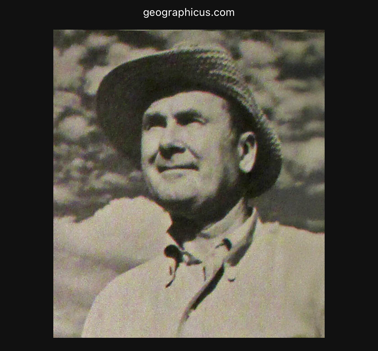
“August Chevalier (fl. c. 1903 – 1932) was a San Francisco based lithographer active in the first decades of the 20th century. Chevalier is a remarkably elusive figure and little is known of his personal or professional life. He is best known for his large and magnificent topographical map of San Francisco boldly known as 'The Chevalier.' His few other maps also, almost exclusively, focus on San Francisco and the surrounding communities.” geographicus.com
E50 - Pan Pacific International Exposition (PPIE)
https://en.wikipedia.org/wiki/Palace_of_Fine_Arts
http://loc.gov/pictures/resource/cph.3j00008/
https://www.mapsofworld.com/answers/united-states/... (Map purchased by Tom Paper)
Palace of Fine Arts
E50 - SF 1906 Earthquake at Grant and Post Avenues
E50 SF 1906 Earthquake at Grant and Post Avenues
E50 - 1906 San Francisco Burn Area
“A map of the area of San Francisco burned in the 1906 earthquake, with a overlay half-toned in red of the dramatic fire. The map appears to have been derived from one published in Leslie's Magazine shortly after the earthquake. See ID #1154, "Destruction of One of the Greatest Modern Cities" (1906). A comparison of these two images shows how the use of color and graphics can dramatically change the impact of a map. Despite the sensationalist impression conveyed by Lee's map, the text legend ("Plain Facts") emphasizes that "the beautiful Golden Gate city" has not been "entirely destroyed" and the "new San Francisco will be grander and more beautiful." See also ID #1155, "Ideal Picture and Map of San Francisco," 1906. This map is tipped into the front of Searight's book, published by the publishers of the map, Laird & Lee. However, the map is mentioned nowhere in the book, nor does it appear in the lengthy "List of Illustrations" in the book. It appears that the map was added after publication, which explains why it is found only in a small number of copies. Red is often used to emphasize the significance of fire or other hazards.” PJ Mode
San Francisco - Harrison Godwin - 1927
One of my favorites. Harrison Godwin made this playful map in 1928. It’s filled with history and humor. I strongly encourage you to spend some time on it. It shows Union Square shopping and it jokes about the Sunset sand dunes. Our Mayor Daniel Lurie should also appreciate that Godwin told his audience that San Francisco was the ideal convention city.


“Unlike many other antique maps of San Francisco, this one is covered in illustrations highlighting points of interest and historical events. The streets are essentially the same and they’re all labeled well enough that you can see if your apartment used to be a cemetery, a slaughterhouse, or an old railroad car barn. The map was originally mass-produced for tourists and I’ve seen a few different copies online. One was found in the forgotten depths of someone’s closet in 2011, and a Redditor mentioned in the comment thread that they had an original framed copy on their wall at home. In 2012, a copy of the map sold on eBay for $1,400.” The Bold Italic
“Harrison Godwin (1899 - 1984) was an American cartoonist and hotelier active in California during the early to middle parts of the 20th century. Harrison was a cartoonist with the Los Angeles Examiner and published two daily strips. With regard to cartographic material he published just three maps, San Francisco, Hollywood and North America, all between the years of 1927 and 1929. The San Francisco and Hollywood maps were first and second maps in a planned series of American cities, each taking some three months to complete. Curiously, no further maps in the series materialized. In addition to his cartoon work Harrison, in partnership with his brother Fred, owned Carmel's La Playa Hotel, where Harrison worked as a manager. Harrison and Fred Godwin and are credited with popularizing Carmel as a tourist destination. Little else is known of his life.” geographicus.com
E50 - Fisherman's Wharf
https://en.wikipedia.org/wiki/Fisherman%27s_Wharf,...
https://www.loc.gov/resource/cph.3b24180/
E50 - 1937 Views of Future Site of SF Giants Ballpark
E50 - SF Giants Baseball Stadium Development 8
E50 - The Coke Bottle
Upper middle, upper right: San Francisco Giants (Chris Koenig)
Upper left, lower middle, lower right: https://scientificartstudio.com/san-francisco-gian...
Lower left: https://en.wikipedia.org/wiki/Oracle_Park
E50 - A Ballpark Connected To The Water
Upper right: https://en.wikipedia.org/wiki/McCovey_Cove
Upper left, lower middle, lower right: https://en.wikipedia.org/wiki/Oracle_Park
Lower left: SF Giants (Chris Koenig, Brad Martens, Suzanna Mitchell)
E50 - McCovey Cove Night Game at Oracle Ballpark SF Giants
E50 - SF Giants Ballpark view of Bay
Place a DOT on the image











No dots yet