

San Francisco Giants Maritime Bay Cruise
Step 0 of 0
1
E50 - San Francisco Giants Enterprises
2

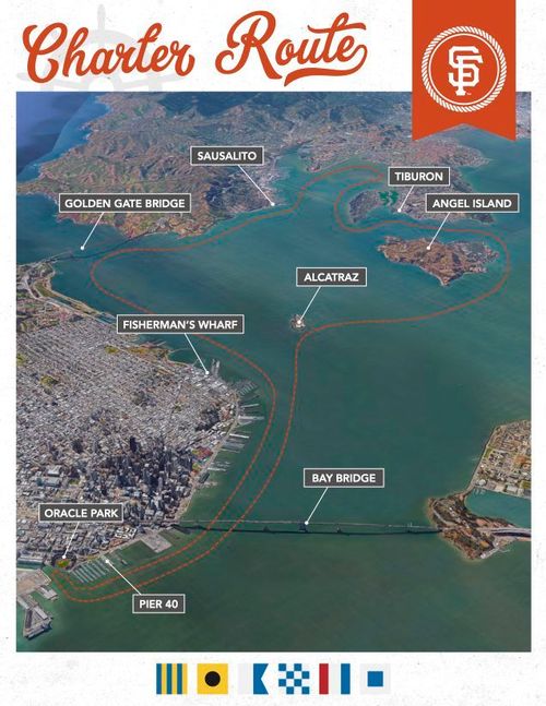
E50 - Map of Cruise Route SF Giants
3
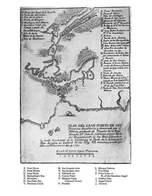
E50 - 1781 Canizares Map of San Francisco Bay
4

E50 - 1833 San Francisco Bay Map by Beechey
5
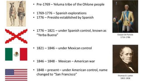
E50 - Timeline of Early San Francisco History
6
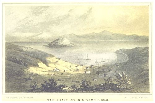
E50 - 1848 Yerba Buena Cove JC Ward
7
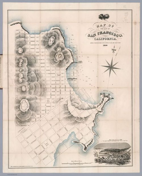
E50 - 1850 Map San Francisco with Apollo Store Ship
8
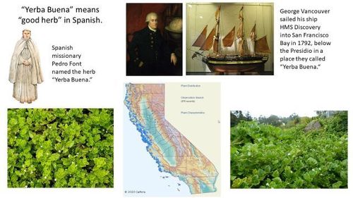
E50 - Yerba Buena
9
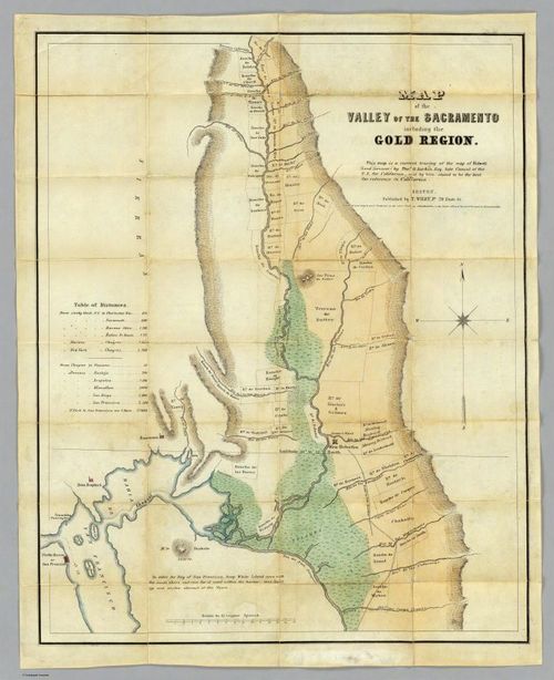
E50 - 1848 Gold Region Larkin
10
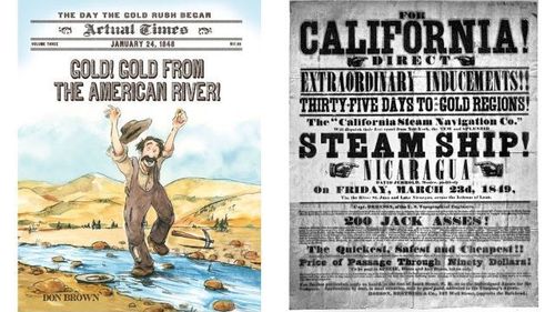
E50 - Gold Rush
11
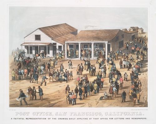
E50 - 1850 San Francisco Post Office
12
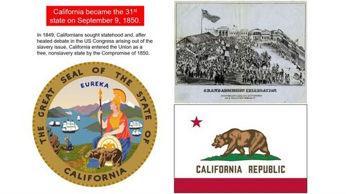
E50 California joins the Union September 9, 1850
13
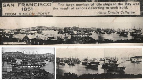
E50 - 1852 Tall Ships in Yerba Buena Cove
14
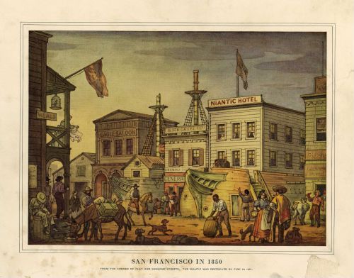
San Francisco Hotel Niantic - 1850
15
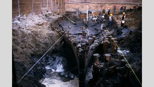
E50 - 2017 San Francisco Buried Ships Michael Warner
16
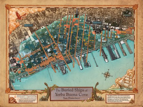
E50 - Buried Ships of Downtown San Francisco
17
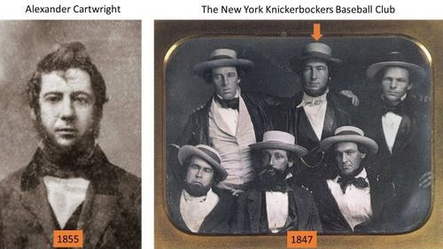
E50 - Alexander Cartwright
18
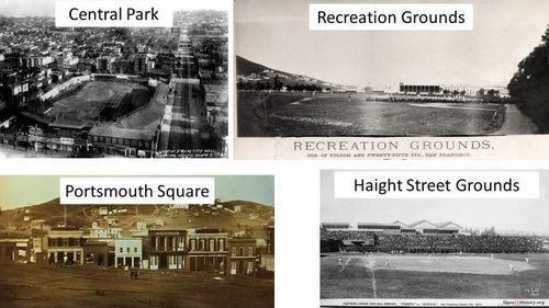
E50 - San Francisco Ballparks 1
19
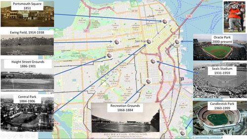
E50 - San Francisco Ballparks Map
20
![[ 2025-08-06 00:39:52 ]](https://iiif.pixeum.org/iiif/3/1754440910/full/500,/0/default.jpg)
[ 2025-08-06 00:39:52 ]
21
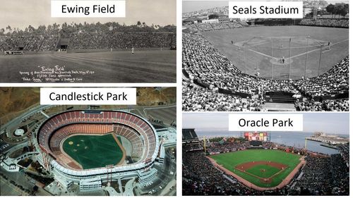
E50 - San Francisco Ballparks 2
22

E50 Map of Cruise 2
23
E50 - Bay Bridge Construction
24
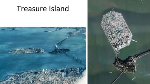
E50 - Treasure Island Construction and Possible Use
25
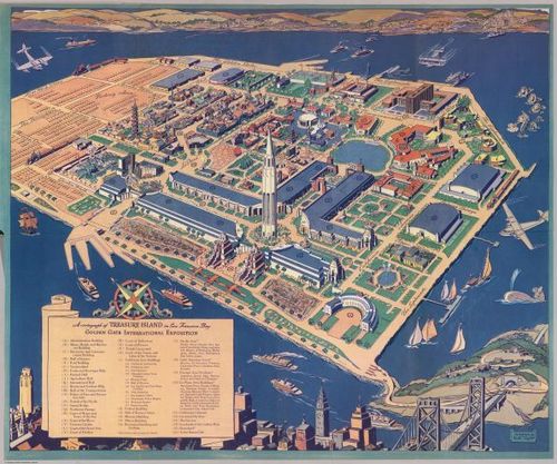
E50 - San Francisco Treasure Island 1939 Ruth Taylor White
26
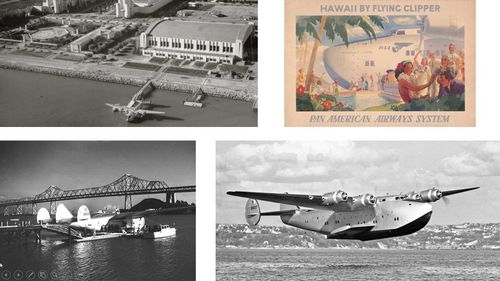
E50 - Pan Am Clipper
27
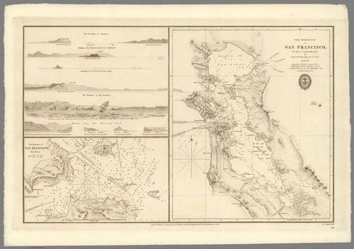
E50 - 1833 San Francisco Bay Map by Beechey
28
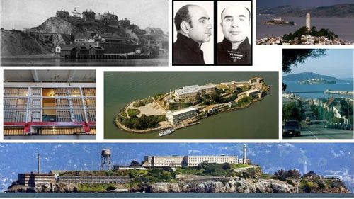
E50 - Alcatraz
29
E50 Map of Cruise 3
30
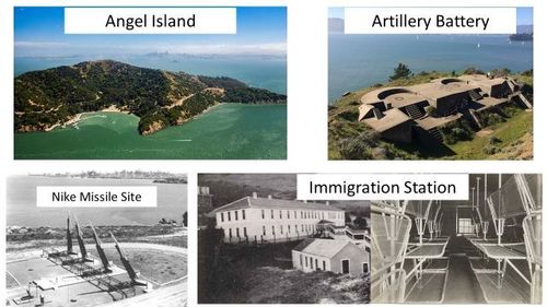
E50 - Angel Island
31
E50 Map of Cruise 4
32
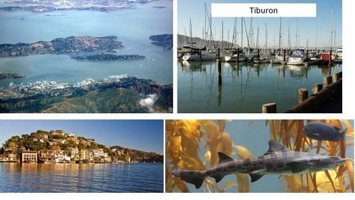
E50 - Tiburon
33
E50 Map of Cruise 5
34
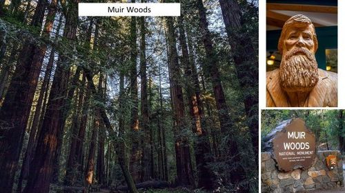
E50 - Muir Woods
35
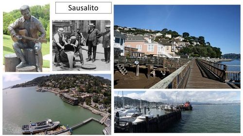
E50 - Sausalito
36
E50 Map of Cruise 6
37
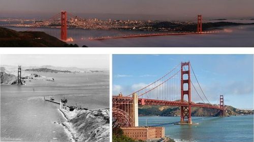
E50 - Golden Gate Bridge
38
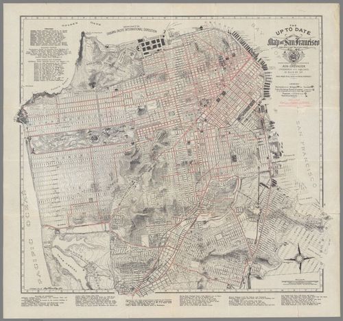
San Francisco - Chevalier - 1915 B&W
39
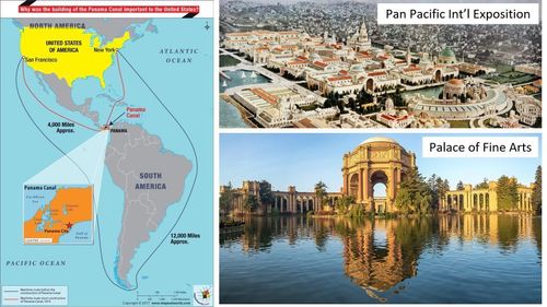
E50 - Pan Pacific International Exposition (PPIE)
40
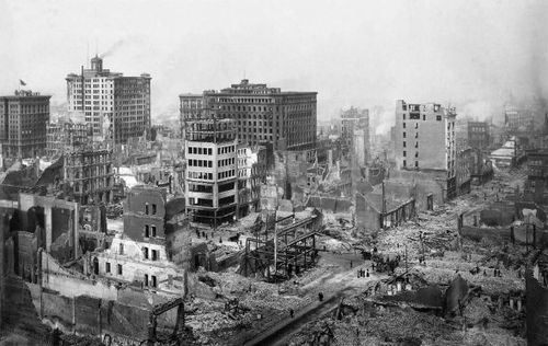
E50 - SF 1906 Earthquake at Grant and Post Avenues
41
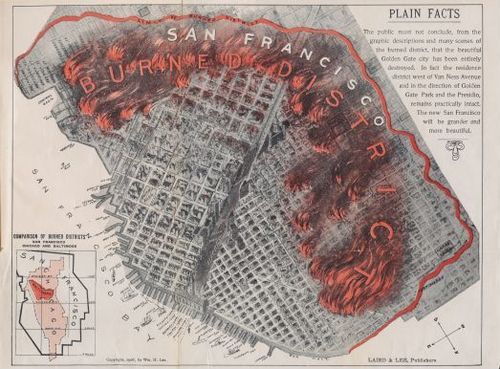
E50 - 1906 San Francisco Burn Area
42

E50 Map of Cruise 7
43
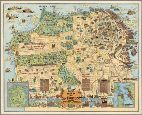
San Francisco - Harrison Godwin - 1927
44
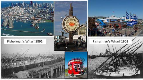
E50 - Fisherman's Wharf
45
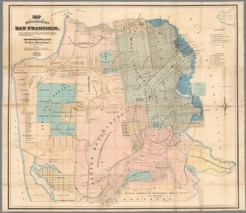
E50 - San Francisco Butler 1864
46
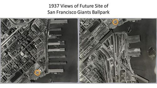
E50 - 1937 Views of Future Site of SF Giants Ballpark
47
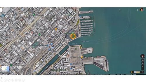
E50 - SF Giants Ballpark on Google Maps Satellite
48
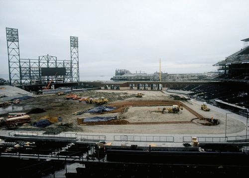
E50 - SF Giants Baseball Stadium Development 8
49
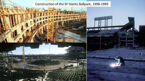
E50 - Construction
50
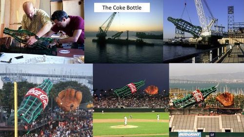
E50 - The Coke Bottle
51
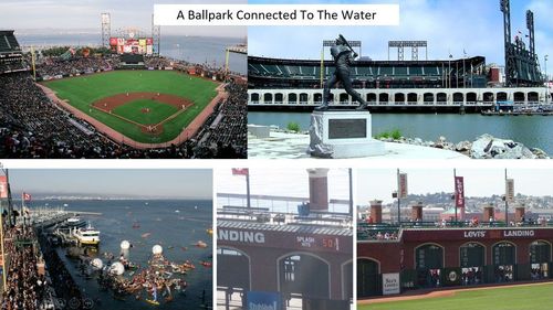
E50 - A Ballpark Connected To The Water
52
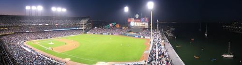
E50 - McCovey Cove Night Game at Oracle Ballpark SF Giants
53
E50 Map of Cruise 8
54
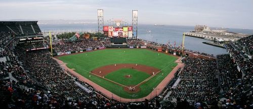
E50 - SF Giants Ballpark view of Bay
55

E50 - SF Giants Slide with Logo 2
Place a DOT on the image