

Various Persuasive & Pictorial
Step 0 of 0
1
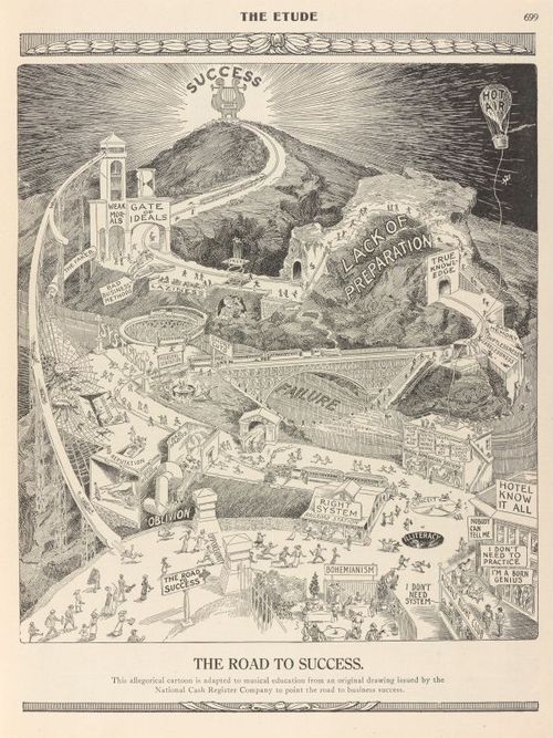
E234 - The Road to Success - 1913
2
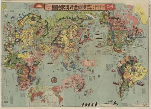
E234 - Japanese Stereotypes - 1932
3
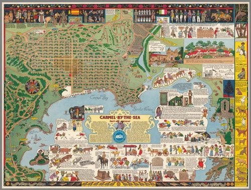
E101 - 1942 Carmel Jo Mora Color DUPLICATED
4
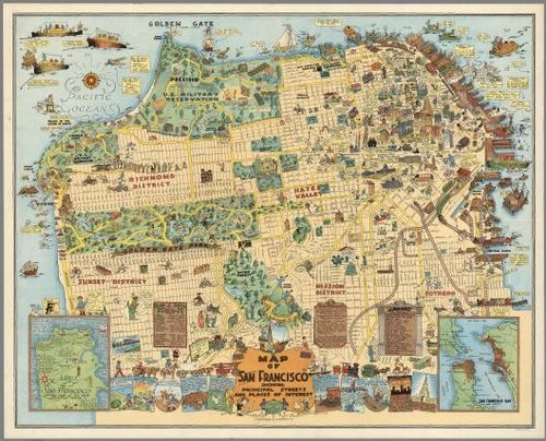
E166 - San Francisco, by Harrison Godwin, 1927 DUPLICATED
5
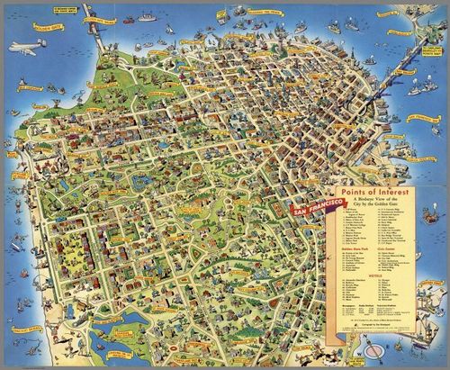
E37 - San Francisco, by Don Bloodgood, 1952 DUPLICATED
6
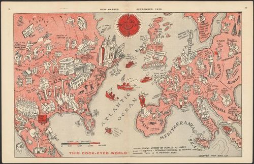
This Cock-Eyed World - William Gropper - 1926
7
![[ 2026-03-22 18:28:56 ]](https://iiif.pixeum.org/iiif/3/1774204173_69c0350d0f366/full/500,/0/default.jpg)
[ 2026-03-22 18:28:56 ]
8
![[ 2026-03-22 18:29:35 ]](https://iiif.pixeum.org/iiif/3/1774204204_69c0352c836f8/full/500,/0/default.jpg)
[ 2026-03-22 18:29:35 ]
9
![[ 2026-03-22 18:30:10 ]](https://iiif.pixeum.org/iiif/3/1774204247_69c03557586ea/full/500,/0/default.jpg)
[ 2026-03-22 18:30:10 ]
10
![[ 2026-03-22 18:30:53 ]](https://iiif.pixeum.org/iiif/3/1774204286_69c0357ea9445/full/500,/0/default.jpg)
[ 2026-03-22 18:30:53 ]
11
![[ 2026-03-22 18:31:34 ]](https://iiif.pixeum.org/iiif/3/1774204334_69c035ae2c569/full/500,/0/default.jpg)
[ 2026-03-22 18:31:34 ]
12
![[ 2026-03-22 18:32:21 ]](https://iiif.pixeum.org/iiif/3/1774204372_69c035d46e051/full/500,/0/default.jpg)
[ 2026-03-22 18:32:21 ]
13
![[ 2026-03-22 18:32:57 ]](https://iiif.pixeum.org/iiif/3/1774204412_69c035fc872d2/full/500,/0/default.jpg)
[ 2026-03-22 18:32:57 ]
14
![[ 2026-03-22 19:17:02 ]](https://iiif.pixeum.org/iiif/3/1774207096_69c0407842053/full/500,/0/default.jpg)
[ 2026-03-22 19:17:02 ]
15

Las Vegas Fun Map - King - 1960
Place a DOT on the image