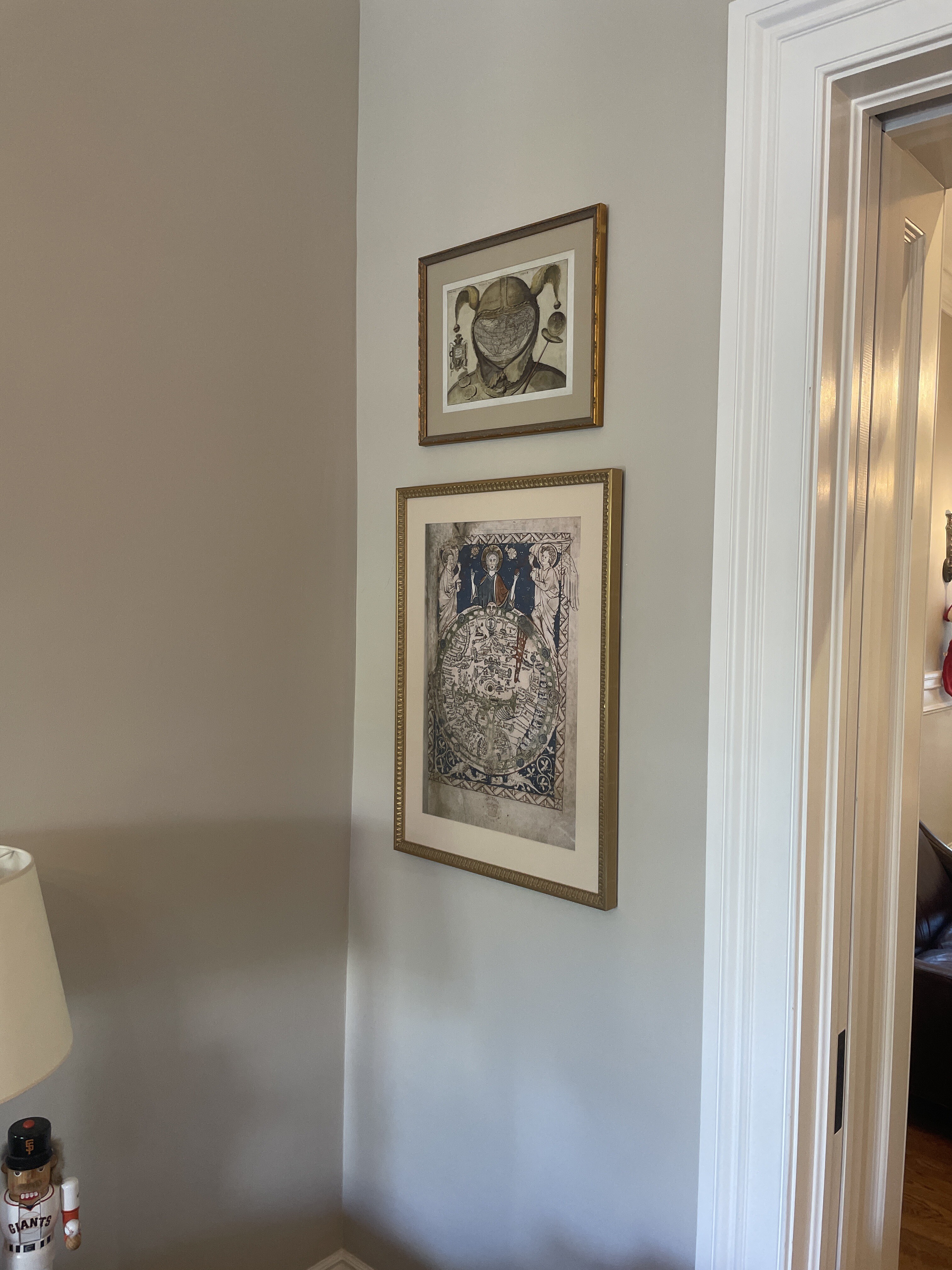
Mappa Mundi Exhibit for Williams College Jan 2024 (Spikes talk)
Exhibit story
Image Title -
Step 0 of 0
e172 |
Dot story
Image Title -
Step 0 of 0
e172 |
1

2

3

4

5

6

7

8

9

10

11

12

13

14

15
![E172 - Nova totius Terrarum Orbis geographica ac hydrographica tabula [ 2023-12-29 23:12:07 ]](https://pxpbstrg.s3.us-west-1.amazonaws.com/images/thumbs/1703891654.jpg)
16
![John Fleming Map Share 13 April 2024 Los Angeles as it appeared in 1871, when Germain Seed and Plant Co was established[ 2024-04-13 18:27:27 ]](https://pxpbstrg.s3.us-west-1.amazonaws.com/images/thumbs/1713033074.jpg)
17
![Fred's Map [ 2024-04-13 21:24:45 ]](https://pxpbstrg.s3.us-west-1.amazonaws.com/images/thumbs/1713043519.jpg)
18
![Fred 2 [ 2024-04-13 21:25:24 ]](https://pxpbstrg.s3.us-west-1.amazonaws.com/images/thumbs/1713046891.jpg)
19
![[ 2025-01-09 11:55:56 ]](https://pxpbstrg.s3.us-west-1.amazonaws.com/images/thumbs/1736423775.jpg)
20
![[ 2025-01-09 11:56:20 ]](https://pxpbstrg.s3.us-west-1.amazonaws.com/images/thumbs/1736423789.jpg)
21
![[ 2025-01-09 11:56:32 ]](https://pxpbstrg.s3.us-west-1.amazonaws.com/images/thumbs/1736423801.jpg)
22
![[ 2025-01-09 11:56:44 ]](https://pxpbstrg.s3.us-west-1.amazonaws.com/images/thumbs/1736423816.jpg)
23

Medieval Map Types - Basic Introduction
Medieval Map Types - Basic Introduction
Zonal image: Macrobius, Commentarii in Somnium Scipionis. Folio 34 recto. Copenhagen, Det Kongelige Bibliotek, ms. NKS 218 4°, fol. 34r
T-O image: Earliest printed example of a classical T and O map (by Günther Zainer, Augsburg, 1472), illustrating the first page of chapter XIV of the Etymologiae of Isidore of Seville. It shows the continents as domains of the sons of Noah: Sem (Shem), Lafeth (Japheth) and Cham (Ham).
V-in-Square image: Tables of the Genealogy of Christ from LOC Beato of Liébana: The Codex of Fernando I & Sancha, 1047
Beatus image: LOC Beato of Liébana: The Codex of Fernando I and Doña Sancha, 1047 (image 126)
Portolan image: LOC Portolan chart of the Mediterranean Sea ca. 1320-1350 : manuscript chart of the Mediterranean and Black seas on vellum
NOTE: Additional resource for open source images of early maps
[ 2024-01-11 01:02:59 ]
Isidore of Seville's Etymologiae (c. 625)
European T-O style maps (mappa mundi) derive from Isidore's 7th century encyclopedia.
The US Library of Congress has a 9th century copy of Etymologiae, describing it as "the best known work by Bishop Isidore of Seville (circa 560--636), a scholar and theologian considered the last of the great Latin Church Fathers. It takes its name from a method of teaching that proceeds by explaining the origins and meaning of each word related to a topic. Isidore drew on many different sources in his attempt to summarize all ancient knowledge and save it for posterity. The fame of the work led to it being widely copied and disseminated, and its popularity lasted even into the Renaissance. To medieval scholars, Etymologiae was an unequaled compendium of information. This important manuscript in Gothic minuscule writing in the style of the Toledo--Seville school came originally from the cathedral of Toledo. It includes notes and Arabic equivalents for some Latin words. Several sheets are made from parchment cuts, crudely drawn. The manuscript also contains a world map with Arabic writing (at 116v), and geometric figures in color, with titles, captions, initials, and capitals in red and green."
Exhibit page from the Royal Library of Brussels full copy of Isidore of Seville's Etymologiae (MSII 4856) from c. 750 France.
[ 2024-01-10 18:05:22 ]
The original 776 Codex [pre-modern book] was created by Beato, a monk in Liébana, Spain, which summarized several historic writings about the Apocalypse. This included Bishop Isidore of Seville's c.625 Etymologiae, an encyclopedia of ancient learning and knowledge that was widely read during the Medieval era and whose T-O map served as a foundation for European mappa mundi, several of which are shared in this exhibit.
Apocalypse writings were widespread before the years 800 and 1000, with images and texts exploring all the atrocities anticipated. Even after the fateful years passed, Beato's work continued to be copied with 35 versions up to the 13th century. This copy of the Codex, commissioned by King Ferdinand I of Léon and Castille, is believed to have been completed by Facundo, hence the name. Christian, Jewish, Romanesque, North African and Mozarab influences can be found throughout.
Library of Congress website to explore the Beato of Liébana: The Codex of Fernando I and Doña Sancha (Also known as Beatus of Liébana-Facundus)
T-O Map within the codex (image source)
[ 2024-01-10 17:25:27 ]
The Sawley Map c.1180
The Sawley Map is the oldest, surviving Mappa Mundi made in England. Previously known as the Henry of Mainz Map.
"This early map performs an encyclopedic function, bringing together and organizing in a visual compendium a wealth of accumulated geographical knowledge from the Bible, Greek legends, Alexandrian adventure tales, and ancient cosmographies. It organizes the world in terms of centrality and remoteness: the Mediterranean Sea, outlined in green, lies at the center, while Britain (Britannia insula at the lower left corner) and the desert monasteries of Egypt (at the upper right) appear at the outer edges. It includes the Red Sea, divided, in the top right corner; Scylla and Charybdis, the sea monsters of Greek myth, in the Mediterranean; and Paradise, appropriately, at the top."
Source: The Met Museum
The Sawley Map
From the Imago mundi by Honorius Augustodunensis
England, probably Durham, ca. 1190
Corpus Christi College, Cambridge, MS 66, Part 1
See also: https://www.jwgreenlee.net/medieval-maps/
[ 2024-01-06 23:27:33 ]
E172 - Psalter Map - 1225-1265 - M5743
British Library, Psalter World Map, England, c. 1265, MS 28681, f. 9r, https://www.bl.uk/
"The Map Psalter gets its name from a very detailed map of the world on the first page, dating from the mid-13th century, one of the most important maps to survive from this period. The world is represented as a flat circle, with Jerusalem in the middle. The upper part of the circle is occupied by Asia, and the lower half divided into two quarters for Europe and Africa. Beneath Jerusalem it is quite easy to make out the names Roma, Grecia, Dalmatia, Burgundia, etc. The countries of the British Isles are discernable in the lower left quadrant, and despite the very limited space available one can make out rivers such as the Thames and Severn, and London is marked with a gold dot.
So, while the map is not accurate in our sense, it shows the places that were of interest to the people using it, and of course, most importantly, the earth is presided over by Christ and two angels: it is very much God’s creation.
There are indications that this manuscript was made in London and it has been suggested that the map may even be a miniature version of one that is known to have been painted on the wall of King Henry III’s bed-chamber in the Palace of Westminster."
Also see:
https://en.wikipedia.org/wiki/Psalter_world_map

(PHOTO above from Thomas Paper's collection.)
The Ebstorf Map 1234
Largest, 12 feet by 12 feet, Medieval Mappa Mundi but sadly destroyed during WWII. Copies made in the nineteenth century and black/white photos taken in 1891 allowed this reproduction to be created.
"The Ebstorf Map (ca 1234) is the largest known mappa mundi – a European medieval map. Less a navigational tool, it is full of religious and ethnographic information, measures 12ft and is illustrated on 30 goatskins. Scholars disagree as to who the author of the map really is. Originally thought to have been created by Gervase of Ebstorf, many others now think it contains too many dissimilar traits and was actually co-created by the nuns of Ebstorf famed for their craft(wo)manship in the Arts." The Ebstorf Map - University of Wisconsin from the American Geographical Society Library Digital Map Collection
https://collections.lib.uwm.edu/digital/collection/agdm/id/16400/
https://en.wikipedia.org/wiki/Ebstorf_Map
[ 2024-01-06 23:15:14 ]
Hereford on UK map
Hereford Cathedral Cloisters
Hereford Mappa Mundi installation
Hereford Mappa Mundi installation
Learn more about Hereford Cathedral and how you can visit the Mappa Mundi housed there and also see their copy of the 1215 Magna Carta.
[ 2024-01-10 08:11:45 ]
The Hereford Mappa Mundi c.1300
The Hereford Mappa Mundi is the largest surviving medieval map of its kind. The United Nations celebrates it as a "memory of the world" for its representation of the medieval and early Christian mindset.
"The Hereford Mappa Mundi is the only complete example of a large medieval world map intended for public display. It is very different to our modern understanding of a world map as it shows not only locations of places and geographic features but also acts as a visual encyclopaedia with historical, anthropological, ethnographical, biblical, classical and theological information. The map is pivotal in our understanding of medieval cartography and sense of place and still has relevance to all peoples in helping them to understand their sense of humanity and self." UNESCO (United Nations Educational, Scientific and Cultural Organization)
Housed at Hereford Cathedral in England and drawn on a single sheet of vellum (animal skin ), it measures 158 cm x 133 cm (approx. 4x5 feet). It depicts 420 towns, 15 Biblical events, 33 animals and plants, 32 people, and five scenes from classical mythology.
Click here for an Interactive Version of Hereford Map. There you can choose to explore the original map (shown this exhibit page), or view a color-enhanced version, or try the 3D imaging to explore the texture and markings that created the final version.
Image Source: Wikipedia (from Hereford)
[ 2024-01-06 23:00:01 ]
Hereford Mappa Mundi with modern countries
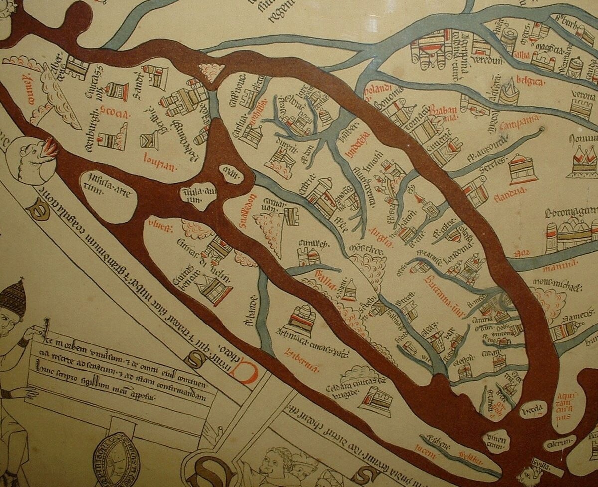
Hereford Mappa Mundi enhanced version with detail of British Isles.
Turn on "Dots" to find Hereford's location on this color-enhanced version of the Hereford Mappa Mundi. If you then scroll back to the original version and click on Dot #11, you will see how faded Hereford has become after centuries of visitors touching that "You Are Here" spot on the map.
[ 2024-01-10 08:09:18 ]
Meldemann print of the 1529 Turkish Seige of Vienna (1530)
Niklas Meldemann was a German printer and publisher in the 16th century. He is known for his association with the "Meldeman Plan," which was a visual representation of the events during the first Turkish siege of Vienna in 1529. Meldemann purchased a drawing from an unknown artist who had captured the events of the siege, and he had the original drawing engraved to create the first maps in May 1530. The "Meldeman Plan" provides a graphical description of the first siege of Vienna and is considered a significant historical artifact.
Source: perplexity.ai
Similar to the style of Mappa Mundi, the artist centers the map around St. Stephen's Cathedral, not because it is the most important feature but it was from the Cathedral's tower that he viewed the terrain and created this highly detailed image.
"The Meldeman-Plan shows a circular image of the besieged Vienna with St. Stephen's Cathedral in the middle, which is not topographically accurate, but more or less emphasized according to the importance of the areas shown. Similarly, numerous events during the siege are shown simultaneously within the image. Buildings are shown minimally while fortifications are shown in detail. On the outskirts of the town, the tents of the Turks are shown, with the main fighting and the destruction of the suburbs in the west and south are depicted. Most of the town is set ablaze while events such as war atrocities and executions also find their place." -K. Patowary
"The so-called Meldeman Plan is a unique and authentic representation of the First Turkish Siege of Vienna. With St. Stephen's Cathedral in the middle, the plan offers a panoramic view of besieged Vienna that is not topographically exact, but rather more or less emphasized according to the importance of the areas depicted. Within the picture, numerous events during the siege are depicted simultaneously. While buildings within the city may be neglected, the ramparts are depicted in detail. The suburbs of Vienna in the west and south are preferred over the north because scenes important to the siege took place in these areas. The tents of the besieging Turks, the most important fighting operations and the destruction of the suburbs are clearly visible. Events such as atrocities or executions also find their place.
The Meldeman Plan represents a visual report of a major political event at the time it happened and is of great importance for the history and topography of Vienna. In 1927 the woodcut, which was printed from six blocks, was purchased at an auction in Leipzig for the Historical Museum of the City of Vienna." Source: Wikipedia
E172 - Plan of Vienna Under siege - Nicholas Meldemann (Pixeum)
[ 2023-12-14 13:56:18 ]
E172 - The World by Hondius - 1630 - M5860 (DUPLICATED from E205)

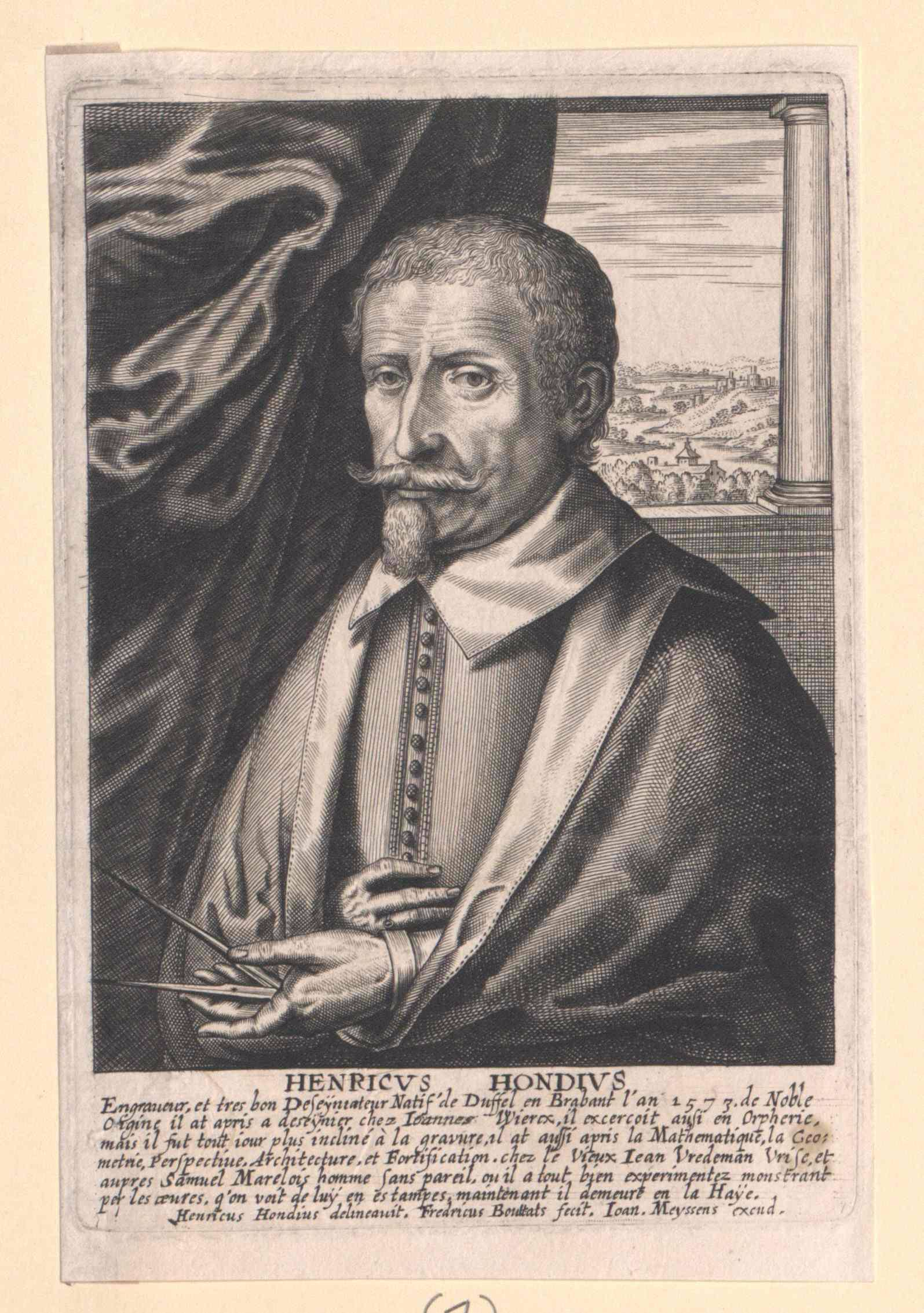
Hendrik Hondius (1573 - 1650) was a Dutch Golden Age engraver, cartographer and publisher. This wonderful and very detailed map was first published around 1630, in his famous atlas Atlantis Maioris. It was the first dated map published in an atlas, and therefore the first widely available map, to show any part of Australia. The map is within decorative border, with portraits of Julius Caesar, Ptolomey, Gerhard Mercator and Jodocus Hondius and tableaus depicting the 4 elements - Earth, Air, Fire and Water. Terra Incognita Maps
Nova Totius Terrarum Orbis Geographica ac Hydrographica Tabula is a map of the world created by Hendrik Hondius in 1630, and published the following year at Amsterdam, in the atlas Atlantis Maioris Appendix. Illustrations of the four elements of fire, air, water, and land are included. In the four corners, there are portraits of Julius Caesar, Claudius Ptolemy, and the atlas's first two publishers, Gerard Mercator and Jodocus Hondius, the father of Hendrik.[39] Among its claims to notability is the fact that it was the first dated map published in an atlas, and therefore the first widely available map, to show any part of Australia, the only previous map to do so being Hessel Gerritsz' 1627 Caert van't Landt van d'Eendracht ("Chart of the Land of Eendracht"), which was not widely distributed or recognised. The Australian coastline shown is part of the west coast of Cape York Peninsula, discovered by Jan Carstensz in 1623. Curiously, the map does not show the west coast features shown in Gerritsz' Caert. Wikipedia
E172 - Nova totius Terrarum Orbis geographica ac hydrographica tabula [ 2023-12-29 23:12:07 ]
Rare separately issued map of the world, being the first printed map to depict Western Australia, first issued by Jodocus Hondius in about 1625 and engraved by Francis van der Hoeye. This exceptional map is the earliest printed map to show the recent Dutch discoveries on the West Coast of Australia. Stanford's The Barry Lawrence Ruderman Map Collection, https://exhibits.stanford.edu/ruderman/catalog/nc157cg8390
Image Source: Wikipedia
https://en.wikipedia.org/wiki/Hendrik_Hondius_I
[ 2023-12-29 23:12:07 ]
John Fleming Map Share 13 April 2024
Los Angeles as it appeared in 1871, when Germain Seed and Plant Co was established
[ 2024-04-13 18:27:27 ]
Fred's Map
[ 2024-04-13 21:24:45 ]
[ 2025-01-09 11:55:56 ]
From: Chet Van Duzer <chet.van.duzer@gmail.com>
Sent: Thursday, January 9, 2025 1:28 AM
To: Thomas Paper <tom@websterpacific.com>
Subject: Fra Mauro mappamundi
Hi Tom,
I'm in Venice to image the Fra Mauro mappamundi -- fun stuff. I attach some images.
Best wishes,
Chet
[ 2025-01-09 11:55:56 ]
[ 2025-01-09 11:56:20 ]
From: Chet Van Duzer <chet.van.duzer@gmail.com>
Sent: Thursday, January 9, 2025 1:28 AM
To: Thomas Paper <tom@websterpacific.com>
Subject: Fra Mauro mappamundi
Hi Tom,
I'm in Venice to image the Fra Mauro mappamundi -- fun stuff. I attach some images.
Best wishes,
Chet
[ 2025-01-09 11:56:20 ]
[ 2025-01-09 11:56:32 ]
From: Chet Van Duzer <chet.van.duzer@gmail.com>
Sent: Thursday, January 9, 2025 1:28 AM
To: Thomas Paper <tom@websterpacific.com>
Subject: Fra Mauro mappamundi
Hi Tom,
I'm in Venice to image the Fra Mauro mappamundi -- fun stuff. I attach some images.
Best wishes,
Chet
[ 2025-01-09 11:56:32 ]
[ 2025-01-09 11:56:44 ]
From: Chet Van Duzer <chet.van.duzer@gmail.com>
Sent: Thursday, January 9, 2025 1:28 AM
To: Thomas Paper <tom@websterpacific.com>
Subject: Fra Mauro mappamundi
Hi Tom,
I'm in Venice to image the Fra Mauro mappamundi -- fun stuff. I attach some images.
Best wishes,
Chet
[ 2025-01-09 11:56:44 ]
Fra Mauro map - 1450
Place a DOT on the image


