

Mappa Mundi Exhibit (Courtney Spikes & Chet Van Duzer)
Step 0 of 0
1
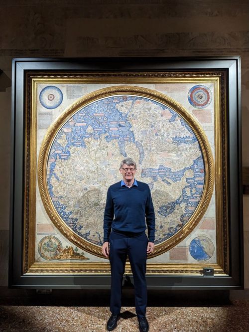
Chet Van Duzer in front of Fra Mauro
2
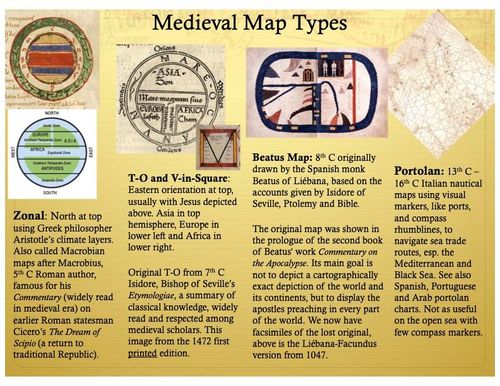
Medieval Map Types - Basic Introduction
3
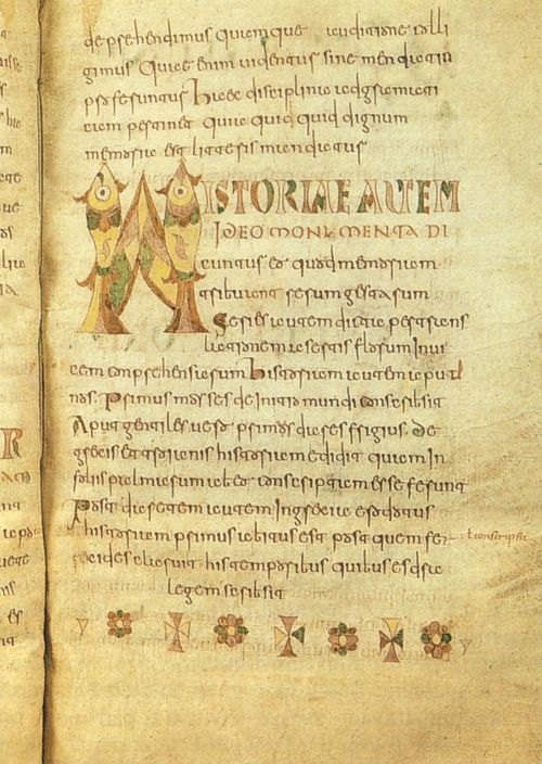
Isidore of Seville's Etymologiae (c. 625)
4
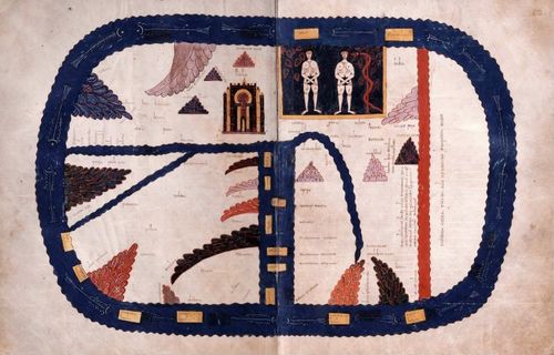
Beato of Liébana: The Codex of Fernando I and Doña Sancha (1047)
5
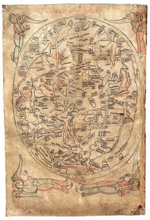
The Sawley Map c.1180
6
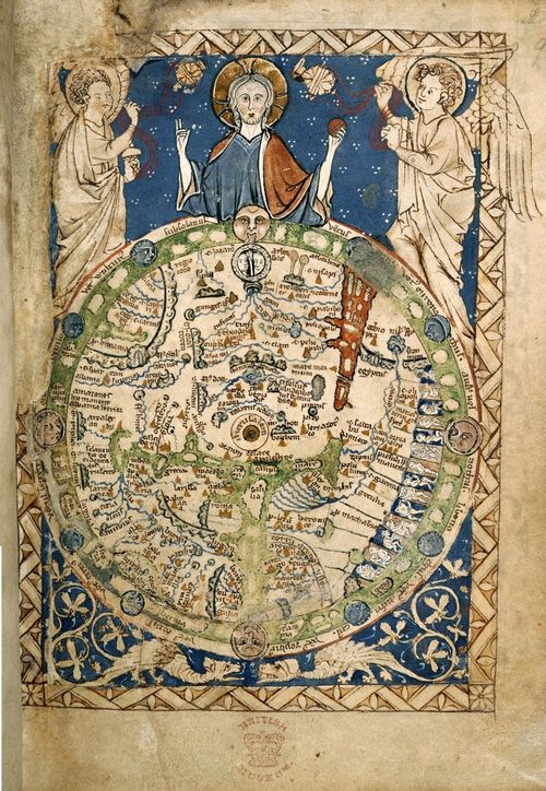
E172 - Psalter Map - 1225-1265 - M5743
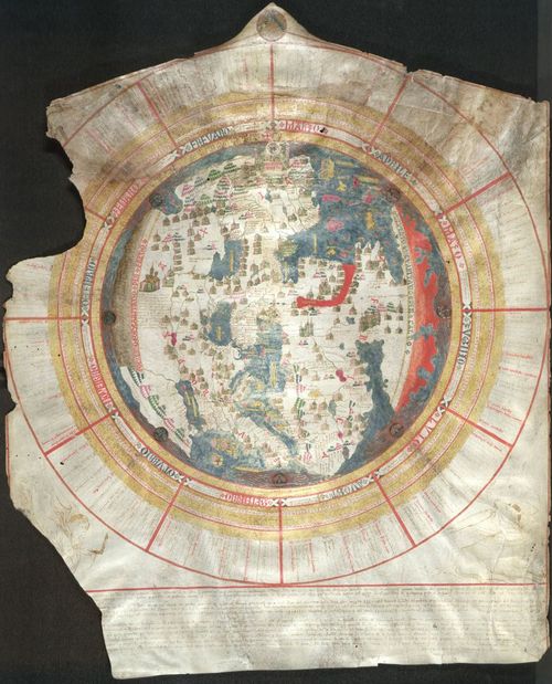
7
Psalter Map - 1265
8
The Ebstorf Map 1234
9
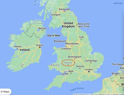
Hereford on UK map
10
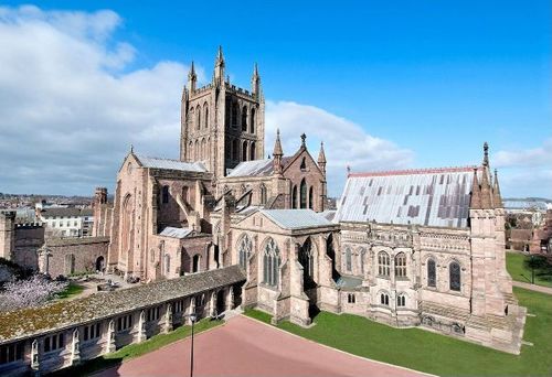
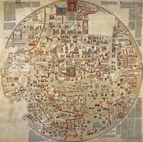
Hereford Cathedral Cloisters
11
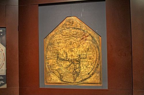
Hereford Mappa Mundi installation
12
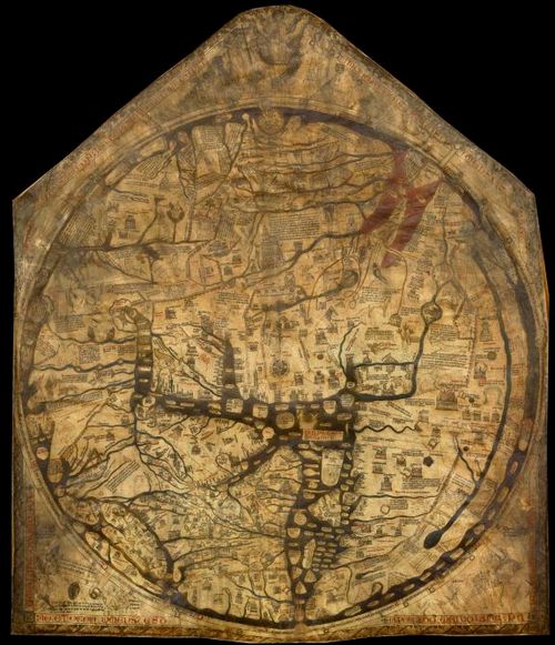
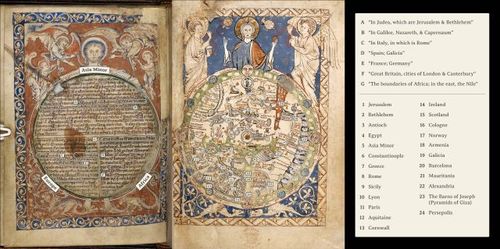
The Hereford Mappa Mundi c.1300
13
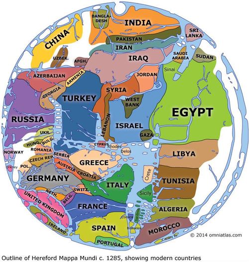
Hereford Mappa Mundi with modern countries
14

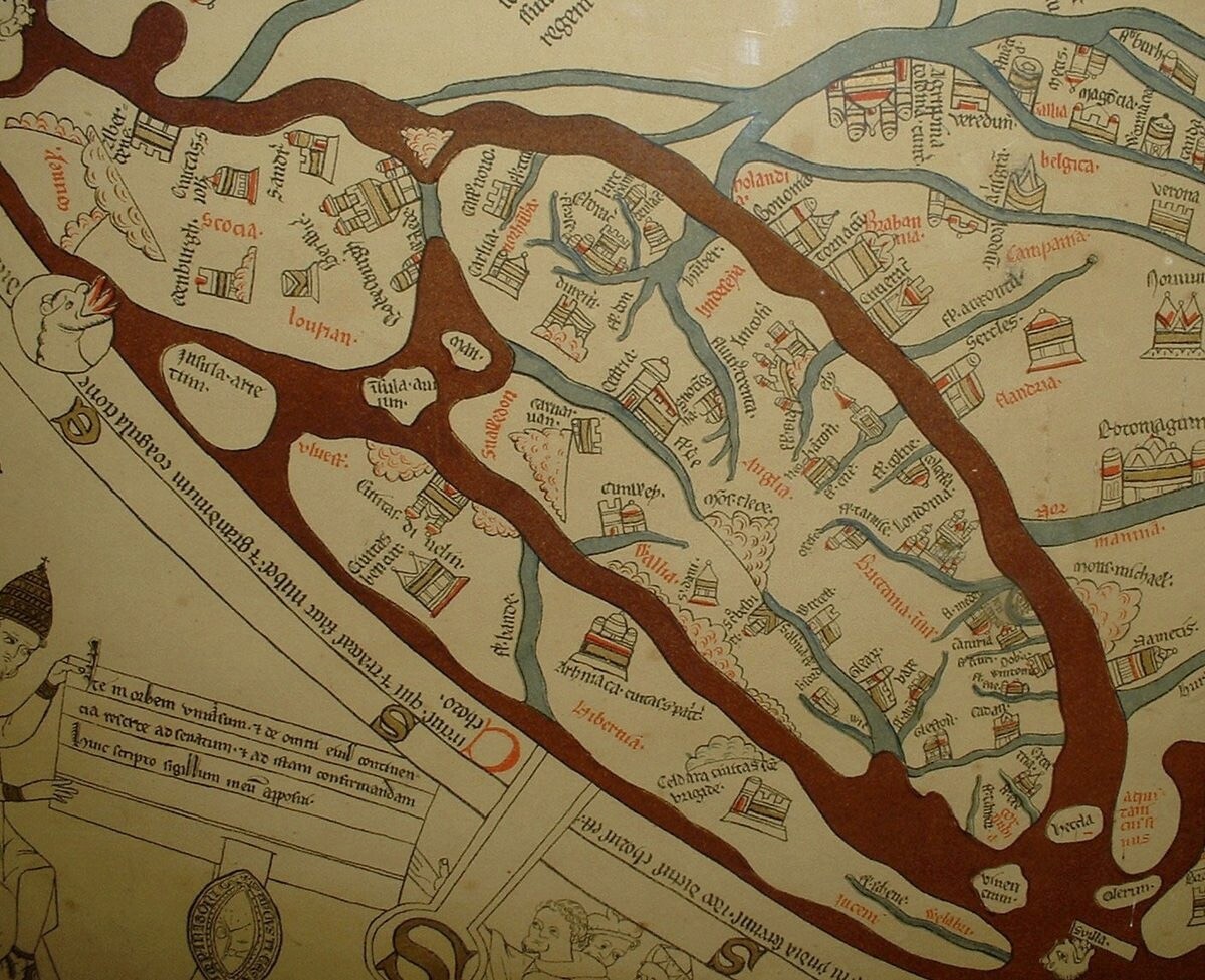
Hereford Mappa Mundi enhanced version with detail of British Isles.
15
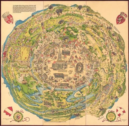
Meldemann print of the 1529 Turkish Seige of Vienna (1530)
16
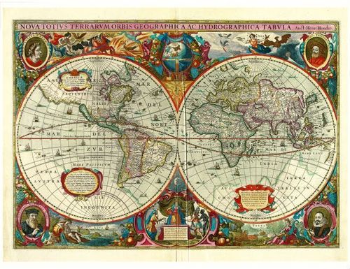
E172 - The World by Hondius - 1630 - M5860 (DUPLICATED from E205)
17
![E172 - Nova totius Terrarum Orbis geographica ac hydrographica tabula [ 2023-12-29 23:12:07 ]](https://iiif.pixeum.org/iiif/3/1703891654/full/500,/0/default.jpg)
E172 - Nova totius Terrarum Orbis geographica ac hydrographica tabula [ 2023-12-29 23:12:07 ]
18
![[ 2025-01-09 11:55:56 ]](https://iiif.pixeum.org/iiif/3/1736423775/full/500,/0/default.jpg)
[ 2025-01-09 11:55:56 ]
19
![[ 2025-01-09 11:56:20 ]](https://iiif.pixeum.org/iiif/3/1736423789/full/500,/0/default.jpg)
[ 2025-01-09 11:56:20 ]
20
![[ 2025-01-09 11:56:32 ]](https://iiif.pixeum.org/iiif/3/1736423801/full/500,/0/default.jpg)
[ 2025-01-09 11:56:32 ]
21

Chet Van Duzer with 1450 Fra Mauro mappamundi
22
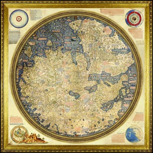
Fra Mauro map - 1450
23
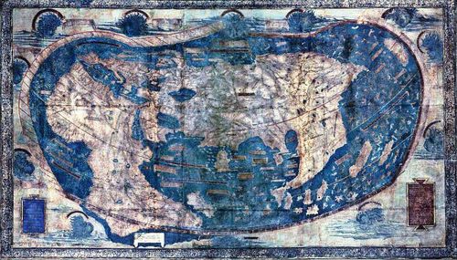
Martellus map - 1491
24
Leardo Mappamundi
25
![[ 2025-03-16 15:53:13 ]](https://iiif.pixeum.org/iiif/3/1742140408/full/500,/0/default.jpg)
[ 2025-03-16 15:53:13 ]
26

Greg Heyworth of Lazarus and Mary Bidney of the AGSL
27
![[ 2025-03-16 15:53:33 ]](https://iiif.pixeum.org/iiif/3/1742140423/full/500,/0/default.jpg)
[ 2025-03-16 15:53:33 ]
28
![[ 2025-03-16 15:53:47 ]](https://iiif.pixeum.org/iiif/3/1742140438/full/500,/0/default.jpg)
[ 2025-03-16 15:53:47 ]
Place a DOT on the image