

IMCoS Summer Talks - June 2021
Step 0 of 0
1
E167 - IMCoS Summer Talks - Overview
2

E167 - IMCoS Summer Talks - Daniel Crouch
3
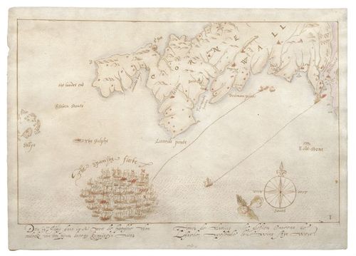
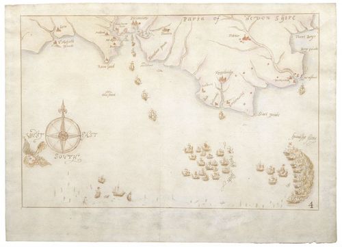
E167 - The Sighting
4
E167 - First Engagement
5
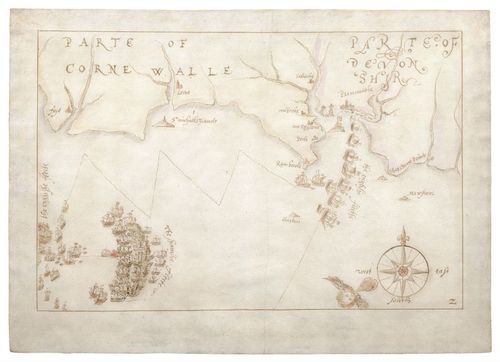
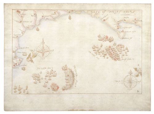
E167 - Skirmish off Plymouth
6
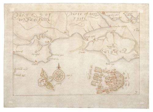
E167 - Drake Capture of the Rosario
7
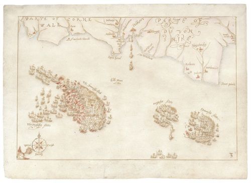
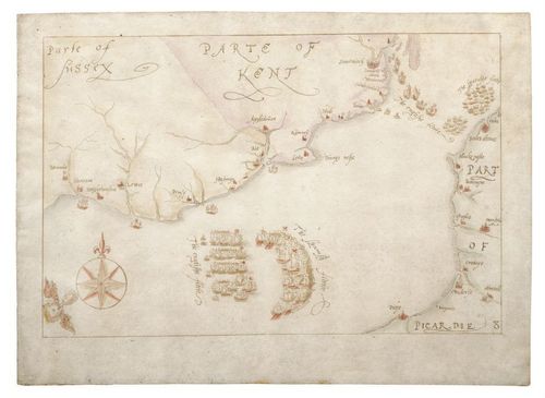
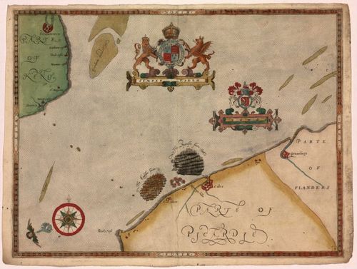
E167 - The Fleet off Berry Head
8

E167 - Engagement of the Fleets
9
E167 - The Battle off the Isle of Wight
10
E167 - The Pursuit to Calais
11
E167 - Fireship Attack
12
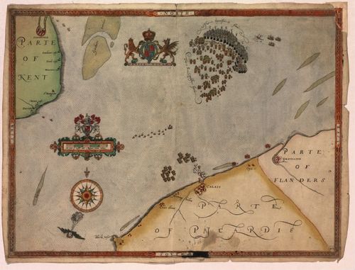
E167 - The Battle of Gravelines
13
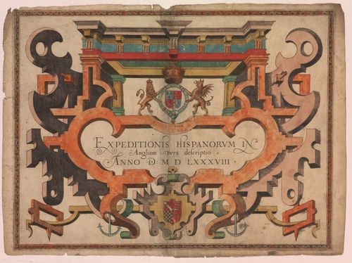
E167 - Title Page
14
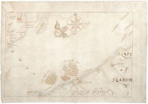
E167 - Map 1
15
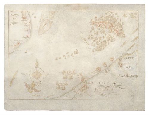
E167 - Map 2
16
E167 - Map 3
17
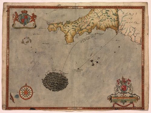
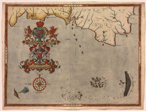
E167 - Map 4
18
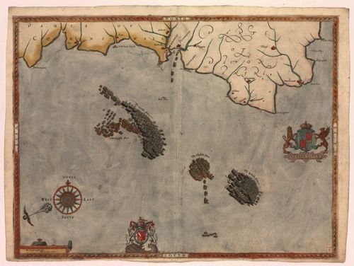
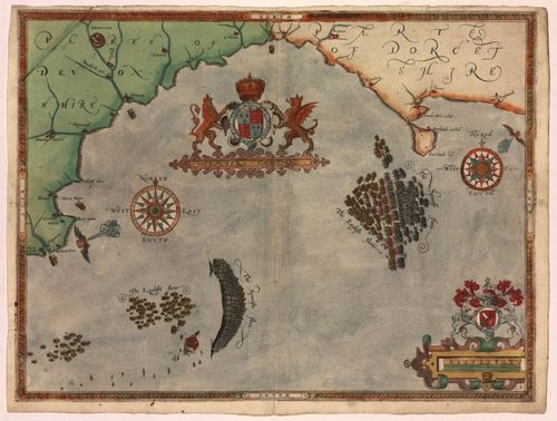
E167 - Map 5
19
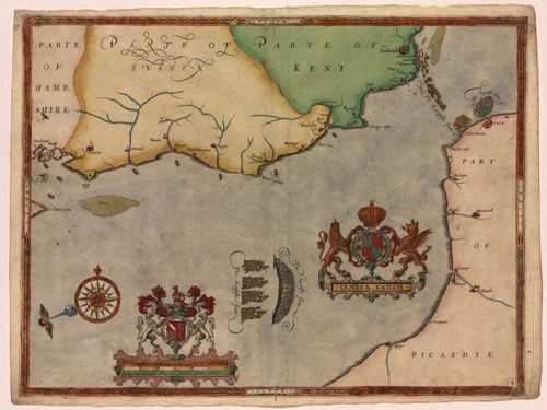
E167 - Map 6
20
E167 - Map 7
21

E167 - IMCoS Summer Talks - Peter Geldart
22
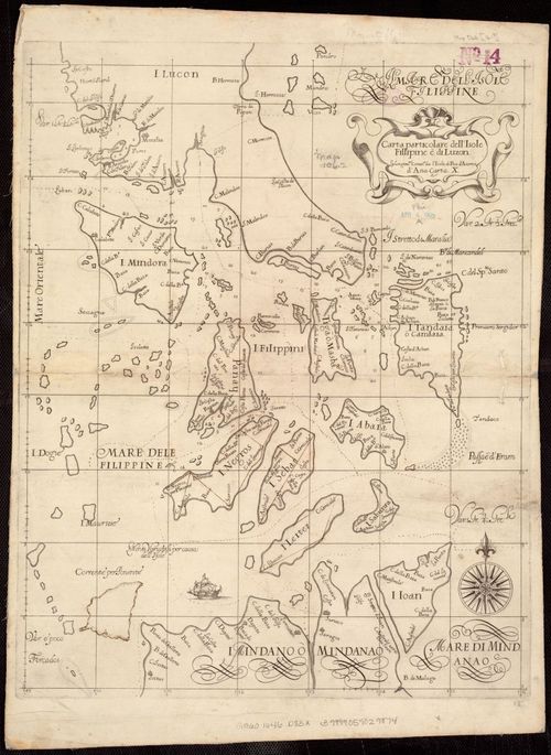
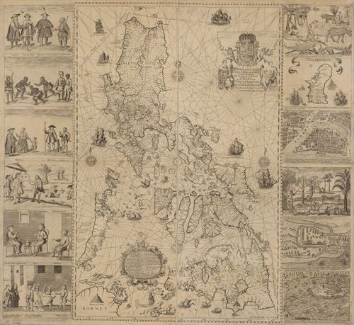
E167 - Carta particolare dell'Isole Fillipine è di Luzon : la longitune. cominca. de l'Isola di Pico d'Asores : d'Asia carta X 1646
23
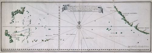
E167 - Plano de la Navegacion que executa la Nao de China desde Acapulco - José Francisco Badaraco
24
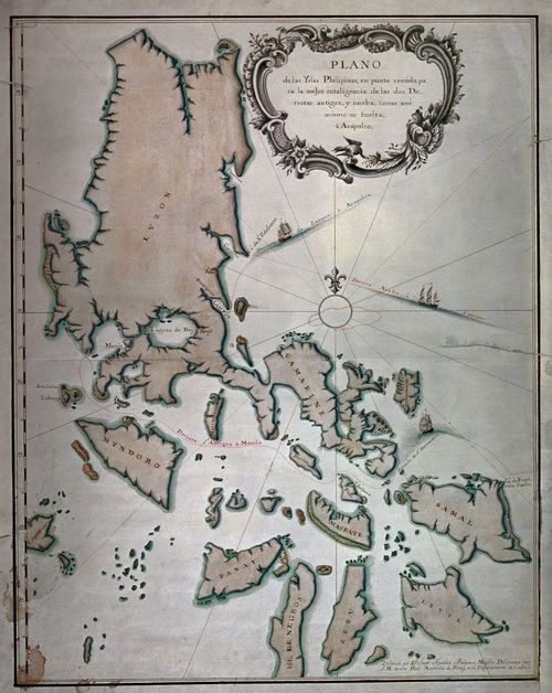
E167 - Plano de las Yslas Philipinas … by José Francisco Badaraco
25
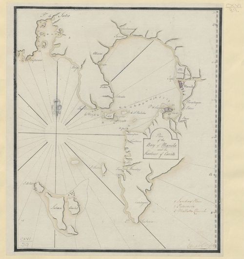
E167 - Plan of the Bay of Manila and Harbour of Cavite by Edward Cotsford, c1762
26
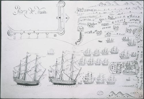
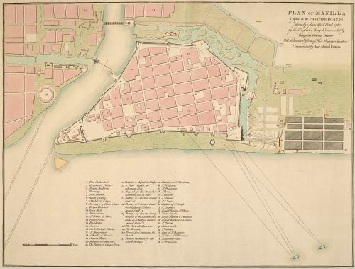
E167 - Plano de la ciudad de Manila, 1753
27
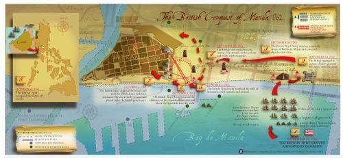
E167 - Map of the British Conquest of Manila in 1762
28
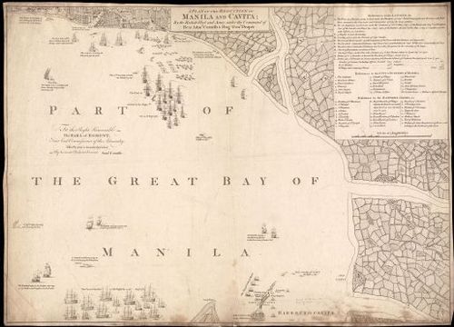
E167 - A Plan of the Reduction of Manila and Cavita … by Samuel Cornish
29
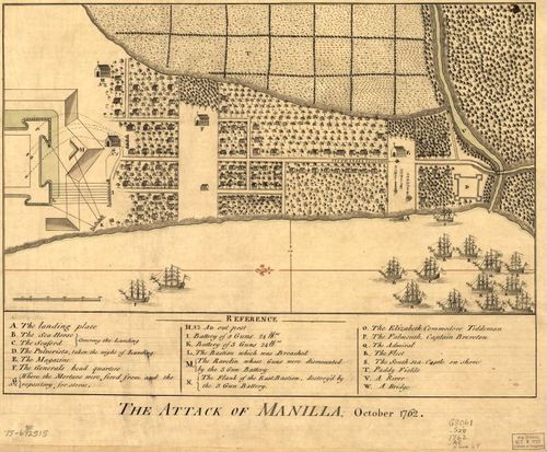
E167 - The Attack of Manilla, October 1762
30
E167 - Plan of Manilla Capital of the Philipines taken by Storm … by Edward Cotsford
31
E167 - Plano de la Bahía de Manila con la "Plaza de Manila", la "Plaza de Cavite" y los alrededores, y la situación del enemigo inglés por mar y tierra
32
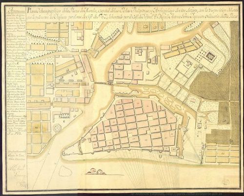
E167 - Plano ychnográphico de la Plaza de Manila … by Miguel Antonio Gomes
33
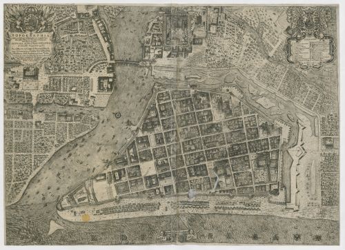
E167 - Topographia de la Ciudad de Manila by Antonio Fernandez de Roxas, 1737
34
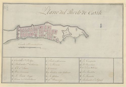
E167 - Plano del Puerto de Cavite 1750
35
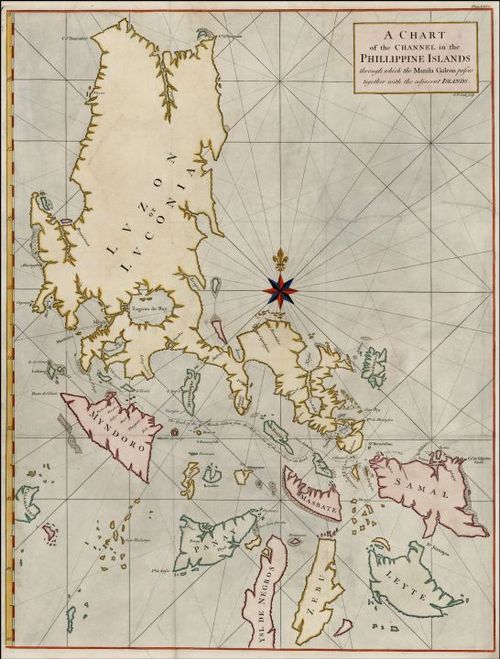
E167 - A Chart of the Channel in the Philipine Islands Through which the Manila Galeon passes, with a Map of Manila Island from the London Magazine, published by Richard Baldwin
36
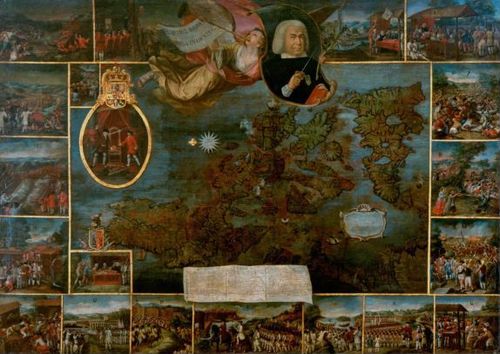
E167 - Alegoría de la defensa de Filipinas por el alavés Don Simón de Anda y Salazar. 1762-1763
37
E167 - Carta Hydrographica y Chorographica delas Yslas Filipinas by Murillo Velarde
38
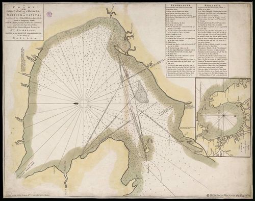
E167 - A Chart of the Great Bay of Manilla … published by William Gilbert, 1789
39
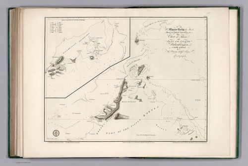
E167 - Chart of Felicia and Plan of the Island Balambangan by Alexander Dalrymple
40
E167 - Plan of Manilla ... Taken by Storm 1765
41

E167 - IMCoS Summer Talks - Paula van Gestel
42
E167 - IMCoS Summer Talks - Wes Brown
Place a DOT on the image