Britannia Depicta or Ogilby Improv'd 1720
Step 0 of 0
1

2

3

4

5

6

7

8

9

10

11

12

13

14

15

16

17

18

19

20

21

22

23

24

25

26

27

28

29

30

31

32

33

34

35

36

37

38

39

40

41

42

43

44

45

46

47

48

49

50

51

52

53

54

55

56

57

58

59

60

61

62

63

64

65

66

67

68

69

70

71

72

73

74

75

76

77

78

79

80

81

82

83

84

85

86

87

88

89

90

91

92

93

94

95

96

97

98

99

100

101

102

103

104

105

106

107

108

109

110

111

112

113

114

115

116

117

118

119

120

121

122

123

124

125

126

127

128

129

130

131

132

133

134

135

136

137

138

139

140

141

142

143

144

145

146

147

148

149

150

151

152

153

154

155

156

157

158

159

160

161

162

163

164

E127.D2 - 1720 Britannia Depicta by Ogilby, Bownen & Owen
E127.D3 - 1720 Britannia Depicta by Ogilby, Bownen & Owen
E127.D4 - 1720 Britannia Depicta by Ogilby, Bownen & Owen
E127.D5 - 1720 Britannia Depicta by Ogilby, Bownen & Owen
http://www.eeescience.utoledo.edu/faculty/harrell/egypt/Turin%20Papyrus/Harrell_Papyrus_Map_text.htm
E127.D6 - 1720 Britannia Depicta by Ogilby, Bownen & Owen
E127.D7 - 1720 Britannia Depicta by Ogilby, Bownen & Owen
E127.D8 - 1720 Britannia Depicta by Ogilby, Bownen & Owen
https://commons.wikimedia.org/wiki/File:Roman_Roads_of_Britain_-_Matthew_Paris,_Book_of_Additions_(c.1250),_f._187v.jpg
E127.D9 - 1720 Britannia Depicta by Ogilby, Bownen & Owen
E127.D10.5 - 1720 Britannia Depicta by Ogilby, Bownen & Owen
E127.D10 - 1720 Britannia Depicta by Ogilby, Bownen & Owen
E127.D11 - 1720 Britannia Depicta by Ogilby, Bownen & Owen
E127.D12 - 1720 Britannia Depicta by Ogilby, Bownen & Owen
E127.D13 - 1720 Britannia Depicta by Ogilby, Bownen & Owen
E127.D14 - 1720 Britannia Depicta by Ogilby, Bowen & Owen
E127.001 - Covers: Britannia Depicta or Ogilby Improved.
E127.002 - Britannia Depicta or Ogilby Improved.
E127.003 - Table of All of the Roads contain'd in this Book.
E127.004 - Table of ye Cities, Towns & describ'd in this Book.
E127.005 - Table of Contents of all the maps contained in this Book.
E127.006 - Road from London to Aberistwith (Aberystwyth). Map of Cardiganshire.
E127.007 - London to Islip, to Oxford.
E127.008 - Islip to Bramyard (Bromard).
E127.009 - Bramyard to Aberistwith (Aberystwyth).
E127.010 - Road from London to Arundel. A Map of Sussex.
E127.011 - Road from London to Arundel, to Chichester. (continued.) London to Barwick. Nottinghamshire.
E127.012 - London to Barwick. (continued.)
E127.013 - London to Barwick. (continued.)
E127.014 - London to Barwick. (continued.)
E127.015 - London to Barwick. (continued.)
E127.016 - London to Barwick. (continued.)
E127.017 - Road from London to Bristol. A Map of Middlesex.
E127.018 - Road from London to Bristol (continued.)
E127.019 - Road from London to Bristol (continued.) Road from London to Buckingham. Map of Northamptonshire.
E127.020 - Road from London to Buckingham (continued.)
E127.021 - Road from London to Buckingham (continued.)
E127.022 - Road from London to St. David's. Map of Glamorganshire.
E127.023 - Road from London to St. David's (continued.)
E127.024 - Road from London to St. David's (continued.)
E127.025 - Road from London to St. David's (continued.)
E127.026 - Road from London to St. David's (continued.) Road from London to Dover.
E127.027 - Road from London to Dover. (continued.)
E127.028 - Road from London to Harwich.
E127.029 - Road from London to Harwich. (continued.) Road from London to Hith.
E127.030 - Road from London to Hith.
E127.031 -Road from London to Holy-Head. Mona, now called Anglesey Island.
E127.032 - Road from London to Holy-Head. (continued.)
E127.033 - Road from London to Holy-Head. (continued.)
E127.034 - Road from London to Holy-Head. (continued.)
E127.035 - Road from London to Holy-Head. (continued.) Road from London to the Lands-End.
E127.036 - Road from London to the Lands-End. (continued.)
E127.037 - Road from London to the Lands-End. (continued.)
E127.038 -Road from London to the Lands-End. (continued.)
E127.039 - Road from London to the Lands-End. (continued.)
E127.040 - Road from London to Newhaven.
E127.041 - Road from London to Newhaven. (continued.) Road from London to Portsmouth.
E127.042 - Road from London to Portsmouth. (continued.)
E127.043 - Road from London to Portsmouth. (continued.) Road from London to Rye.
E127.044 - Road from London to Rye. (continued.) Roads from London to Barnstable.
E127.045 - Roads from London to Barnstable. (continued.)
E127.046 - Roads from London to Barnstable. (continued.)
E127.047 - Roads from London to Barnstable. (continued.)
E127.048 - Road from London to Bath & Wells.
E127.049 - Road from London to Bath & Wells. (continued.) Roads from London to Boston.
E127.050 - Roads from London to Boston.
E127.051 - Road from London to Carlisle.
E127.052 - Road from London to Carlisle. (continued.)
E127.053 - Road from London to Carlisle. (continued.) Road from London to Chichester.
E127.054 - Road from London to Chichester. (continued.)
E127.055 - Road from London to Darby (Derby). A Map of Darbyshire(Derbyshire).
E127.056 - Road from London to Darby (Derby). (continued.) Road from London to Flamborough.
E127.057 - Road from London to Flamborough. (continued.)
E127.058 - Road from London to Flamborough. (continued.)
E127.059 - Road from London to Kings Lyn. Map of Cambridgeshire.
E127.060 - Road from London to Kings Lyn. (continued.) Road from London to Montgomery. Merionethshire.
E127.061 - Road from London to Montgomery. (continued.)
E127.062 - Road from London to St. Neots.
E127.063 - Road from London to St. Neots. (continued.) Road from London to Norwich. Map of Rutlandshire (Rutland).
E127.064 - Road from London to Norwich. (continued.)
E127.065 - Road from London to Oakham. Bedfordshire.
E127.066 - Road from London to Oakham. (continued.)
E127.067 - Road from London to Oakham. (continued.)
E127.068 - Road from London to Oakham. (continued.) Road from London to Shrewsbury. Shropshire.
E127.069 - Road from London to Shrewsbury. (continued.)
E127.070 -Road from London to Southampton. Smaller Islands in the British Ocean.
E127.071 - Road from London to Southampton. (continued.) Road from London to Wells. Hertfordshire.
E127.072 -Road from London to Wells. (continued.)
E127.073 - Road from London to Weymouth. Map of Wiltshire.
E127.074 - Road from London to Weymouth. (continued.) Road from London to Yarmouth. Buckinghamshire.
E127.075 -Road from London to Yarmouth. (continued.)
E127.076 - Road from Bristol to Banbury. Map of Oxfordshire.
E127.077 - Road from Bristol to Banbury. (continued.) Road from Bristol to Westchester. Map of Herefordshire.
E127.078 - Road from Bristol to Westchester. (continued.)
E127.079 - Road from Bristol to Westchester. (continued.)
E127.080- Road from Bristol to Exeter. Devonshire (Devon).
E127.081 - Road from Bristol to Exeter. (continued.) Road from Bristol to Worcester. Map of Worcestershire.
E127.082 - Road from Bristol to Worcester. (continued.)
E127.083 -Road from Bristol to Weymouth. Dorsetshire.
E127.084 - Road from Bristol to Weymouth. (continued.) Road from Cambridge to Coventry.
E127.085 - Road from Cambridge to Coventry. (continued.)
E127.086 - Road from Carlisle to Rarwick (Barwick). North & East Riding of Yorkshire.
E127.087 - Road from Carlisle to Rarwick (Barwick). (continued.) Road from Chester to Cardiff. Map of Brecknockshire.
E127.088 - Road from Chester to Cardiff. (continued.)
E127.089 - Road from Chester to Cardiff. (continued.)
E127.090 - Road from Dartmouth to Minhead. Map of Somersetshire (Somerset).
E127.091 - Road from Dartmouth to Minhead. (continued.) Road from St. Davids to Holywell. Pembrokeshire.
E127.092 - Road from St. Davids to Holywell. (continued.)
E127.093 - Road from St. Davids to Holywell. (continued.)
E127.094 - Road from Exeter to Barnstable.
E127.095 - Road from Exeter to Barnstable. (continued.) Road from Exeter to Truro. Map of Cornwall.
E127.096 - Road from Exeter to Truro. (continued.)
E127.097 - Road from Glocester to Coventry. Map of Denbighshire.
E127.098 - Road from Glocester to Coventry. (continued.) The Road from Glocester to Montgomery. A Map of Montgomeryshire.
E127.099 - Road from Glocester to Montgomery. (continued.)
E127.100 - Road from Hereford to Leicester. A Map of Leicestershire.
E127.101 - Road from Hereford to Leicester. (continued.) Road from Huntingdon to Ipswich. Huntingdonshire.
E127.102 - Road from Huntingdon to Ipswich. (continued.)
E127.103 - Road from Ipswich to Norwich. Map of Suffolk.
E127.104 - Road from Ipswich to Norwich. (continued.) Road from Kings Lyn to Harwich.
E127.105 - Road from Kings Lyn to Harwich. (continued.)
E127.106 - Road from Kings Lyn to Norwich. A Map of Norfork.
E127.107 - Road from Kings Lyn to Norwich. (continued.) Road from Monmouth to Lenbeder. Monmouthshire.
E127.108 - Road from Monmouth to Lenbeder. (continued.)
E127.109 - Road from Nottingham to Grimsby. A Map of Lincolnshire.
E127.110 - Road from Nottingham to Grimsby. (continued.) Road from Oxford to Bristol.
E127.111 - Road from Oxford to Bristol. (continued.)
E127.112 - Road from Oxford to Cambridg (Cambridge).
E127.113 - Road from Oxford to Cambridg (Cambridge). (continued.) Road from Oxford to Chichester.
The first edition, first issue of a small size edition of Olgilby's 1675 road atlas of England and Wales, our Pub List No. 9735.000. Ogilby's 1675 edition was so large that we assume few travelers could actually take it on the road. This small edition was far more portable. Revised with additional text, coats-of-arms, town descriptions (revised) and county maps. "First edition, first issue of this of this highly popular reduced version of John Ogilby's 1675 road atlas; Bowen's address given as "next ye King of Spain", plate 128 misnumbered 121, and plates 74 and 75 transposed. Bowles decided to go one better than Thomas Gardner and John Senex, who were planning reduced size re-issues of Ogilby, by augmenting the work with 54 county maps and "a multitude of historical, topographical and statistical information" (Hodson) by the antiquarian John Owen, the whole engraved onto 273 strip-maps by Emanuel Bowen. Bowles puffed the work extravagantly claiming, that "One leaf of this, contains more Observations than any whole book of this Nature yet publish'd", and seems to have stirred up "a great demand as there were four editions issued from 1720 to 1724" (Chubb). How practical this was as a road-book is questionable, the lay-out is rather cluttered with three or four road strips per page, together with the county maps, armorials, and minisculely engraved cursive text, however, it is certainly lively, and undoubtedly would have possessed considerable novelty on publication. Ogilby's survey itself was the first of the roads of England and Wales, "and [he] is probably best known on this account . Sir H.G. Fordham . says [the survey] 'is of particular and historical importance, as it displaced the old British mile of 2,428 yards, and substituted it for the statute mile of 1,760 yards, thus effecting a revolution in customary measurements'" (Chubb, p. 444)." (Daniel Crouch).
E127.114 - Road from Oxford to Chichester. (continued.)
E127.115 - Road from Oxford to Coventry. Warwickshire.
E127.116 - Road from Oxford to Coventry. (continued.) Roads from Oxford to Salisbury. Berkshire.
E127.117 - Roads from Oxford to Salisbury. (continued.)
E127.118 - Road from Prestain to Carmarthen. Map of Radnorshire.
E127.119 - Road from Prestain to Carmarthen. (continued.) Road from Salisbury to Campden. Glocestershire (Gloucestershire).
E127.120 - Road from Salisbury to Campden. (continued.)
E127.121 - Road from Tinmouth to Carlisle. Map of Northumberland.
E127.122 - Road from Tinmouth to Carlisle. (continued.) Road from Welshpool to Carnarvan. Carnarvanshire (Caernarvanshire).
E127.123 - Road from Welshpool to Carnarvan (Caernarvan). (continued.)
E127.124 - Road from York to Lancaster. Lancashire.
E127.125 - Road from York to Lancaster. (continued.) Roads from York to West Chester. Map of Cheshire.
E127.126 - Roads from York to West Chester. (continued).
E127.127 - Roads from York to West Chester. (continued).
E127.128 - Roads from Cardigan to Lladebar. Map of Carmarthenshire.
E127.129 - Roads from Cardigan to Lladebar. (continued.) Roads from Chelmsford to Bury St. Edmunds. Map of Essex.
E127.130 - Roads from Chelmsford to Bury St. Edmunds. (continued.)
E127.131 - Road from Chelmsford to Maldon. Map of Kent.
E127.132 - Road from Chelmsford to Maldon. (continued.) Roads from Exeter to Dorchester.
E127.133 - Roads from Exeter to Dorchester. (continued.)
E127.134 - Road from Ferribridg to Borobridg. West Riding of Yorkshire.
E127.135 - Road from Ferribridg to Borobridg. (continued.) Road from Kendal to Cockermouth. Cumberland.
E127.136 - Road from Kendal to Cockermouth. (continued.)
E127.137 - Road from London to Pool. Map of Hampshire.
E127.138 - Road from London to Pool. (continued.) Road from Shrewsbury to Holywell. Flintshire.
E127.139 - Road from Shrewsbury to Holywell. (continued.)
E127.140 - Road from Whitby to Durham. Map of Durham.
E127.141 - Road from Whitby to Durham. (continued.) Roads from York to Whitby's & Scarboro. Map of Westmoreland (Westmorland).
E127.142 - Roads from York to Whitby's & Scarboro. (continued.)
E127.B.001 - Ogilby 1675 Covers
E127.B.002 - Ogilby 1675 Frontispiece 1
E127.B.003 - Ogilby 1675 Title
E127.B.028 - Ogilby 1675 Road from London to Aberistwith
E127.B.029 - Ogilby 1675 Text 1
E127.B.030 - Ogilby 1675 Text 2
E127.C.026 - Ogilby Willdey Map of the Roads of England 1717
Place a DOT on the image




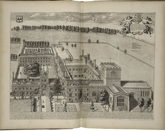
 Aan engraving by John Bareblock from 1566.











No dots yet