IMCoS Show and Tell - February 25, 2021
Step 0 of 0
1

2

3

4

5

6

7

8

9

10

11

12

13

14

15

16

17

18

19

20

21

22

23

24

25

26

27

28

29

30

31

32

33

34

35

36

37

38

39

40

41

42

43

44

45

46

47

48

49

50

51

52

53

54

55

56

57

58

59

60

61

62
63

64

65

66

67

68

69

70

71

72

73

74

75

76

77

78

79

80

81

82

83

84

85

86

87

88

89

90

91

92

93

94

95

96

97

98

99

E126 IMCoS Intro Slide
Our ten presenters are a mix - famous names and new faces - whether collector, dealer, enthusiast or academic, each is passionate about what they will be bringing before us. The contributed items are an equal mix - maps, a globe, an atlas, and town plans. The significance of these contributions ranges from the historical and topographical to the cultural and the linguistic. The items range from the 16th to the 20th Centuries.
E126 IMCoS Nick Kanas
Brief Biosketch: Nick Kanas, M.D. (January 2, 2020)
Dr. Kanas is an Emeritus Professor of Psychiatry at the University of California, San Francisco (UCSF). He trained at Stanford University (B.A. Psychology), UCLA Medical School (M.D. 1971), University of Texas Medical Branch in Galveston (Internship), and UCSF (Psychiatry Residency 1975). He joined the faculty at UCSF and the affiliated San Francisco VA Medical Center, where he conducted clinical and research work on people suffering from stressful conditions for over 35 years. For over 15 years, he was a NASA-funded principal investigator, doing psychological research with astronauts and cosmonauts. He has over 215 professional publications and is the recipient of the Dr. J. Elliott Royer Award for academic psychiatry and the International Academy of Astronautics Life Science Award.
Dr. Kanas has been an amateur astronomer since childhood. He is a Fellow of the Royal Astronomical Society (London). He has collected antiquarian star maps for over 37 years and has given talks on celestial cartography to amateur and professional groups, including the Adler Planetarium; the Lick Observatory; the California Academy of Sciences; and annual meetings of the International Conference on the History of Cartography, the Society for the History of Astronomy, and the Flamsteed Astronomical Society in Greenwich, U.K. He has published articles on celestial cartography in magazines and journals, such as Sky and Telescope, Imago Mundi, and the Journal of the International Map Collectors Society. He has written two celestial map-related books: Star Maps: History, Artistry, and Cartography (3rd ed.), and Solar System Maps: From Antiquity to the Space Age. He also has published three science fiction novels.
E126 Nick Kanas - Slide 1
E126 Nick Kanas - The Daily Telegraph London 1950
A terrestrial pictorial city map labelled The Daily Telegraph Picture Map of London, produced in 1950 by Geographia Ltd. 45.7 X 69.8 cm. It depicts the people, places of interest, boroughs, and streets of the city using bright colors, varied textual fonts, expanded images of famous buildings, and humorous images of subjects that are characteristic of famous places. The border shows vehicles and cartoonish people dressed in the style of the late 1940s. Mapping © Geographia Ltd. 1950, reproduced with kind permission of HarperCollins Publishers Ltd.
E126 Nick Kanas - Air France - Lucien Boucher - 1953
A promotional poster for Air France produced by Lucien Boucher in 1951. 36.8 X 57.2 cm. Note in the lower foreground a globe showing countries over which are principal air routes of Air France from. In the background are the northern and southern celestial hemispheres showing dramatic images of the constellations and their principal stars using a stylized Art Deco format. The effect is to link the routes of Air France with the mystique and romance of the heavens. This item from David Rumsey. The Nick and Carolynn Kanas collection have a similar item with lighter colors.
E126 Nick Kanas - Myths Maps and Men - Merrill Lynch - 1969
A promotional poster produced by Merrill Lynch to celebrate the Moon landing in 1969 entitled Myths, Maps & Men: Merrill Lynch Salutes the Year of the Moon. 36.6 X 42.7 cm. Note the American eagle at the top, on which are sitting three U.S. presidents; the double hemisphere map of the Moon separated by an Apollo rocket in the center, with cartoonish figures and humorous labels on the lunar surface; and a tribute to the event and hopes for the future in the two curtains on either side of the central cartouche at the bottom.
E126 Nick Kanas - Slide 5
This is the third edition of my book, which is hard-bound and includes new chapters on pictorial maps and celestial images in art. I included the latter based on the subtitle of the book: “Artistry”. It is my contention that most celestial maps are not only artistic in their style, but they have appeared as content in paintings, sculptures, and other art forms that were admired by people for their beauty and artistry. In this talk, I plan to show examples of this going back thousands of years.
E126 IMCoS Wes Brown
Wesley Brown has been a collector of old maps for forty years. His collection focuses on two areas (1) the earliest world maps from 1472 to 1540 and (2) the exploration and settlement of Colorado from the 16th through 20th centuries. A Denver resident, he co-founded the Rocky Mountain Map Society in 1991. Wes has served as the Co-Chairman of the national map and geography society of the Library of Congress. He is a frequent speaker at map and history conferences and has published many papers on maps.
Wes fell in love with maps at age 16 using U.S. Geological Survey maps for climbing mountains. He has since climbed over 400 named peaks. For 14 years he used topo maps weekly as a Field Active member of Alpine Rescue Team in Colorado.
E126 Wes Brown - Alta 1992
E126 IMCoS Deirdre Boys
Deirdre Boys works as a paediatrician, specialising in neurodevelopment and the health of looked after children. Her interest in antique maps started towards the end of 2016 when she bought her first antique map. Her main focus is on miniature or small maps of the African continent and the areas around Kenya, Malawi and Zimbabwe produced prior to 1800. She does stray outside those boundaries at times. Why Africa? Her childhood was spent in Africa and she likes the fact that many of the maps were based on legends rather than fact. Most of her maps are completely useless when it comes to finding your way around!
E126 Deirdre Boys - St. Helena - Read 1817
E126 Deirdre Boys Sources
E126 IMCoS Martin Van Brauman
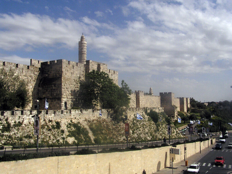
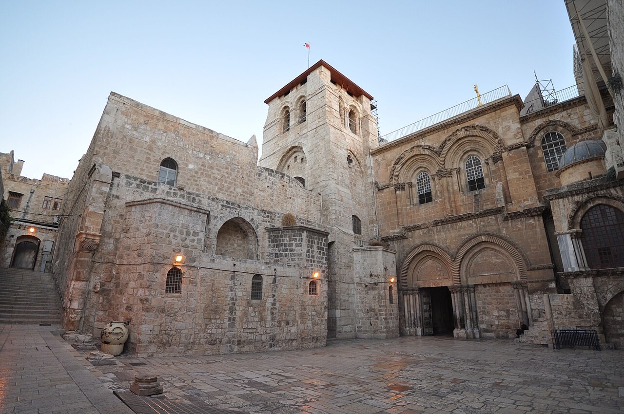
Martin M. van Brauman, as a collector the focus has been on maps of the Holy Land and Jerusalem, which number close to 100 early edition maps by Schedel, Fries, Mūnster, Camocio, Duchetti, Braun, Hogenberg, Bünting, Ortelius, de Jode, Adrichomius, Blaeu, Baudoin, Merian, Boisseau, Fuller, Hollar, Janssonius, Hornius, Speed, Dapper, Moxon, Visscher, Montano, Varea, Chatelain, Covens, Mortier, Moll, Calmet, Seutter and Basire. I have been comparing each early edition map and researching differences and similarities between the maps by the cartographers and engravers and by watermarks, etc. From this study, I have been writing a book entitled SACRED GEOGRAPHY AND SACRED SPACE, 15th TO 19th CENTURY Maps of THE HOLY LAND and JERUSALEM, A WINDOW INTO CHRISTIAN AND JEWISH ESCHATOLOGY., which I plan to publish (up to 70,000 words of text and still examining the maps and collecting rare maps).
As the Executive VP, Corporate Secretary, Treasurer and Director of Zion Oil & Gas, Inc., I usually make a yearly trip to our offices in Israel. B.E., Vanderbilt University; J.D., St. Mary’s University; M.B.A. and LL.M., Southern Methodist University. Advisory Board of the Jewish and Israel Studies Program, University of North Texas. Author of Jews and Christians, Fellow Travelers to the End of Days, (2nd ed. 2020).
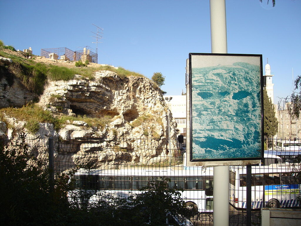
E126 Martin Van Brauman - Jerusalem photo
E126 Martin Van Brauman - Jerusalem map
E126 Martin van Brauman - Civitas Hierusalem - Giovanni Francesco Camocio - 1570
E126 IMCoS Daniel Crouch
Daniel has worked as a bookseller since the age of sixteen; first at Sanders of Oxford on weekends and holidays whilst at school and university, before starting full-time in 1997 and becoming general manager in 1998. Subsequent to this, he left to work as a business developer in the book department at Bonham’s auction house in 1999. In 2002 he was invited to set up a map and atlas department at Bernard Shapero Rare Books in London.
Daniel has given numerous lectures on maps and atlases, including talks at the Library of Congress, the Minneapolis Institute of Arts, and the Fine Art Museum, Houston.
In the summer of 2010, with the support of a group of their customers, Daniel together with Nick Trimming started Daniel Crouch Rare Books. Daniel still lives in Oxford with his wife, Jen, and two young daughters.
E126 Daniel Crouch Slide 1
E126 Daniel Crouch Slide 2
E126 Daniel Crouch Slide 3
E126 Daniel Crouch Slide 4
E126 Daniel Crouch Slide 5
E126 Daniel Crouch Slide 6
E126 Daniel Crouch Slide 7
E126 Daniel Crouch Slide 8
E126 Daniel Crouch Slide 9
E126 Daniel Crouch Slide 10
E126 Daniel Crouch Slide 11
E126 Daniel Crouch Slide 12
E126 Daniel Crouch Slide 13
E126 Daniel Crouch Slide 14
E126 Daniel Crouch Slide 15
E126 Daniel Crouch Slide 16
E126 IMCoS Mark Rogers
Mark Rogers started his career in the British Royal Navy as a Weapons Engineer. He is now a Manager for London Underground working in electrical Power Distribution, managing a team of Engineers that educate and licence apprentices, power engineers and managers in technical disciplines, for work on substation equipment up to 22000VAC. His love for map collecting started over 23 years ago with a trip to Edinburgh, Scotland. His collecting area of interest is Antarctica and the Southern Hemisphere; and in the last 12 months he has also started collecting globes and cartographic reference books & material. He has been a member of IMCoS for about 15 years and is currently the photographer for IMCoS events.
E126 IMCoS David Webb
David Webb joined IMCoS in June 1980 at a meeting held by Yasha Beresina in Birmingham, where it was proposed that a society should be formed for anyone interested in antique maps. He was, for a number of years, the official photographer of the Society. He has collected and researched Antique Road Maps extensively - in particular, anything in the style of Ogilby, such as the Owen & Bowen Atlases. He is the only IMCoS member who has been to every Symposium held abroad (although unfortunately he was ill and had to miss the one held in London!)
E126 David Webb - Herman Moll 1 - London to Lands End
E126 David Webb - Herman Moll 4 - London to Lands End detail
E126 David Webb - Herman Moll 3j - London to Dover detail
E126 IMCoS Joseph Schiro
E126 Joseph Schiro Overview Hal Muxi
E126 Joseph Schiro Hal Muxi 1691
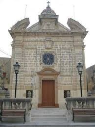
This beautiful finely-executed manuscript map of the village of Hal-Muxi which is found in my collection is linked with a murder. It tells the story of a man who sought sanctuary in the church of the Assumption at Ħal-Muxi (shown in the map) after he had killed a man during a botched-up robbery.
When the civil authorities heard about the case, police were immediately sent to the area waiting for the fugitive to come out of the church to apprehend him. When in the quiet of one afternoon, the fugitive stealthily came out of the church to empty a bucket full of his personal needs, he was shot at and fatally wounded by the police.
What happened next is a story full of intrigue, power, and authority.
E126 Joseph Schiro Hal Muxi 1745
The second map I will be showing at the very end. It is another map which was drawn during the onsite enquiry of another murderer who had sought sanctuary in the same church (if you notice the Medieval Church had been demolished and a Baroque Church was built to replace it).
The unbelievable coincidence lies in the fact that the first case happened on 26 July 1691, and the second case also happened on the 26 July, but 54 years later, in 1745.
E126 IMCoS Stephen Nagler
For a brief biographical introduction, I am a physicist working primarily on quantum materials, but have always loved maps and I worked as a surveyor for a few years in the mid-1970s. I am originally from Western Canada but live and work in the USA in East Tennessee. I started collecting old maps around 1990 during a sabbatical year when I was a visiting Professor at the Clarendon Lab. at the University of Oxford. My collection is roughly threefold with subsets focusing on Canada, Denmark, and the Holy Land. I have many 16th/17th/18th century maps of types that are probably familiar to most IMCoS members. However what I propose to present at the meeting is something quite different. I recently acquired a copy of the first modern world atlas printed in Hebrew (the Jabotinsky - Perlman atlas c. 1925). This atlas is known for its maps of Palestine, but has some very interesting peculiarities in its depictions of other countries, including Canada, that I was unaware of before acquiring it.
E126 IMCoS John Davies
John Davies is a life-long map collector and enthusiast. He encountered Soviet mapping whilst working in Latvia in early 2000s. Since retiring from a career in Information Systems he has been writing and lecturing about these maps and is editor of Sheetlines, the Journal of The Charles Close Society for the Study of Ordnance Survey Maps. He lives in London and runs the website www.Sovietmaps.com
Place a DOT on the image


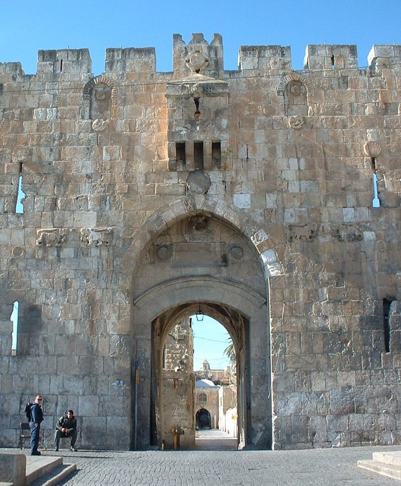
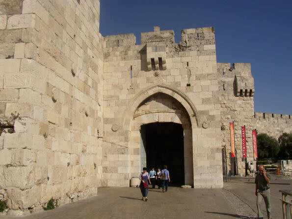 Jaffa Gate (Porta di Santo Joppo)




No dots yet