

Rochambeau Map Collection - Library of Congress
Step 0 of 0
1
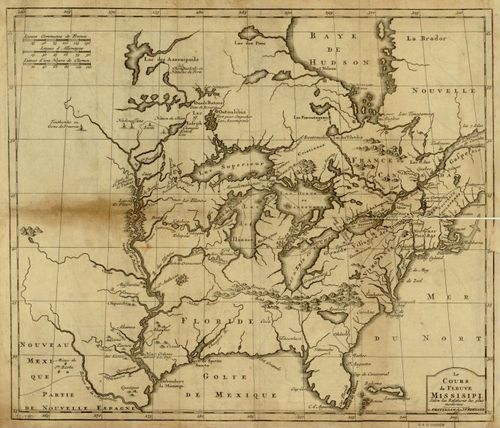
E109 - Le cours du fleuve Missisipi selon les relations les plus modernes
2
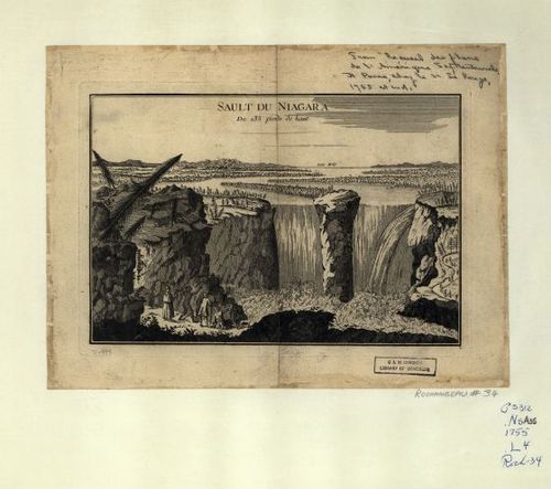
E 109 - Sault du Niagara, de 135 pieds de haut.
3
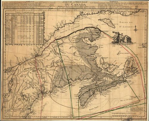
E109 - Partie orientale du Canada, traduitte de l'anglois de la carte de Jefferys publiée a Londres en May 1755.
4
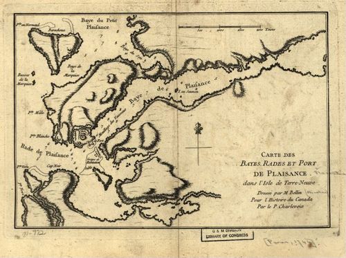
E109 - Carte des bayes, rades et port de Plaisance dans l'Isle de Terre-Neuve.
5
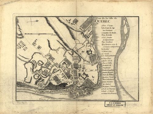
E109 - Plan de la ville de Quebec.
6
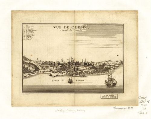
E109 - Vue de Quebec, capitale du Canada.
7
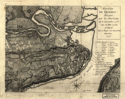
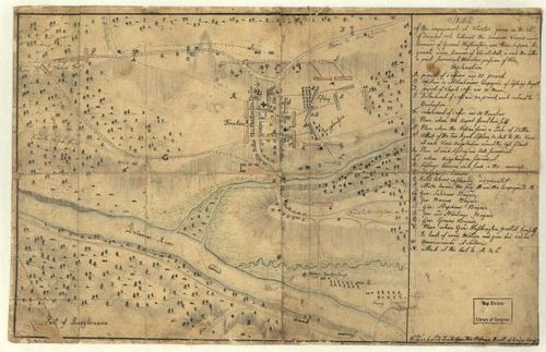
E109 - Environs de Quebec: Bloque par les Americains du 8. decembre 1775 au 13. mai 1776.
8
![E109 - [Etats-Unis: Partie septentrionale].](https://iiif.pixeum.org/iiif/3/1668117080/full/500,/0/default.jpg)
E109 - [Etats-Unis: Partie septentrionale].
9
E109 - [Differents camps de l'armée de York-town à Boston.
10
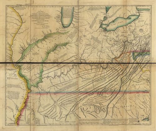
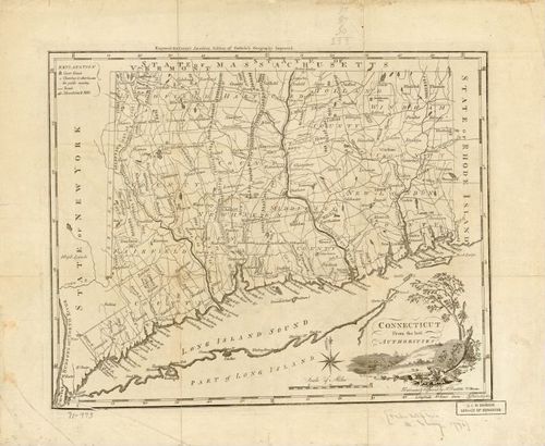
E109 - A new map of the western parts of Virginia, Pennsylvania ...
11
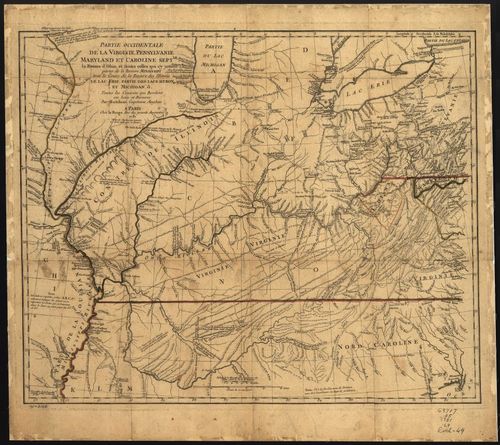
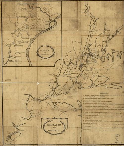
E109 - Partie occidentale de la Virginie, Pensylvanie, Maryland, et Caroline Septle. la rivière d'Ohio, et toutes celles qui s'y jettent, partie de la Rivière Mississippi, tout le cours de la rivière de Illinois, le Lac Erie, partie des Lacs Huron et Michigan &. toutes les contrées qui bordent ces lacs et rivières,
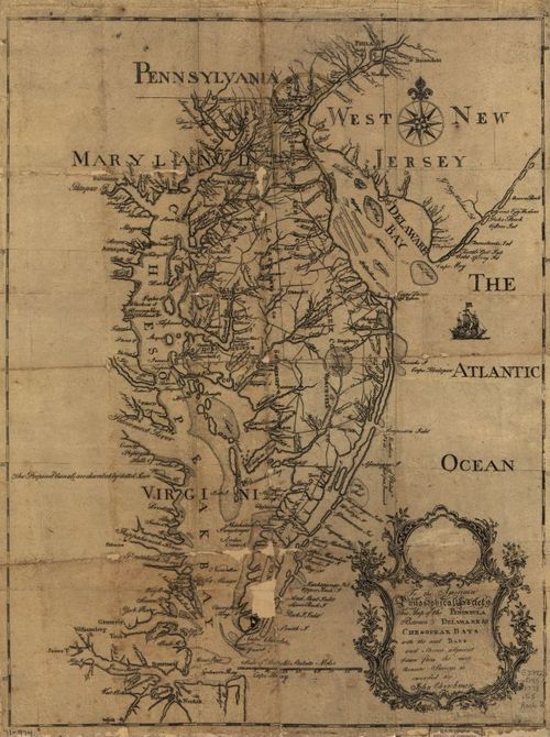
12
E109 - Marche de l'armée française de Providence à la Rivière du Nord.
13
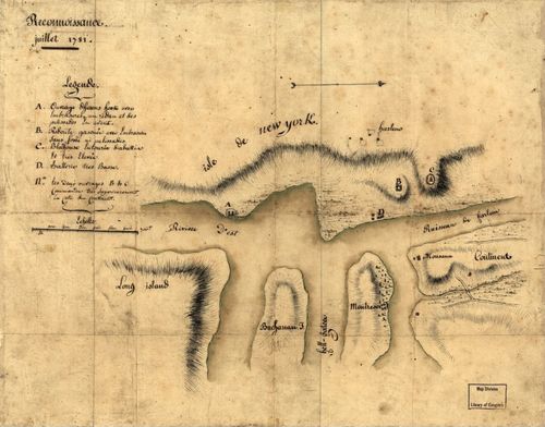
E109 - [Côte de York-town à Boston: Marches de l'armée.
14
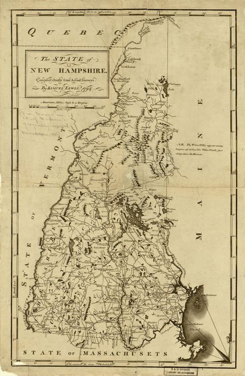
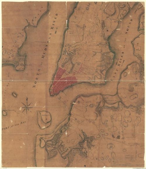
E109 - The State of New Hampshire. Compiled chiefly from actual surveys.
15
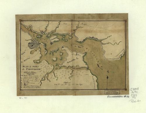
E109 - Plan du port de Portsmouth levé à vue.
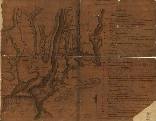
16
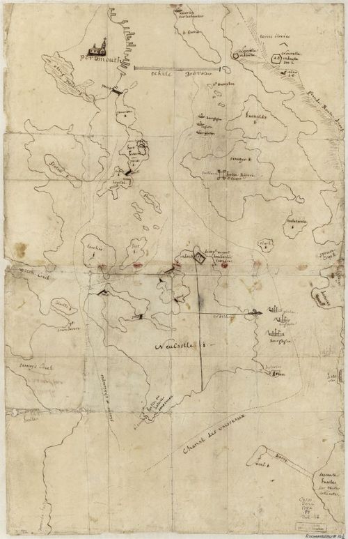
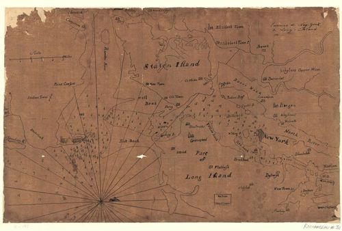
E109 - Portsmouth, New Hampshire.
17

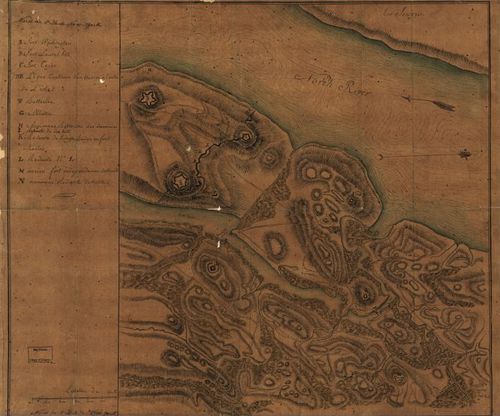
E109 - Vermont, from actual survey.
18
E109 - Plan d'une partie de la rade de Boston pour faire connaitre le dispositif de ses deffenses.
19
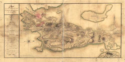
E109 - Plan de Rhodes-Island, et position de l'armée françoise a Newport.
20
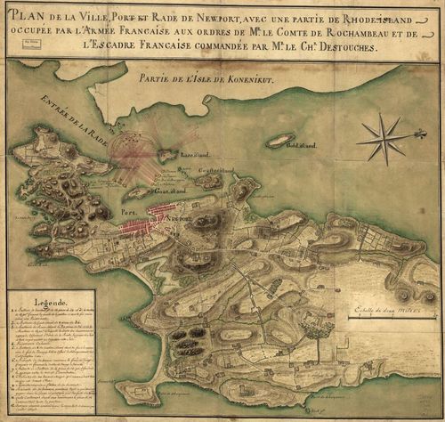
E109 - Plan de la ville, port, et rade de Newport, avec une partie de Rhode-Island occupée par l'armée française aux ordres de Mr. Le comte de Rochambeau, et de l'escadre française commandée.
21
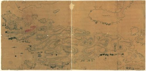
E109 - [Plan de la ville, du port, et de la rade de New-port et Rhode Island. Debarquement en 1780.
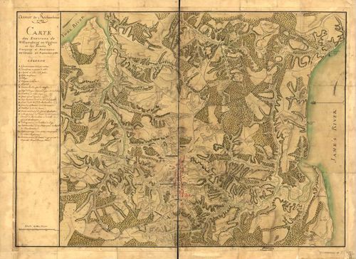
22
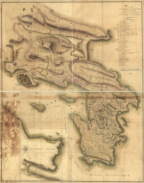
E109 - Plan de la position de l'armée françoise autour de Newport et du mouillage de l'escadre dans la rade de cette ville.
23
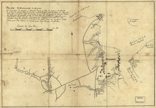
E109 - Connecticut, from the best authorities.
24
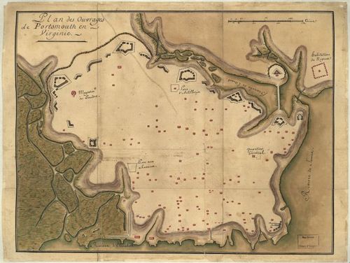
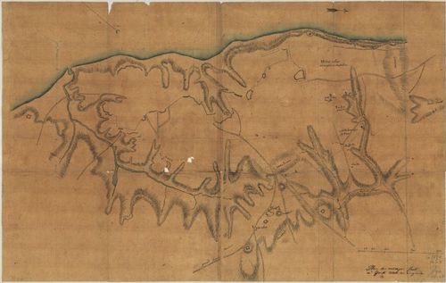
E109 - Campaign of MDCCLXXVI.
25
E109 - This map of the peninsula between Delaware & Chesopeak Bays, with the said bays and shores adjacent drawn from the most accurate surveys.
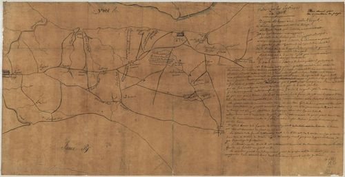
26
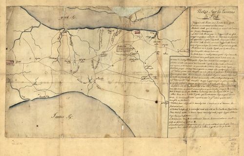
E109 - Map of Queens Village or Lloyd Neck in Queens County on the north side of Long Island in the Province (now State) of New York. Situated near the parallel of 41 degrees north lattitude.
27
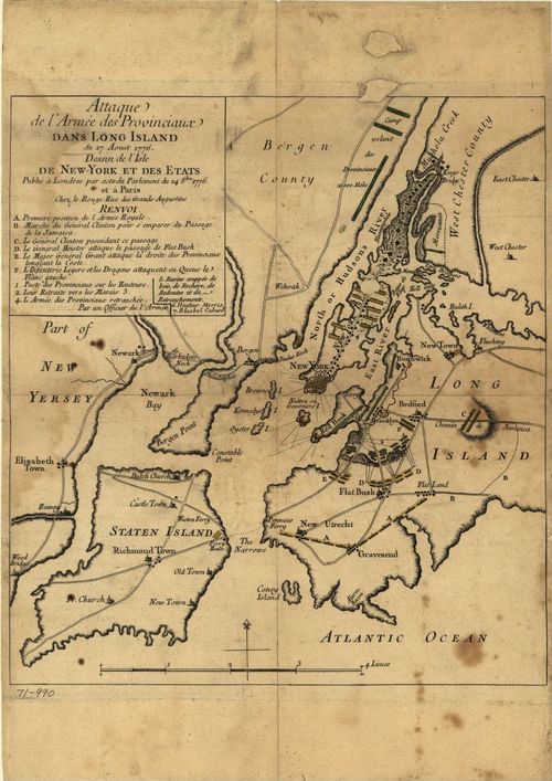
E109 - Attaque de l'armée des provinciaux dans Long Island du 27. aoust 1776; dessin de l'isle de New-York et des Etats.
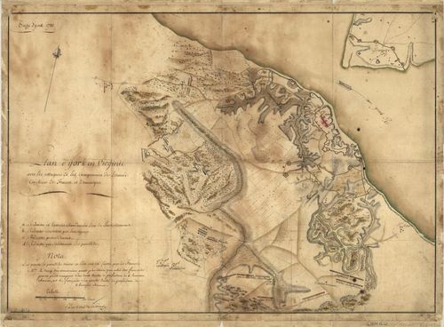
28
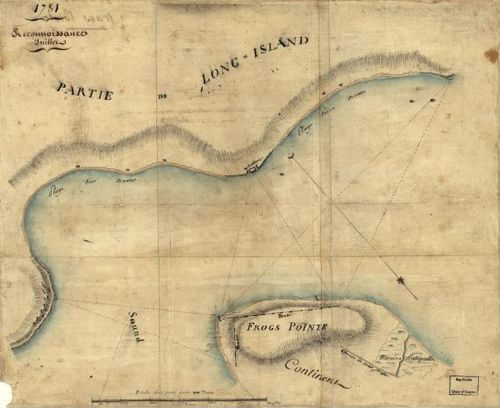
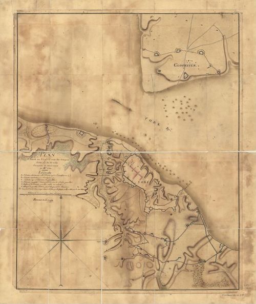
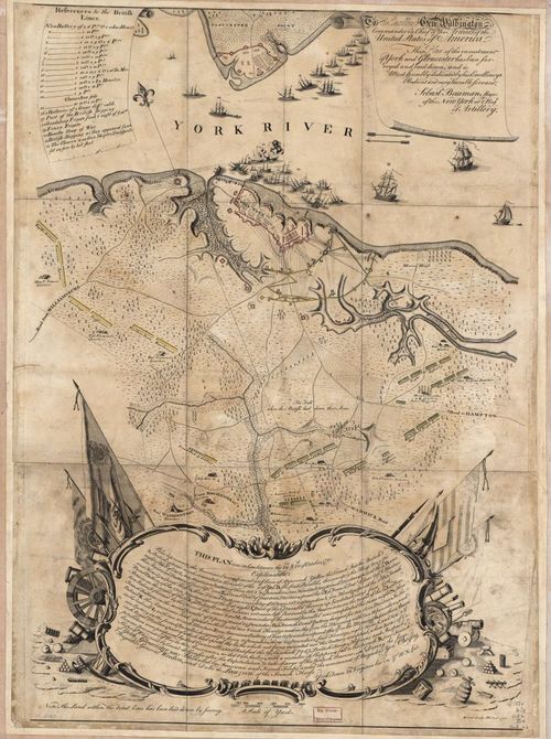
E109 - Reconnoissance, juillet, 1781.
29
E109 - Position du camp de l'armée combinée a Philipsburg du 6 juillet au 19 aoust.
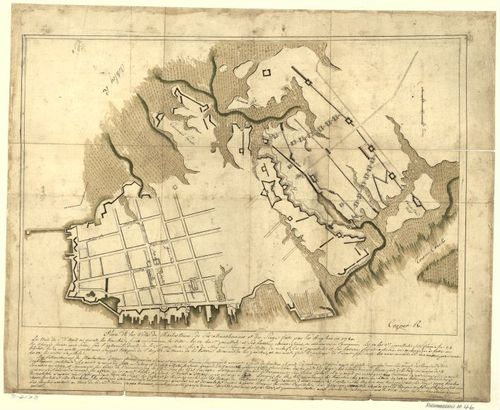
30
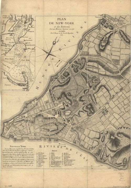
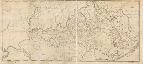
E109 - Plan de New-York et des environs,
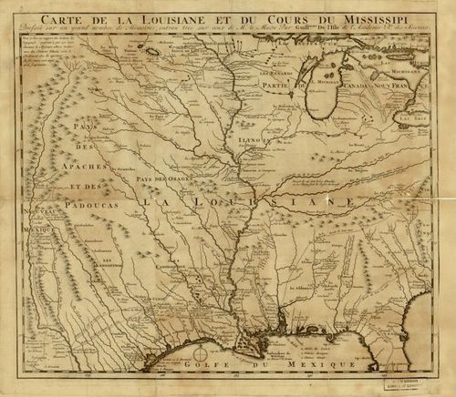
31
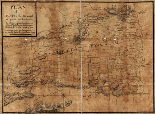
E109 - [Plan de New-York et des îles environnantes.
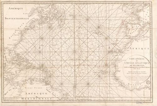
32
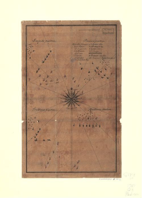
E109 - [Plan de New-York et les environs.
33
E109 - Nord de l'Ile de New-York.
34
E109 - Environs de New-York, de Long-Island, etc.
35
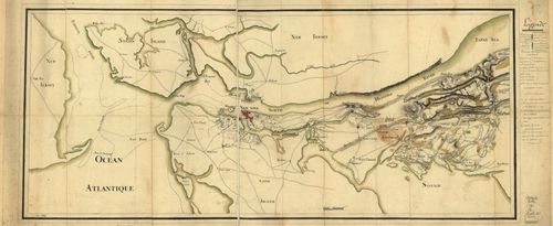
E109 - Reconnoissance, juillet 1781.
36

E109 - Reconnoissance des ouvrages du nord de l'Isle de Newyork dont on a déterminé géometriquement les principaux points le 22 et le 23 juillet.
37
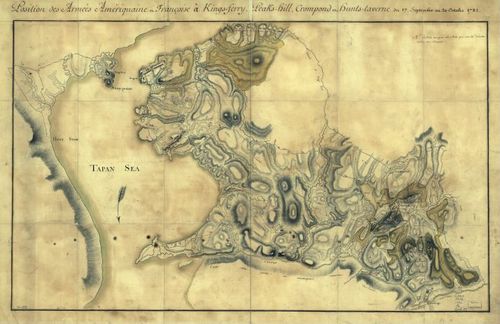
E109 - Position des Armées amériquaine et françoise à Kings-ferry, Peaks-hill, Crompond et Hunts-taverne du 17. septembre au 20 octobre 1782.
38
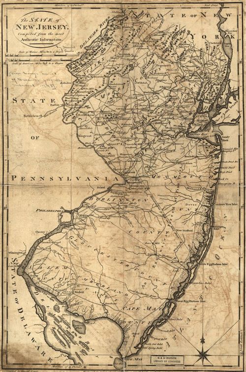
E109 - The State of New Jersey, compiled from the most authentic information.
39
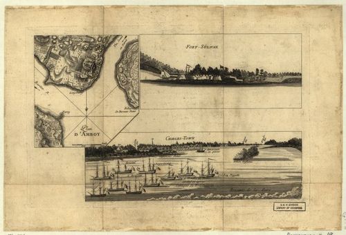
E109 - [Plan d'Amboy. Vues de la rade de Charles-Town et de Fort Sulivan, mai 1780.
40
E109 - Sketch of the engagement at Trenton, given on the 26th of December 1776 betwixt the American troops under command of General Washington, and three Hessian regiments under command of Colonell Rall, in which the latter a part surrendert themselves prisoner of war.
41
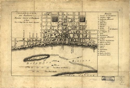
E109 - Philadelphie,
42
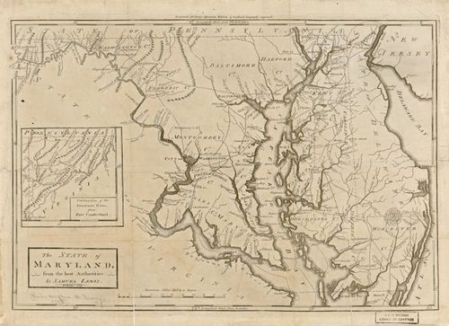
E109 - The State of Maryland from the best authorities.
43
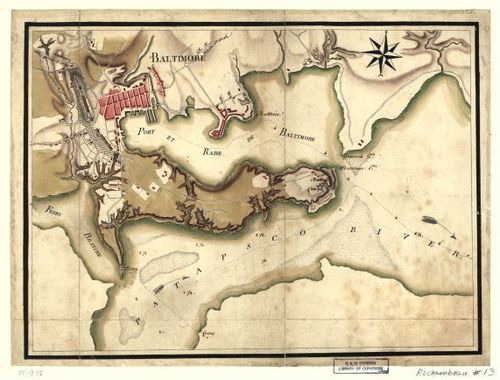
E109 - [Ville, port, et rade de Baltimore dans le Maryland.
44
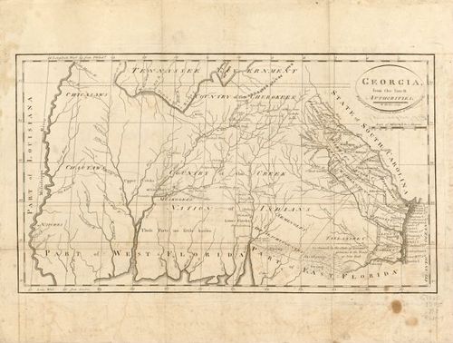
E109 - Georgia, from the latest authorities.
45
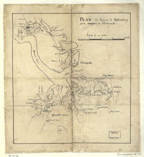
E109 - Plan des environs de Williamsburg, York, Hampton, et Portsmouth.
46
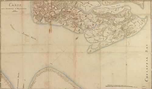
E109 - Carte des environs d'Hampton.
47
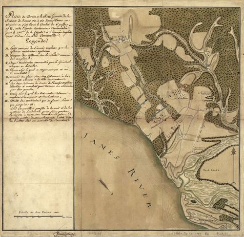
E109 - Plan du terrein à la rive gauche de la rivière de James vis-à-vis Jamestown en Virginie ou s'est livré le combat du 6 juillet 1781 entre l'armée américaine commandée par le Mis. de La Fayette el l'armée angloise aux ordres du Lord Cornwallis.
48
E109 - Plan de Portsmouth en Virginie.
49
E109 - Plan des ouvrages de Portsmouth en Virginie.
50
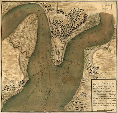
E109 - Carte detaillée de West Point sur la rivière d'York au confluent des Rivières de Pamunkey et Matapony.
51
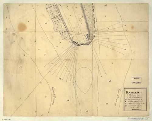
E109 - Batteries de West-point au haut de la Rivière d'York.
52
E109 - Armée de Rochambeau, 1782. Carte des environs de Williamsburg en Virginie où les armées françoise et américaine ont campés en Septembre 1781.
53
E109 - Notes sur les environs de York: Plan donné par des arpenteurs du pays.
54
E109 - Notes sur les environs de York.
55
E109 - Plan des ouvrages faits à York-town en Virginie.
56
E109 - Plan d'York en Virginie avec les attaques faites par les Armées françoise et américaine en 8bre. 1781.
57
E109 - Siege d'York, 1781. Plan d'York en Virginie avec les attaques et les campemens de l'Armée combinée de France et d'Amérique.
58
E109 - To His Excellency Genl. Washington, Commander in Chief of the armies of the United States of America, this plan of the investment of York and Gloucester has been surveyed and laid down,
59
![E109 - [An accurate map of North and South Carolina, with their Indian frontier, shewing in a distinct manner all the mounta]ins, rivers, swamps, marshes, bays, creeks, harbours, sandbanks and soundings on the coasts; with the roads and Indian paths; as well as the boundary or provincial lines, the several townships, and other divisions of the land in both the provinces;](https://iiif.pixeum.org/iiif/3/1668117392/full/500,/0/default.jpg)
E109 - [An accurate map of North and South Carolina, with their Indian frontier, shewing in a distinct manner all the mounta]ins, rivers, swamps, marshes, bays, creeks, harbours, sandbanks and soundings on the coasts; with the roads and Indian paths; as well as the boundary or provincial lines, the several townships, and other divisions of the land in both the provinces;
60
E109 - Charles-Town, capitale de la Caroline.
61
E109 - Plan de la ville de Charlestown, de ses retranchements et du siege faits par les Anglois en 1780.
62
E109 - A map of Kentucky from actual survey
63
E109 - Carte de la Louisiane et du cours du Mississipi
64
E109 - Plan du canton de Plimouth et partie des Baradéres.
65
E109 - Carte générale de l'Océan Atlantique ou Occidental,
66
E109 - Quatre positions de la flotte française et positions de la flotte anglaise.
Place a DOT on the image